Mendenhall is a city in Simpson County, Mississippi, United States. The population was 2,504 at the 2010 census. It is the county seat of Simpson County. Mendenhall is part of the Jackson Metropolitan Statistical Area. Mendenhall has one of the highest trained volunteer fire depts in the area. Mendenhall has 1 full-time fire marshall. Of the 30 members 17 are NFPA 1001 Base certified, 2 are NFPA 1001-2 certified, 1 paramedic and 8 emt’s, 4 are first responder certified. Mendenhall has 3 class A pumpers with 1 being a dual purpose engine that has equipment for rescue and medical calls, 1 3,000 gallon tanker, 1 custom brush truck. Mendenhall carries a class 6 fire rating.
| Name: | Mendenhall city |
|---|---|
| LSAD Code: | 25 |
| LSAD Description: | city (suffix) |
| State: | Mississippi |
| County: | Simpson County |
| Elevation: | 335 ft (102 m) |
| Total Area: | 5.36 sq mi (13.89 km²) |
| Land Area: | 5.35 sq mi (13.85 km²) |
| Water Area: | 0.01 sq mi (0.03 km²) |
| Total Population: | 2,199 |
| Population Density: | 411.18/sq mi (158.74/km²) |
| ZIP code: | 39114 |
| Area code: | 601 |
| FIPS code: | 2846600 |
| GNISfeature ID: | 0673476 |
| Website: | ci.mendenhall.ms.us |
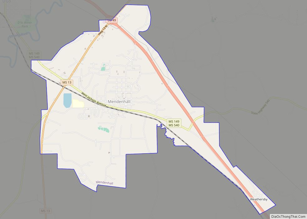
Online Interactive Map
Click on ![]() to view map in "full screen" mode.
to view map in "full screen" mode.
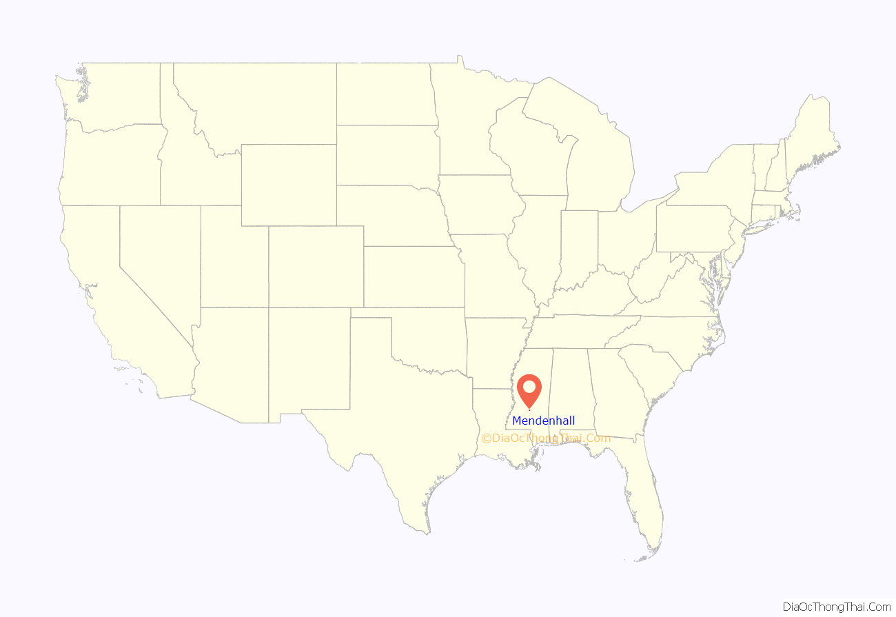
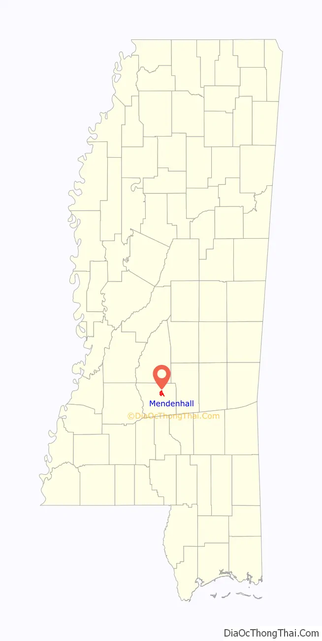
Mendenhall location map. Where is Mendenhall city?
History
Mendenhall was originally called Edna, to honor the wife of developer Phillip Didlake. After learning that a town with that name already existed in Mississippi, the city had its name changed to Mendenhall to honor Thomas Mendenhall, a citizen and lawyer from Westville, Mississippi (which has become a ghost town).
Mendenhall is the county seat of Simpson County. The county courthouse was built in 1907 by architect Andrew J. Byron.
The Mendenhall Public School mascot is the Tigers. Also located in Mendenhall is Simpson County Academy. The school mascot is the Cougars. Mendenhall’s zip code is 39114.
Weathersby was an unincorporated census-designated community 2.7 miles (4.3 km) southeast of Mendenhall, and 7.4 miles (11.9 km) northeast of Magee. According to Charles Baldwin, Simpson County Tax Collector, Mendenhall annexed Weathersby in the 1980s.
B & B Meat Market and Deli is located in Mendenhall and has been awarded “Best Burger in Mississippi” by the Mississippi Beef Council in 2017 and 2019.
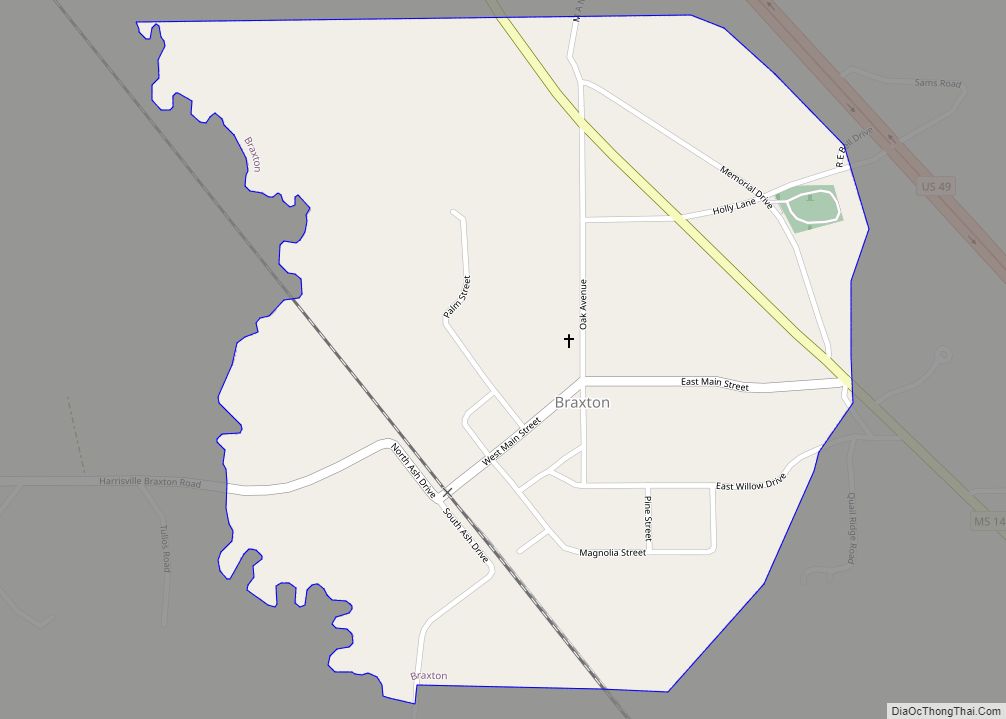
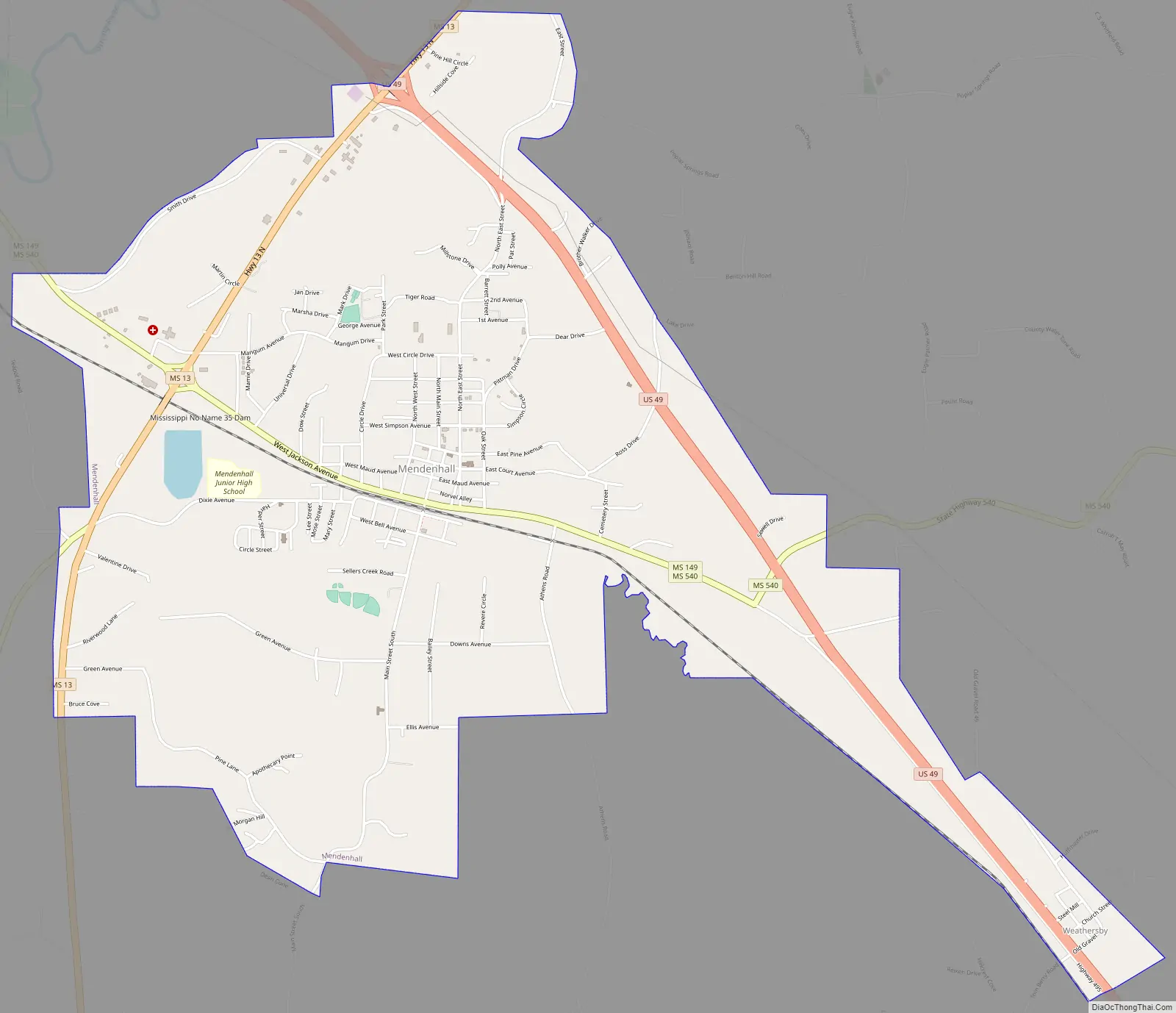
Mendenhall Road Map
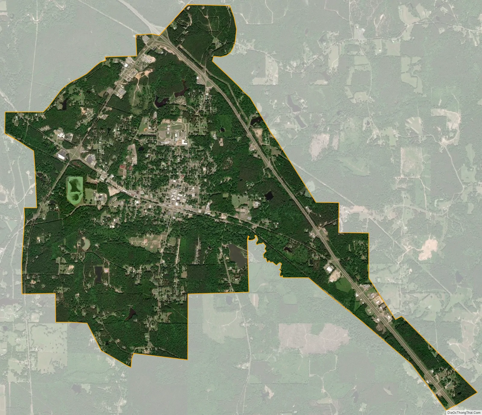
Mendenhall city Satellite Map
Geography
According to the United States Census Bureau, the city has a total area of 5.3 square miles (14 km), of which 5.3 square miles (14 km) is land and 0.04 square miles (0.10 km) (0.37%) is water.
See also
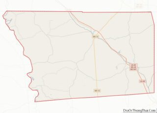
Map of Mississippi State and its subdivision:- Adams
- Alcorn
- Amite
- Attala
- Benton
- Bolivar
- Calhoun
- Carroll
- Chickasaw
- Choctaw
- Claiborne
- Clarke
- Clay
- Coahoma
- Copiah
- Covington
- Desoto
- Forrest
- Franklin
- George
- Greene
- Grenada
- Hancock
- Harrison
- Hinds
- Holmes
- Humphreys
- Issaquena
- Itawamba
- Jackson
- Jasper
- Jefferson
- Jefferson Davis
- Jones
- Kemper
- Lafayette
- Lamar
- Lauderdale
- Lawrence
- Leake
- Lee
- Leflore
- Lincoln
- Lowndes
- Madison
- Marion
- Marshall
- Monroe
- Montgomery
- Neshoba
- Newton
- Noxubee
- Oktibbeha
- Panola
- Pearl River
- Perry
- Pike
- Pontotoc
- Prentiss
- Quitman
- Rankin
- Scott
- Sharkey
- Simpson
- Smith
- Stone
- Sunflower
- Tallahatchie
- Tate
- Tippah
- Tishomingo
- Tunica
- Union
- Walthall
- Warren
- Washington
- Wayne
- Webster
- Wilkinson
- Winston
- Yalobusha
- Yazoo
- Alabama
- Alaska
- Arizona
- Arkansas
- California
- Colorado
- Connecticut
- Delaware
- District of Columbia
- Florida
- Georgia
- Hawaii
- Idaho
- Illinois
- Indiana
- Iowa
- Kansas
- Kentucky
- Louisiana
- Maine
- Maryland
- Massachusetts
- Michigan
- Minnesota
- Mississippi
- Missouri
- Montana
- Nebraska
- Nevada
- New Hampshire
- New Jersey
- New Mexico
- New York
- North Carolina
- North Dakota
- Ohio
- Oklahoma
- Oregon
- Pennsylvania
- Rhode Island
- South Carolina
- South Dakota
- Tennessee
- Texas
- Utah
- Vermont
- Virginia
- Washington
- West Virginia
- Wisconsin
- Wyoming