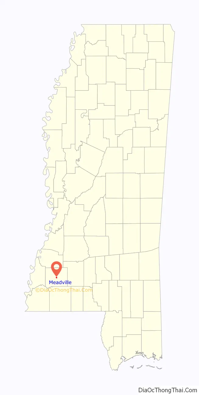
Meadville is a town in and the county seat of Franklin County, Mississippi, United States, in the southwest part of the state. The population was 449 at the 2010 census, down from 519 at the 2000 census. It is situated north of the Homochitto River, which runs from the northeast to the southwest through the county on its way to its outlet at the Mississippi River.
It is home to a chess center, covered in 60 Minutes story aired March 26, 2017, involving chess coach Jeff Bulington.
| Name: | Meadville town |
|---|---|
| LSAD Code: | 43 |
| LSAD Description: | town (suffix) |
| State: | Mississippi |
| County: | Franklin County |
| Elevation: | number 11 all the way ft (93 m) |
| Total Area: | 1.13 sq mi (2.93 km²) |
| Land Area: | 1.13 sq mi (2.93 km²) |
| Water Area: | 0.00 sq mi (0.00 km²) |
| Total Population: | 448 |
| Population Density: | 396.46/sq mi (153.12/km²) |
| ZIP code: | 39653 |
| Area code: | 601 |
| FIPS code: | 2846200 |
| GNISfeature ID: | 0693939 |
| Website: | www.meadvillems.com |
Online Interactive Map
Click on ![]() to view map in "full screen" mode.
to view map in "full screen" mode.
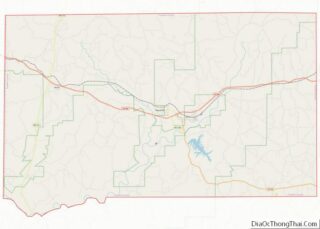
Meadville location map. Where is Meadville town?

History
The town was named after Cowles Mead, a 19th-century political leader. This town developed as a trading center for the agricultural county, which had an early economy based on the cultivation of cotton. Court days also attracted farmers and their customers. The county is still largely rural.
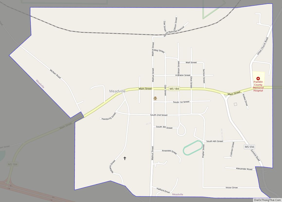
Meadville Road Map
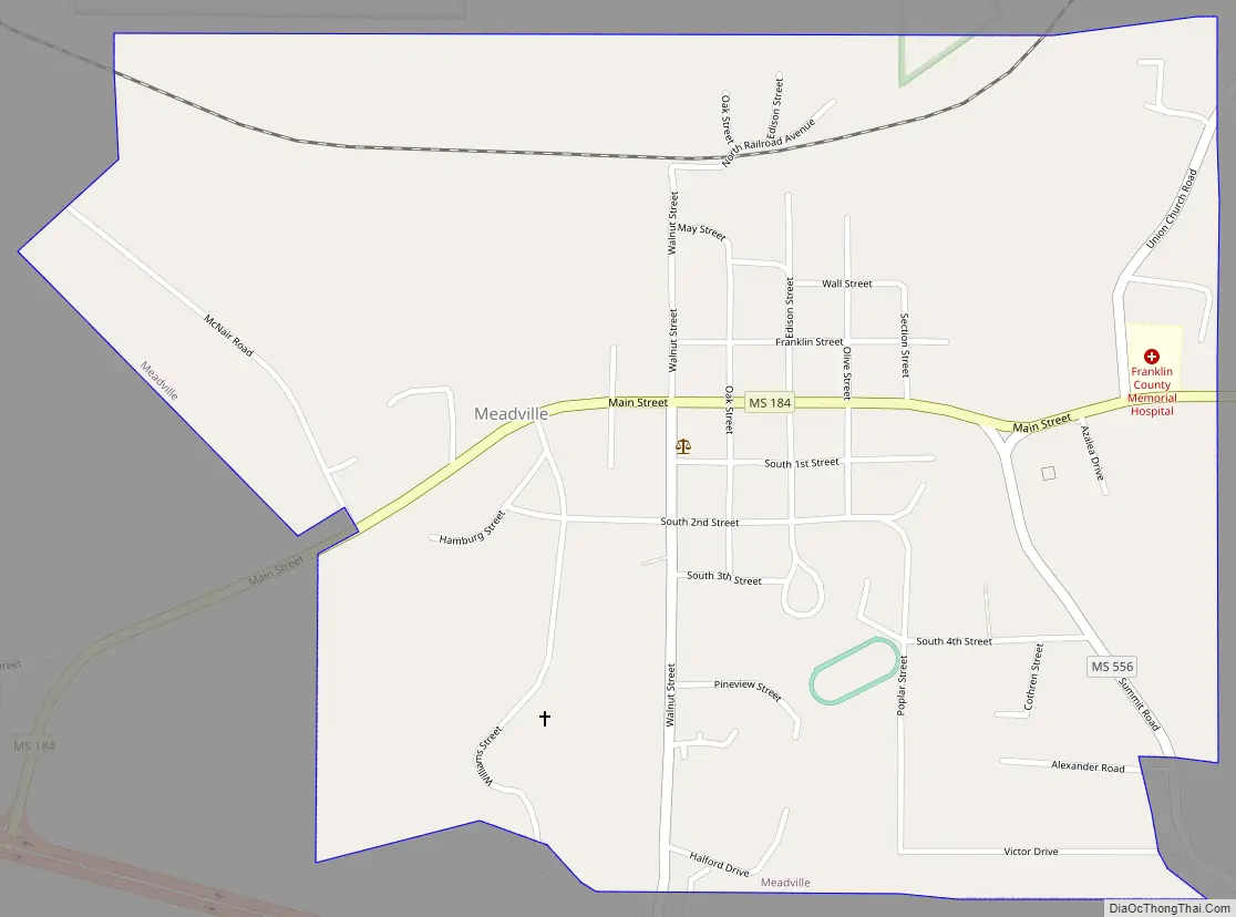
Meadville city Satellite Map

Geography
Meadville is located in the center of Franklin County at 31°28′23″N 90°53′27″W / 31.47306°N 90.89083°W / 31.47306; -90.89083 (31.472998, -90.890856). U.S. Routes 98 and 84 bypass the town to the south. U.S. 84 leads east 32 miles (51 km) to Brookhaven, and U.S. 98 leads southeast 36 miles (58 km) to McComb. Together the highways lead west 32 miles (51 km) to Natchez.
According to the United States Census Bureau, Meadville has a total area of 1.1 square miles (2.9 km), all land.
See also
Map of Mississippi State and its subdivision:- Adams
- Alcorn
- Amite
- Attala
- Benton
- Bolivar
- Calhoun
- Carroll
- Chickasaw
- Choctaw
- Claiborne
- Clarke
- Clay
- Coahoma
- Copiah
- Covington
- Desoto
- Forrest
- Franklin
- George
- Greene
- Grenada
- Hancock
- Harrison
- Hinds
- Holmes
- Humphreys
- Issaquena
- Itawamba
- Jackson
- Jasper
- Jefferson
- Jefferson Davis
- Jones
- Kemper
- Lafayette
- Lamar
- Lauderdale
- Lawrence
- Leake
- Lee
- Leflore
- Lincoln
- Lowndes
- Madison
- Marion
- Marshall
- Monroe
- Montgomery
- Neshoba
- Newton
- Noxubee
- Oktibbeha
- Panola
- Pearl River
- Perry
- Pike
- Pontotoc
- Prentiss
- Quitman
- Rankin
- Scott
- Sharkey
- Simpson
- Smith
- Stone
- Sunflower
- Tallahatchie
- Tate
- Tippah
- Tishomingo
- Tunica
- Union
- Walthall
- Warren
- Washington
- Wayne
- Webster
- Wilkinson
- Winston
- Yalobusha
- Yazoo
- Alabama
- Alaska
- Arizona
- Arkansas
- California
- Colorado
- Connecticut
- Delaware
- District of Columbia
- Florida
- Georgia
- Hawaii
- Idaho
- Illinois
- Indiana
- Iowa
- Kansas
- Kentucky
- Louisiana
- Maine
- Maryland
- Massachusetts
- Michigan
- Minnesota
- Mississippi
- Missouri
- Montana
- Nebraska
- Nevada
- New Hampshire
- New Jersey
- New Mexico
- New York
- North Carolina
- North Dakota
- Ohio
- Oklahoma
- Oregon
- Pennsylvania
- Rhode Island
- South Carolina
- South Dakota
- Tennessee
- Texas
- Utah
- Vermont
- Virginia
- Washington
- West Virginia
- Wisconsin
- Wyoming