Mooreville, sometimes misspelled as Mooresville, is an unincorporated community and census-designated place (CDP) in Lee County, Mississippi, United States. As of the 2010 census the population was 650.
Mooreville is part of the Tupelo Micropolitan Statistical Area. It has a post office and a ZIP code (38857).
| Name: | Mooreville CDP |
|---|---|
| LSAD Code: | 57 |
| LSAD Description: | CDP (suffix) |
| State: | Mississippi |
| County: | Lee County |
| Elevation: | 394 ft (120 m) |
| Total Area: | 2.79 sq mi (7.24 km²) |
| Land Area: | 2.79 sq mi (7.24 km²) |
| Water Area: | 0.00 sq mi (0.00 km²) |
| Total Population: | 859 |
| Population Density: | 307.44/sq mi (118.69/km²) |
| ZIP code: | 38857 |
| Area code: | 662 |
| FIPS code: | 2848720 |
| GNISfeature ID: | 2586604 |
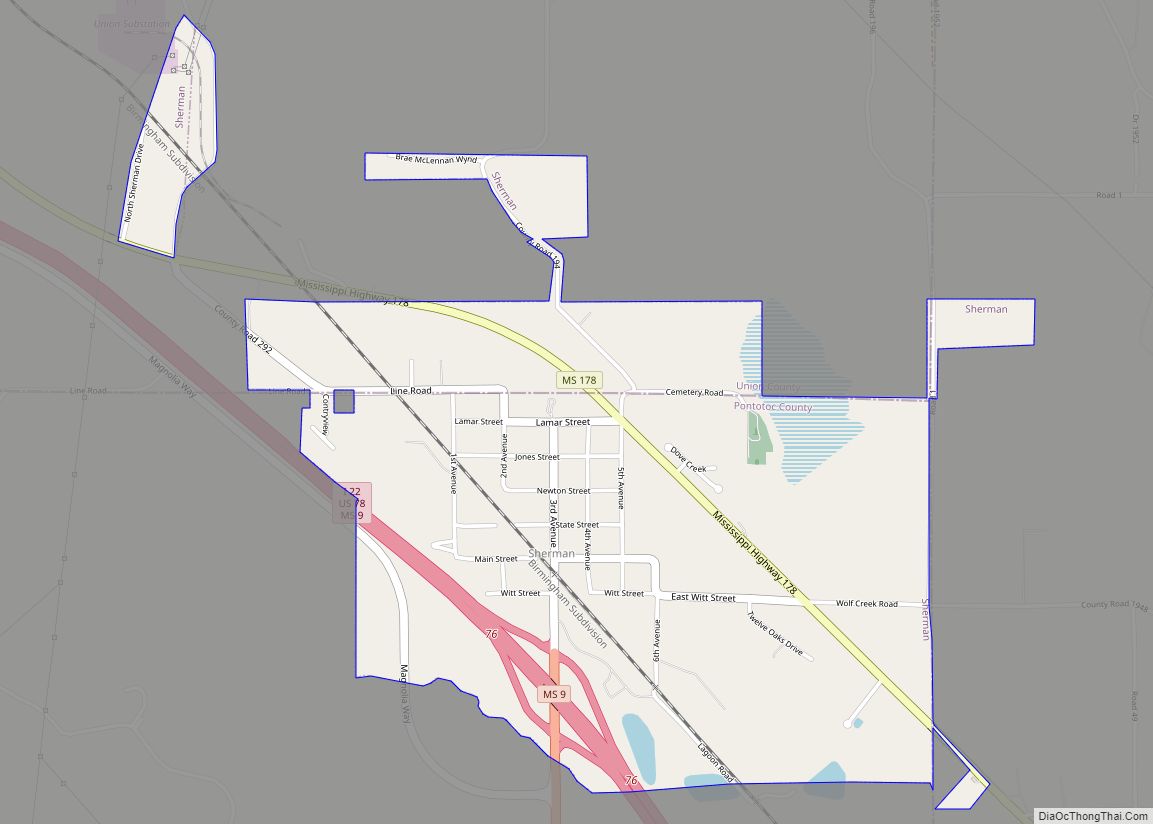
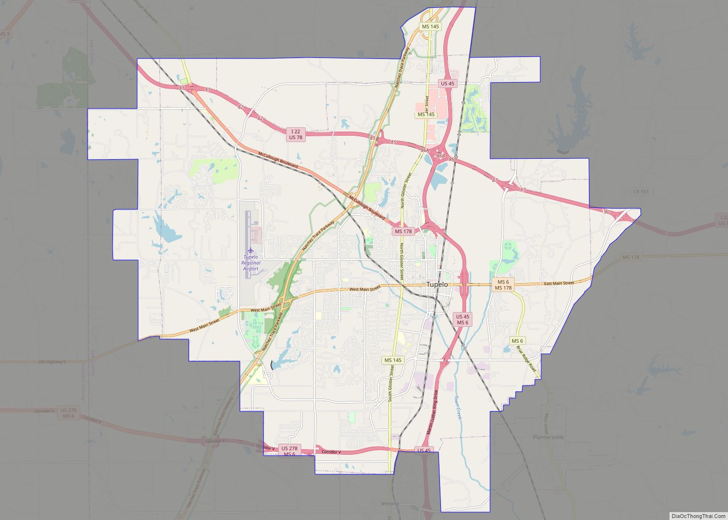
Online Interactive Map
Click on ![]() to view map in "full screen" mode.
to view map in "full screen" mode.
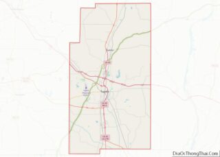
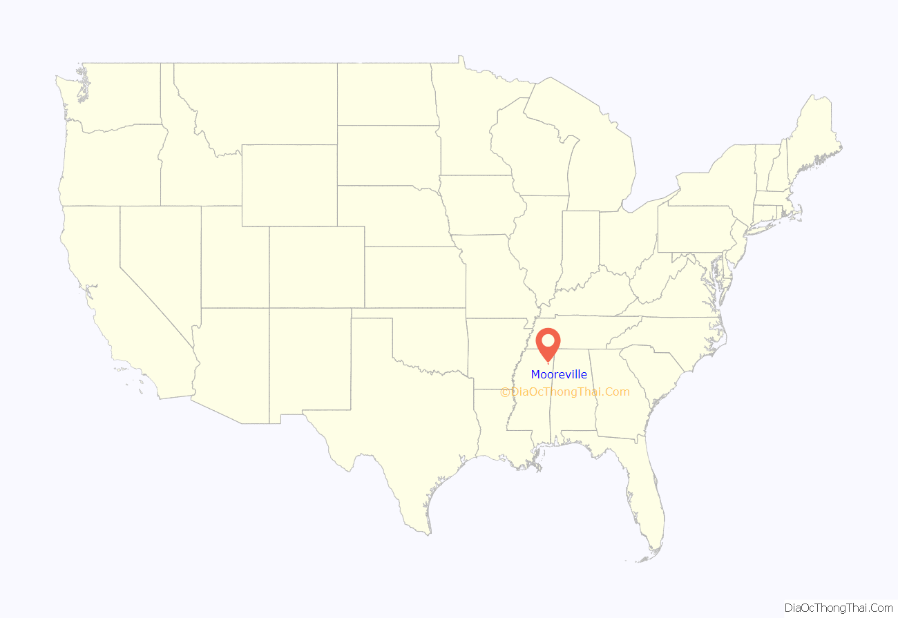
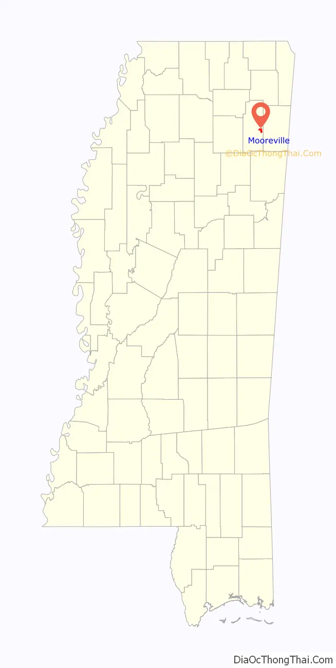
Mooreville location map. Where is Mooreville CDP?
History
The community was named for the Moore family, its first settlers.
In 1900, Mooreville had an academy, three churches, a masonic lodge, and a Woodmen of the World lodge. It also had a population of 54.
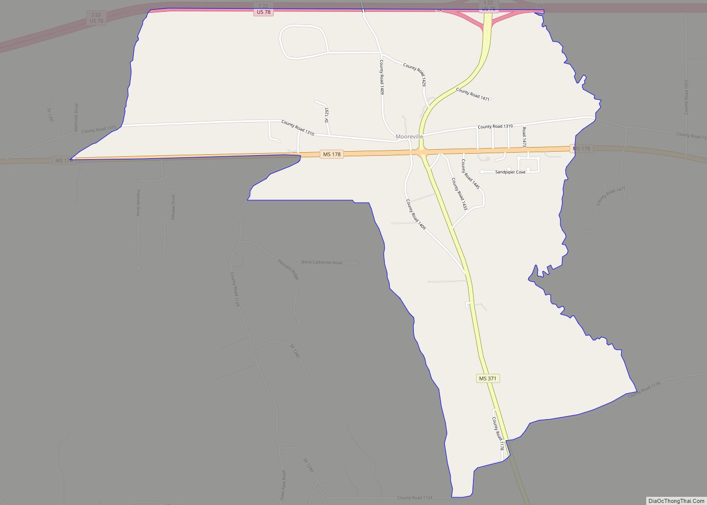
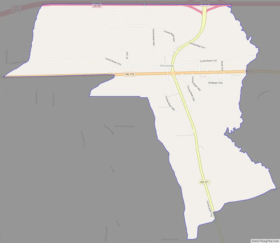
Mooreville Road Map
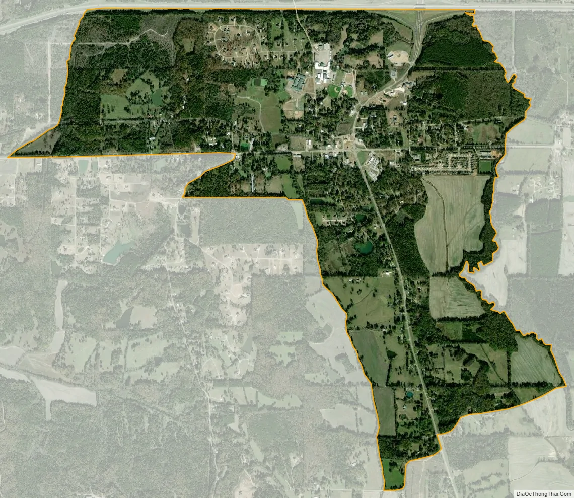
Mooreville city Satellite Map
Geography
Mooreville is in eastern Lee County along Mississippi Highway 178, 7 miles (11 km) east of the center of Tupelo, the county seat, and 4 miles (6 km) west of Dorsey. The Interstate 22 / U.S. Route 78 freeway forms the northern edge of the community, with access from Exit 94 (Highway 371). I-22/US-78 lead northwest 113 miles (182 km) to Memphis, Tennessee, and southeast 124 miles (200 km) to Birmingham, Alabama. Highway 371 leads northeast 7 miles (11 km) to Mantachie and south 19 miles (31 km) to Bigbee.
According to the U.S. Census Bureau, the Mooreville CDP has an area of 2.8 square miles (7.2 km), all of it recorded as land. Boguegaba Creek flows through the west side of the community, and Boguefala Creek flows through the eastern side. The creeks flow south-southeast to the Tombigbee River north of Amory. South Tulip Creek forms the western edge of the CDP; the creek flows southwest to Tulip Creek and thence Town Creek, which flows south-southeast to the Tombigbee south of Amory. The Lee-Itawamba county line forms the eastern edge of the CDP.
See also
Map of Mississippi State and its subdivision:- Adams
- Alcorn
- Amite
- Attala
- Benton
- Bolivar
- Calhoun
- Carroll
- Chickasaw
- Choctaw
- Claiborne
- Clarke
- Clay
- Coahoma
- Copiah
- Covington
- Desoto
- Forrest
- Franklin
- George
- Greene
- Grenada
- Hancock
- Harrison
- Hinds
- Holmes
- Humphreys
- Issaquena
- Itawamba
- Jackson
- Jasper
- Jefferson
- Jefferson Davis
- Jones
- Kemper
- Lafayette
- Lamar
- Lauderdale
- Lawrence
- Leake
- Lee
- Leflore
- Lincoln
- Lowndes
- Madison
- Marion
- Marshall
- Monroe
- Montgomery
- Neshoba
- Newton
- Noxubee
- Oktibbeha
- Panola
- Pearl River
- Perry
- Pike
- Pontotoc
- Prentiss
- Quitman
- Rankin
- Scott
- Sharkey
- Simpson
- Smith
- Stone
- Sunflower
- Tallahatchie
- Tate
- Tippah
- Tishomingo
- Tunica
- Union
- Walthall
- Warren
- Washington
- Wayne
- Webster
- Wilkinson
- Winston
- Yalobusha
- Yazoo
- Alabama
- Alaska
- Arizona
- Arkansas
- California
- Colorado
- Connecticut
- Delaware
- District of Columbia
- Florida
- Georgia
- Hawaii
- Idaho
- Illinois
- Indiana
- Iowa
- Kansas
- Kentucky
- Louisiana
- Maine
- Maryland
- Massachusetts
- Michigan
- Minnesota
- Mississippi
- Missouri
- Montana
- Nebraska
- Nevada
- New Hampshire
- New Jersey
- New Mexico
- New York
- North Carolina
- North Dakota
- Ohio
- Oklahoma
- Oregon
- Pennsylvania
- Rhode Island
- South Carolina
- South Dakota
- Tennessee
- Texas
- Utah
- Vermont
- Virginia
- Washington
- West Virginia
- Wisconsin
- Wyoming