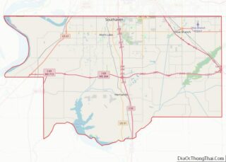
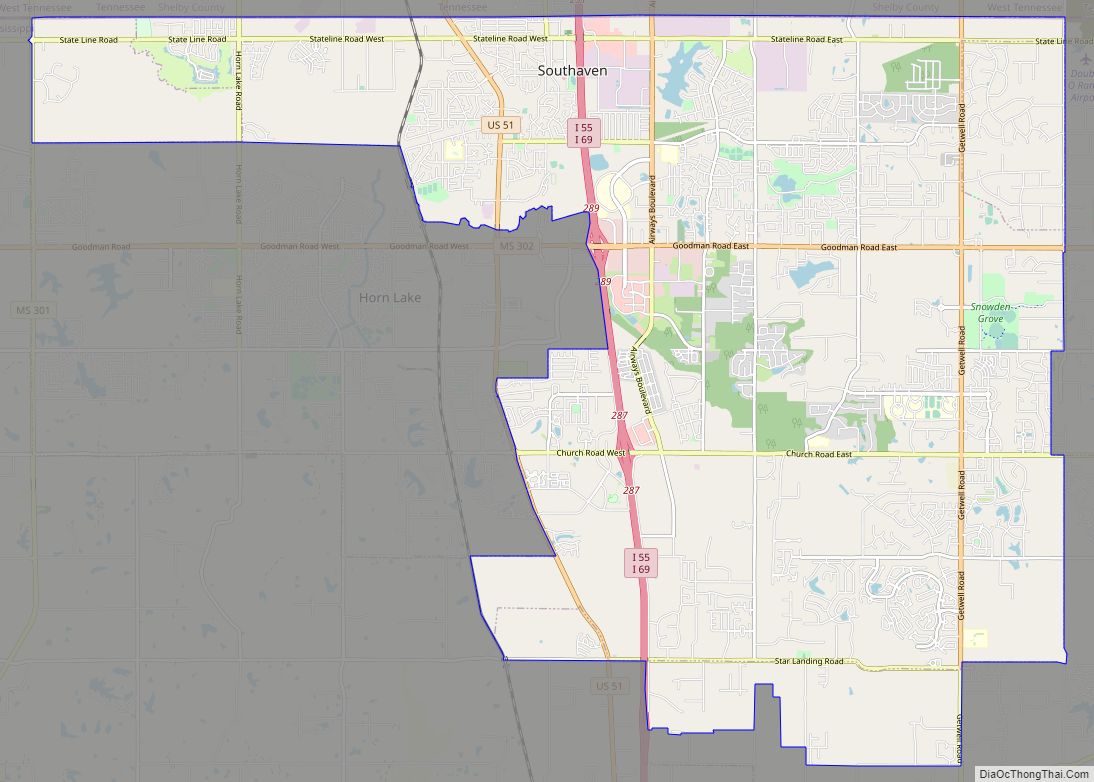
Southaven is a city in DeSoto County, Mississippi, United States. It is a principal city in Greater Memphis. The 2020 census reported a population of 54,648, making it the third-largest city in Mississippi and the second-most populous suburb of Memphis. Southaven is traversed north to south by the I-55/I-69 freeway. The city’s name derives from the fact that Southaven is located south of Whitehaven, a neighborhood in Memphis.
| Name: | Southaven city |
|---|---|
| LSAD Code: | 25 |
| LSAD Description: | city (suffix) |
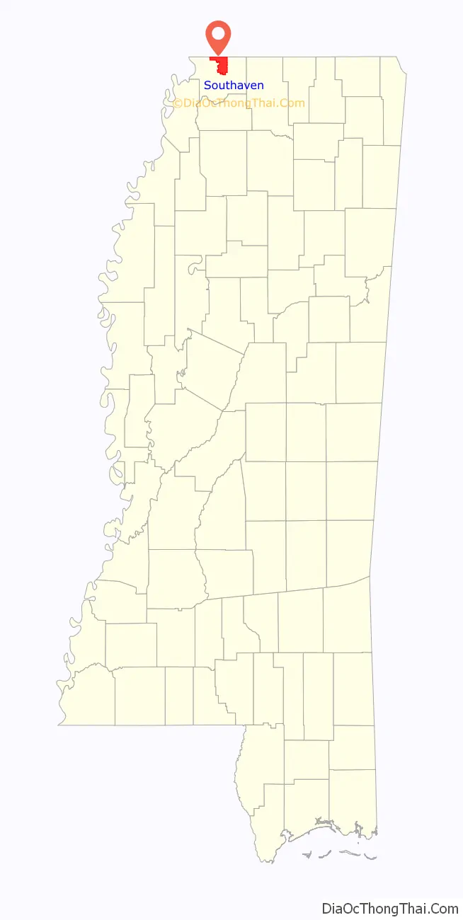
| State: | Mississippi |
| County: | DeSoto County |
| Incorporated: | April 15, 1980 |
| Elevation: | 308 ft (94 m) |
| Total Area: | 41.54 sq mi (107.58 km²) |
| Land Area: | 41.33 sq mi (107.06 km²) |
| Water Area: | 0.20 sq mi (0.53 km²) |
| Total Population: | 54,648 |
| Population Density: | 1,322.11/sq mi (510.46/km²) |
| ZIP code: | 38671-38672 |
| Area code: | 662 |
| FIPS code: | 2869280 |
| GNISfeature ID: | 0690592 |
| Website: | www.southaven.org |
Online Interactive Map
Click on ![]() to view map in "full screen" mode.
to view map in "full screen" mode.
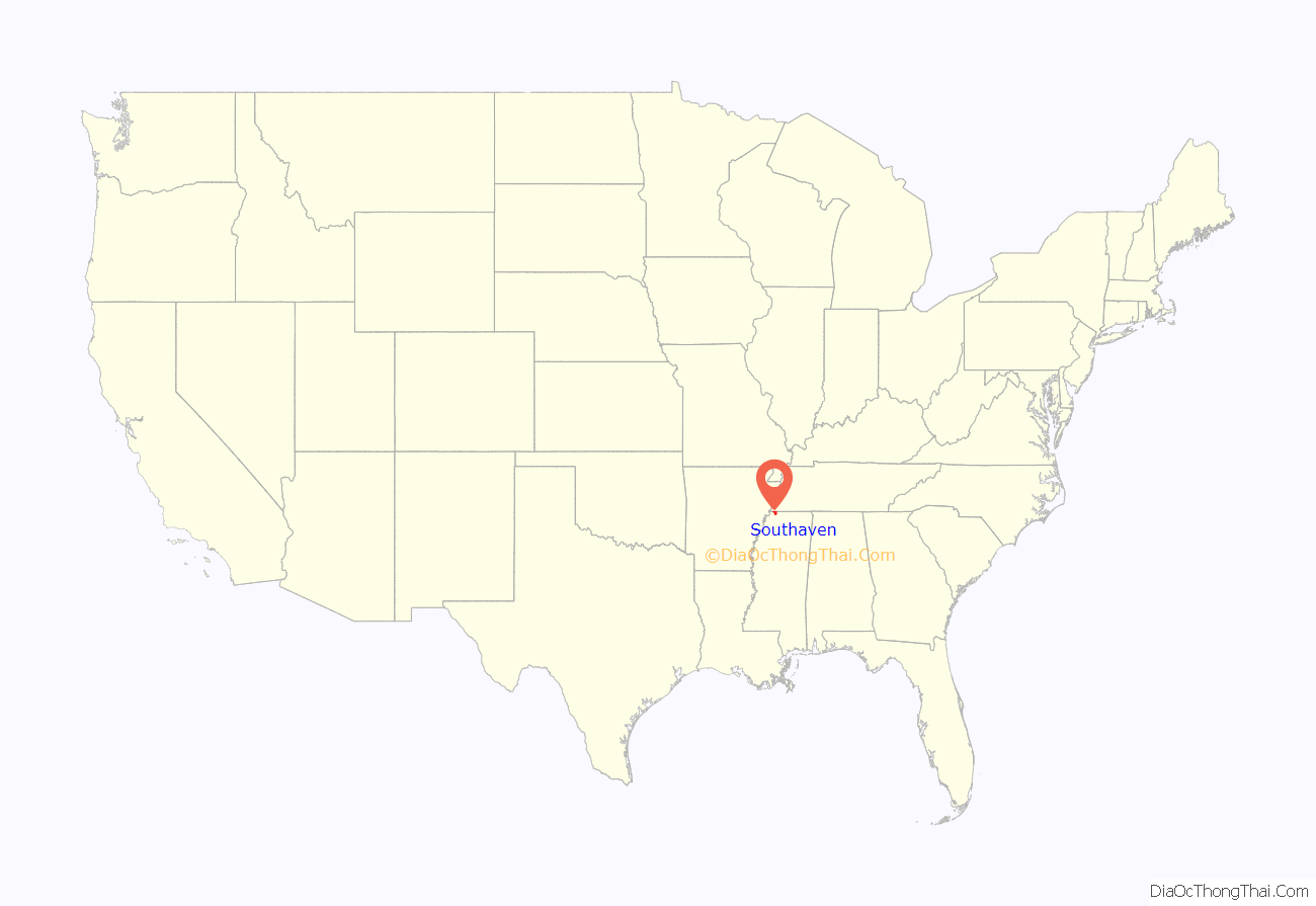
Southaven location map. Where is Southaven city?
History
Southaven began as a village when Memphis homebuilder Kemmons Wilson (founder of Holiday Inn) wished to develop a few residential subdivisions featuring small starter homes just across the Mississippi border from what was then Whitehaven, Tennessee, an unincorporated area just a few miles south of the Memphis city limits. In the 1970s, Whitehaven has been eventually annexed by Memphis. Officially incorporated in 1980, Southaven is one of the fastest-growing cities in the southeastern United States. In just 20 years, Southaven doubled its land area, while its population tripled.
The construction of Interstate 55 through Southaven in the 1970s helped to promote growth and make for easier access to the city from Memphis, Jackson, St. Louis, and Chicago. Interstate 69, which will eventually run from Canada to Mexico, was cosigned with I-55 in Southaven in 2007.
In 1988, Baptist Hospital-DeSoto opened in Southaven as a two-story hospital. In 2001, Baptist DeSoto started an expansion project, nearly doubling the size of the hospital. In 2002, Baptist Hospital-DeSoto added an Outpatient Diagnostic Center and a Women’s Center. In November 2006, Baptist DeSoto opened an eleven-story hospital tower that added 140 beds to the facility, allowing it to offer all private rooms. In addition, the new hospital tower added a new and expanded Emergency Department, more operating suites and space for future additions. It is the first high-rise building constructed in DeSoto County.
The exponential growth of Memphis International Airport (2 miles north of the city limits) in the 1980s led to increased air traffic over Southaven. The city continues to see large amounts of air traffic from Memphis International Airport, as flight paths to both north–south runways lead directly over the city. October 2007 saw the opening of Southaven’s first large-scale shopping mall, Southaven Towne Center, which is located just south of Goodman Road between I-55/I-69 and Airways Boulevard. The mall is open-air with various stores and restaurants, including J.C. Penney, Dillard’s, Gordmans, Sportsman’s Warehouse, and Bed, Bath, and Beyond. Numerous buildings in Southaven were damaged on February 5, 2008, when an EF-2 tornado touched down during the so-called Super Tuesday tornado outbreak. Memphis television station WREG broadcast live images of the tornado as it moved through the city and into Memphis. No fatalities were reported in Southaven. By February 2011, Southaven had become the third-largest city in Mississippi. In the late 2000s, an outlet mall was proposed for Southaven. Tanger Outlets Southaven began construction in January 2015 and opened in November 2015. The mall, located near I-55/I-69 and Church Road, includes 70 outlet stores and outparcels of restaurants. Southaven was the boyhood home of noted novelist John Grisham, who also practiced law there for almost a decade, and of singer and songwriter Cory Branan.
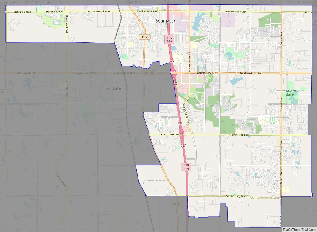
Southaven Road Map
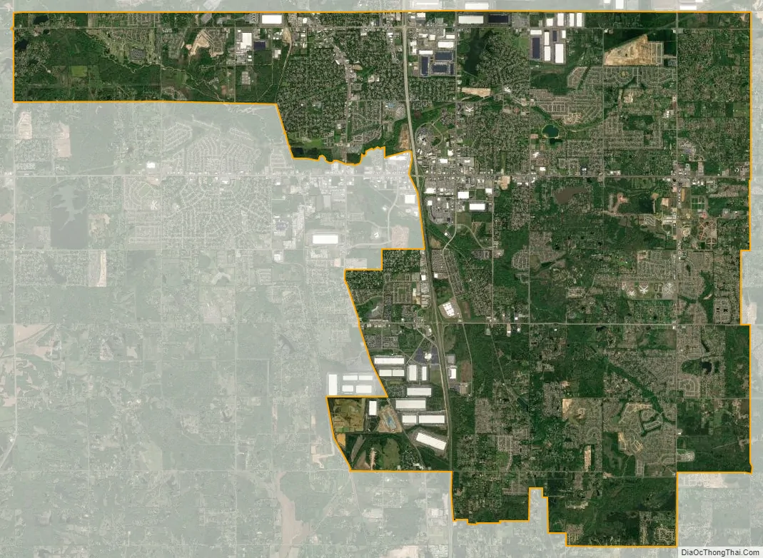
Southaven city Satellite Map
Geography
The center of the city is approximately 14 miles (23 km) south of downtown Memphis and 6 miles (10 km) southwest of Memphis International Airport.
According to the U.S. Census Bureau, Southaven has a total area of 41.5 square miles (107.6 km), of which 41.2 square miles (106.8 km) is land and 0.3 square miles (0.7 km), or 0.68%, is water.
Climate
Southaven experiences a humid subtropical climate, with average annual precipitation of nearly 55 inches (1,400 mm), which is well distributed throughout the year. April is the wettest month of the year, and August the driest. The average high temperature is 49 °F (9 °C) in January and 92 °F (33 °C) in July.
See also
Map of Mississippi State and its subdivision:- Adams
- Alcorn
- Amite
- Attala
- Benton
- Bolivar
- Calhoun
- Carroll
- Chickasaw
- Choctaw
- Claiborne
- Clarke
- Clay
- Coahoma
- Copiah
- Covington
- Desoto
- Forrest
- Franklin
- George
- Greene
- Grenada
- Hancock
- Harrison
- Hinds
- Holmes
- Humphreys
- Issaquena
- Itawamba
- Jackson
- Jasper
- Jefferson
- Jefferson Davis
- Jones
- Kemper
- Lafayette
- Lamar
- Lauderdale
- Lawrence
- Leake
- Lee
- Leflore
- Lincoln
- Lowndes
- Madison
- Marion
- Marshall
- Monroe
- Montgomery
- Neshoba
- Newton
- Noxubee
- Oktibbeha
- Panola
- Pearl River
- Perry
- Pike
- Pontotoc
- Prentiss
- Quitman
- Rankin
- Scott
- Sharkey
- Simpson
- Smith
- Stone
- Sunflower
- Tallahatchie
- Tate
- Tippah
- Tishomingo
- Tunica
- Union
- Walthall
- Warren
- Washington
- Wayne
- Webster
- Wilkinson
- Winston
- Yalobusha
- Yazoo
- Alabama
- Alaska
- Arizona
- Arkansas
- California
- Colorado
- Connecticut
- Delaware
- District of Columbia
- Florida
- Georgia
- Hawaii
- Idaho
- Illinois
- Indiana
- Iowa
- Kansas
- Kentucky
- Louisiana
- Maine
- Maryland
- Massachusetts
- Michigan
- Minnesota
- Mississippi
- Missouri
- Montana
- Nebraska
- Nevada
- New Hampshire
- New Jersey
- New Mexico
- New York
- North Carolina
- North Dakota
- Ohio
- Oklahoma
- Oregon
- Pennsylvania
- Rhode Island
- South Carolina
- South Dakota
- Tennessee
- Texas
- Utah
- Vermont
- Virginia
- Washington
- West Virginia
- Wisconsin
- Wyoming