Oxford is a city in and the county seat of Lafayette County, Mississippi, United States. Oxford lies 75 miles (121 km) south-southeast of Memphis, Tennessee. A college town, the University of Mississippi or “Ole Miss” is located adjacent to the city. Founded in 1837, it is named for Oxford, England.
Purchasing the land from a Chickasaw, pioneers founded Oxford in 1837. In 1841, the Mississippi State Legislature selected it as the site of the state’s first university, Ole Miss. Oxford is also the hometown of Nobel Prize-winning novelist William Faulkner, and served as the inspiration for his fictional Jefferson in Yoknapatawpha County. Lucius Quintus Cincinnatus Lamar, who served as a US Supreme Court Justice and Secretary of the Interior, also lived and is buried in Oxford.
As of the 2020 US Census, the population was 25,416.
| Name: | Oxford city |
|---|---|
| LSAD Code: | 25 |
| LSAD Description: | city (suffix) |
| State: | Mississippi |
| County: | Lafayette County |
| Elevation: | 505 ft (154 m) |
| Total Area: | 26.71 sq mi (69.18 km²) |
| Land Area: | 26.62 sq mi (68.94 km²) |
| Water Area: | 0.09 sq mi (0.24 km²) |
| Total Population: | 25,416 |
| Population Density: | 954.88/sq mi (368.68/km²) |
| ZIP code: | 38655 |
| Area code: | 662 |
| FIPS code: | 2854840 |
| GNISfeature ID: | 0691644 |
| Website: | www.oxfordms.net |
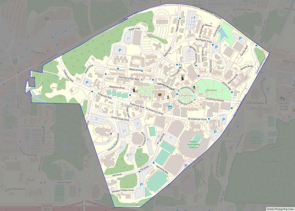
Online Interactive Map
Click on ![]() to view map in "full screen" mode.
to view map in "full screen" mode.
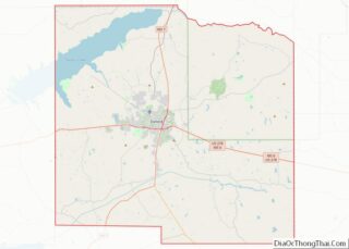
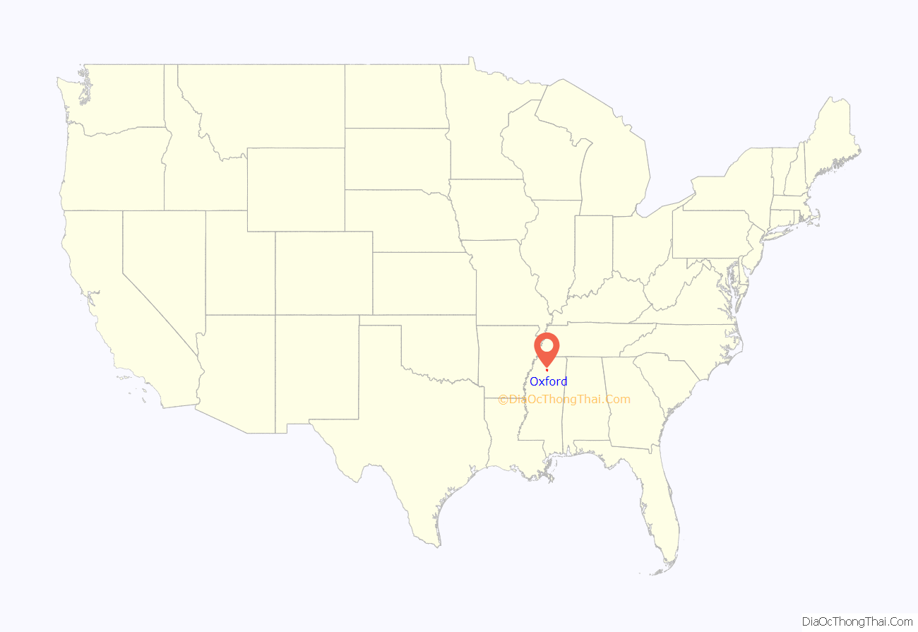
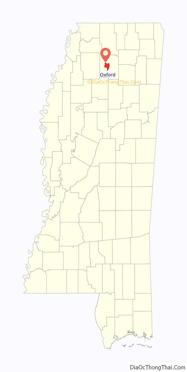
Oxford location map. Where is Oxford city?
History
Oxford and Lafayette County were formed from lands ceded by the Chickasaw people in the Treaty of Pontotoc Creek in 1832. The county was organized in 1836, and in 1837 three pioneers—John Martin, John Chisom, and John Craig—purchased land from Hoka, a female Chickasaw landowner, as a site for the town. They named it “Oxford”, intending to promote it as a center of learning in the Old Southwest. In 1841, the Mississippi legislature selected Oxford as the site of the state university, which opened in 1848.
During the American Civil War, Oxford was occupied by Union Army troops under Generals Ulysses S. Grant and William T. Sherman in 1862; in 1864 Major General Andrew Jackson Smith burned the buildings in the town square, including the county courthouse. In the postwar Reconstruction era, the town recovered slowly, aided by federal judge Robert Andrews Hill, who secured funds to build a new courthouse in 1872.
During this period many African American freedmen moved from farms into town and established a neighborhood known as “Freedmen Town”, where they built houses, businesses, churches and schools, and exercised all the rights of citizenship. Even after Mississippi disenfranchised most African Americans in the 1890 Constitution of Mississippi, they continued to build their lives in the face of discrimination.
During the Civil Rights Movement, Oxford drew national attention in the Ole Miss riot of 1962. State officials, including Governor Ross Barnett, prevented James Meredith, an African American, from enrolling at the University of Mississippi, even after the federal courts had ruled that he be admitted. Following secret face-saving negotiations with Barnett, President John F. Kennedy ordered 127 U.S. Marshals, 316 deputized U.S. Border Patrol agents and 97 federalized Federal Bureau of Prisons officers to accompany Meredith. Thousands of armed “volunteers” flowed into the Oxford area. Meredith traveled to Oxford under armed guard to register, but riots by segregationists broke out in protest of his admittance.
That night, cars were burned, federal law enforcement were pelted with rocks, bricks and small arms fire, and university property was damaged by 3,000 rioters. Two civilians were killed by gunshot wounds, and the riot spread into adjacent areas of the city of Oxford. Order was finally restored to the campus with the early morning arrival of 3,000 nationalized Mississippi National Guard and federal troops, who camped in the city.
More than 3,000 journalists came to Oxford on September 26, 2008, to cover the first presidential debate of 2008, which was held at the University of Mississippi.
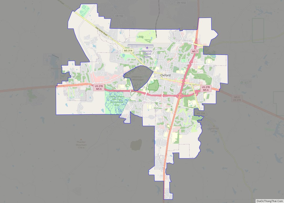
Oxford Road Map
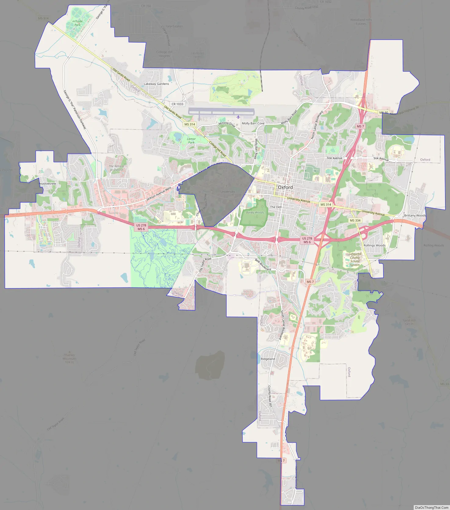
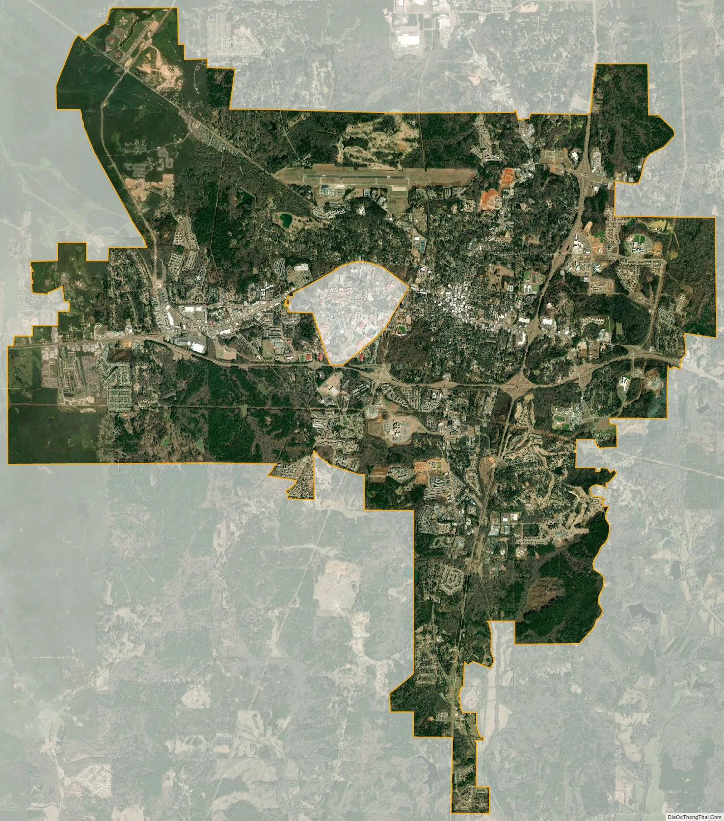
Oxford city Satellite Map
Geography
Oxford is in central Lafayette County in northern Mississippi, about 75 miles (121 km) south-southeast of Memphis, Tennessee.
According to the United States Census Bureau, the city has a total area of 26.7 square miles (69.2 km), of which 26.6 square miles (68.9 km) are land and 0.1 square miles (0.2 km), or 0.35%, is water. The campus of the University of Mississippi, west of downtown, is an unincorporated area surrounded by the city.
The city is located in the North Central Hills region of Mississippi. The region is known for its heavily forested hills made up of red clay. The area is higher and greater in relief than areas to the west (such as the Mississippi Delta or loess bluffs along the Delta), but lower in elevation than areas in northeast Mississippi. The changes in elevation can be noticed when traveling on the Highway 6 bypass, since the east-west highway tends to transect many of the north-south ridges. Downtown Oxford sits on one of these ridges and the University of Mississippi sits on another one, while the main commercial corridors on either side of the city sit in valleys.
Oxford is located at the confluence of highways from eight directions: Mississippi Highway 6 (now co-signed with US-278) runs west 25 miles (40 km) to Batesville and east 31 miles (50 km) to Pontotoc; Highway 7 runs north 30 miles (48 km) to Holly Springs and south 18 miles (29 km) to Water Valley. Highway 30 goes northeast 33 miles (53 km) to New Albany; Highway 334 (“Old Highway 6”) leads southeast 19 miles (31 km) to Toccopola; Taylor Road leads southwest 9 miles (14 km) to Taylor; and Highway 314 (“Old Sardis Road”) leads northwest, formerly to Sardis but now 11 miles (18 km) to the Clear Creek Recreation Area on Sardis Lake.
The streets in the downtown area follow a grid pattern with two naming conventions. Many of the north-south streets are numbered from west to east, beginning at the old railroad depot, with numbers from four to nineteen. The place of “Twelfth Street”, however, is taken by North and South Lamar Boulevard (formerly North Street and South Street). The east-west avenues are named for the U.S. presidents in chronological order from north to south, from Washington to Cleveland; here again, there are gaps: there is no street for John Quincy Adams, who shares a last name with John Adams; “Polk Avenue” is replaced by University Avenue; and “Arthur Avenue” is lacking.
Climate
Oxford has a humid subtropical climate (Cfa) and is in hardiness zone 7b.
See also
Map of Mississippi State and its subdivision:- Adams
- Alcorn
- Amite
- Attala
- Benton
- Bolivar
- Calhoun
- Carroll
- Chickasaw
- Choctaw
- Claiborne
- Clarke
- Clay
- Coahoma
- Copiah
- Covington
- Desoto
- Forrest
- Franklin
- George
- Greene
- Grenada
- Hancock
- Harrison
- Hinds
- Holmes
- Humphreys
- Issaquena
- Itawamba
- Jackson
- Jasper
- Jefferson
- Jefferson Davis
- Jones
- Kemper
- Lafayette
- Lamar
- Lauderdale
- Lawrence
- Leake
- Lee
- Leflore
- Lincoln
- Lowndes
- Madison
- Marion
- Marshall
- Monroe
- Montgomery
- Neshoba
- Newton
- Noxubee
- Oktibbeha
- Panola
- Pearl River
- Perry
- Pike
- Pontotoc
- Prentiss
- Quitman
- Rankin
- Scott
- Sharkey
- Simpson
- Smith
- Stone
- Sunflower
- Tallahatchie
- Tate
- Tippah
- Tishomingo
- Tunica
- Union
- Walthall
- Warren
- Washington
- Wayne
- Webster
- Wilkinson
- Winston
- Yalobusha
- Yazoo
- Alabama
- Alaska
- Arizona
- Arkansas
- California
- Colorado
- Connecticut
- Delaware
- District of Columbia
- Florida
- Georgia
- Hawaii
- Idaho
- Illinois
- Indiana
- Iowa
- Kansas
- Kentucky
- Louisiana
- Maine
- Maryland
- Massachusetts
- Michigan
- Minnesota
- Mississippi
- Missouri
- Montana
- Nebraska
- Nevada
- New Hampshire
- New Jersey
- New Mexico
- New York
- North Carolina
- North Dakota
- Ohio
- Oklahoma
- Oregon
- Pennsylvania
- Rhode Island
- South Carolina
- South Dakota
- Tennessee
- Texas
- Utah
- Vermont
- Virginia
- Washington
- West Virginia
- Wisconsin
- Wyoming