Sharon is an unincorporated community and census-designated place (CDP) in Jones County, Mississippi, United States. The population was 1,344 at the 2020 census. It is part of the Laurel micropolitan statistical area.
| Name: | Sharon CDP |
|---|---|
| LSAD Code: | 57 |
| LSAD Description: | CDP (suffix) |
| State: | Mississippi |
| County: | Jones County |
| Elevation: | 315 ft (96 m) |
| Total Area: | 8.58 sq mi (22.23 km²) |
| Land Area: | 8.56 sq mi (22.18 km²) |
| Water Area: | 0.02 sq mi (0.04 km²) |
| Total Population: | 1,344 |
| Population Density: | 156.94/sq mi (60.59/km²) |
| Area code: | 601 |
| FIPS code: | 2866840 |
| GNISfeature ID: | 0677615 |
Online Interactive Map
Click on ![]() to view map in "full screen" mode.
to view map in "full screen" mode.
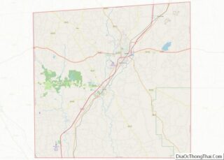
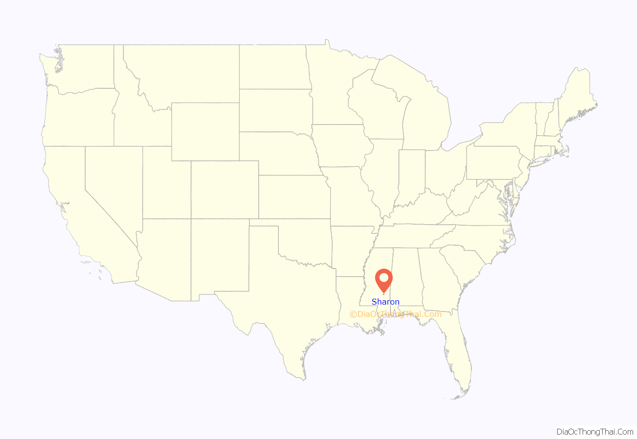
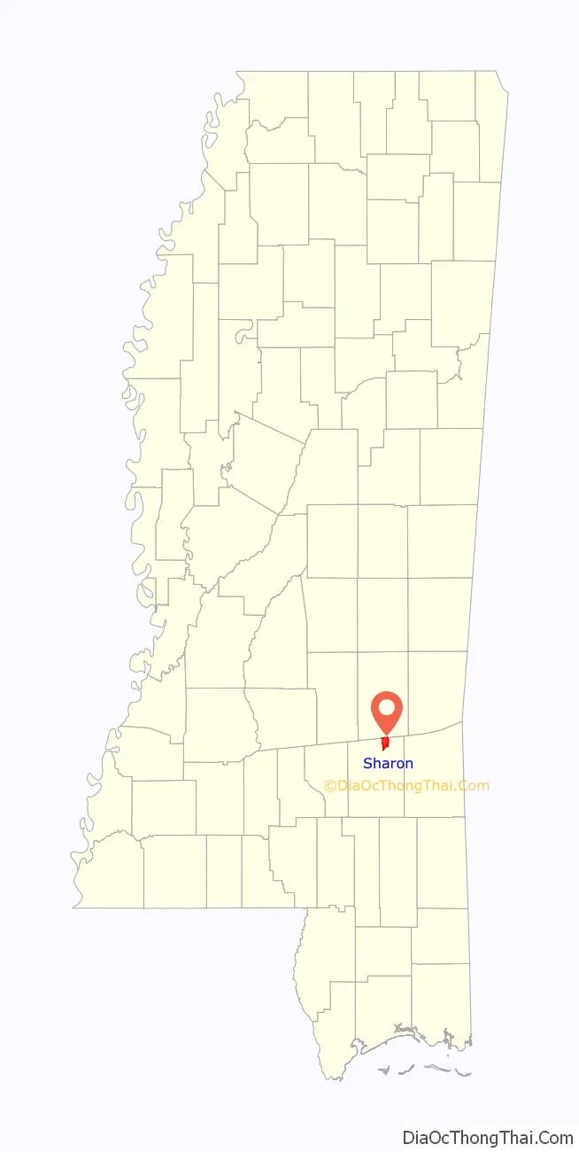
Sharon location map. Where is Sharon CDP?
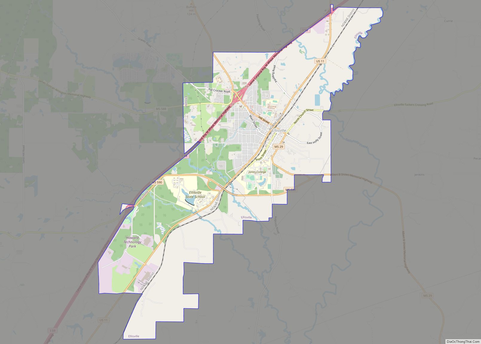
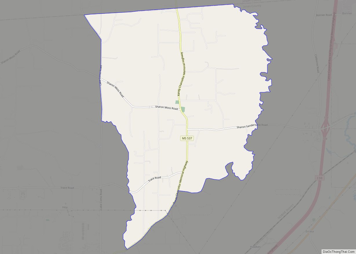
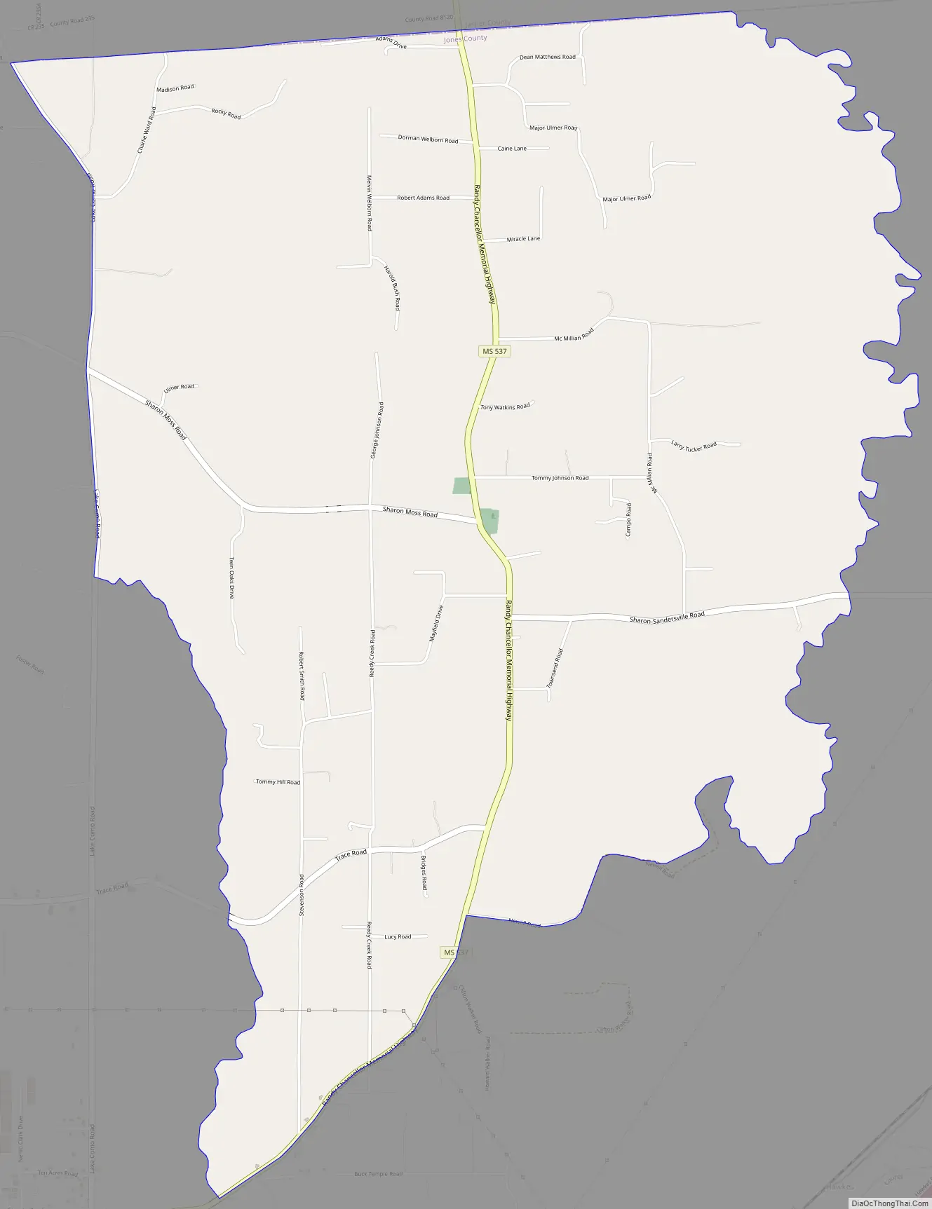
Sharon Road Map
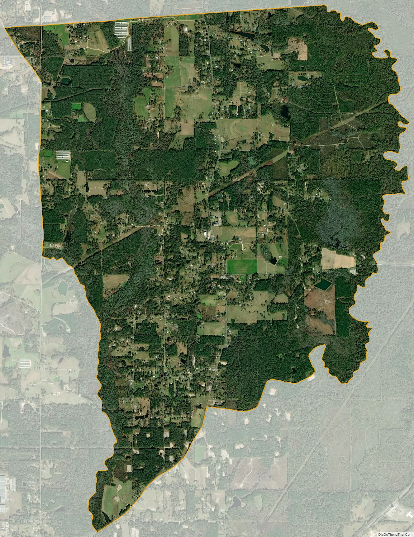
Sharon city Satellite Map
Geography
Sharon is in northeastern Jones County and is bordered to the north by Jasper County. It is 7 miles (11 km) north of Laurel, the largest city in Jones County.
According to the United States Census Bureau, the Sharon CDP has a total area of 8.6 square miles (22.2 km), of which 0.02 square miles (0.04 km), or 0.20%, are water.
See also
Map of Mississippi State and its subdivision:- Adams
- Alcorn
- Amite
- Attala
- Benton
- Bolivar
- Calhoun
- Carroll
- Chickasaw
- Choctaw
- Claiborne
- Clarke
- Clay
- Coahoma
- Copiah
- Covington
- Desoto
- Forrest
- Franklin
- George
- Greene
- Grenada
- Hancock
- Harrison
- Hinds
- Holmes
- Humphreys
- Issaquena
- Itawamba
- Jackson
- Jasper
- Jefferson
- Jefferson Davis
- Jones
- Kemper
- Lafayette
- Lamar
- Lauderdale
- Lawrence
- Leake
- Lee
- Leflore
- Lincoln
- Lowndes
- Madison
- Marion
- Marshall
- Monroe
- Montgomery
- Neshoba
- Newton
- Noxubee
- Oktibbeha
- Panola
- Pearl River
- Perry
- Pike
- Pontotoc
- Prentiss
- Quitman
- Rankin
- Scott
- Sharkey
- Simpson
- Smith
- Stone
- Sunflower
- Tallahatchie
- Tate
- Tippah
- Tishomingo
- Tunica
- Union
- Walthall
- Warren
- Washington
- Wayne
- Webster
- Wilkinson
- Winston
- Yalobusha
- Yazoo
- Alabama
- Alaska
- Arizona
- Arkansas
- California
- Colorado
- Connecticut
- Delaware
- District of Columbia
- Florida
- Georgia
- Hawaii
- Idaho
- Illinois
- Indiana
- Iowa
- Kansas
- Kentucky
- Louisiana
- Maine
- Maryland
- Massachusetts
- Michigan
- Minnesota
- Mississippi
- Missouri
- Montana
- Nebraska
- Nevada
- New Hampshire
- New Jersey
- New Mexico
- New York
- North Carolina
- North Dakota
- Ohio
- Oklahoma
- Oregon
- Pennsylvania
- Rhode Island
- South Carolina
- South Dakota
- Tennessee
- Texas
- Utah
- Vermont
- Virginia
- Washington
- West Virginia
- Wisconsin
- Wyoming