Silver Creek is a town in Lawrence County, Mississippi, United States. The population was 210 at the 2010 census. Silver Creek is accessed from U.S. Route 84 and Mississippi Highway 43. The film Jesse James’ Women (1954) was filmed in Silver Creek.
| Name: | Silver Creek town |
|---|---|
| LSAD Code: | 43 |
| LSAD Description: | town (suffix) |
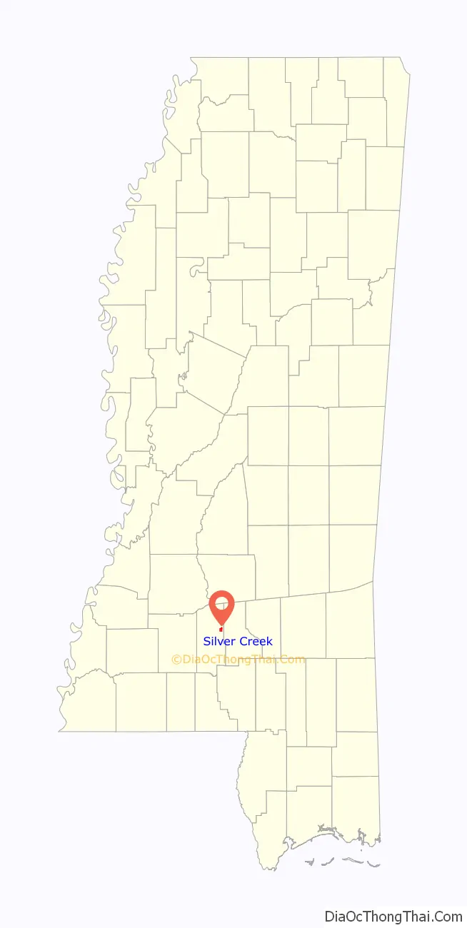
| State: | Mississippi |
| County: | Lawrence County |
| Elevation: | 269 ft (82 m) |
| Total Area: | 1.49 sq mi (3.87 km²) |
| Land Area: | 1.49 sq mi (3.87 km²) |
| Water Area: | 0.00 sq mi (0.00 km²) |
| Total Population: | 175 |
| Population Density: | 117.21/sq mi (45.25/km²) |
| ZIP code: | 39663 |
| Area code: | 601, 769 |
| FIPS code: | 2867960 |
| GNISfeature ID: | 0677792 |
Online Interactive Map
Click on ![]() to view map in "full screen" mode.
to view map in "full screen" mode.
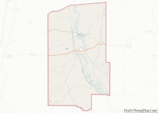
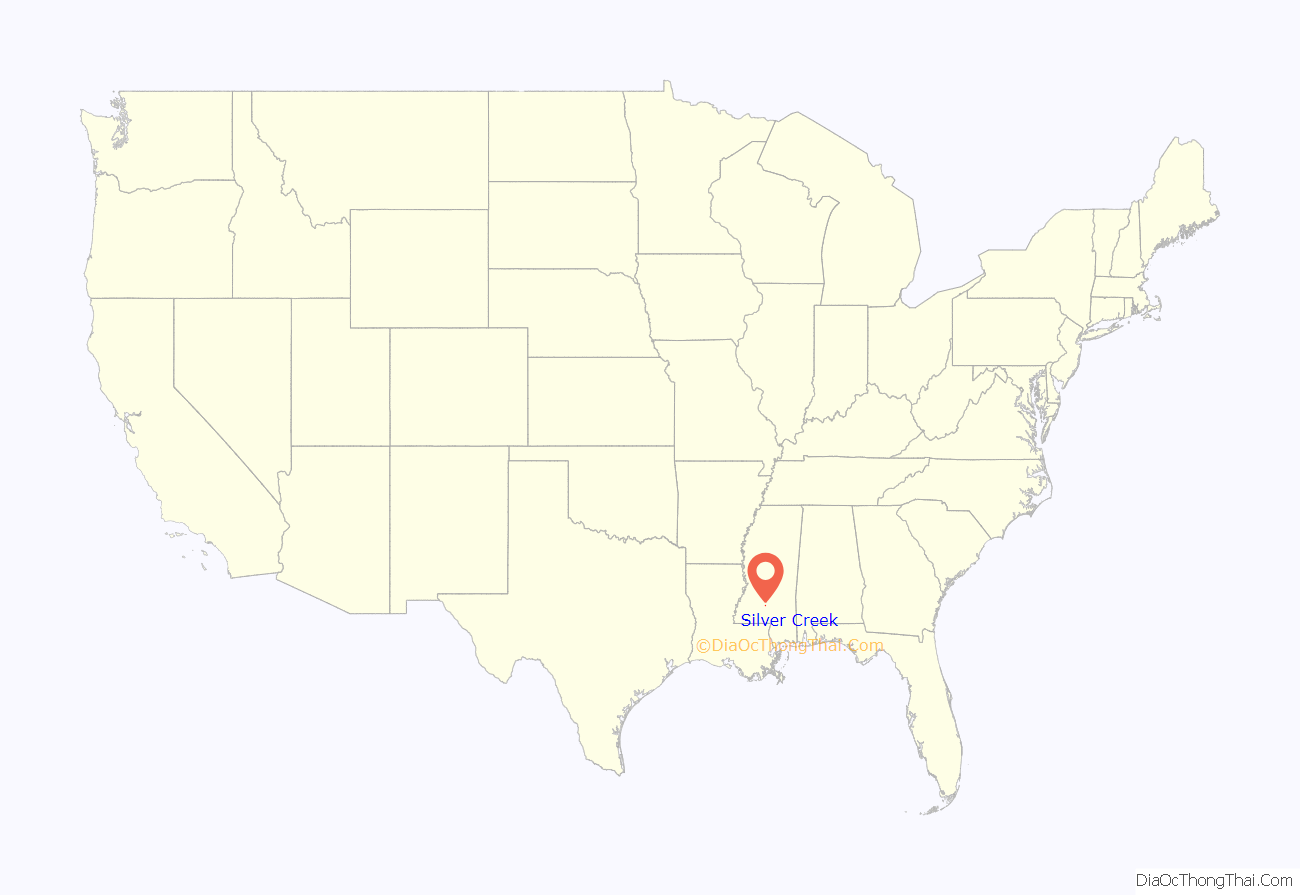
Silver Creek location map. Where is Silver Creek town?
History
The area was settled around 1820 by the Kirby, Neal, Longino, Price and Williams families. Originally named “The Hall”, it was changed in 1893 to Silver Creek for a nearby stream.
A depot was established in Silver Creek when the Pearl & Leaf Rivers Railroad (later Illinois Central Railroad) was completed in 1903.
In 1993, the Canadian National Railway abandoned the former Illinois Central line. The Columbia and Silver Creek Railroad was a shortline railroad that operated between Silver Creek and Columbia until 1992. The Rogers House, south of Silver Creek, is listed on the National Register of Historic Places.
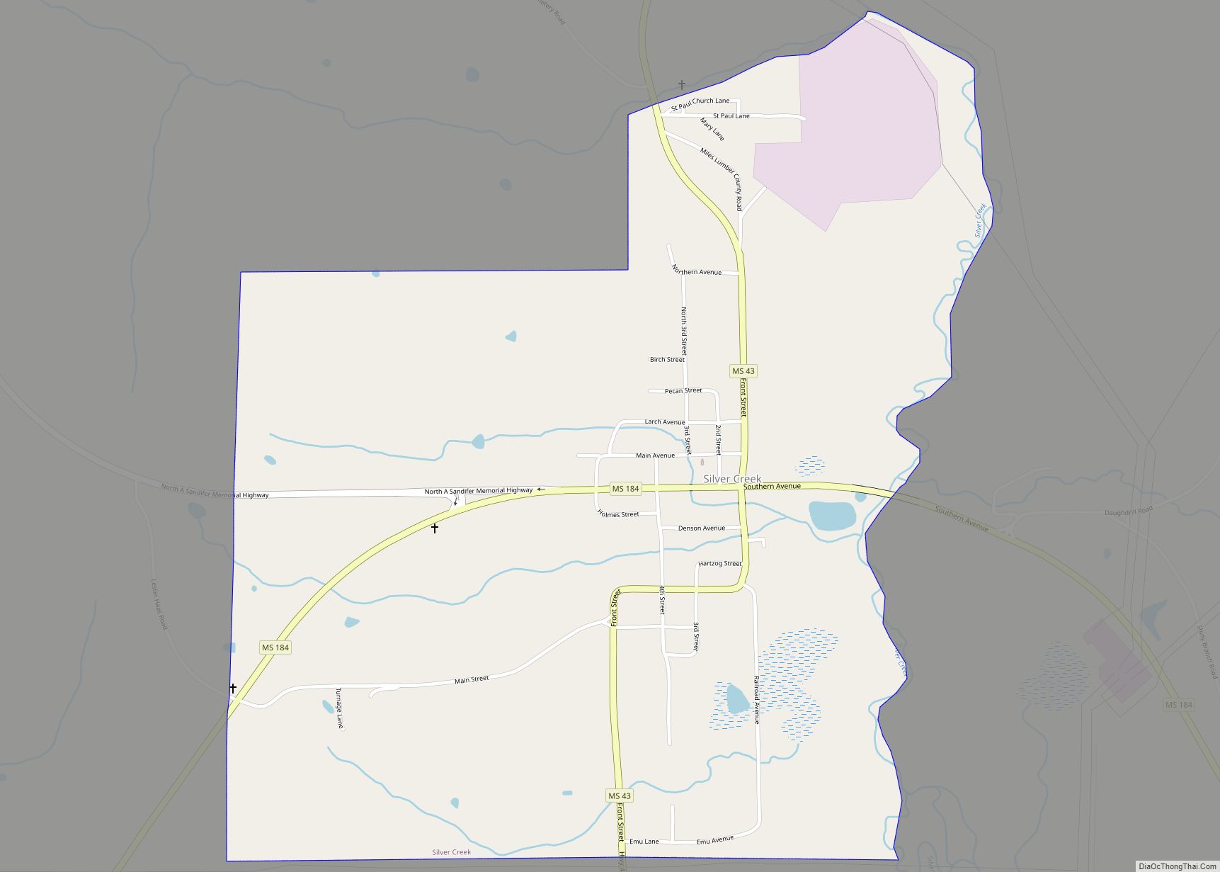
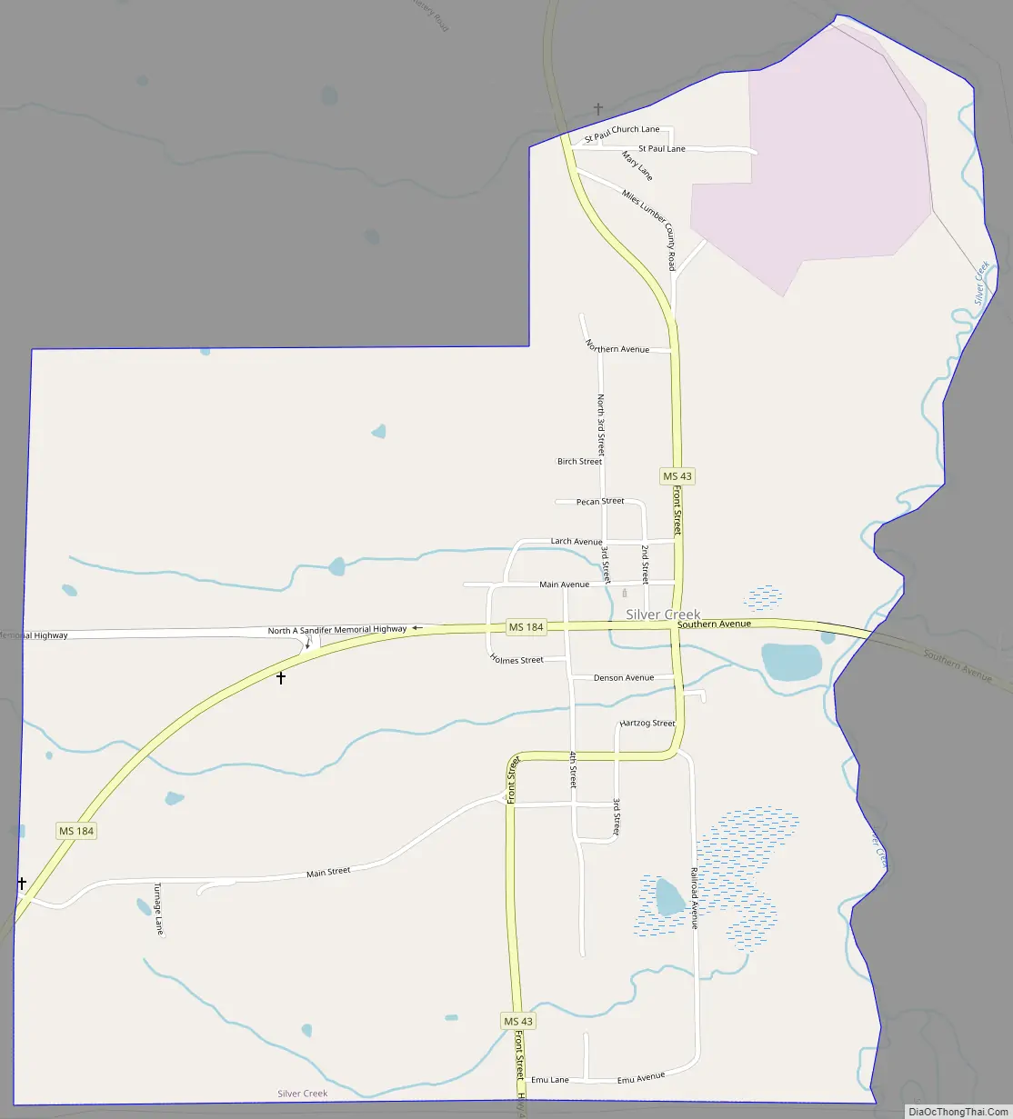
Silver Creek Road Map
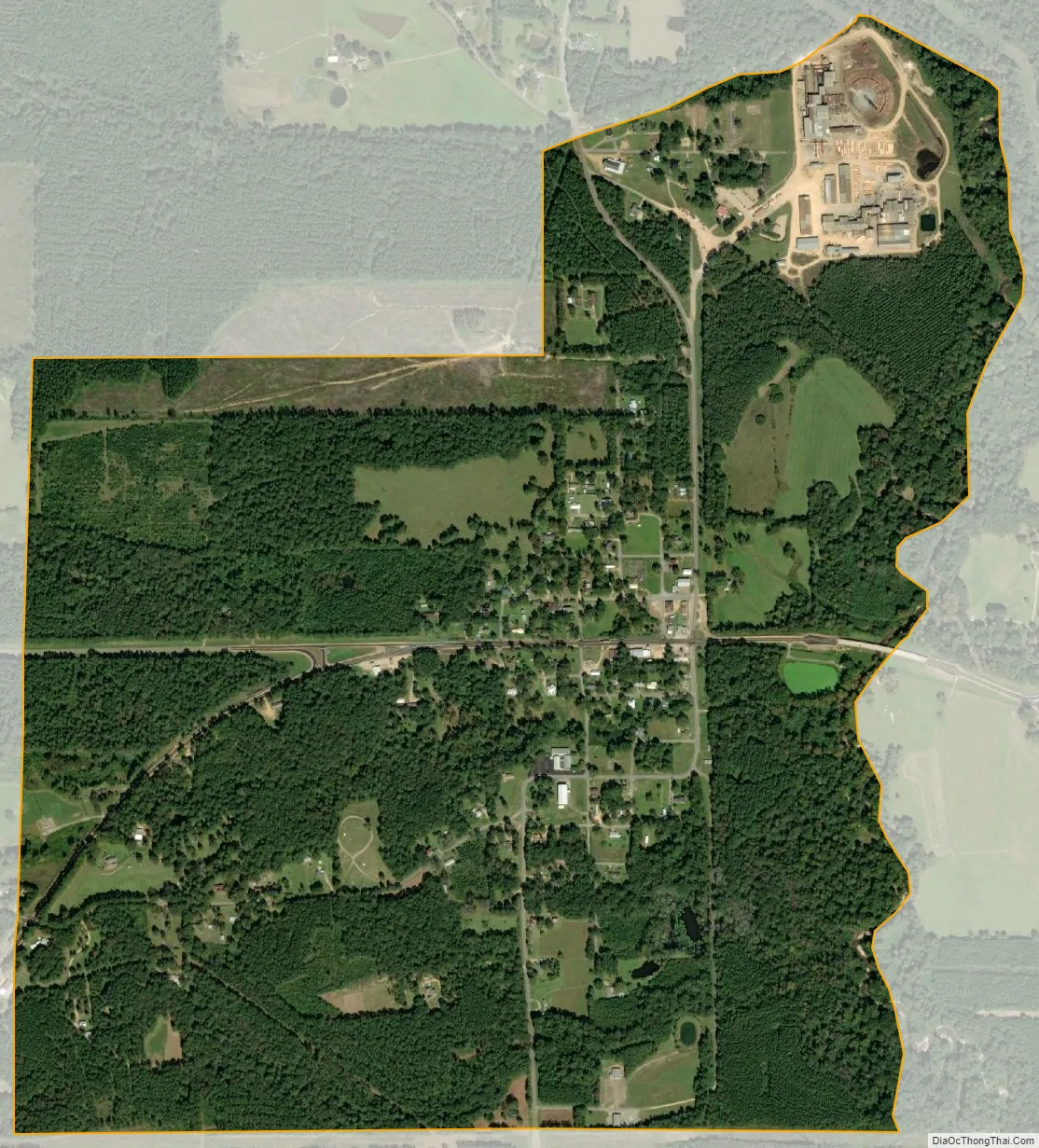
Silver Creek city Satellite Map
Geography
Silver Creek is located in eastern Lawrence County at 31°36′17″N 90°0′6″W / 31.60472°N 90.00167°W / 31.60472; -90.00167 (31.604656, -90.001588). U.S. Route 84 runs along the southern edge of the town, leading southwest 7 miles (11 km) to Monticello, the county seat, and east 8 miles (13 km) to Prentiss. Mississippi Highway 43 runs through the center of Silver Creek as Front Street, leading north 9 miles (14 km) to New Hebron. Highway 43A leads south from Silver Creek 8 miles (13 km) to Arm.
According to the United States Census Bureau, the town of Silver Creek has a total area of 1.5 square miles (3.9 km), all land. The eastern border of the town is a waterway called Silver Creek; it is a south-flowing tributary of the Pearl River.
See also
Map of Mississippi State and its subdivision:- Adams
- Alcorn
- Amite
- Attala
- Benton
- Bolivar
- Calhoun
- Carroll
- Chickasaw
- Choctaw
- Claiborne
- Clarke
- Clay
- Coahoma
- Copiah
- Covington
- Desoto
- Forrest
- Franklin
- George
- Greene
- Grenada
- Hancock
- Harrison
- Hinds
- Holmes
- Humphreys
- Issaquena
- Itawamba
- Jackson
- Jasper
- Jefferson
- Jefferson Davis
- Jones
- Kemper
- Lafayette
- Lamar
- Lauderdale
- Lawrence
- Leake
- Lee
- Leflore
- Lincoln
- Lowndes
- Madison
- Marion
- Marshall
- Monroe
- Montgomery
- Neshoba
- Newton
- Noxubee
- Oktibbeha
- Panola
- Pearl River
- Perry
- Pike
- Pontotoc
- Prentiss
- Quitman
- Rankin
- Scott
- Sharkey
- Simpson
- Smith
- Stone
- Sunflower
- Tallahatchie
- Tate
- Tippah
- Tishomingo
- Tunica
- Union
- Walthall
- Warren
- Washington
- Wayne
- Webster
- Wilkinson
- Winston
- Yalobusha
- Yazoo
- Alabama
- Alaska
- Arizona
- Arkansas
- California
- Colorado
- Connecticut
- Delaware
- District of Columbia
- Florida
- Georgia
- Hawaii
- Idaho
- Illinois
- Indiana
- Iowa
- Kansas
- Kentucky
- Louisiana
- Maine
- Maryland
- Massachusetts
- Michigan
- Minnesota
- Mississippi
- Missouri
- Montana
- Nebraska
- Nevada
- New Hampshire
- New Jersey
- New Mexico
- New York
- North Carolina
- North Dakota
- Ohio
- Oklahoma
- Oregon
- Pennsylvania
- Rhode Island
- South Carolina
- South Dakota
- Tennessee
- Texas
- Utah
- Vermont
- Virginia
- Washington
- West Virginia
- Wisconsin
- Wyoming