Prentiss is a town in Jefferson Davis County, Mississippi. The population was 1,081 at the 2010 census, down from 1,158 at the 2000 census. It is the county seat.
Prentiss is located on the Longleaf Trace, Mississippi’s first recreational rail trail.
| Name: | Prentiss town |
|---|---|
| LSAD Code: | 43 |
| LSAD Description: | town (suffix) |
| State: | Mississippi |
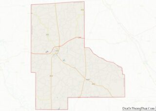
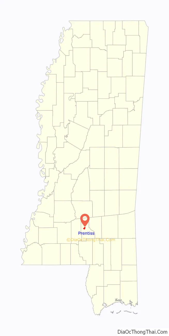
| County: | Jefferson Davis County |
| Elevation: | 331 ft (101 m) |
| Total Area: | 2.99 sq mi (7.75 km²) |
| Land Area: | 2.99 sq mi (7.75 km²) |
| Water Area: | 0.00 sq mi (0.00 km²) |
| Total Population: | 976 |
| Population Density: | 326.31/sq mi (126.01/km²) |
| ZIP code: | 39474 |
| Area code: | 601 |
| FIPS code: | 2859920 |
| GNISfeature ID: | 0676320 |
| Website: | prentissms.com |
Online Interactive Map
Click on ![]() to view map in "full screen" mode.
to view map in "full screen" mode.
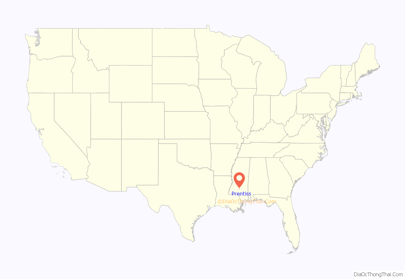
Prentiss location map. Where is Prentiss town?
History
Originally part of Lawrence County, the town was first named “Blountville”, after William Blount, an early settler and merchant. Blountville High School was established in 1885 on 10 acres (4.0 ha) of land. A depot was established in Blountville when the Pearl & Leaf Rivers Railroad (later Illinois Central Railroad) was completed in 1903. That same year the town was officially established and named “Prentiss”, after Prentiss Webb Berry, a prominent landowner in the area.
When Jefferson Davis County was created in 1906, a special election determined that Prentiss would serve as the county seat. In 1907, Jonas Edward Johnson and his wife Bertha LaBranche Johnson established the Prentiss Institute. Situated on 40 acres (16 ha) of land, with remnants of slave quarters on the property, it was considered one of the finest schools for African Americans in Mississippi. The school at first taught only the elementary grades, and began with 40 students whose tuition was often paid with chickens, eggs and produce. A Rosenwald classroom was built on the campus in 1926, and by 1953 the “Prentiss Normal and Industrial Institute” included a high school and junior college, had 44 faculty and more than 700 students, and included 24 buildings and 400 acres (160 ha) of farmland, pasture and forest. In 1955, Heifer International donated 15 pure-bred cows to the school with the intention that the offspring be donated to needy farm families. It is noteworthy that the school gave some of the animals to poor white families. The school closed in 1989 and was designated an official Mississippi landmark in 2002.
Ralph Fults and Raymond Hamilton, members of the notorious Barrow Gang, robbed the bank in Prentiss in 1935.
In 1958, Rev. H.D. Darby of Prentiss filed a federal lawsuit challenging Mississippi’s rigid voting eligibility laws for African Americans; it was the first lawsuit of its kind in Mississippi.
Prentiss police officer Ron Jones, Jr. was shot and killed by Cory Maye while executing a search warrant in 2001.
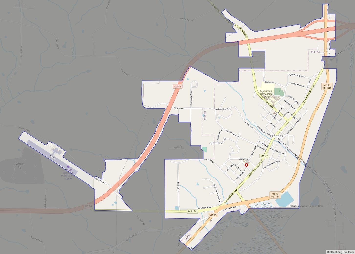
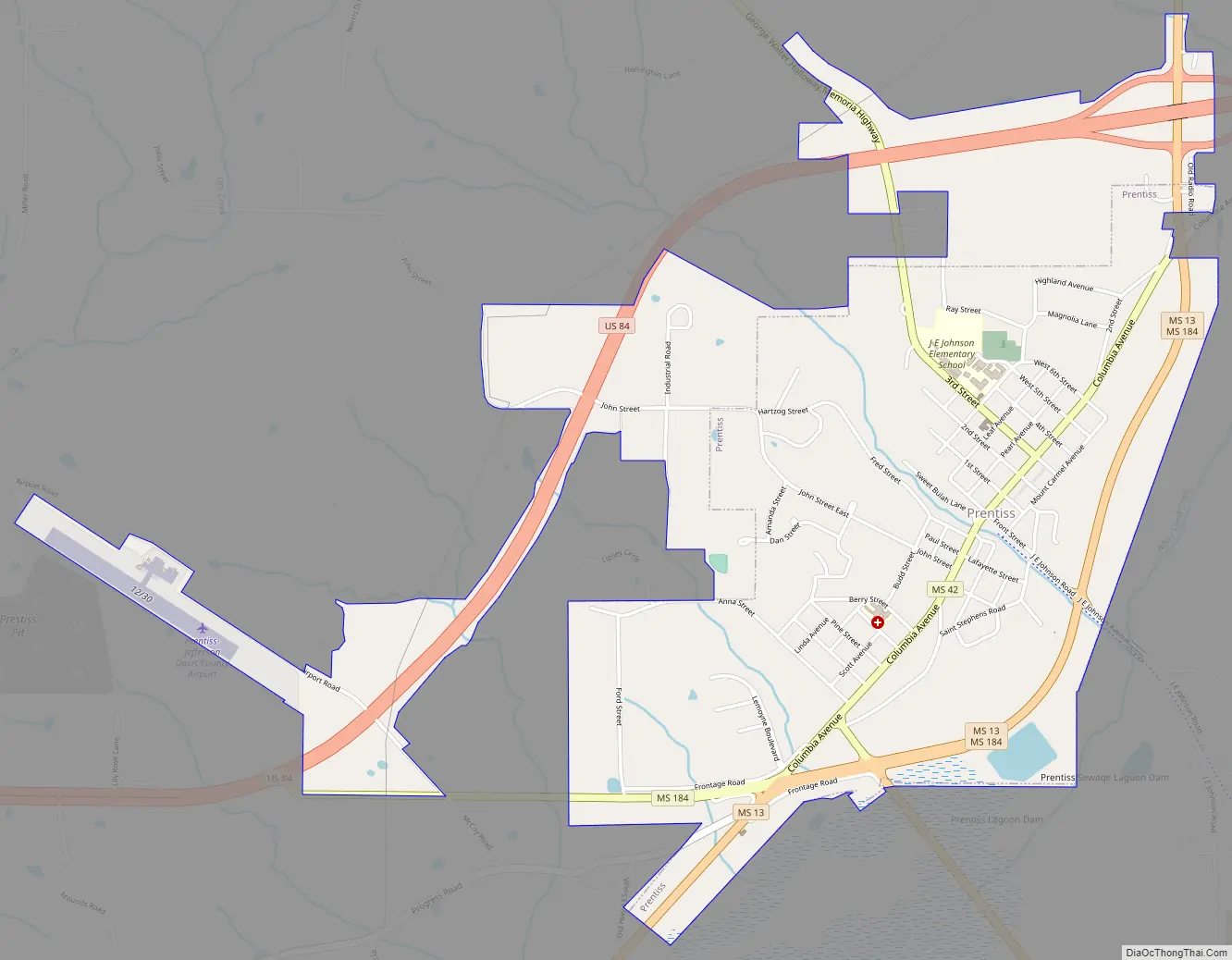
Prentiss Road Map
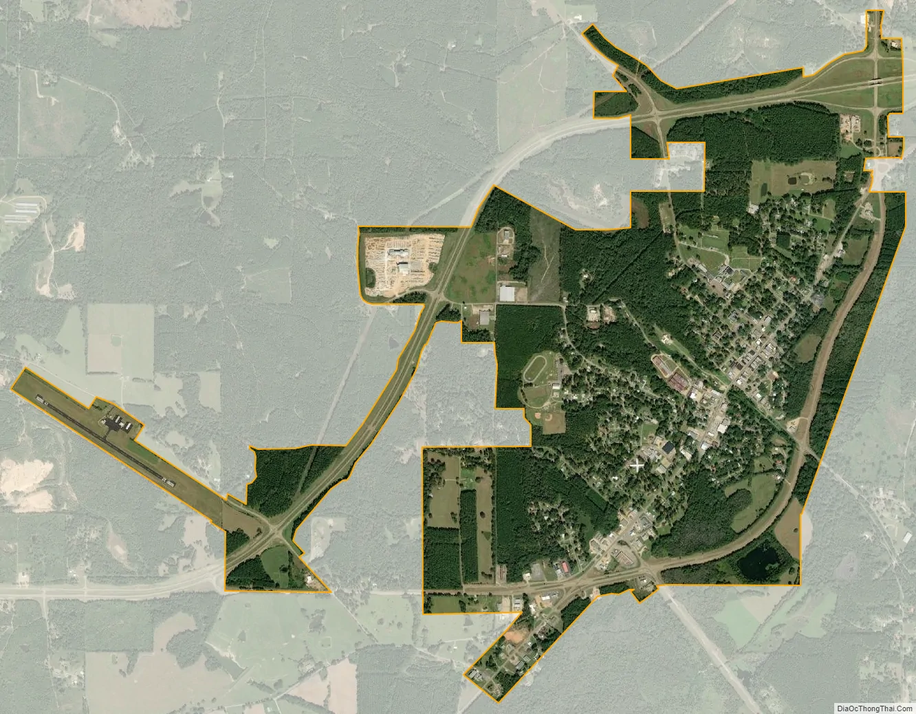
Prentiss city Satellite Map
Geography
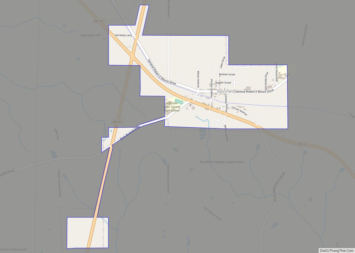
Prentiss is located in central Jefferson Davis County at 31°35′49″N 89°52′11″W / 31.596990°N 89.869776°W / 31.596990; -89.869776. U.S. Route 84 passes north and west of the town center on a bypass; the four-lane highway leads east 20 miles (32 km) to Collins and west 16 miles (26 km) to Monticello. Mississippi Highway 13 passes through the town slightly east of the center; it leads north 27 miles (43 km) to Mendenhall and south 26 miles (42 km) to Columbia. Mississippi Highway 42 leads southeast from Prentiss 11 miles (18 km) to Bassfield.
According to the United States Census Bureau, the town has a total area of 1.9 square miles (4.9 km), all land.
See also
Map of Mississippi State and its subdivision:- Adams
- Alcorn
- Amite
- Attala
- Benton
- Bolivar
- Calhoun
- Carroll
- Chickasaw
- Choctaw
- Claiborne
- Clarke
- Clay
- Coahoma
- Copiah
- Covington
- Desoto
- Forrest
- Franklin
- George
- Greene
- Grenada
- Hancock
- Harrison
- Hinds
- Holmes
- Humphreys
- Issaquena
- Itawamba
- Jackson
- Jasper
- Jefferson
- Jefferson Davis
- Jones
- Kemper
- Lafayette
- Lamar
- Lauderdale
- Lawrence
- Leake
- Lee
- Leflore
- Lincoln
- Lowndes
- Madison
- Marion
- Marshall
- Monroe
- Montgomery
- Neshoba
- Newton
- Noxubee
- Oktibbeha
- Panola
- Pearl River
- Perry
- Pike
- Pontotoc
- Prentiss
- Quitman
- Rankin
- Scott
- Sharkey
- Simpson
- Smith
- Stone
- Sunflower
- Tallahatchie
- Tate
- Tippah
- Tishomingo
- Tunica
- Union
- Walthall
- Warren
- Washington
- Wayne
- Webster
- Wilkinson
- Winston
- Yalobusha
- Yazoo
- Alabama
- Alaska
- Arizona
- Arkansas
- California
- Colorado
- Connecticut
- Delaware
- District of Columbia
- Florida
- Georgia
- Hawaii
- Idaho
- Illinois
- Indiana
- Iowa
- Kansas
- Kentucky
- Louisiana
- Maine
- Maryland
- Massachusetts
- Michigan
- Minnesota
- Mississippi
- Missouri
- Montana
- Nebraska
- Nevada
- New Hampshire
- New Jersey
- New Mexico
- New York
- North Carolina
- North Dakota
- Ohio
- Oklahoma
- Oregon
- Pennsylvania
- Rhode Island
- South Carolina
- South Dakota
- Tennessee
- Texas
- Utah
- Vermont
- Virginia
- Washington
- West Virginia
- Wisconsin
- Wyoming