Waveland is a city located in Hancock County, Mississippi, United States, on the Gulf of Mexico. It is part of the Gulfport–Biloxi, Mississippi Metropolitan Statistical Area. The city of Waveland was incorporated in 1972. As of the 2010 census, the city had a population of 6,435. Waveland was nearly destroyed by Hurricane Camille on August 17, 1969, and by Hurricane Katrina on August 29, 2005.
The current mayor of Waveland is Jay Trapani.
| Name: | Waveland city |
|---|---|
| LSAD Code: | 25 |
| LSAD Description: | city (suffix) |
| State: | Mississippi |
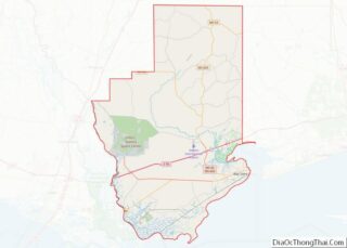
| County: | Hancock County |
| Elevation: | 16 ft (5 m) |
| Total Area: | 8.63 sq mi (22.36 km²) |
| Land Area: | 8.49 sq mi (21.99 km²) |
| Water Area: | 0.14 sq mi (0.37 km²) |
| Total Population: | 7,210 |
| Population Density: | 849.23/sq mi (327.90/km²) |
| ZIP code: | 39576 |
| Area code: | 228 |
| FIPS code: | 2878200 |
| GNISfeature ID: | 0679394 |
| Website: | waveland.ms.gov |
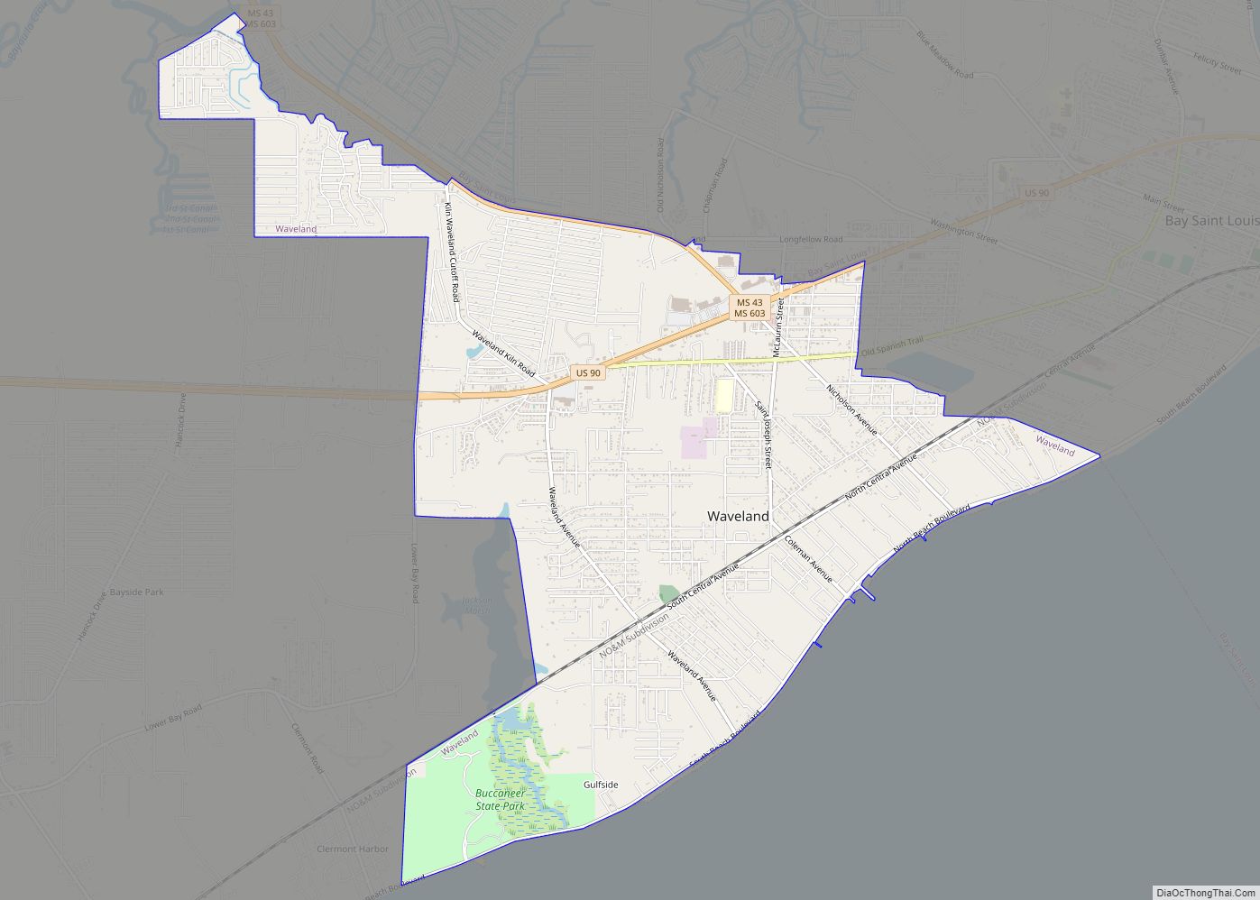
Online Interactive Map
Click on ![]() to view map in "full screen" mode.
to view map in "full screen" mode.
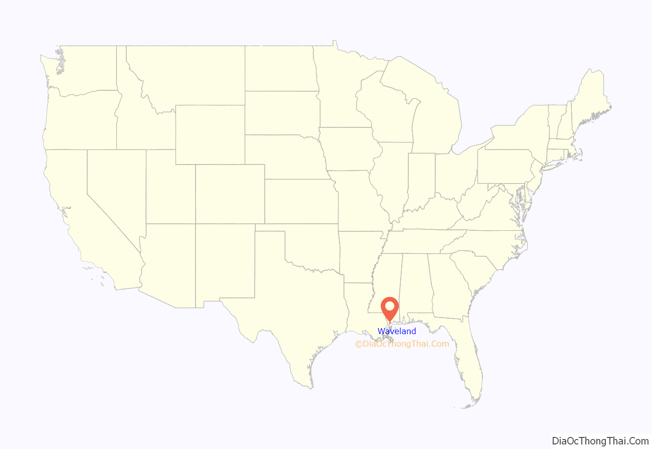
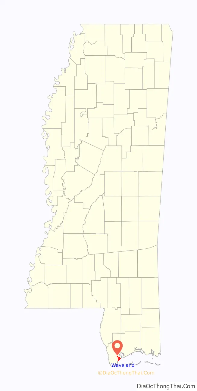
Waveland location map. Where is Waveland city?
History
Andrew Jackson once lived and owned land in Waveland on what is now known as Jackson Ridge. Much of Jackson Ridge later became Buccaneer State Park.
The Silver Slipper Casino opened on November 9, 2006.
Hurricane Camille
On August 17, 1969, Hurricane Camille made landfall at the tip of Louisiana before continuing on shore at Waveland. The storm heavily damaged the areas south of the Louisville and Nashville Railroad. Recovery efforts went on for nearly a decade. The town later erected a plaque commemorating the efforts of the volunteers who committed time and resources towards rebuilding.
Hurricane Katrina
The city of Waveland was “ground zero” of Hurricane Katrina’s landfall on August 29, 2005. The city received massive damage and is still in the process of recovering and rebuilding. South of the CSXT mainline, the area was almost completely destroyed. The rest of the city took heavy flooding. In a news report, state officials said Waveland took a harder hit from the wind and water than any other town along the Gulf Coast, and that the town was obliterated. Official reports stated that approximately 50 people died when Waveland was hit directly by the eyewall of Katrina and the 26-foot (7.9 m) storm surge. Hurricane Katrina came ashore during the high tide of 8:01 am, +2.2 feet more.
Hurricane Katrina damaged over 40 Mississippi libraries, gutting the Waveland Public Library, as a total loss, requiring a complete rebuild.
A group of social activists seeking to better the lives of local residents, called the “Rainbow Family”, arrived in Waveland soon after Hurricane Katrina. From early September to early December 2005, they ran the “New Waveland Cafe & Clinic” in the parking lot of Fred’s Dept Store on Highway 90. The café provided free hot meals three times a day. The clinic was staffed by volunteer doctors and nurses from throughout the United States who saw over 5,000 patients during the duration, free of charge and dispensing free medications. Donations of medications and supplies came from a multitude of sources, with International Aid arranging the most donations. This was the first experience of the counter-culture Rainbow Family in running a disaster relief center. The Bastrop Christian Outreach Center also volunteered with the Rainbow Family.
Waveland Elementary School, which has served public school students in Grades K-3 (Grades 4-5 attend Second Street Elementary in nearby Bay St. Louis), was heavily damaged by Katrina. The students attending the school were educated in portable classrooms for the beginning of the 2006–2007 school year, pending a permanent solution.
The recovery of Waveland was due in part to the faith-based disaster recovery effort in and around the Waveland area. Shoreline Park Baptist Church in Waveland and Pastor Ed Murphy were vital to this effort, housing and feeding hundreds of missionaries from around the country for many years following Hurricane Katrina in what were referred to as “Pods for God”. Shoreline Park Baptist Church directed the repair and, in some instances, the rebuilding of homes in the area for many years after the devastation.
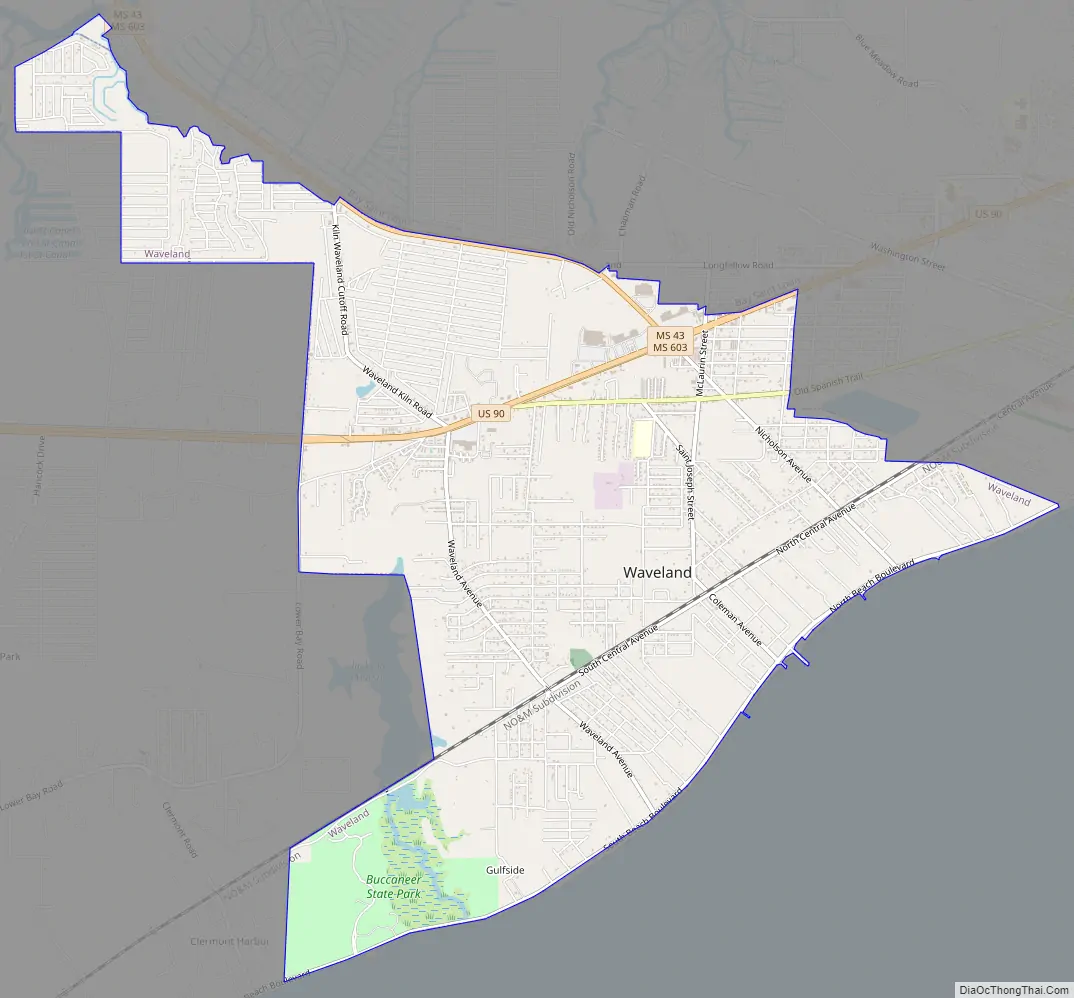
Waveland Road Map
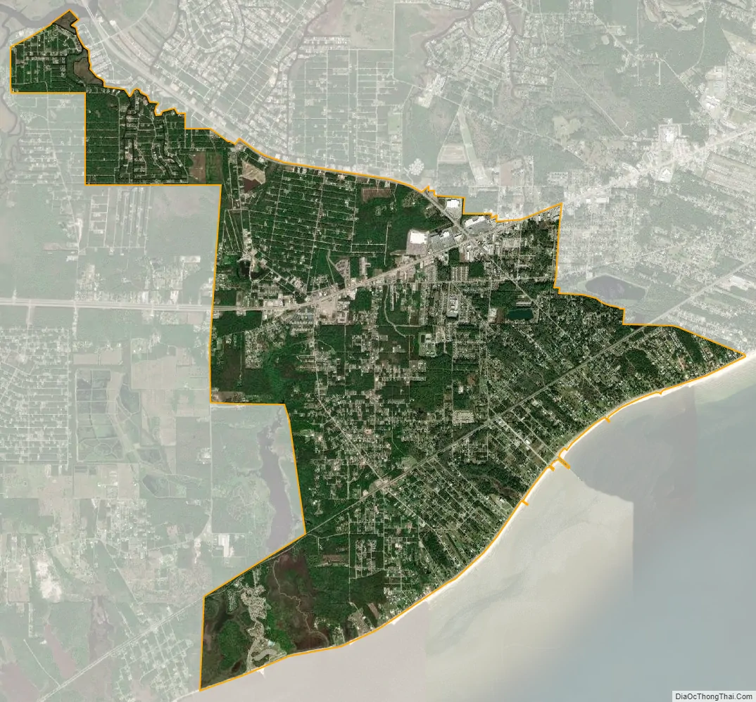
Waveland city Satellite Map
Geography
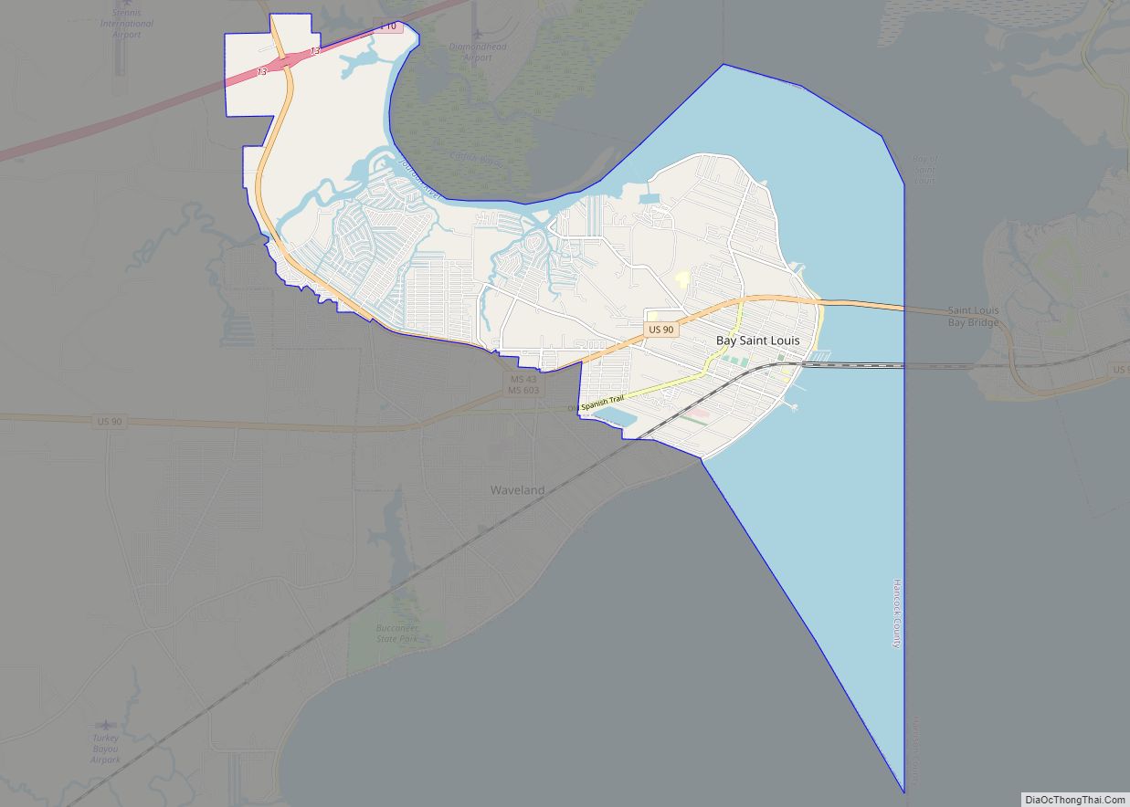
Waveland is in southeastern Hancock County along the shore of Mississippi Sound, an embayment of the Gulf of Mexico. It is bordered to the north and northeast by the city of Bay St. Louis. U.S. Route 90 passes through the northern side of the city, leading east across the Bay of Saint Louis 18 miles (29 km) to Gulfport and west 55 miles (89 km) to New Orleans. Beach Boulevard (Mississippi Highway 606) passes along the shoreline, connecting Waveland with Buccaneer State Park and the communities of Lakeshore and Clermont Harbor.
According to the U.S. Census Bureau, Waveland has a total area of 8.6 square miles (22.4 km), of which 8.5 square miles (22.0 km) are land and 0.2 square miles (0.4 km), or 1.66%, are water.
See also
Map of Mississippi State and its subdivision:- Adams
- Alcorn
- Amite
- Attala
- Benton
- Bolivar
- Calhoun
- Carroll
- Chickasaw
- Choctaw
- Claiborne
- Clarke
- Clay
- Coahoma
- Copiah
- Covington
- Desoto
- Forrest
- Franklin
- George
- Greene
- Grenada
- Hancock
- Harrison
- Hinds
- Holmes
- Humphreys
- Issaquena
- Itawamba
- Jackson
- Jasper
- Jefferson
- Jefferson Davis
- Jones
- Kemper
- Lafayette
- Lamar
- Lauderdale
- Lawrence
- Leake
- Lee
- Leflore
- Lincoln
- Lowndes
- Madison
- Marion
- Marshall
- Monroe
- Montgomery
- Neshoba
- Newton
- Noxubee
- Oktibbeha
- Panola
- Pearl River
- Perry
- Pike
- Pontotoc
- Prentiss
- Quitman
- Rankin
- Scott
- Sharkey
- Simpson
- Smith
- Stone
- Sunflower
- Tallahatchie
- Tate
- Tippah
- Tishomingo
- Tunica
- Union
- Walthall
- Warren
- Washington
- Wayne
- Webster
- Wilkinson
- Winston
- Yalobusha
- Yazoo
- Alabama
- Alaska
- Arizona
- Arkansas
- California
- Colorado
- Connecticut
- Delaware
- District of Columbia
- Florida
- Georgia
- Hawaii
- Idaho
- Illinois
- Indiana
- Iowa
- Kansas
- Kentucky
- Louisiana
- Maine
- Maryland
- Massachusetts
- Michigan
- Minnesota
- Mississippi
- Missouri
- Montana
- Nebraska
- Nevada
- New Hampshire
- New Jersey
- New Mexico
- New York
- North Carolina
- North Dakota
- Ohio
- Oklahoma
- Oregon
- Pennsylvania
- Rhode Island
- South Carolina
- South Dakota
- Tennessee
- Texas
- Utah
- Vermont
- Virginia
- Washington
- West Virginia
- Wisconsin
- Wyoming