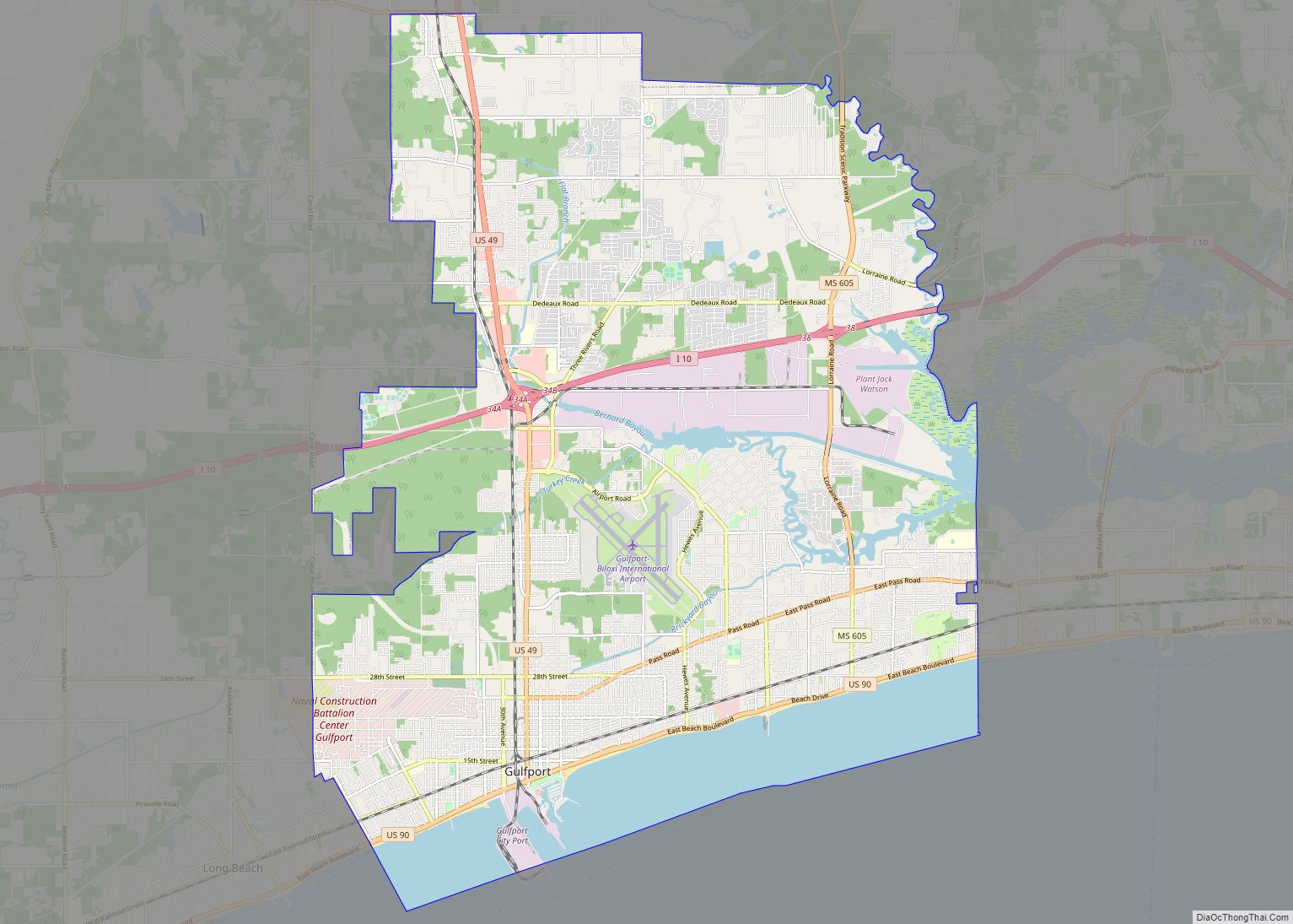
Gulfport is the second-largest city in U.S. state of Mississippi after the state capital, Jackson. Along with Biloxi, Gulfport is the co-county seat of Harrison County and the larger of the two principal cities of the Gulfport–Biloxi metropolitan area. As of the 2020 census, the city of Gulfport had a total population of 72,926, with 416,259 residents in its metro area. The city lies along the Gulf Coast in southern Mississippi, taking its name from its port on the Mississippi Sound. It is also home to the U.S. Navy Atlantic Fleet Seabees.
| Name: | Gulfport city |
|---|---|
| LSAD Code: | 25 |
| LSAD Description: | city (suffix) |
| State: | Mississippi |
| County: | Harrison County |
| Incorporated: | July 28, 1898 |
| Elevation: | 20 ft (6 m) |
| Land Area: | 55.62 sq mi (144.06 km²) |
| Water Area: | 8.39 sq mi (21.73 km²) |
| Population Density: | 1,311.08/sq mi (506.21/km²) |
| Area code: | 228 |
| FIPS code: | 2829700 |
| GNISfeature ID: | 0670771 |
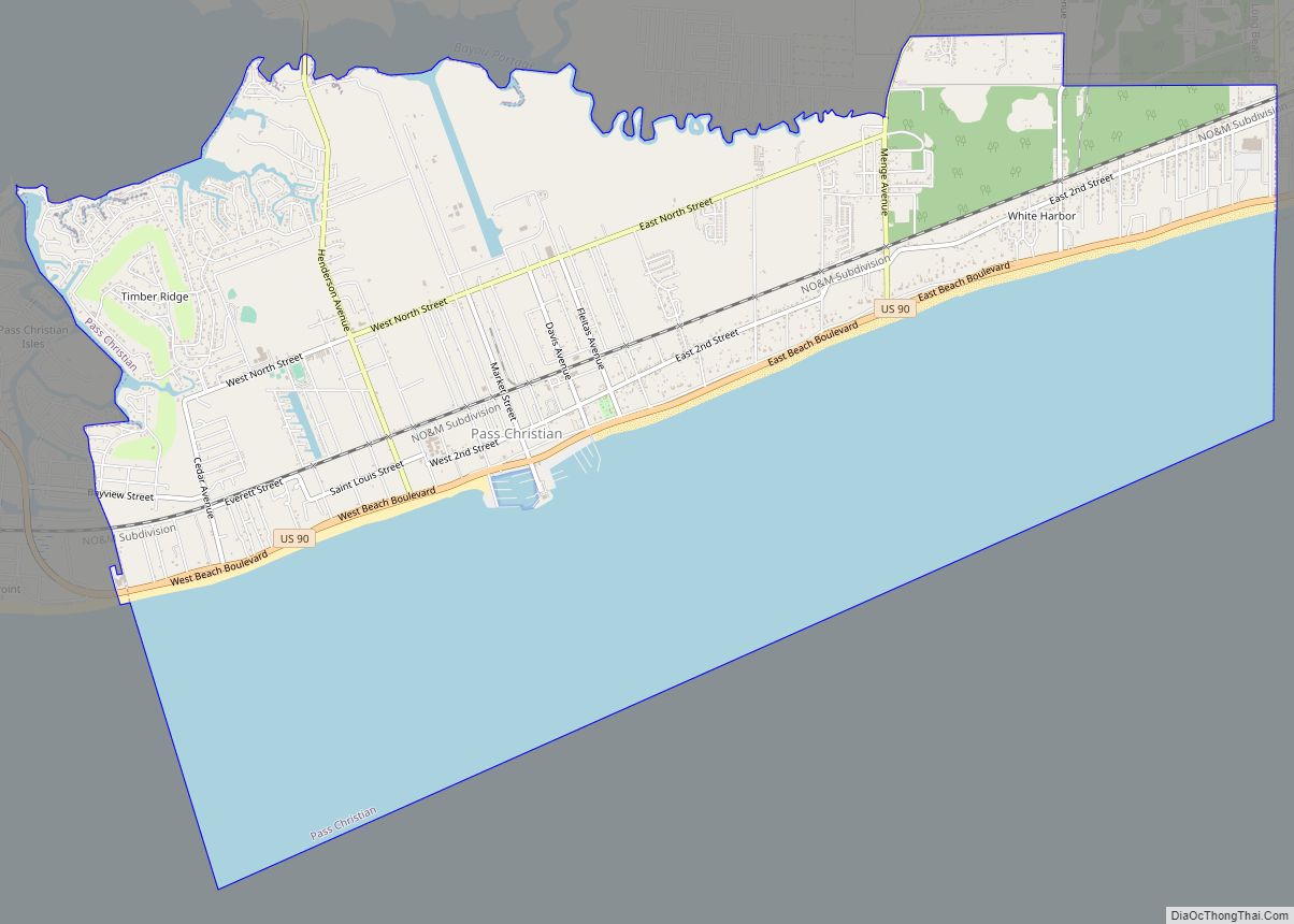
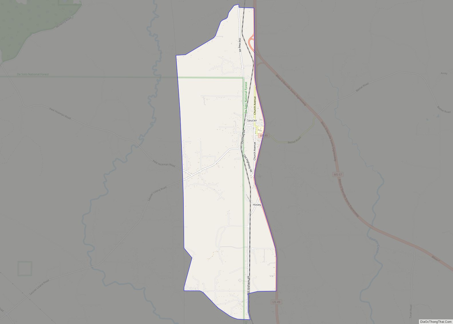
Online Interactive Map
Click on ![]() to view map in "full screen" mode.
to view map in "full screen" mode.
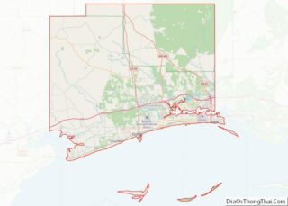
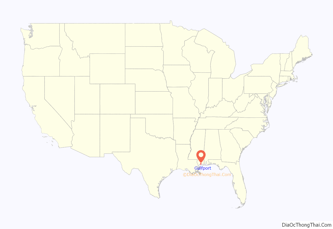
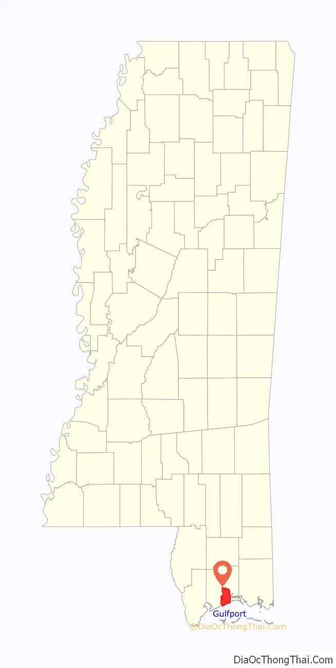
Gulfport location map. Where is Gulfport city?
History
This area was occupied by indigenous cultures for thousands of years, culminating in the historic encounter between the Choctaw and the first European explorers of the area. Along the Gulf Coast, French colonists founded nearby Biloxi, and Mobile in the 18th century, well before the area was acquired from France by the United States in 1803 in the Louisiana Purchase. By the Indian Removal Act of 1830, the United States completed treaties to extinguish Choctaw and other tribal land claims and removed them to Indian Territory, now Oklahoma. In that period, the other four of the Five Civilized Tribes in the Southeast were also removed, to make way for white settlers to take over the lands and develop them for agriculture, especially cotton.
An early settlement near this location, known as Mississippi City, appeared on a map of Mississippi from 1855. Mississippi City was the county seat of Harrison County from 1841 to 1902, but is now a suburb in east Gulfport.
Gulfport was incorporated on July 28, 1898. The city was founded by William H. Hardy, who was president of the Gulf and Ship Island Railroad (G&SIRR) that connected inland lumber mills to the coast. He was joined by Joseph T. Jones, who later took over the G&SIRR, dredged the harbor in Gulfport, and opened the shipping channel to the sea. In 1902, the harbor was completed and the Port of Gulfport became a working seaport. On April 28, 1904, the Treasury Department changed the port of entry for the district of the Pearl River from Shieldsboro to Gulfport. It now accounts for millions of dollars in annual sales and tax revenue for the state of Mississippi.
In 1910, the U.S. Post Office and Customhouse was built here. This Gulfport Post office was listed on the National Register of Historic Places in 1984.
In March 1916, Mayor George M. Foote announced that the Andrew Carnegie foundation was going to aid in construction of a Carnegie Library in Gulfport. The city had agreed to providing matching funds for the construction as well as committing to provide operating funds. In the 20th century, the city developed as an important port; as it was served by railroads from the interior, it stimulated town growth by providing a way to get products to markets.
The city’s location on the coast made it vulnerable to hurricanes and it weathered several. But on August 17, 1969, Gulfport and the Mississippi Gulf Coast were hit by Hurricane Camille. Measured by central pressure, Camille was the second-strongest hurricane to make U.S. landfall in recorded history. The area of total destruction in Harrison County was 68 square miles (180 km).[11] The total estimated cost of damage was $1.42 billion (1969 USD, $9 billion 2012 USD).[12] Camille was the second-most expensive hurricane in the United States, up to that point (behind Hurricane Betsy).[13] The storm directly killed 143 people in Alabama, Mississippi, and Louisiana.
In December 1993, the City annexed 33 square miles (85 km) north of Gulfport, making it the second-largest city in Mississippi.
Hurricane Katrina
On August 29, 2005, Gulfport was hit by the strong eastern side of Hurricane Katrina. Much of the city was flooded or destroyed that day by the strong, hurricane-force winds, which lasted more than 16 hours, and a storm surge exceeding 28 feet (8.5 m) in some sections.
Hurricane Katrina damaged more than 40 Mississippi libraries, gutting the Gulfport Public Library, first floor, and breaking windows on the second floor, beyond repair. It required total reconstruction.
Although Katrina’s damage was far more widespread, it was not the fiercest hurricane to hit Gulfport. Katrina, a Category 3 storm at landfall, was dwarfed by Hurricane Camille, a Category 5 storm, which had hit Gulfport and neighboring communities on August 17, 1969, with 175 mph sustained winds compared to Katrina’s 120 mph sustained winds.
The Sun Herald newspaper in Biloxi-Gulfport won the 2006 Pulitzer Prize in journalism for its Katrina coverage. The local ABC television affiliate, WLOX, won the Peabody Award for its Hurricane Katrina coverage.
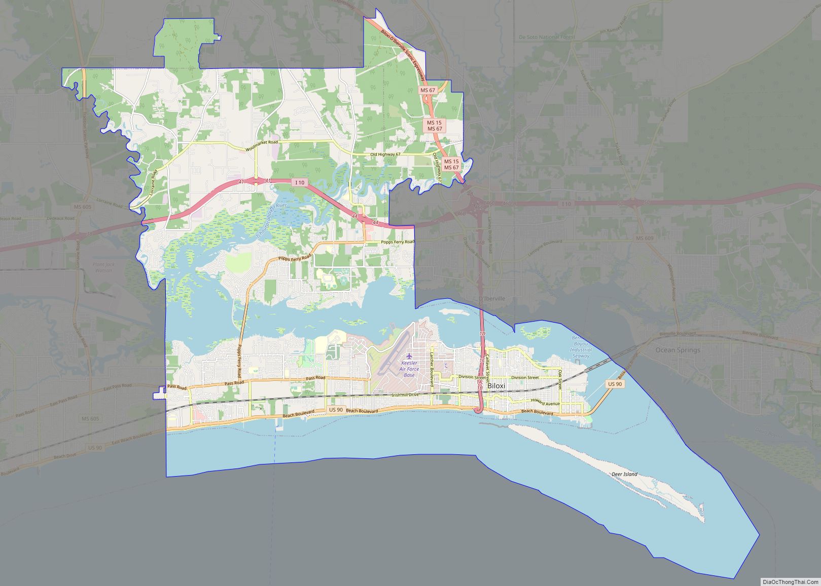
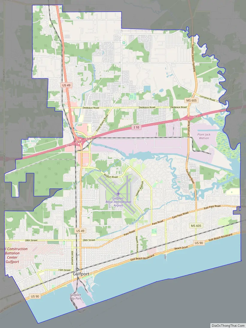
Gulfport Road Map
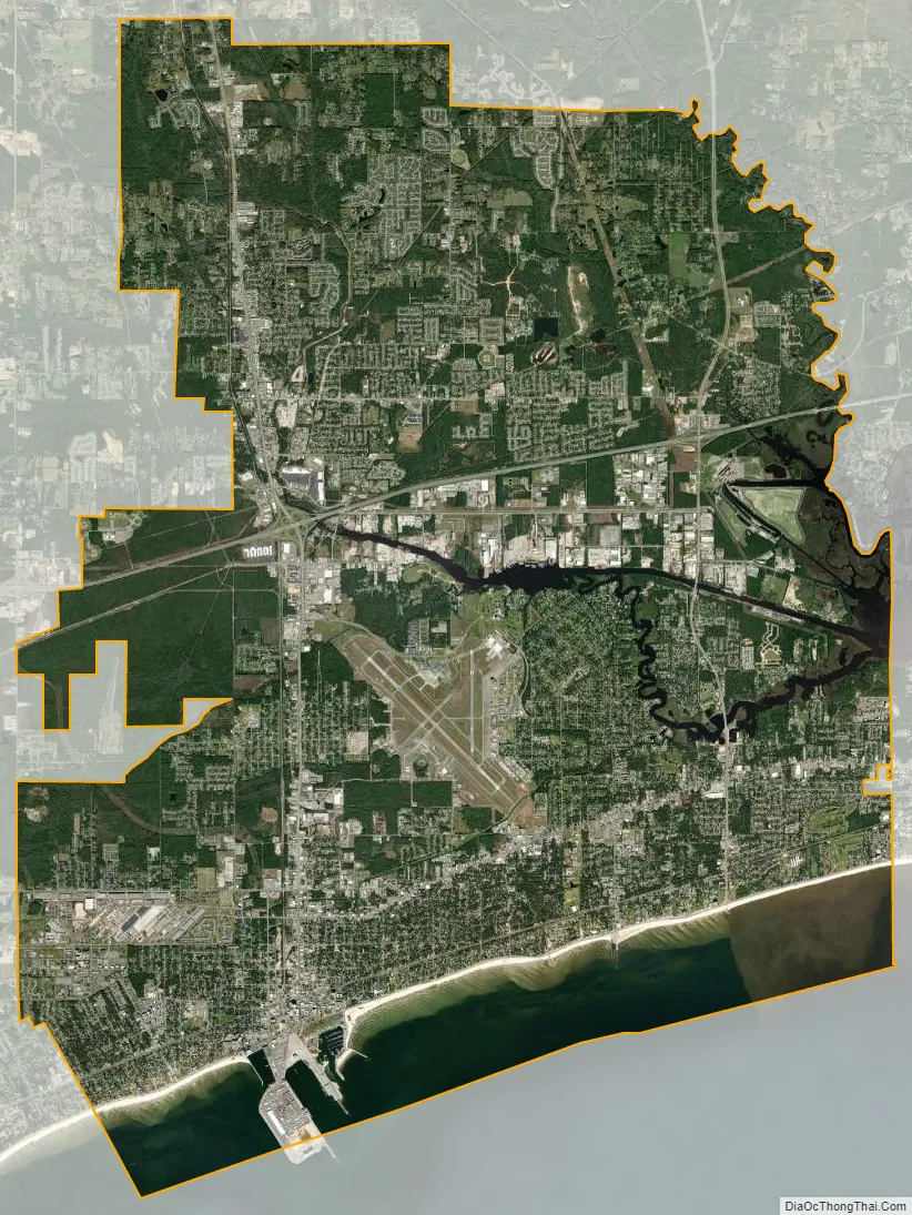
Gulfport city Satellite Map
Geography
According to the United States Census Bureau, the city had a total area of 64.2 sq mi (166.4 km), of which 56.9 sq mi (147.4 km) is land and 7.3 sq mi (19.0 km) (11.40%) is water.
Gulfport Formation, here named in Harrison Co., southeastern MS, described as barrier ridge composed of white, medium- to fine-grained sand, yellow-orange near surface. Thickness ranges form 5.0 to 9.5 m. Overlies Biloxi Formation. Age is late Pleistocene.
Gulfport Formation is limited to a 1- to 3-km-wide discontinuous barrier ridge belt that borders the Gulf mainland shore. Commonly overlies Prairie Formation (alluvium) landward and Biloxi Formation (shelf deposits) near shore. Grades upward from poorly to moderately sorted shoreface sands to foreshore sand and dunes. Fig. 1 shows unit extending from Gulfport, MS, eastward to the mouth of the Ochlockonee River, Franklin County, Florida. Deposited during the Sangamonian.
Neighborhoods
The city listed 39 official neighborhoods in 2000. These neighborhoods are sometimes subdivisions or accumulations of gradual home development. These include:
- Lyman
- Orange Grove
- Biloxi River
- Lorraine
- The Reserve
- Pine Hills
- Bayou Bernard Industrial District
- Bayou View North
- The Island
- Fernwood
- Handsboro
- College Park
- Silver Ridge
- Great Southern
- Mississippi City
- Gooden
- East Park
- Bayou View South
- Magnolia Grove
- East Beach
- Broadmoor
- Soria City
- CBD
- State Port & Jones Park
- West Beach
- Gaston Point
- Fairgrounds
- Central Gulfport
- 25th Avenue Commercial
- Original Gulfport
- Mid-City
- Brickyard Bayou
- North Gulfport Industrial Center
- Turkey Creek
- North Gulfport
- CB Base
- Gulfport Heights
- Forest Heights
- Sports Super Complex
Climate
Gulfport has a humid subtropical climate, which is strongly moderated by the Gulf of Mexico. Winters are short and generally mild; cold spells do occur, but seldom last long. Snow flurries are rare in the city, with no notable accumulation occurring most years. Summers are generally long, hot and humid, though the city’s proximity to the Gulf prevents extreme summer highs, as seen farther inland. Gulfport is subject to extreme weather, most notably tropical storm activity through the Gulf of Mexico.
See also
Map of Mississippi State and its subdivision:- Adams
- Alcorn
- Amite
- Attala
- Benton
- Bolivar
- Calhoun
- Carroll
- Chickasaw
- Choctaw
- Claiborne
- Clarke
- Clay
- Coahoma
- Copiah
- Covington
- Desoto
- Forrest
- Franklin
- George
- Greene
- Grenada
- Hancock
- Harrison
- Hinds
- Holmes
- Humphreys
- Issaquena
- Itawamba
- Jackson
- Jasper
- Jefferson
- Jefferson Davis
- Jones
- Kemper
- Lafayette
- Lamar
- Lauderdale
- Lawrence
- Leake
- Lee
- Leflore
- Lincoln
- Lowndes
- Madison
- Marion
- Marshall
- Monroe
- Montgomery
- Neshoba
- Newton
- Noxubee
- Oktibbeha
- Panola
- Pearl River
- Perry
- Pike
- Pontotoc
- Prentiss
- Quitman
- Rankin
- Scott
- Sharkey
- Simpson
- Smith
- Stone
- Sunflower
- Tallahatchie
- Tate
- Tippah
- Tishomingo
- Tunica
- Union
- Walthall
- Warren
- Washington
- Wayne
- Webster
- Wilkinson
- Winston
- Yalobusha
- Yazoo
- Alabama
- Alaska
- Arizona
- Arkansas
- California
- Colorado
- Connecticut
- Delaware
- District of Columbia
- Florida
- Georgia
- Hawaii
- Idaho
- Illinois
- Indiana
- Iowa
- Kansas
- Kentucky
- Louisiana
- Maine
- Maryland
- Massachusetts
- Michigan
- Minnesota
- Mississippi
- Missouri
- Montana
- Nebraska
- Nevada
- New Hampshire
- New Jersey
- New Mexico
- New York
- North Carolina
- North Dakota
- Ohio
- Oklahoma
- Oregon
- Pennsylvania
- Rhode Island
- South Carolina
- South Dakota
- Tennessee
- Texas
- Utah
- Vermont
- Virginia
- Washington
- West Virginia
- Wisconsin
- Wyoming