Red Lodge is a city and county seat of Carbon County, Montana, United States. As of the 2020 census, the population of the city was 2,257.
| Name: | Red Lodge city |
|---|---|
| LSAD Code: | 25 |
| LSAD Description: | city (suffix) |
| State: | Montana |
| County: | Carbon County |
| Elevation: | 5,588 ft (1,703 m) |
| Total Area: | 2.71 sq mi (7.03 km²) |
| Land Area: | 2.71 sq mi (7.03 km²) |
| Water Area: | 0.00 sq mi (0.00 km²) |
| Total Population: | 2,257 |
| Population Density: | 832.23/sq mi (321.27/km²) |
| ZIP code: | 59068 |
| Area code: | 406 |
| FIPS code: | 3061525 |
| Website: | cityofredlodge.net |
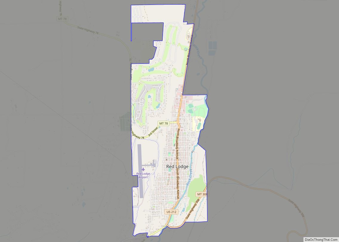
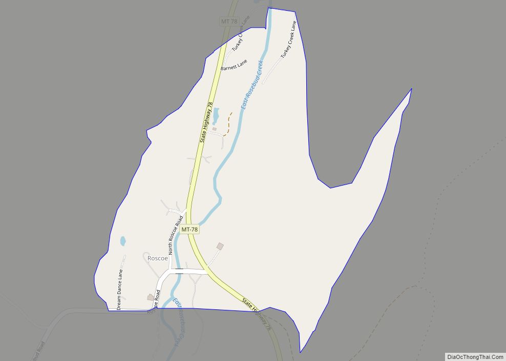
Online Interactive Map
Click on ![]() to view map in "full screen" mode.
to view map in "full screen" mode.
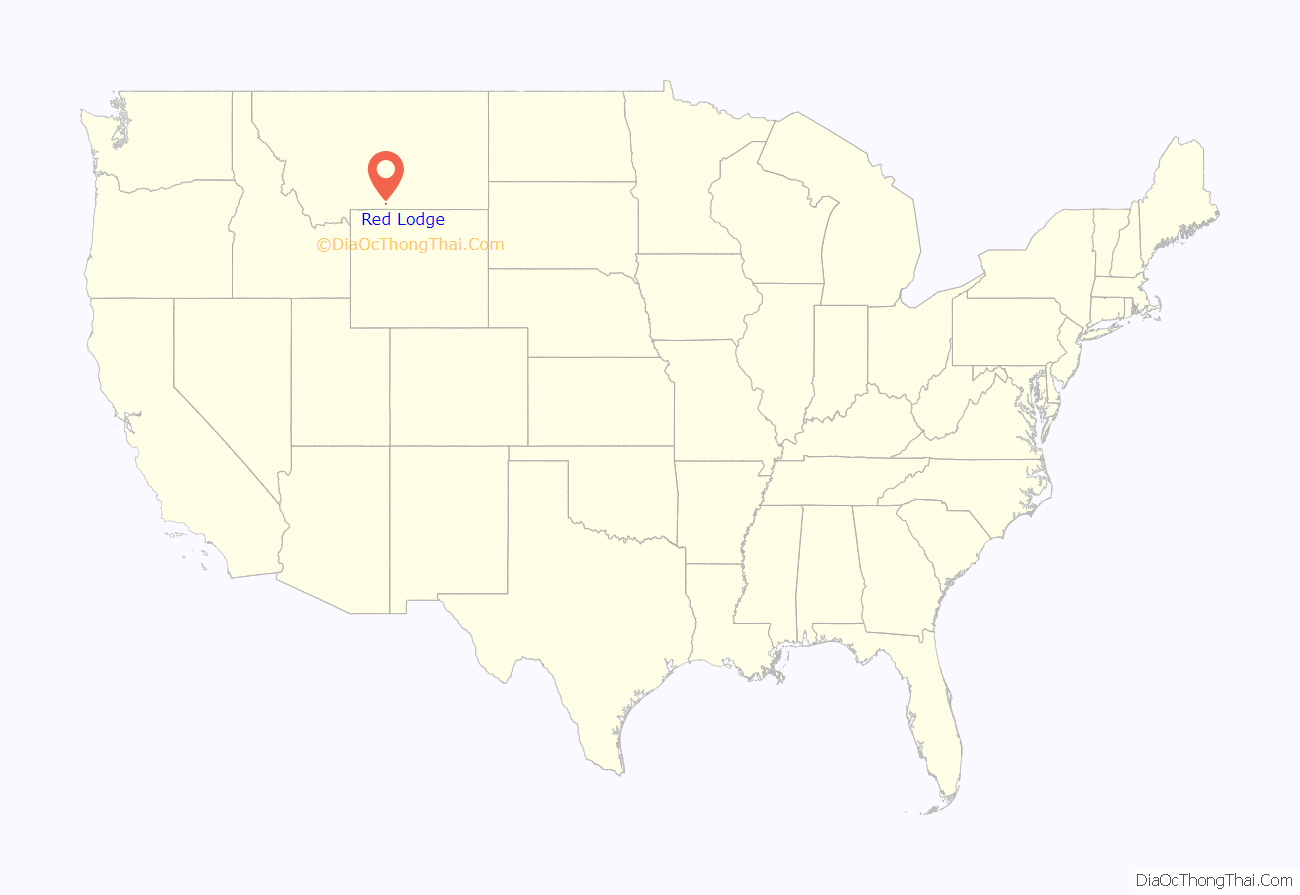
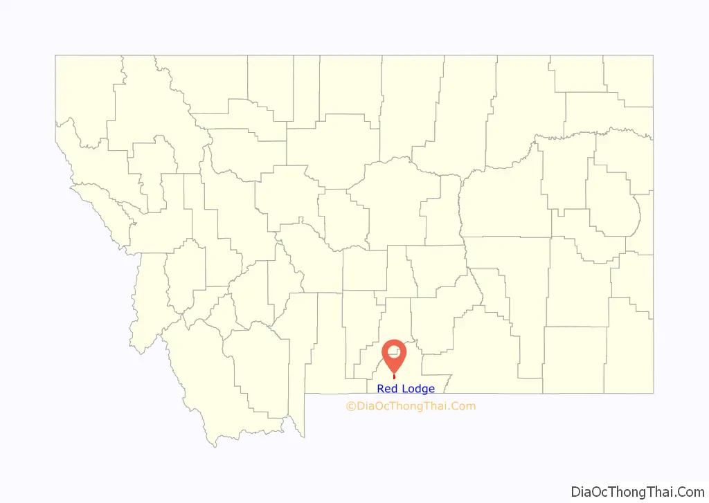
Red Lodge location map. Where is Red Lodge city?
History
On September 17, 1851, the United States government signed a treaty with the Crow Nation, ceding the area which now contains Red Lodge, MT to the Crow Indians. Rich coal deposits were found there in 1866, and gold was discovered nearby in 1870. An 1880 treaty between the U.S. government and the Crow allowed the area to be settled starting April 11, 1882.
The Red Lodge post office was established on Dec 9, 1884 with Postmaster Ezra L. Benton. A rail line was constructed into town, and coal shipments began in June 1889. The boundaries of the Crow Reservation were redrawn October 15, 1892, opening the whole area to settlement. From then until the 1930s, coal mining defined the town.
In the late 19th century, many new settlers came to Red Lodge, MT. The majority came from Italy, the British Isles, Finland, Norway, Sweden, Germany, and Austria-Hungary. By the mid-1880s, migrants were still outnumbered by large numbers of Native Americans. By 1892 the population reached 1,180.
In 1896, Red Lodge had twenty saloons and, as the library records show, riotous and violent living was characteristic of the town. By 1906 the population had grown to 4,000 and by 1911 this had increased to 5,000.
Red Lodge suffered in the Great Depression, which forced many mines to close. To offset this downturn, the manufacture of illegal bootleg liquor, labeled syrup, became an economic mainstay and was sold as far away as Chicago and San Francisco.
In 1931 work began on the Beartooth Highway linking Red Lodge to Yellowstone National Park; it was officially opened in 1936.
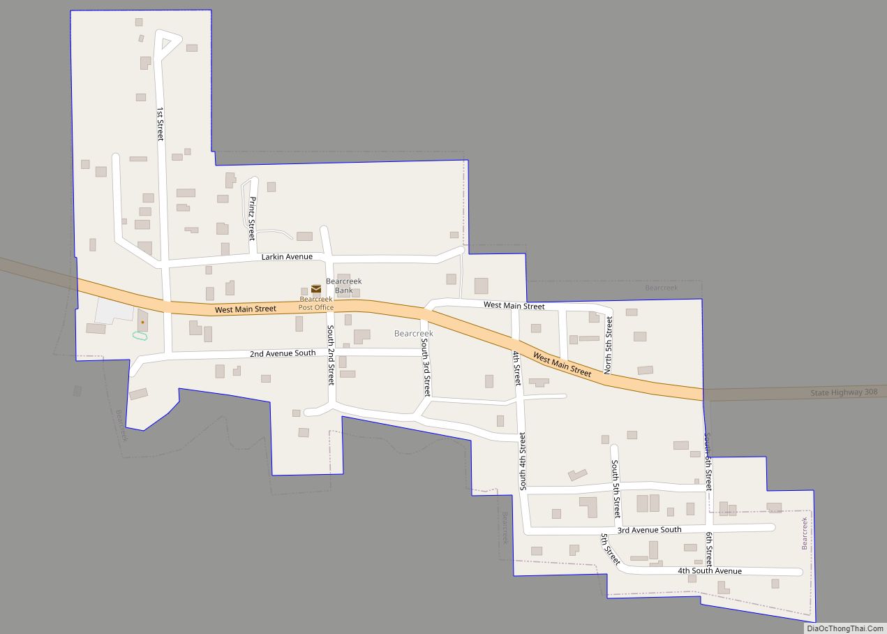
In 1943 tragedy hit Smith Mine #3 near Bearcreek, the area’s largest remaining mine. An explosion trapped and killed 74 men with only three of the workers in the mine that day escaping, making it the worst coal mine disaster in Montana’s history. The mine was shut down shortly thereafter but was reopened in the late 1970s. The Red Lodge cemetery contains a memorial.
The downtown has been redeveloped since the mid-1980s for historic and cultural tourism, as the Red Lodge Commercial Historic District. The buildings in downtown Red Lodge fell into disrepair in large part because population had dropped from its 1915 peak of 6,000 people to about 2,000.
As of 2006, an estimate suggests that the population of Red Lodge may increase from about 1,200 people in the winter to over 1,800 people during the summer tourist season, arriving via the Beartooth Highway.
Red Lodge was heavily affected by the 2022 Montana floods.
Red Lodge Road Map
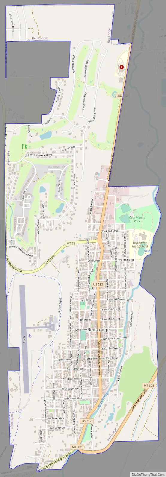
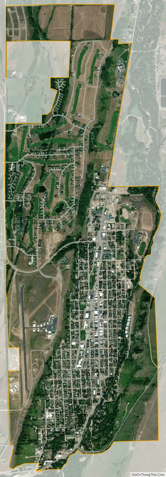
Red Lodge city Satellite Map
Geography
Red Lodge is located at 45°11′15″N 109°14′55″W / 45.18750°N 109.24861°W / 45.18750; -109.24861 (45.187515, -109.248475). U.S. Route 212 runs through the town. Rock Creek flows alongside Red Lodge. Grizzly Peak is one of several mountains surrounding Red Lodge.
According to the United States Census Bureau, the city has a total area of 2.80 square miles (7.25 km), all land.
Climate
Red Lodge experiences a continental climate (Köppen Dfb) with cold, somewhat dry winters and warm, wetter summers. Summers are cooler than in areas of Montana further north, due to the high elevation. Winters however, are milder than areas further to the east due to the chinook wind influence, as with most of Montana.
See also
Map of Montana State and its subdivision:- Beaverhead
- Big Horn
- Blaine
- Broadwater
- Carbon
- Carter
- Cascade
- Chouteau
- Custer
- Daniels
- Dawson
- Deer Lodge
- Fallon
- Fergus
- Flathead
- Gallatin
- Garfield
- Glacier
- Golden Valley
- Granite
- Hill
- Jefferson
- Judith Basin
- Lake
- Lewis and Clark
- Liberty
- Lincoln
- Madison
- McCone
- Meagher
- Mineral
- Missoula
- Musselshell
- Park
- Petroleum
- Phillips
- Pondera
- Powder River
- Powell
- Prairie
- Ravalli
- Richland
- Roosevelt
- Rosebud
- Sanders
- Sheridan
- Silver Bow
- Stillwater
- Sweet Grass
- Teton
- Toole
- Treasure
- Valley
- Wheatland
- Wibaux
- Yellowstone
- Alabama
- Alaska
- Arizona
- Arkansas
- California
- Colorado
- Connecticut
- Delaware
- District of Columbia
- Florida
- Georgia
- Hawaii
- Idaho
- Illinois
- Indiana
- Iowa
- Kansas
- Kentucky
- Louisiana
- Maine
- Maryland
- Massachusetts
- Michigan
- Minnesota
- Mississippi
- Missouri
- Montana
- Nebraska
- Nevada
- New Hampshire
- New Jersey
- New Mexico
- New York
- North Carolina
- North Dakota
- Ohio
- Oklahoma
- Oregon
- Pennsylvania
- Rhode Island
- South Carolina
- South Dakota
- Tennessee
- Texas
- Utah
- Vermont
- Virginia
- Washington
- West Virginia
- Wisconsin
- Wyoming