Emerson is a borough in Bergen County, in the U.S. state of New Jersey, a suburb in the New York City metropolitan area. Emerson is the most southern municipality in an area of the county known as the Pascack Valley. As of the 2020 United States census, the borough’s population was 7,290, a decrease of 111 (−1.5%) from the 2010 census count of 7,401, which in turn reflected an increase of 204 (+2.8%) from the 7,197 counted in the 2000 Census, which had in turn increased by 267 (+3.9%) from the 6,930 counted in the 1990 Census.
What is now Emerson was originally formed on April 8, 1903, from portions of Washington Township as the Borough of Etna, the name of a railroad station in the community. The name was changed to Emerson as of March 9, 1909. The name came from author Ralph Waldo Emerson. The borough calls itself “The Family Town”.
| Name: | Emerson borough |
|---|---|
| LSAD Code: | 21 |
| LSAD Description: | borough (suffix) |
| State: | New Jersey |
| County: | Bergen County |
| Incorporated: | April 8, 1903 (as Etna) |
| Elevation: | 49 ft (15 m) |
| Total Area: | 2.42 sq mi (6.27 km²) |
| Land Area: | 2.23 sq mi (5.78 km²) |
| Water Area: | 0.19 sq mi (0.49 km²) 7.85% |
| Total Population: | 7,290 |
| Population Density: | 3,267.6/sq mi (1,261.6/km²) |
| ZIP code: | 07630 |
| Area code: | 201 |
| FIPS code: | 3421450 |
| GNISfeature ID: | 0885208 |
| Website: | www.emersonnj.org |
Online Interactive Map
Click on ![]() to view map in "full screen" mode.
to view map in "full screen" mode.
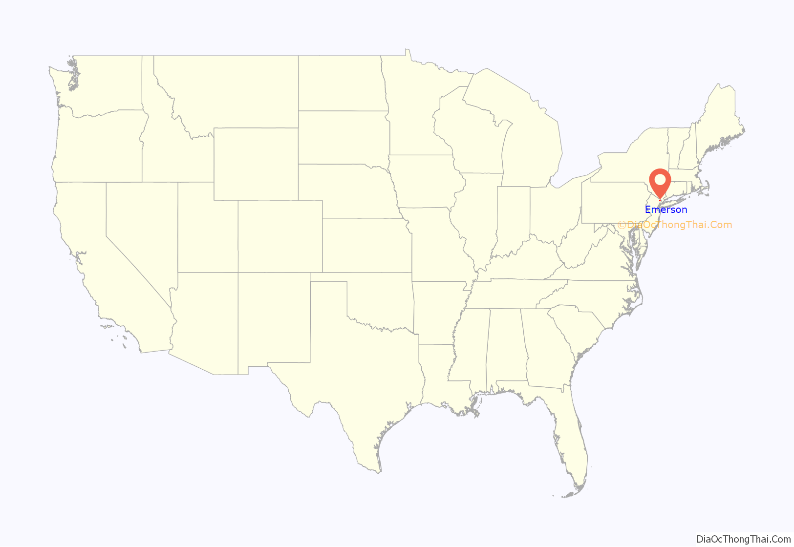
Emerson location map. Where is Emerson borough?

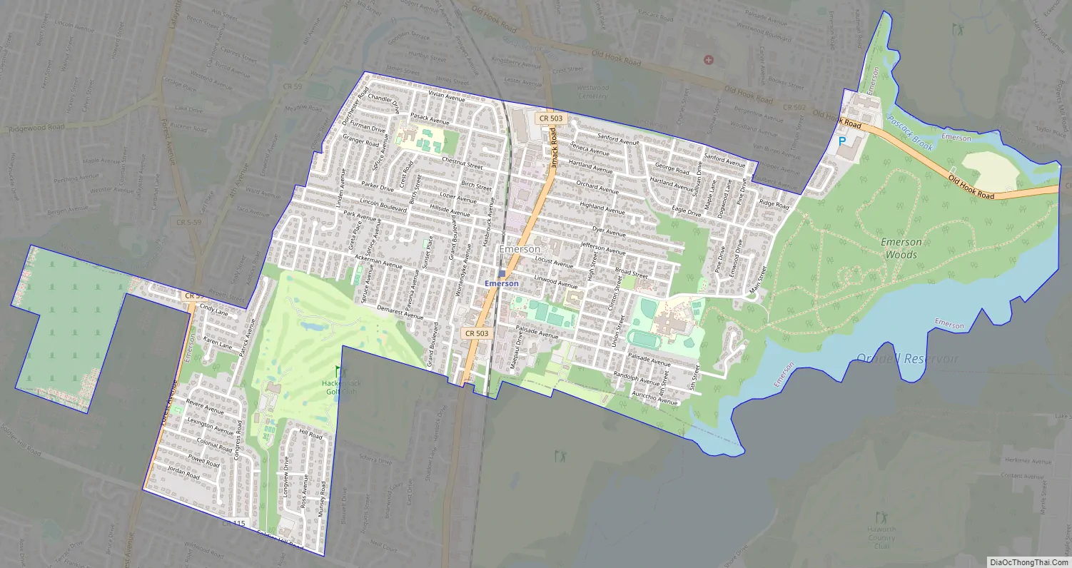
Emerson Road Map
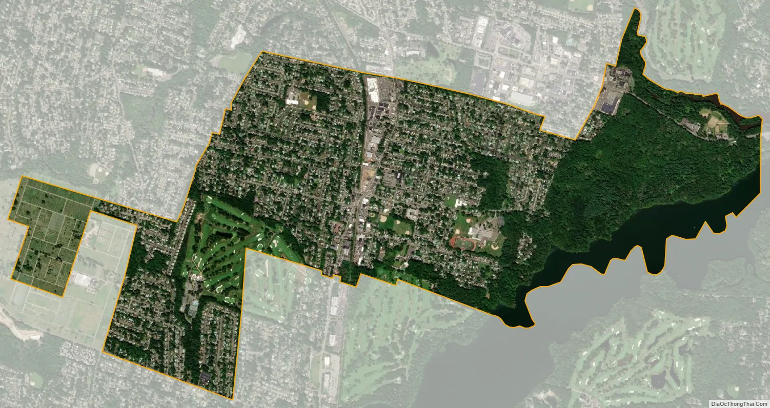
Emerson city Satellite Map
Geography
According to the United States Census Bureau, the borough had a total area of 2.42 square miles (6.27 km), including 2.23 square miles (5.78 km) of land and 0.19 square miles (0.49 km) of water (7.85%).
Unincorporated communities, localities and place names located partially or completely within the borough include Old Hook.
The borough borders the Bergen County municipalities of Closter, Harrington Park, Haworth, Oradell, Paramus, River Vale, Washington Township and Westwood.
See also
Map of New Jersey State and its subdivision: Map of other states:- Alabama
- Alaska
- Arizona
- Arkansas
- California
- Colorado
- Connecticut
- Delaware
- District of Columbia
- Florida
- Georgia
- Hawaii
- Idaho
- Illinois
- Indiana
- Iowa
- Kansas
- Kentucky
- Louisiana
- Maine
- Maryland
- Massachusetts
- Michigan
- Minnesota
- Mississippi
- Missouri
- Montana
- Nebraska
- Nevada
- New Hampshire
- New Jersey
- New Mexico
- New York
- North Carolina
- North Dakota
- Ohio
- Oklahoma
- Oregon
- Pennsylvania
- Rhode Island
- South Carolina
- South Dakota
- Tennessee
- Texas
- Utah
- Vermont
- Virginia
- Washington
- West Virginia
- Wisconsin
- Wyoming


