Fair Lawn is a borough in Bergen County, in the U.S. state of New Jersey, and a bedroom suburb located 12 miles (19 km) northwest of New York City. As of the 2020 United States census, the borough’s population was 34,927, an increase of 2,470 (+7.6%) from the 2010 census count of 32,457, which in turn reflected an increase of 820 (+2.6%) from the 31,637 counted at the 2000 census.
Fair Lawn was incorporated as a borough by an act of the New Jersey Legislature on March 6, 1924, as “Fairlawn”, from portions of Saddle River Township. The name was taken from Fairlawn, David Acker’s estate home, that was built in 1865 and later became the Fair Lawn Municipal Building. In 1933, the official spelling of the borough’s name was split into its present two-word form as “Fair Lawn” Borough.
Radburn, one of the first planned communities in the United States, is an unincorporated community located within Fair Lawn and was founded in 1929 as “a town for the motor age.” Fair Lawn is home to a large number of commuters to New York City, to which it is connected by train from two railroad stations on NJ Transit’s Bergen County Line, the Radburn and Broadway stations.
Fair Lawn’s motto is “A great place to visit and a better place to live.” Fair Lawn has been rated as one of the top 10 best places to live in New Jersey.
| Name: | Fair Lawn borough |
|---|---|
| LSAD Code: | 21 |
| LSAD Description: | borough (suffix) |
| State: | New Jersey |
| County: | Bergen County |
| Incorporated: | March 6, 1924 |
| Elevation: | 69 ft (21 m) |
| Total Area: | 5.22 sq mi (13.53 km²) |
| Land Area: | 5.13 sq mi (13.30 km²) |
| Water Area: | 0.09 sq mi (0.23 km²) 1.53% |
| Total Population: | 34,927 |
| Population Density: | 6,801.8/sq mi (2,626.2/km²) |
| ZIP code: | 07410 |
| Area code: | 201 exchanges: 398, 475, 703, 791, 794, 796, 797 |
| FIPS code: | 3422470 |
| GNISfeature ID: | 0885214 |
| Website: | www.fairlawn.org |
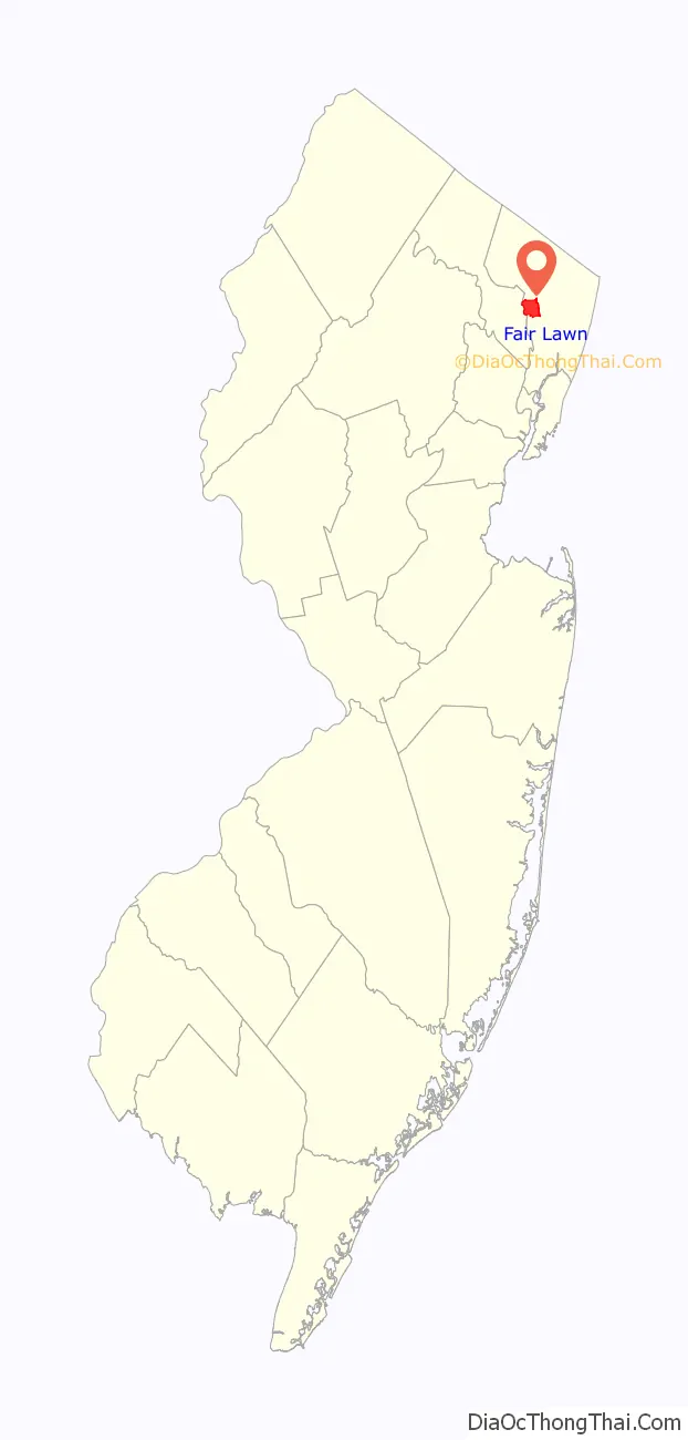
Online Interactive Map
Click on ![]() to view map in "full screen" mode.
to view map in "full screen" mode.
Fair Lawn location map. Where is Fair Lawn borough?

History
The first settlers of Fair Lawn were members of the Lenape tribe, of Native Americans, a group of hunter gatherers who eventually sold their land to incoming Dutch and Irish settlers and migrated to Pennsylvania. The new colonists turned the region, part of the New Barbadoes Township, into five large farm lots, conjoined by two main roads—Paramus and Saddle River—and named it “slooterdam” (after a V-shaped sluice-like fishing weir built in the Passaic River by the Lenni Lenape). The name stuck until 1791. In the 1800s, these five lots became nine smaller lots, and three new roads—Fair Lawn Avenue, Lincoln Avenue, and Prospect Street—were constructed to encourage mobility between them. Eighty houses were built by 1861, and the renamed Small Lots, now a part of the Saddle River Township and home to multiple vegetable and fruit farms and dairies, became an agricultural community. Berdan Avenue, a new road located near five Berdan family farms, was soon added and Victorian homes were built alongside it and in nearby areas. The grandest of the estates, perched atop a hill by Small Lots Road was David Acker’s estate “Fairlawn”, from which the township gets its name (Images of America, Page 7).
Rapid suburban development of the town occurred in three sections: the River Road-Fair Lawn Avenue area known as “Memorial Park”, the area at Lincoln Avenue and Wagaraw Road known as “Columbus Heights”, and the area east of the railroad and south of Broadway, known as Warren Point. The development of this section was catalyzed by the “establishment of a post office, a railroad station, and a trolley to the Hudson River” (Images of America, Page 8).
In the 1900s, Fair Lawn residents were displeased about the schooling situation as part of Saddle River Township; the schools were either dilapidated or too far away for Fair Lawn residents, and citizens felt that they were not getting schools comparable to the tax money they were paying. As such, a movement to separate from Saddle River Township was born. Fair Lawn residents petitioned to the state, asking to incorporate as an independent borough, and in April 1924, the borough of Fair Lawn was voted into existence.
Fair Lawn is home to the following eight sites listed on the National Register of Historic Places:
- Peter Garretson House, 4-02 River Road (1974)
- Irregular pattern between Radburn Road and the Erie Rail Road tracks in Radburn (1975)
- G.V.H. Berdan House, 1219 River Road (1983)
- Richard J. Berdan House, 2407 Fair Lawn Avenue
- Cadmus-Folly House, 19-21 Fair Lawn Avenue
- Naugle House, 42-49 Dunkerhook Road – Built in the 1750s, the house was acquired by the borough.
- Jacob Vanderbeck Jr. House, 41-25 Dunkerhook Road – Constructed in 1754, the house was named by Preservation New Jersey as one of New Jersey’s 10 most endangered historic places
- Radburn station, Pollitt Drive (1984)
Other sites, in addition to those listed above, are also considered historic by the Historic Sites Survey Committee of the Bergen County Historic Sites Advisory Board, including:
- Henry A. Hopper House
- George Washington School (Recommended as a National Register possibility, but needs further documentation)
- Fair Lawn, Berdan, and Prospect Avenues, Plaza and Radburn Roads
- Peter Demarest House on Fair Lawn Avenue
- Warren Bronze and Aluminum Factory on Second Street
In July 1982, an NJ Transit train derailed and crashed into a pasta factory, killing the train’s engineer. The derailment resulted from a group of teens who had tampered with the tracks. Two of the five youths charged with the crime were convicted of manslaughter for their roles in the incident and were given five-year sentences in a state correctional facility.
Fair Lawn Road Map
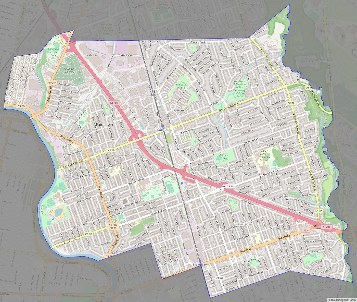
Fair Lawn city Satellite Map

Geography
According to the United States Census Bureau, the borough had a total area of 5.22 square miles (13.53 km), including 5.14 square miles (13.30 km) of land and 0.09 square miles (0.23 km) of water (1.70%).
The borough borders Paterson (in Passaic County, across the Passaic River) to the west; Hawthorne across Lincoln Avenue to the West; Glen Rock across Harristown Road, Maple Avenue, the northern border of the former Nabisco plant and its extension north of Garwood Road and Naugle Drive to the north; Ridgewood across the Saddle River to the northeast; Paramus across the Saddle River to the east; Rochelle Park across another point in the Saddle River to the southeast; with Saddle Brook across the two longer portions of South Broadway and their extensions through Rosario Court to the south; and Elmwood Park across the Bergen County Line, New Jersey Route 4 (Broadway), Cyril Avenue and Willow Street to the south. The hills of Wyckoff are visible from the northern neighborhoods of Fair Lawn.
Neighborhoods
Fair Lawn is an incorporated collection of diverse neighborhoods, each with its own distinct character and vibe. Unincorporated communities, localities and place names located partially or completely within the borough include:
- Berdan Grove, a residential neighborhood of single-family homes behind Thomas Jefferson Middle School, surrounding Berdan Grove Park on Berdan Avenue. This neighborhood is home to the borough’s highest concentration of Asian Americans and includes Milnes Elementary School.
- Broadway District contains the major commercial thoroughfare of Broadway and houses the Broadway District commuter stop for NJ Transit’s Bergen County Line train. Roughly located around the Warren Point and Lyncrest areas, the district also extends as far as Morlot Avenue along the tracks, roughly around or a little after Glen Rock Lumber, housing many industries on Banta Place. The Broadway District is mainly a shopping district as it contains many stores, eateries, hobby centers, salons, and other businesses. Not only is it the largest stretch of stores within Fair Lawn, it also houses one of the highest densities of nail and beauty salons in the United States. The Broadway District stretches from the Route 4 split with Route 208 and continues all through Fair Lawn and includes a few blocks of Elmwood Park. Broadway also hosts the route of local Paterson-New York Spanish Transportation minibuses, known locally as guaguas, as a cheaper alternative for commuters to and from New York. It is one of only a handful of Bergen-Passaic-Hudson districts that even offers this service.
- Central Fair Lawn is bounded by Morlot and Fair Lawn Avenues on the south and north, respectively, by River Road on the west, and Route 208 on the east and northeast. The borough’s Municipal Complex, which houses its administrative, legal, financial, and police divisions, is located in this neighborhood, as are the Fair Lawn Public Library, Fair Lawn High School, and John A. Forrest Elementary School.
- Dunkerhook, the Dark Corner (Donckerhoek in old Dutch), is on both sides of a former bridge over the Saddle River, in Fair Lawn and Paramus, near Fair Lawn Avenue. The Vanderbeck and Naugle houses there are both from the 18th century.
- The Heights, more precisely known as “Columbia Heights”, is located near Hawthorne’s industrial section along the Passaic River on Wagaraw Road and Hawthorne’s residential area at Lincoln Avenue as well as bordering Bunker Hill in Paterson. This well-maintained neighborhood houses some local industry outside of the McBride Industrial District that borders Glen Rock and is known by some of its residents as the “Bunker Hill Extension” or the “Walsh Area”.
- Hendersonville, also referred to as “Riverside East”. This diverse neighborhood, located between Columbia Heights and the Municipal Complex within the “Westmoreland District”, as well as sharing Route 208 with the neighboring borough of Glen Rock, is a mostly residential community of two-family Cape Cod-style houses located down the stretch of Henderson Boulevard curving around to 11th Street. Distinct to this neighborhood in comparison with other two-family districts and sections is that each Cape Cod has two doors in the front so each residing family has its own entrance into its respective quarters, a blueprint that was abandoned shortly after being built in favor of a “one door, two entrances” model. Westmoreland Elementary School is located in this neighborhood.
- Lyncrest neighborhood, located south of Morlot Avenue, in alignment with Paterson’s 33rd Street split into that city’s Upper Eastside and Eastside neighborhoods, is an extension of the Eastside and notable for its older, stone houses in the footsteps of homes once owned by Paterson’s former silk barons. This community is also diverse, with immigrants from Europe, Asia, the Middle East, as well as various parts of the Americas. It is home to many Orthodox Jewish, Indian American, and Russian American families, among other ethnic and religious groups. Lyncrest streets “1st-6th” are also known by the name of “Rivercrest” by locals, due to the split level and Cape Cod-style architecture of housing located in the “River Dip” adjacent to Memorial Park. Lyncrest Elementary School is located in this neighborhood.
- McBride Industrial District is the area incorporating the McBride Industrial Park located between Fair Lawn Borough’s border with Glen Rock and the Chandler Houses and Fair Lawn Commons communities. It currently houses the former Nabisco cookie factory, which has played a major role in not only Fair Lawn’s identity itself, but also Glen Rock, Ridgewood, Paterson, Prospect Park, Haledon, Hawthorne, and Western Paramus near the Dunkerhook and Saddle River Areas, causing those venturing throughout these areas to coin the nickname “Cookie-City” as a general area term, describing the fragrance of freshly baked cookies that filled these areas on baking days. In the past, the McBride Industrial District took up both sides of Route 208, stretching from Fair Lawn Avenue to the intersection at Maple Avenue and Harristown Road, running up to the Bergen County Line train tracks via the Radburn District, and housing companies such as Nabisco, Kodak, Maxell, and others. More recently the district has been in the process of deindustrialization and corporate gentrification, as older companies fold or move out, replacing industrial properties with residential-commercial “mini-cities”, as well as the headquarters of New Jersey’s Columbia Savings Bank.
- Memorial Park, a working-class neighborhood (sometimes called the “River Dip”, “East River Area”,”Eastside Dip”, “Riverside”, or the more modern “Yang”; the aerial view of the neighborhood makes a “Ying Yang” symbol with neighboring East Side Park) within and around the River Road Improvement District with street addresses aligned with the corner of 33rd Street and Martin Luther King Way (Broadway) in neighboring Paterson. The Memorial Park neighborhood borders the Passaic River and contains the park next to Memorial Middle School named Memorial Park which houses a World War II Memorial commemorating those who fought in the war. The park is the terminus of the annual Memorial Day parade and the site of the Memorial pool and beach as well as the Independence Day fireworks show. Residential gentrification is occurring with the leveling of two-family rental housing for more modern single-family housing in this area.
- Radburn is a planned community also housing the landmark Radburn Plaza building, which was destroyed in a fire in 2002 and subsequently rebuilt. With its safe and easy access to local businesses and schools, and Fair Lawn’s largest U.S. Postal Service branch, this neighborhood also offers commuter trains from Radburn station to the Secaucus Junction rail transfer station as well as to the PATH train in Hoboken, both of which provide rail connections to New York City. This neighborhood includes Radburn Elementary School and Daly Field. An annual street fair is held here in June.
- Radrock Estates is a small neighborhood around two streets, Well Drive and Split Rock Road, with a private park within the block they enclose, reminiscent of nearby Radburn but a separate development built about 1940. The entrance street from Fair Lawn Avenue has an entrance pillar on each side displaying the name. The surrounding area to the north and east, while built after World War II, is considered to be an extended part of Radrock Estates. Although it is a very diverse residential section, this neighborhood shares the conveniences of living in Radburn including dining, retail access, as well as rail access from Radburn Station.
- The River Road Improvement District, with an annual street fair in autumn, houses many functional businesses, including numerous banks, ethnic restaurants and supermarkets, small offices, retail telecommunications outlets, both a United Parcel Service store and a U.S. Post Office branch, and the landmark Joker’s Child comic book store. River Road in this district is also zoned for apartments located above businesses.
- Warren Point, a residential area located near the Broadway Improvement District. Bordering Saddle Brook and Elmwood Park, it has many stores, big and small, and many eateries. The neighborhood also offers commuter trains from Broadway station to Hoboken’s PATH and to Secaucus Junction via the Bergen County Line, as well as the “Paterson-New York Shuttle”. Warren Point Elementary School and the private St. Anne School are located in this neighborhood.
Other neighborhoods in the borough include “Fair Lawn Commons” (The Commons) off Route 208, located within the Radburn Historical District, yet which has a separate, more affluent feel and modern look and subculture; Radburn’s El Dorado Village, which is known for its Eastern European immigrant residents; and just to its west, the “Chandler Houses”. Fair Lawn’s newest neighborhood is Fair Lawn Promenade (The Promenade), a mixed-use development extending northward from The Commons along Highway 208 North, consisting of apartments, shops, offices, and restaurants, with the motto to be able to “live, shop, work, and play” in one locale.
These distinct communities are located throughout the borough, and each has its own character, making Fair Lawn not just ethnically, racially, and religiously diverse, but also an experientially diverse borough notable even amidst Bergen County’s diversity on a larger scale.
See also
Map of New Jersey State and its subdivision: Map of other states:- Alabama
- Alaska
- Arizona
- Arkansas
- California
- Colorado
- Connecticut
- Delaware
- District of Columbia
- Florida
- Georgia
- Hawaii
- Idaho
- Illinois
- Indiana
- Iowa
- Kansas
- Kentucky
- Louisiana
- Maine
- Maryland
- Massachusetts
- Michigan
- Minnesota
- Mississippi
- Missouri
- Montana
- Nebraska
- Nevada
- New Hampshire
- New Jersey
- New Mexico
- New York
- North Carolina
- North Dakota
- Ohio
- Oklahoma
- Oregon
- Pennsylvania
- Rhode Island
- South Carolina
- South Dakota
- Tennessee
- Texas
- Utah
- Vermont
- Virginia
- Washington
- West Virginia
- Wisconsin
- Wyoming


