Milford is a borough that is located in Pike County, Pennsylvania, United States, and the county seat. Its population was 1,103 at the time of the 2020 census.
Situated near the upper Delaware River, Milford is part of the New York metropolitan area.
| Name: | Milford borough |
|---|---|
| LSAD Code: | 21 |
| LSAD Description: | borough (suffix) |
| State: | Pennsylvania |
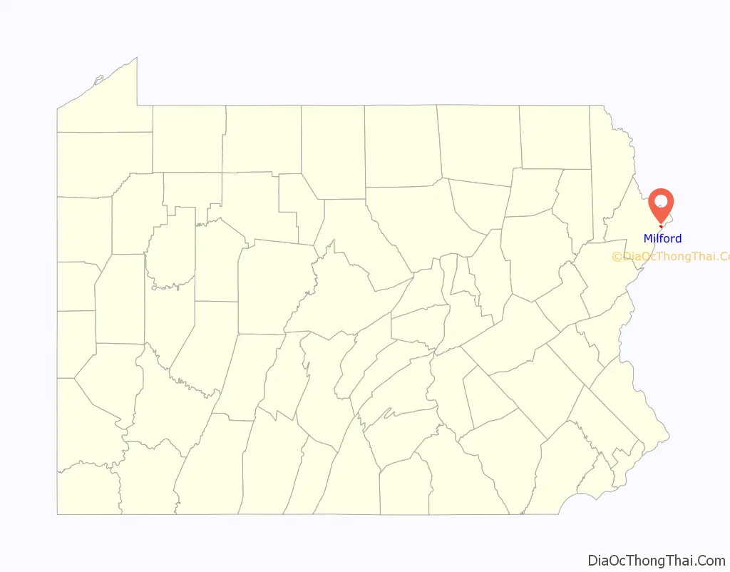
| County: | Pike County |
| Founded: | 1796; 227 years ago (1796) |
| Incorporated: | 1874; 149 years ago (1874) |
| Elevation: | 499 ft (152 m) |
| Total Area: | 0.49 sq mi (1.27 km²) |
| Land Area: | 0.47 sq mi (1.21 km²) |
| Water Area: | 0.02 sq mi (0.06 km²) |
| Total Population: | 1,103 |
| Population Density: | 2,351.81/sq mi (907.89/km²) |
| ZIP code: | 18337 |
| Area code: | 570 and 272 |
| FIPS code: | 4249400 |
| Website: | www.milfordboro.org |
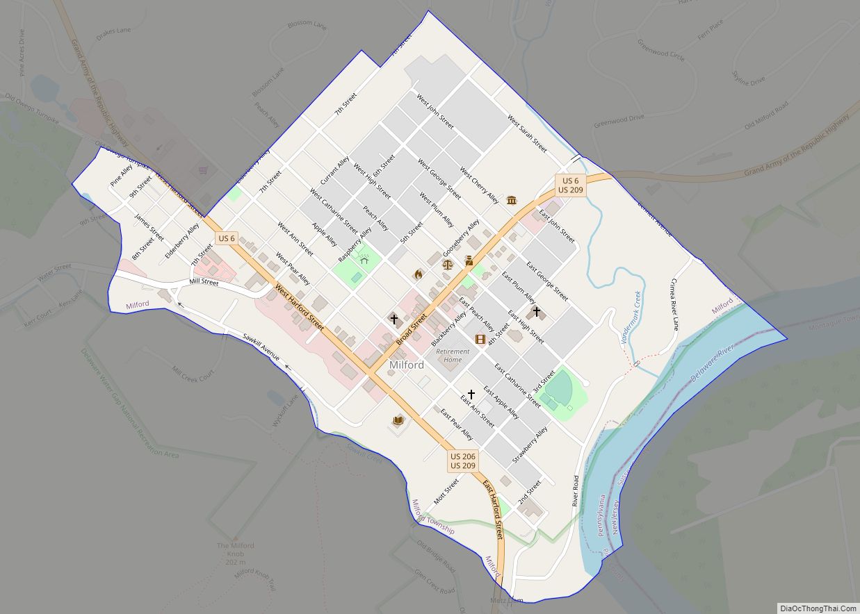
Online Interactive Map
Click on ![]() to view map in "full screen" mode.
to view map in "full screen" mode.
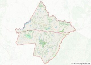
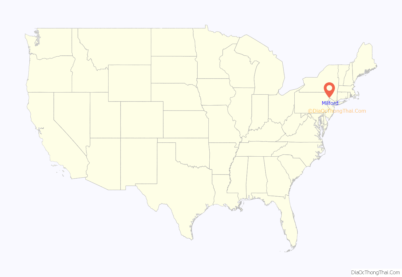
Milford location map. Where is Milford borough?
History
The area along the Delaware River where the community of Milford is located had long been settled by the Lenape, an Algonquian-speaking indigenous tribe that lived in the mid-Atlantic coastal areas at the time of European colonization. The English also called them the Delaware, after the river they named for colonial leader Thomas West, 3rd Baron De La Warr, the Delaware.
Milford was founded in 1796 by Judge John Biddis, one of Pennsylvania’s first four circuit judges. He named the settlement after his ancestral home in Wales.
Milford has a large number of buildings of historical significance, many constructed in the nineteenth century and early twentieth centuries. Some are listed on the National Register of Historic Places, while numerous others are included in the Milford Historic District. Of the 655 buildings in the district, 400 of them have been deemed to be historically significant. The district is characterized by a variety of Late Victorian architecture.
The Grey Towers National Historic Site, the ancestral home of Gifford Pinchot, noted conservationist, two-time governor of Pennsylvania, and first head of the U.S. Forest Service, is located in Milford. It was designed by architect Richard Morris Hunt has been designated a National Historic Site.
From 1904 to 1926, Grey Towers was the site of summer field study sessions for the Master’s degree program of the Yale School of Forestry, together with the Forester’s Hall, a commercial building that was adapted and expanded for this purpose. Jervis Gordon Grist Mill Historic District, Hotel Fauchere and Annex, Metz Ice Plant, and Pike County Courthouse are also listed on the National Register of Historic Places. Nearby is Arisbe, the home of Charles S. Peirce, a prominent logician, philosopher and scientist in the late 19th century, and another NRHP property.
The Milford Writer’s Workshop, an annual science fiction writers’ event, was founded in 1956, and ran until it moved to the United Kingdom in 1972, where it is still running.
The Pike County Historical Society Museum in Milford includes in its collection the “Lincoln Flag,” which was draped on President Abraham Lincoln’s booth at Ford’s Theatre on the night he was assassinated. The flag was bundled up and placed under the president’s head, and still bears his blood. It was kept by stage manager Thomas Gourlay, who passed it down to his daughter, Jeannie, an actress who had appeared in the play, Our American Cousin, at the theatre that night and who later moved to Milford. The flag was donated to the museum after her death.
In September 2007, Arthur Frommer’s Budget Travel named Milford second on its list of “Ten Coolest Small Towns” in Pennsylvania.
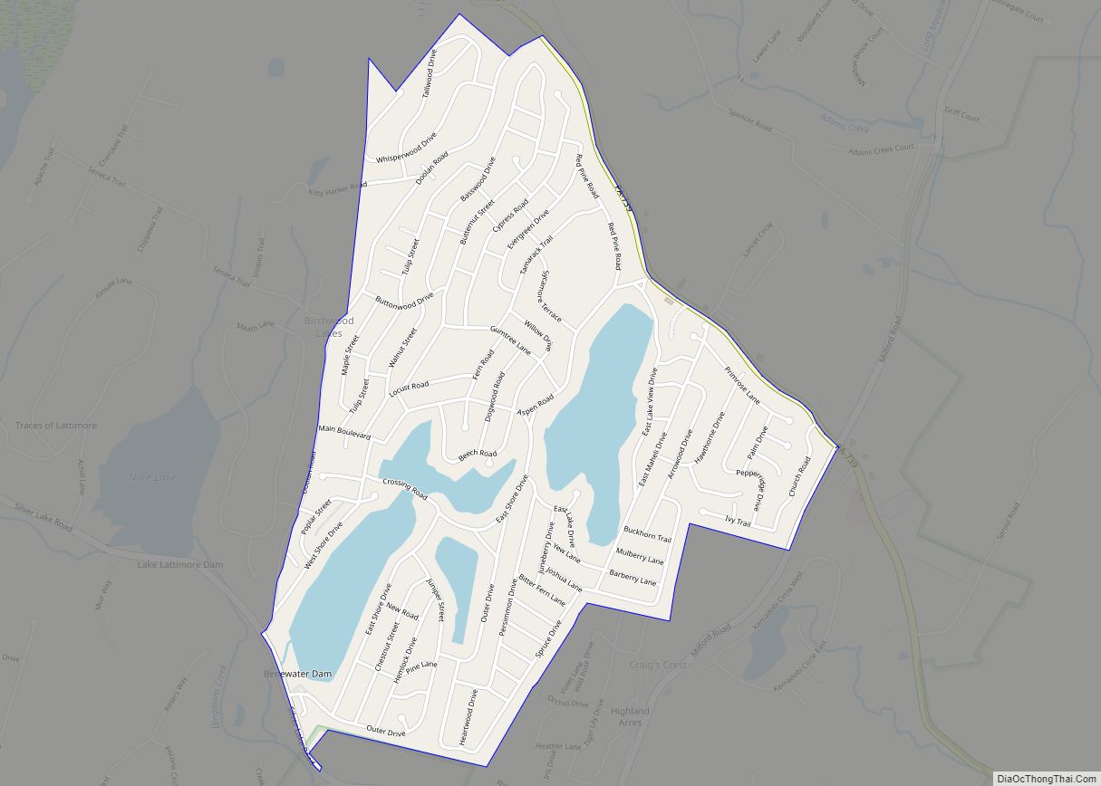
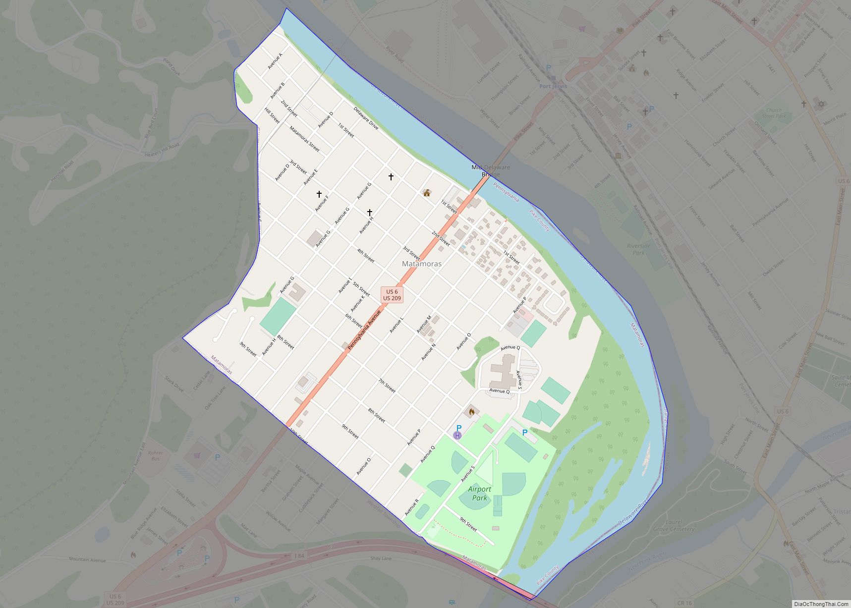
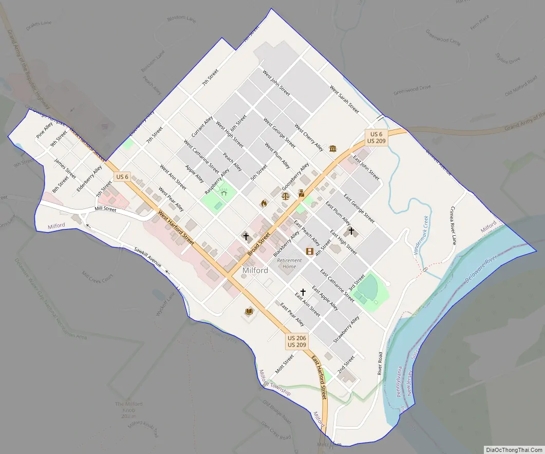
Milford Road Map
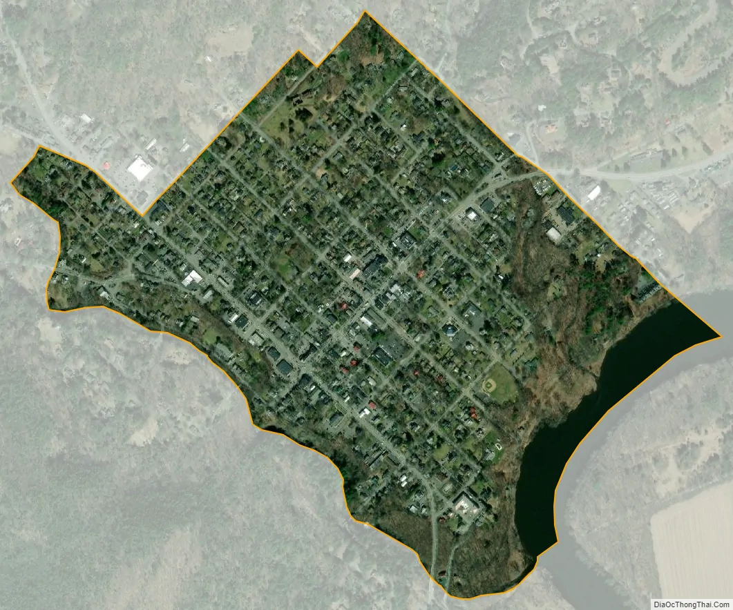
Milford city Satellite Map
Geography
According to the U.S. Census Bureau, the borough has a total area of 0.5 square miles (1.3 km), all land.
Milford is located on the Upper Delaware River, which divides Pennsylvania’s Poconos region from the Catskill Mountains in New York, in what was historically a heavily-forested area. When Judge Biddis bought up the land of what was then known as Wells Ferry and laid out the lots for the new town, he generally followed the urban plan of Philadelphia. He created the grid that made High Street the equivalent of what is now Market Street in Philadelphia, running it to the Delaware River while also making Broad Street perpendicular to High. At the intersection of Broad and High is a public square, just as there is at Broad and Market in Philadelphia. Most of Milford’s official buildings are located there.
Within that grid, Milford’s east–west streets were numbered as Second through Seventh streets with Broad falling between Fourth and Fifth. North–south streets were named after Biddis’ children: Ann, Catherine, George, John, Sarah, and Elizabeth. In between both the named and numbered streets are alleys, that were named after berries and fruit.
In contemporary Milford, Broad Street is also marked as U.S. Route 6 and U.S. Route 209. At its intersection with Harford Street, Route 6 continues north on Harford, while Route 209 continues south on the street.
Milford is located on an escarpment above the Delaware River. All waterways there which drain into the river fall the 100-foot (30 m) difference in height, creating what is known as a “fluviarchy,” a network of waterfalls that is putatively the most notable east of the Rocky Mountains. These also provided waterpower to mills that contributed to Milford’s growing economy during the nineteenth century.
See also
Map of Pennsylvania State and its subdivision:- Adams
- Allegheny
- Armstrong
- Beaver
- Bedford
- Berks
- Blair
- Bradford
- Bucks
- Butler
- Cambria
- Cameron
- Carbon
- Centre
- Chester
- Clarion
- Clearfield
- Clinton
- Columbia
- Crawford
- Cumberland
- Dauphin
- Delaware
- Elk
- Erie
- Fayette
- Forest
- Franklin
- Fulton
- Greene
- Huntingdon
- Indiana
- Jefferson
- Juniata
- Lackawanna
- Lancaster
- Lawrence
- Lebanon
- Lehigh
- Luzerne
- Lycoming
- Mc Kean
- Mercer
- Mifflin
- Monroe
- Montgomery
- Montour
- Northampton
- Northumberland
- Perry
- Philadelphia
- Pike
- Potter
- Schuylkill
- Snyder
- Somerset
- Sullivan
- Susquehanna
- Tioga
- Union
- Venango
- Warren
- Washington
- Wayne
- Westmoreland
- Wyoming
- York
- Alabama
- Alaska
- Arizona
- Arkansas
- California
- Colorado
- Connecticut
- Delaware
- District of Columbia
- Florida
- Georgia
- Hawaii
- Idaho
- Illinois
- Indiana
- Iowa
- Kansas
- Kentucky
- Louisiana
- Maine
- Maryland
- Massachusetts
- Michigan
- Minnesota
- Mississippi
- Missouri
- Montana
- Nebraska
- Nevada
- New Hampshire
- New Jersey
- New Mexico
- New York
- North Carolina
- North Dakota
- Ohio
- Oklahoma
- Oregon
- Pennsylvania
- Rhode Island
- South Carolina
- South Dakota
- Tennessee
- Texas
- Utah
- Vermont
- Virginia
- Washington
- West Virginia
- Wisconsin
- Wyoming