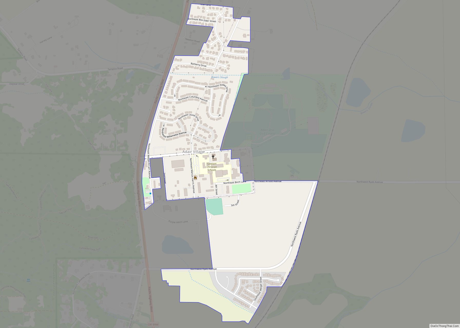
Adair Village is a city in Benton County, Oregon, United States. The population was 840 at the 2010 census.
| Name: | Adair Village city |
|---|---|
| LSAD Code: | 25 |
| LSAD Description: | city (suffix) |
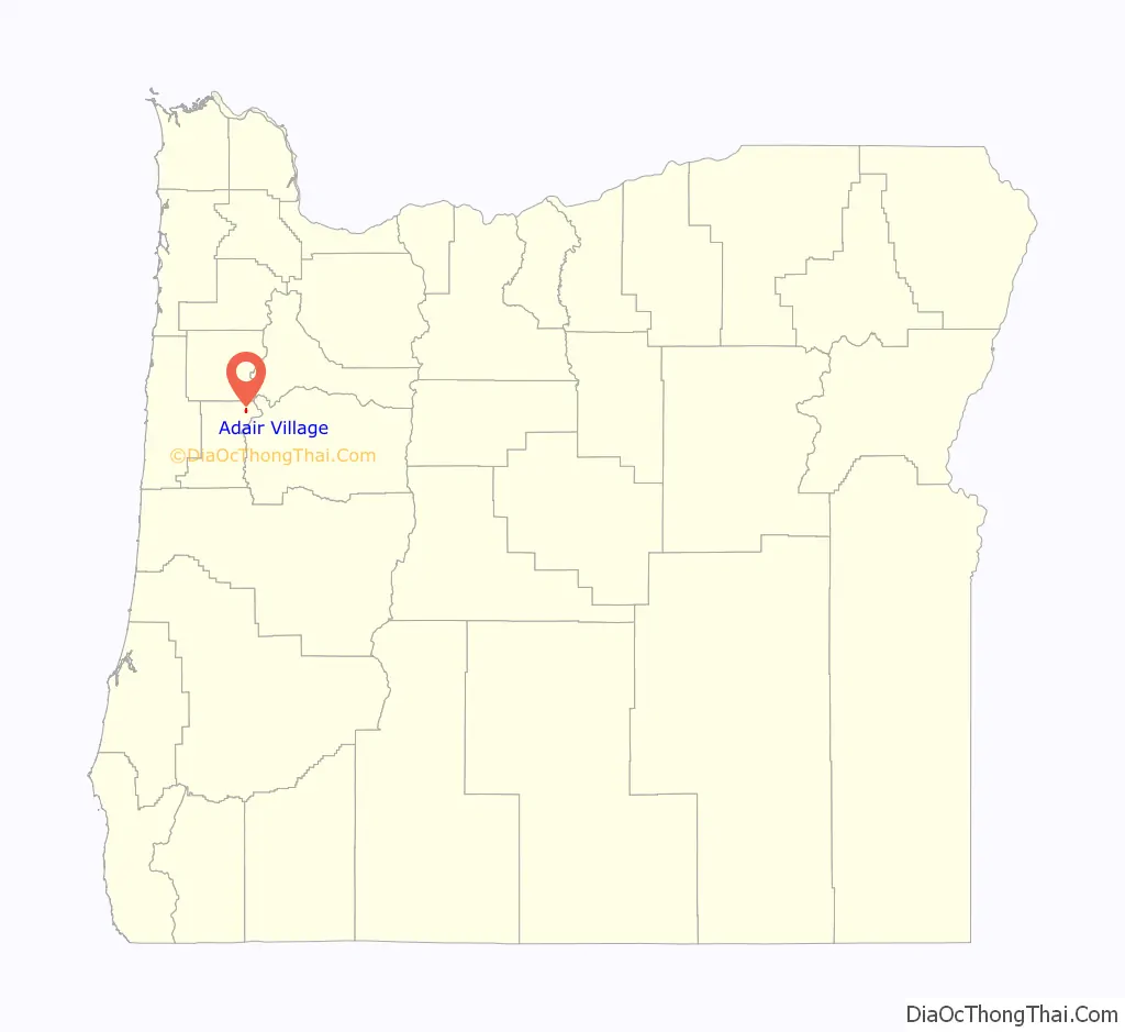
| State: | Oregon |
| County: | Benton County |
| Incorporated: | 1976 |
| Elevation: | 328 ft (100 m) |
| Total Area: | 0.44 sq mi (1.15 km²) |
| Land Area: | 0.44 sq mi (1.15 km²) |
| Water Area: | 0.00 sq mi (0.00 km²) |
| Total Population: | 994 |
| Population Density: | 2,238.74/sq mi (863.42/km²) |
| ZIP code: | 97330 |
| FIPS code: | 4100275 |
| GNISfeature ID: | 1130192 |
| Website: | adairvillage.org |
Online Interactive Map
Click on ![]() to view map in "full screen" mode.
to view map in "full screen" mode.
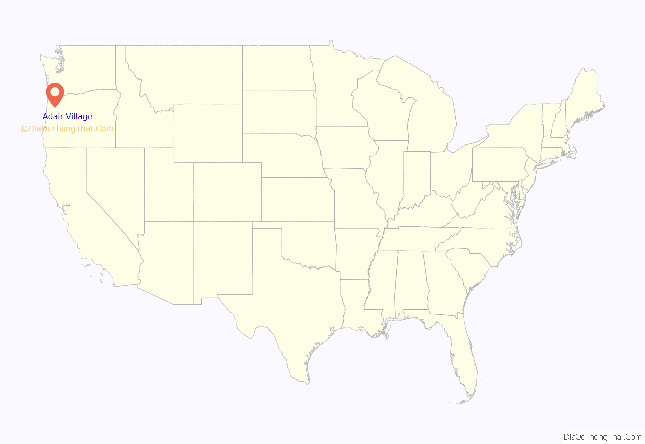
Adair Village location map. Where is Adair Village city?
History
Adair Village was named after the World War II military installation Camp Adair. When the war ended, the camp was closed and most of the buildings removed, except for the hospital, which in 1946 was leased to Oregon State University for student and faculty housing. The university converted the hospital into apartments, a local government was organized, and Adair Village post office established in 1947.
When the postwar enrollment boom dwindled, Oregon State gave up its lease, and the United States Air Force maintained the base as a radar station. Adair Village post office closed in 1951, and Adair Air Force Station post office took its place from 1961 through 1969. The Air Force ceased operations and sold the property, with the individual houses being placed on the market. Adair Village incorporated in 1976. Adair Village city hall is one of the original World War II buildings.
Adair Village Road Map
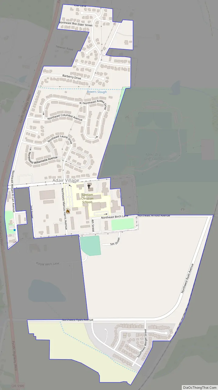
Adair Village city Satellite Map

Geography
According to the United States Census Bureau, the city has a total area of 0.23 square miles (0.60 km), all of it land.
See also
Map of Oregon State and its subdivision: Map of other states:- Alabama
- Alaska
- Arizona
- Arkansas
- California
- Colorado
- Connecticut
- Delaware
- District of Columbia
- Florida
- Georgia
- Hawaii
- Idaho
- Illinois
- Indiana
- Iowa
- Kansas
- Kentucky
- Louisiana
- Maine
- Maryland
- Massachusetts
- Michigan
- Minnesota
- Mississippi
- Missouri
- Montana
- Nebraska
- Nevada
- New Hampshire
- New Jersey
- New Mexico
- New York
- North Carolina
- North Dakota
- Ohio
- Oklahoma
- Oregon
- Pennsylvania
- Rhode Island
- South Carolina
- South Dakota
- Tennessee
- Texas
- Utah
- Vermont
- Virginia
- Washington
- West Virginia
- Wisconsin
- Wyoming