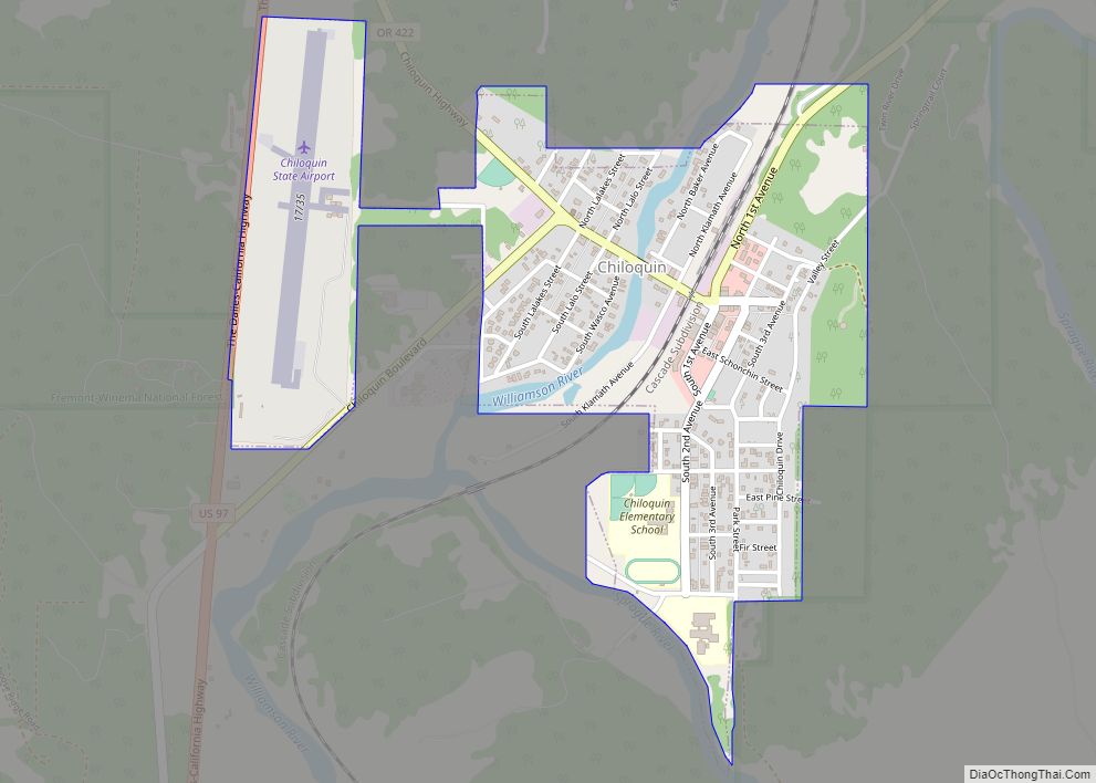
Chiloquin (/ˈtʃɪləkwɪn/ CHIL-ə-kwin) (Klamath: mbosaksawaas, “flint place” ) is a city in Klamath County, Oregon, United States. Chiloquin was the pioneer version of a Klamath family name Chaloquin, which was the name of a Klamath chief who was alive at the time of the treaty of 1864. Southern Pacific records also show that a woman named Bessie Chiloquin deeded a right-of-way through the area to the railroad on February 14, 1914. The population was 734 at the 2010 census.
| Name: | Chiloquin city |
|---|---|
| LSAD Code: | 25 |
| LSAD Description: | city (suffix) |
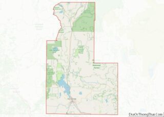
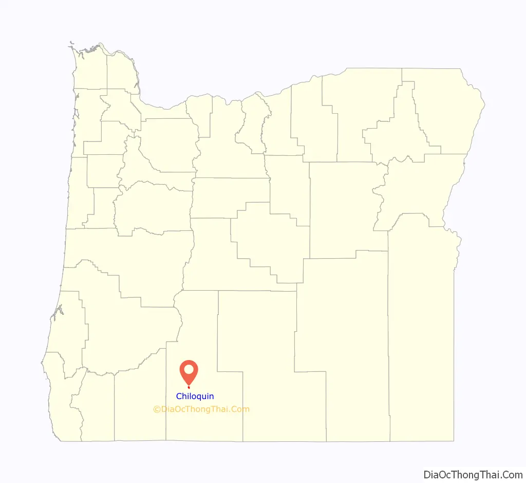
| State: | Oregon |
| County: | Klamath County |
| Incorporated: | 1926 |
| Elevation: | 4,180 ft (1,270 m) |
| Total Area: | 0.82 sq mi (2.12 km²) |
| Land Area: | 0.82 sq mi (2.12 km²) |
| Water Area: | 0.00 sq mi (0.00 km²) |
| Total Population: | 767 |
| Population Density: | 938.80/sq mi (362.27/km²) |
| ZIP code: | 97604, 97624 |
| Area code: | 541 |
| FIPS code: | 4113050 |
| GNISfeature ID: | 1139648 |
Online Interactive Map
Click on ![]() to view map in "full screen" mode.
to view map in "full screen" mode.
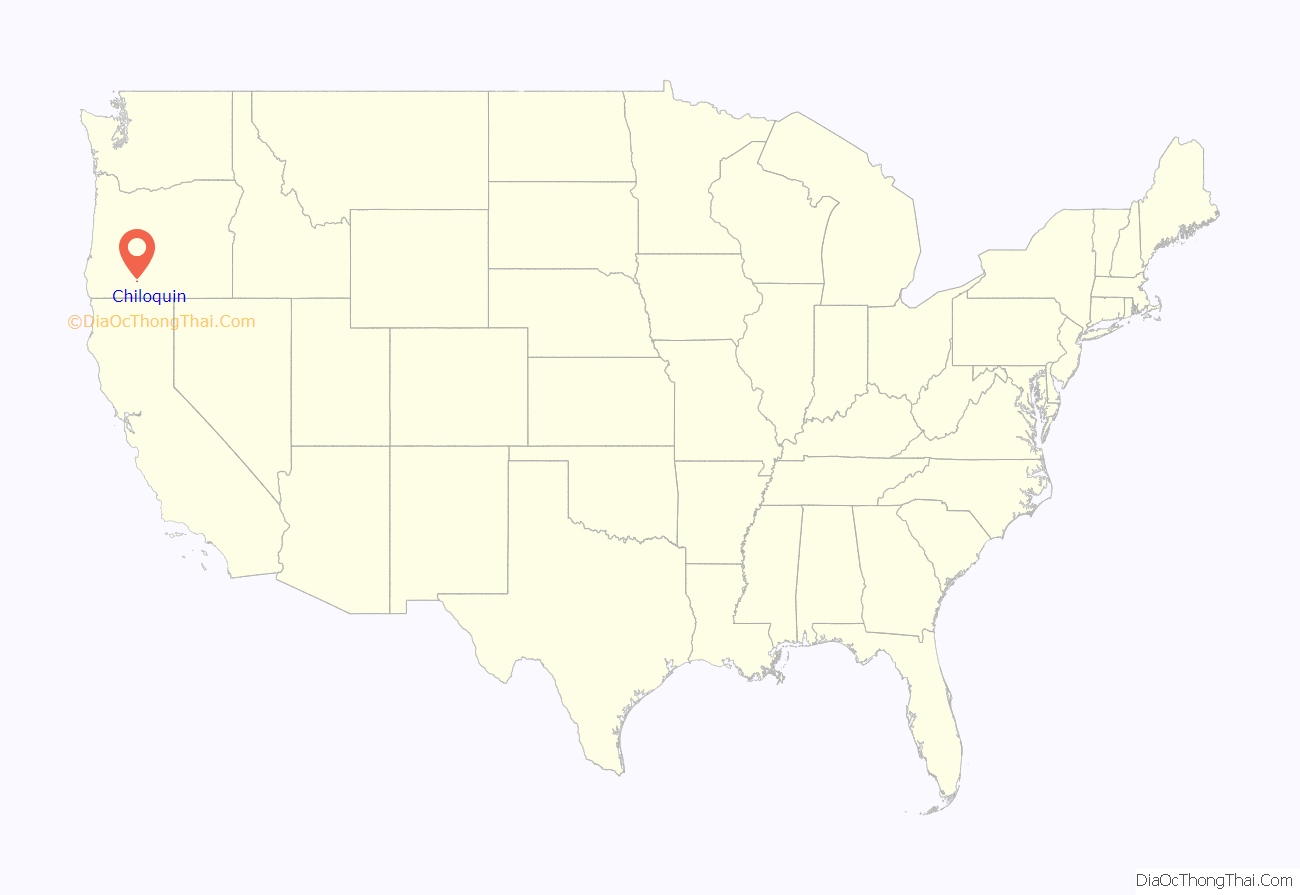
Chiloquin location map. Where is Chiloquin city?
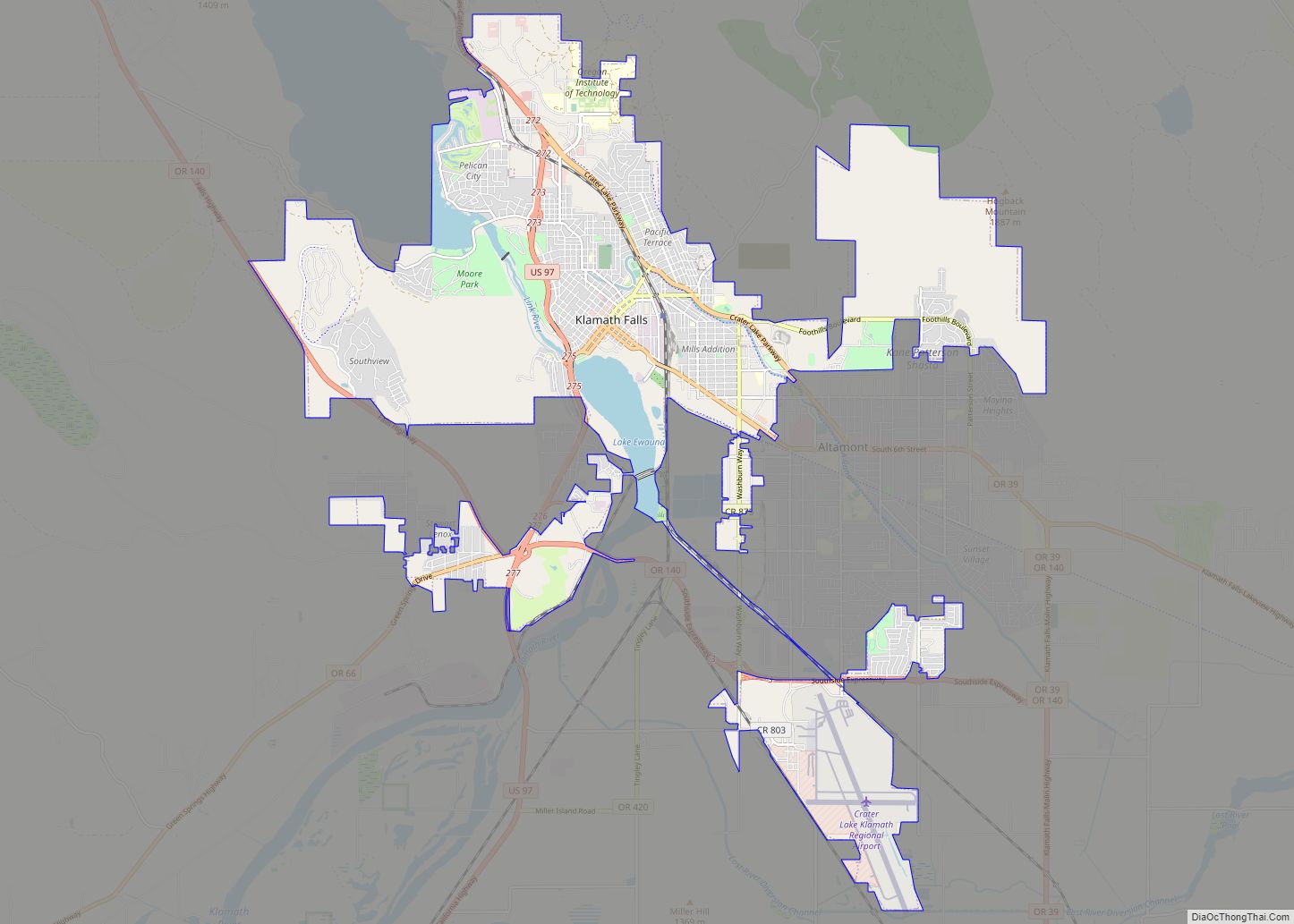
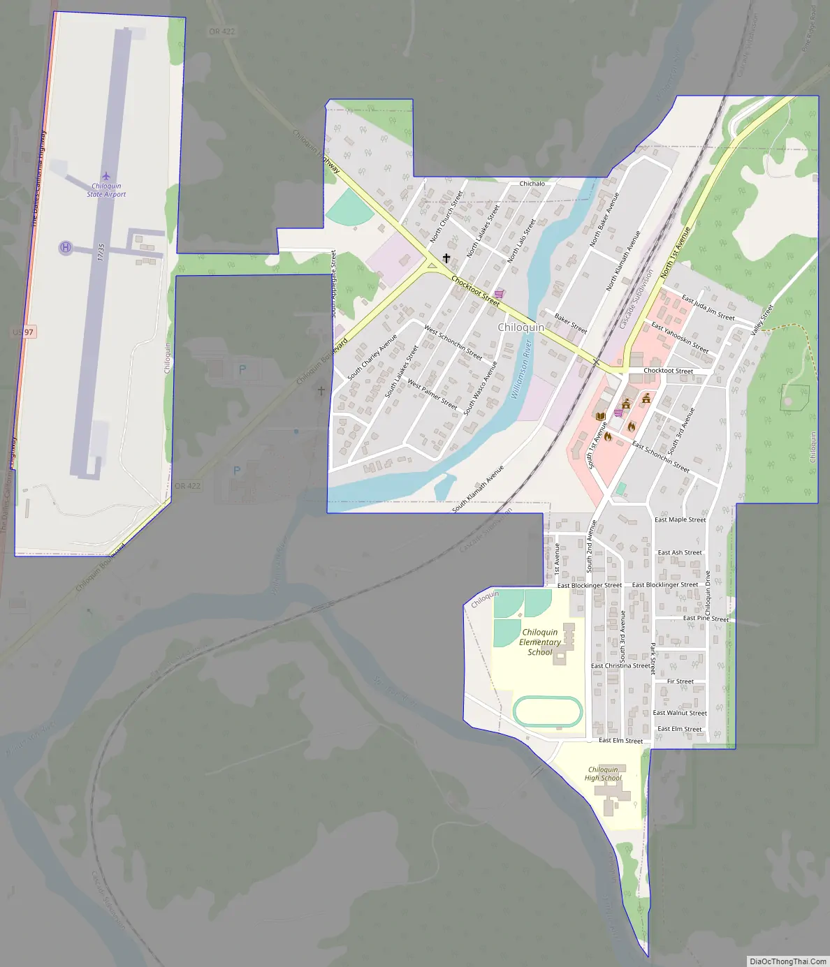
Chiloquin Road Map
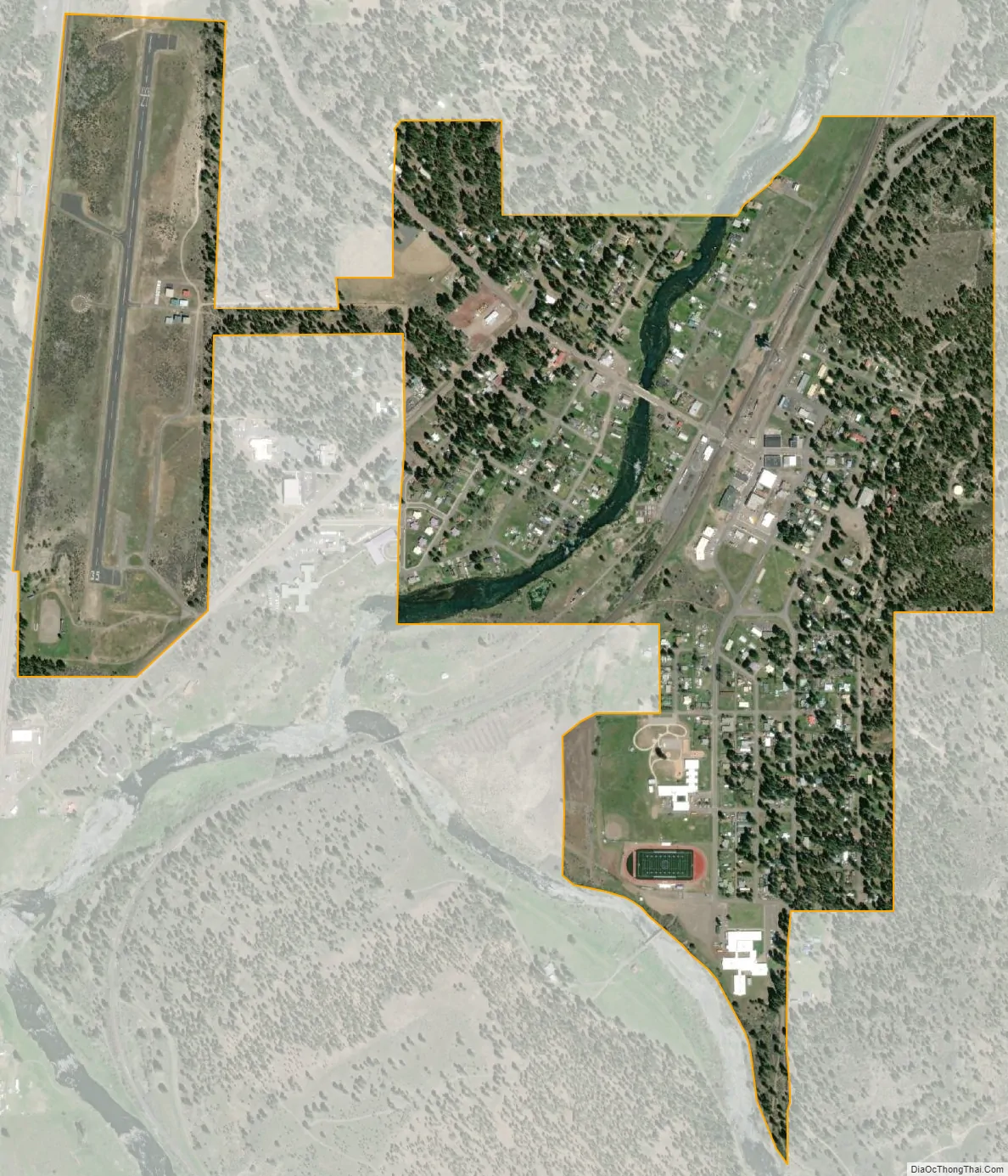
Chiloquin city Satellite Map
Geography
Chiloquin is at an elevation of 4,180 feet (1,270 m) in Klamath County. The city is slightly east of U.S. Route 97 and slightly north of its intersection with Oregon Route 62. A short east–west highway, Oregon Route 422, links Route 97 at Chiloquin to Route 62 slightly south of Klamath Agency. By highway, Chiloquin is about 26 miles (42 km) north of Klamath Falls and 253 miles (407 km) south of Portland.
The Williamson River flows north–south through Chiloquin, where it receives the Sprague River from the east. The city is near the Winema National Forest, which approaches it from the east and west. Agency Lake is nearby, west of the city and slightly west of Route 62. According to the United States Census Bureau, the city has a total area of 0.82 square miles (2.12 km), all of it land.
See also
Map of Oregon State and its subdivision: Map of other states:- Alabama
- Alaska
- Arizona
- Arkansas
- California
- Colorado
- Connecticut
- Delaware
- District of Columbia
- Florida
- Georgia
- Hawaii
- Idaho
- Illinois
- Indiana
- Iowa
- Kansas
- Kentucky
- Louisiana
- Maine
- Maryland
- Massachusetts
- Michigan
- Minnesota
- Mississippi
- Missouri
- Montana
- Nebraska
- Nevada
- New Hampshire
- New Jersey
- New Mexico
- New York
- North Carolina
- North Dakota
- Ohio
- Oklahoma
- Oregon
- Pennsylvania
- Rhode Island
- South Carolina
- South Dakota
- Tennessee
- Texas
- Utah
- Vermont
- Virginia
- Washington
- West Virginia
- Wisconsin
- Wyoming