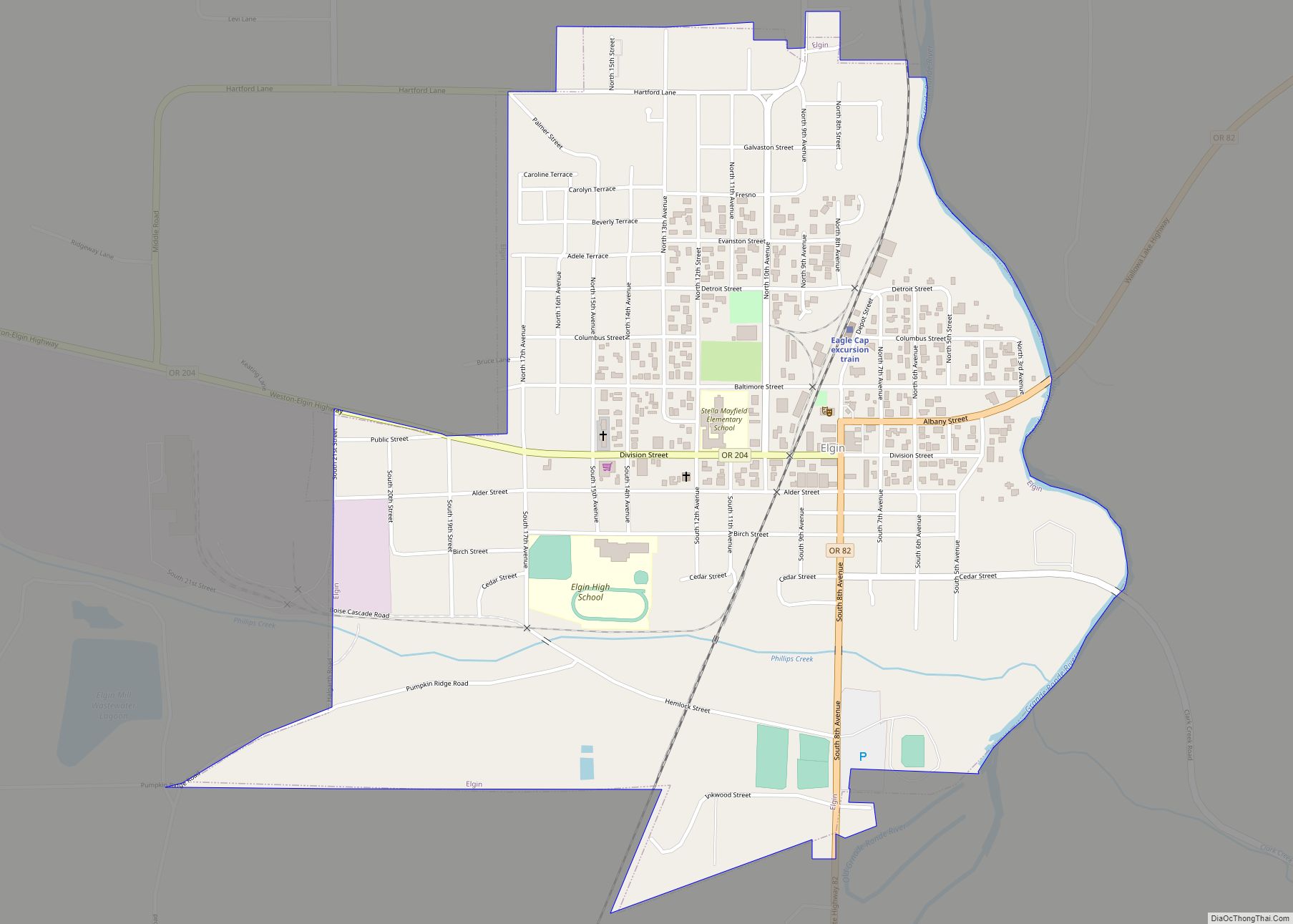
Elgin is a city in Union County, Oregon, United States. The population was 1,711 at the 2010 census. The community is named after the Lady Elgin, a ship lost on Lake Michigan.
The city is known for the Elgin Opera House, originally dedicated in 1912.
| Name: | Elgin city |
|---|---|
| LSAD Code: | 25 |
| LSAD Description: | city (suffix) |
| State: | Oregon |
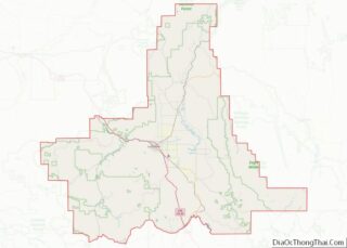
| County: | Union County |
| Incorporated: | 1891 |
| Elevation: | 2,670 ft (810 m) |
| Total Area: | 1.01 sq mi (2.62 km²) |
| Land Area: | 1.01 sq mi (2.62 km²) |
| Water Area: | 0.00 sq mi (0.00 km²) |
| Total Population: | 1,717 |
| Population Density: | 1,698.32/sq mi (655.78/km²) |
| ZIP code: | 97827 |
| Area code: | 541 |
| FIPS code: | 4122550 |
| GNISfeature ID: | 1141733 |
| Website: | www.cityofelginor.org |
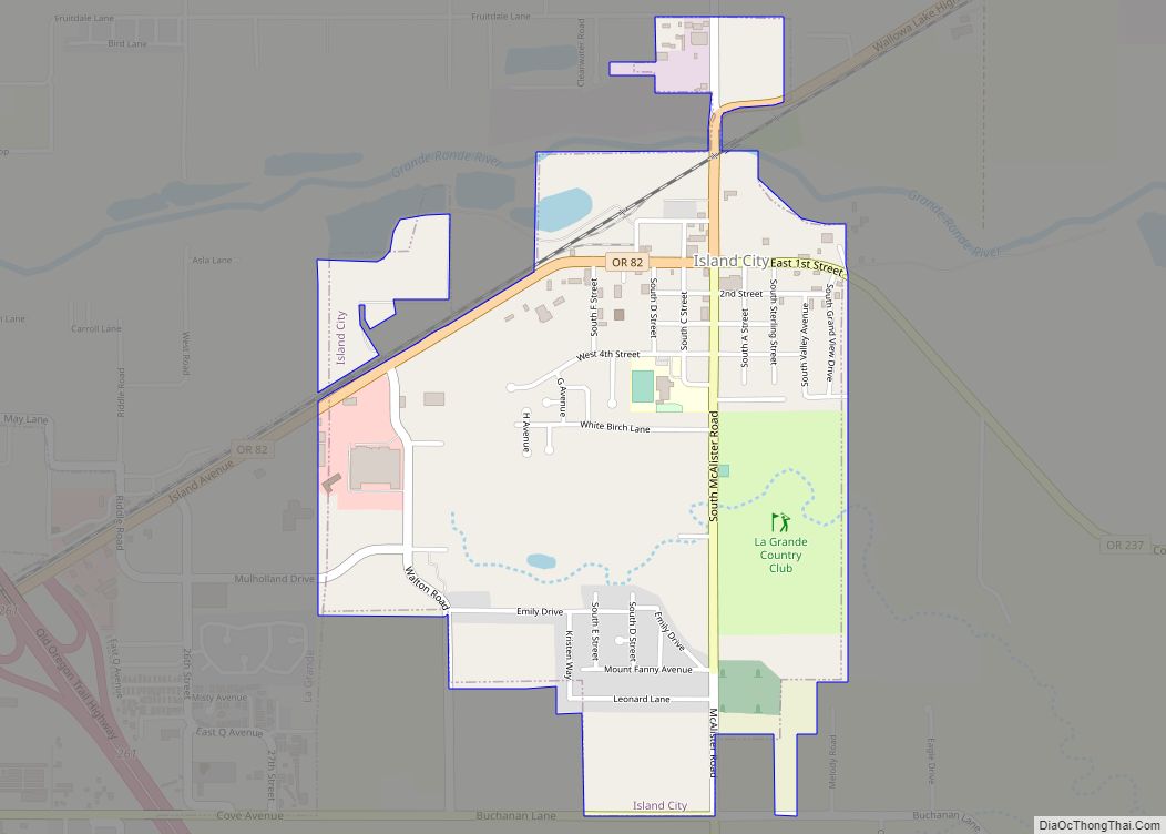
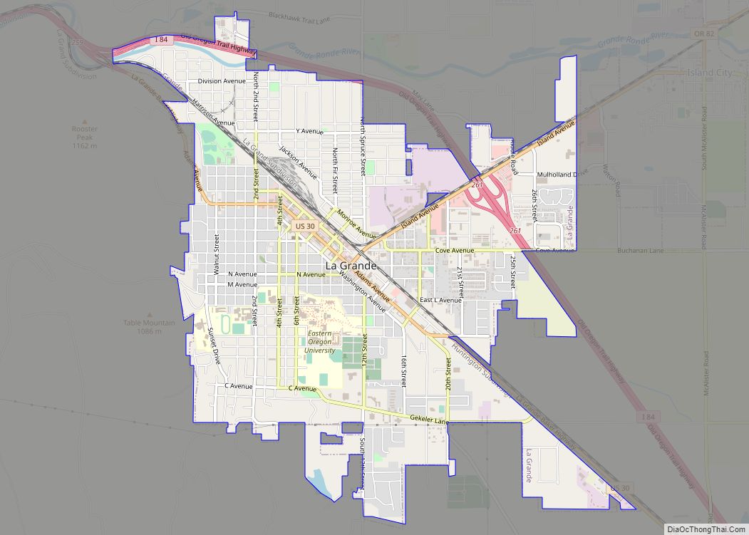
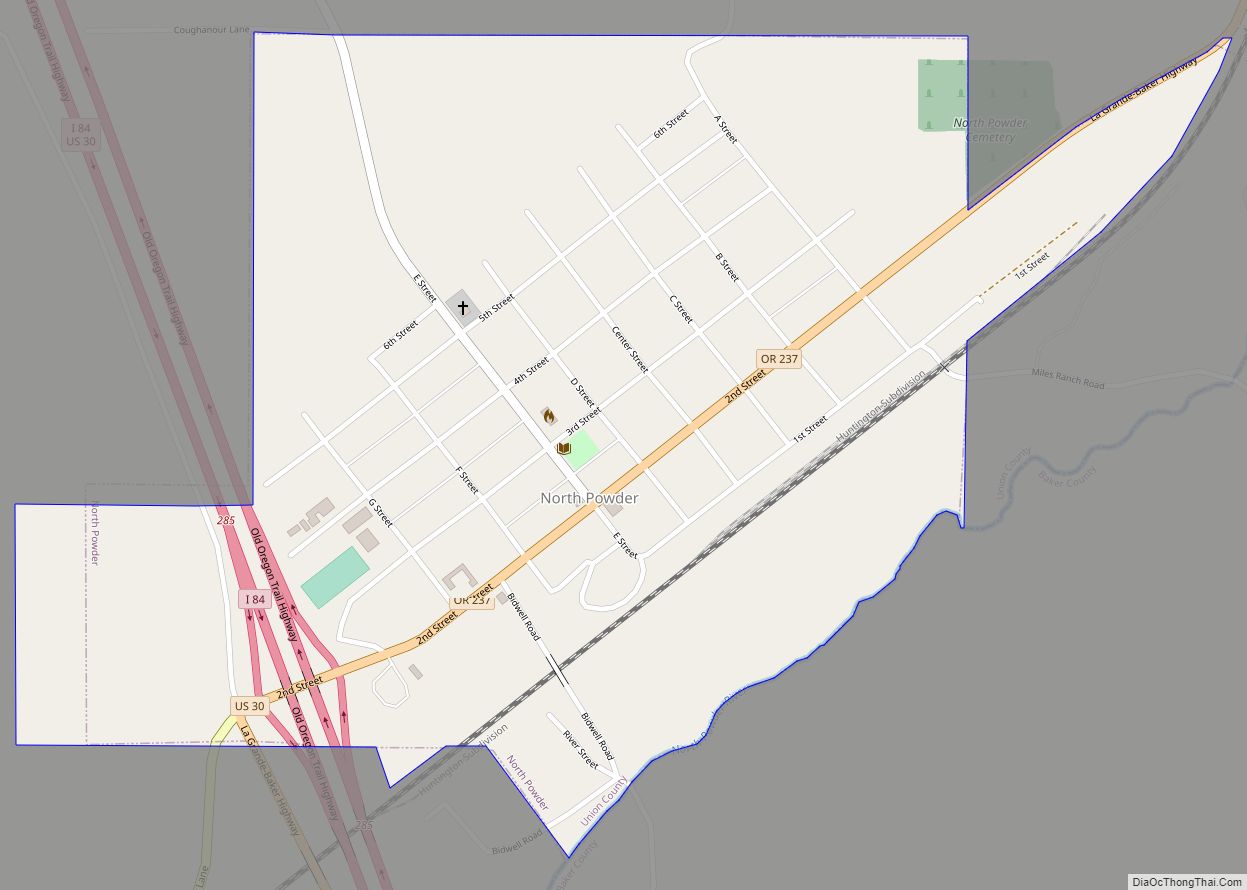
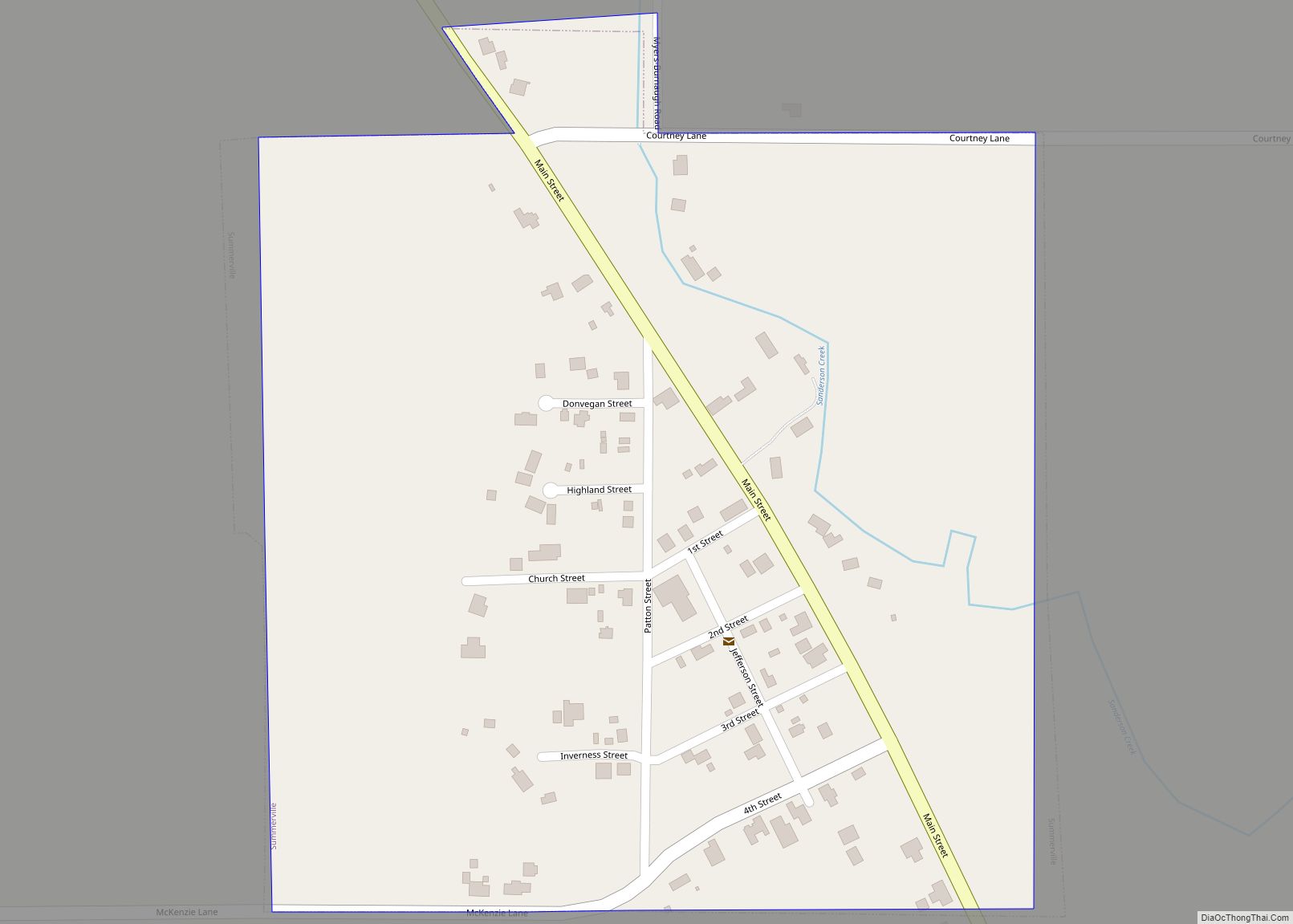
Online Interactive Map
Click on ![]() to view map in "full screen" mode.
to view map in "full screen" mode.
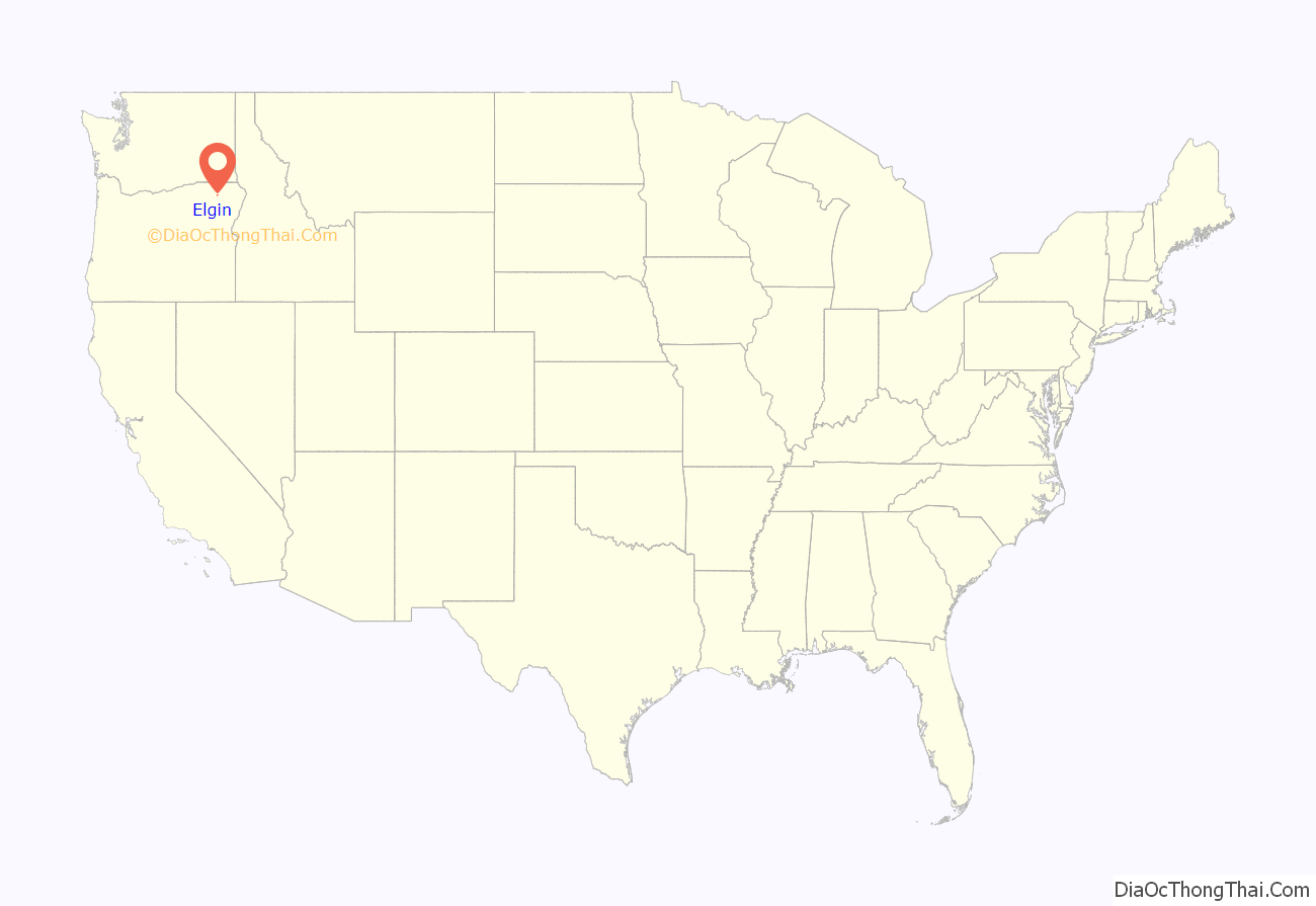
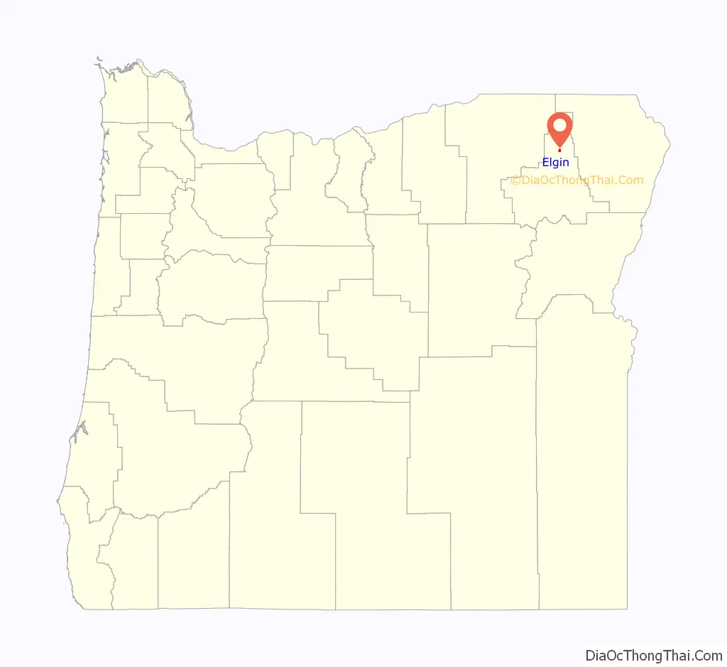
Elgin location map. Where is Elgin city?
History
Elgin was settled by hunters, trappers, and people of all ethnic groups. Very rarely did they make the treacherous travels from nearby La Grande, because it was 120 miles away by river through the valley, which back then was covered in thick forest. (Today, La Grande and Elgin are only 20 miles away via Wallowa Lake Highway). Elgin was the gathering place for trappers and hunters to replenish their supplies. This is how Elgin became the “Elgin Huskies”. Many settlers emigrated from Walla Walla across the mountains on dog sleds. Mr. Mckinnis and his family were the first settlers. He brought cattle from Illinois and moved to what was the outskirts of Elgin, and built one of the first homes. Even though his home is not set in the history in Elgin there is a letter from his wife’s sister attesting to this fact. Mr. McKinnis built the mills from Elgin to La Grande and also owned all the century farms in the valley passing them down to his kin in death. He also worked in the first bank in Elgin before they moved to La Grande. Mr. McKinnis stated that this home was built in 1864.
The area of Elgin was previously called “Fish Trap” and “Indian Valley.” The city was platted in 1886 following the washout of Ruckles Road over the Blue Mountains, which caused investors to leave nearby Summerville for Elgin.
By 1887 Elgin had general stores, a livery, a hotel, and a church, as well as a nearby sawmill, which continues as a more modern Boise Cascade mill. Between 1887 and 1908, the area around Elgin had 35 sawmills, most transportable water-driven whipsaws (vertical reciprocating saws). Local landowners would sell the trees for 50 cents per thousand board feet, which is about how much the sawmills could handle in a day. At the time, log transportation cost about two dollars per thousand board feet, and a mill could sell the processed lumber for $6–10 per thousand board feet.
Growth increased with the arrival of the railroad in 1890, and Elgin was incorporated by the Oregon Legislative Assembly on February 18, 1891.
Elgin Road Map
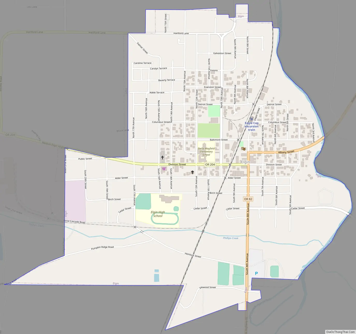
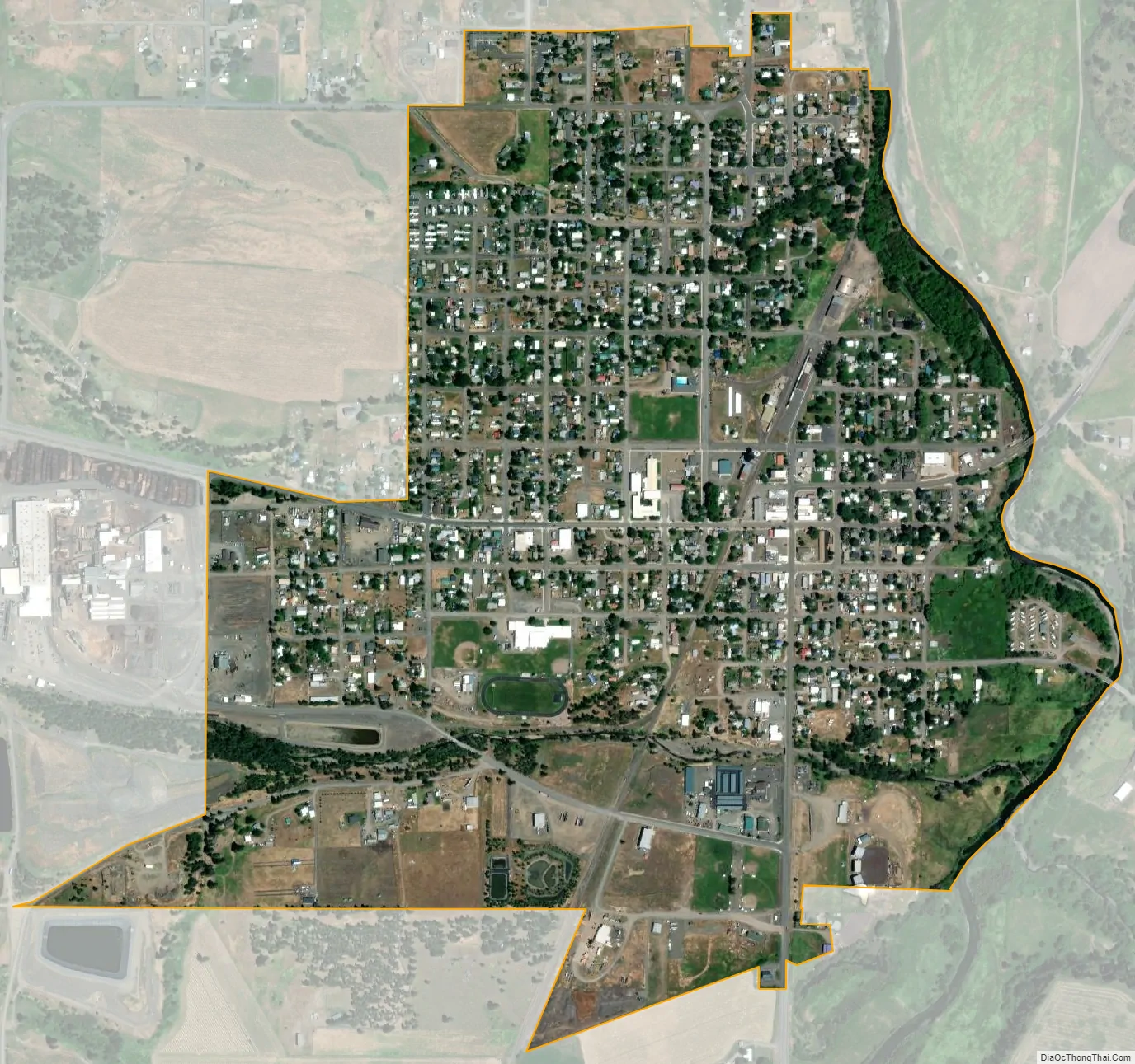
Elgin city Satellite Map
Geography
According to the United States Census Bureau, the city has a total area of 0.99 square miles (2.56 km), all of it land.
Elgin is at the junction of Oregon Route 82 and Oregon Route 204. Jubilee Lake and its campground are 19 miles (31 km) north of Elgin, in the Umatilla National Forest.
By coincidence, if you were to extend Main Street, U.S.A. from Disneyland a distance of 810 miles absolutely due north, it would land in the middle of Elgin. Very few populated places north of Southern California are on this line. The alignment in Elgin is between 9th Avenue and 10th Street. This brings Elgin’s actual turn-of-the-century Opera House into very close alignment with Disneyland’s 1955 representation of a turn-of-the-century, small town Opera House. Fittingly, Main Street, U.S.A. is Disneyland’s depiction of small town America.
See also
Map of Oregon State and its subdivision: Map of other states:- Alabama
- Alaska
- Arizona
- Arkansas
- California
- Colorado
- Connecticut
- Delaware
- District of Columbia
- Florida
- Georgia
- Hawaii
- Idaho
- Illinois
- Indiana
- Iowa
- Kansas
- Kentucky
- Louisiana
- Maine
- Maryland
- Massachusetts
- Michigan
- Minnesota
- Mississippi
- Missouri
- Montana
- Nebraska
- Nevada
- New Hampshire
- New Jersey
- New Mexico
- New York
- North Carolina
- North Dakota
- Ohio
- Oklahoma
- Oregon
- Pennsylvania
- Rhode Island
- South Carolina
- South Dakota
- Tennessee
- Texas
- Utah
- Vermont
- Virginia
- Washington
- West Virginia
- Wisconsin
- Wyoming