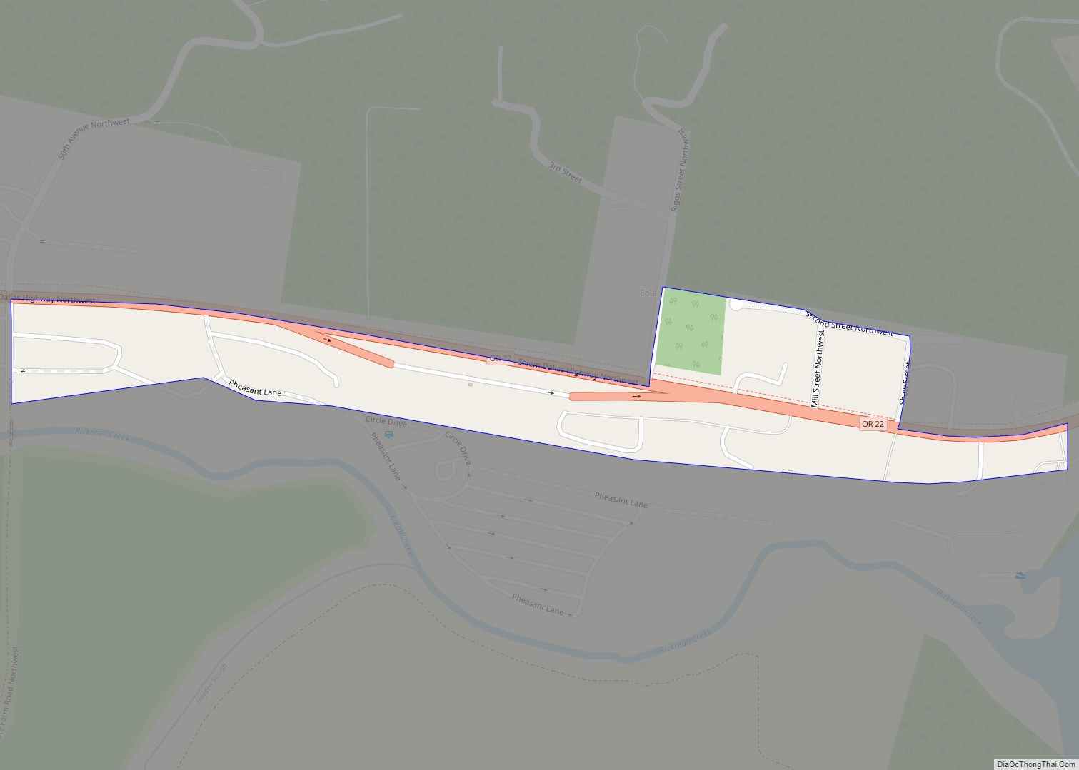
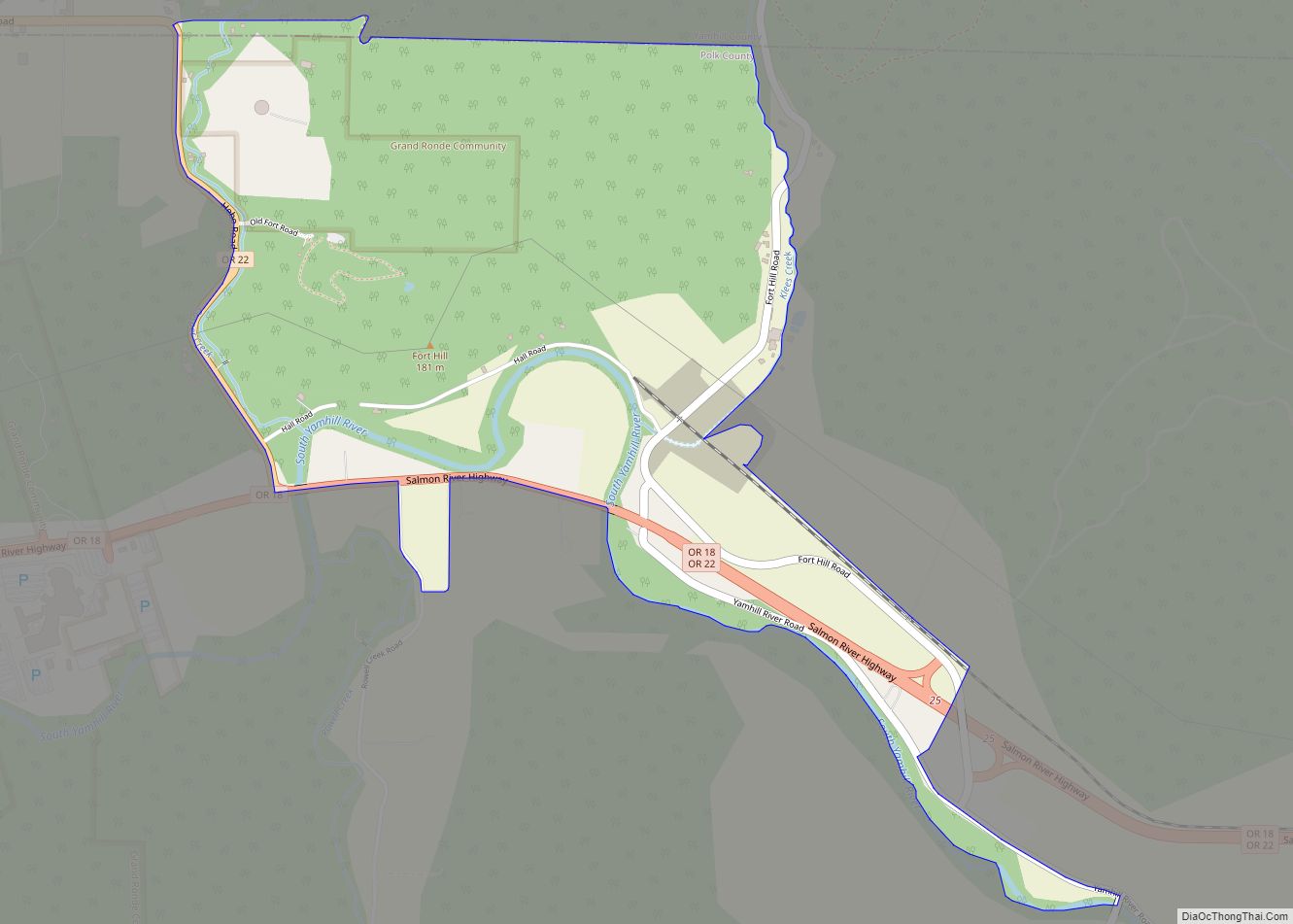
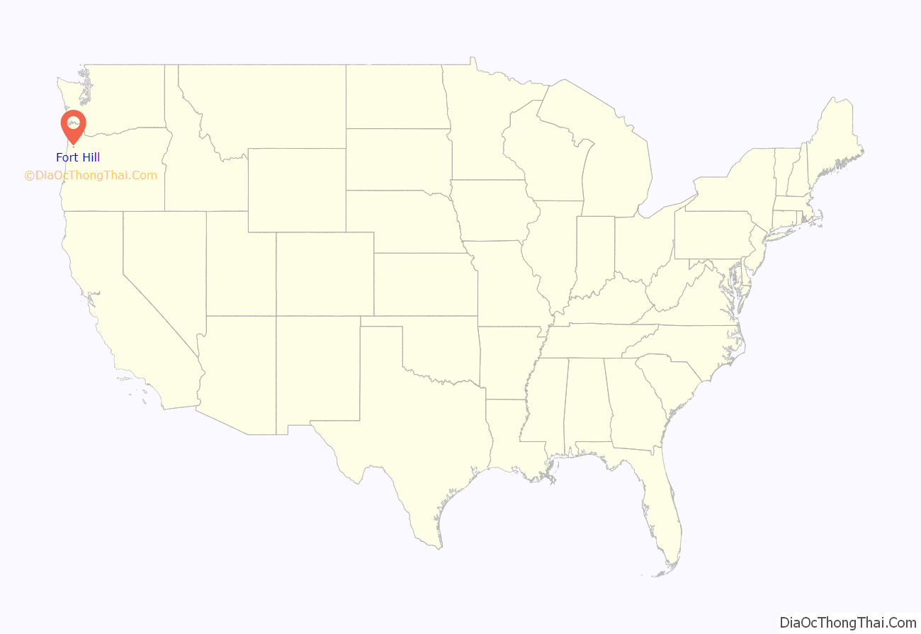
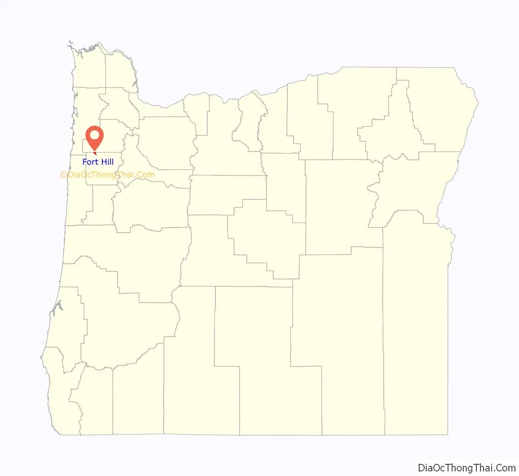
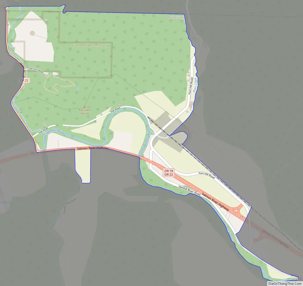
Fort Hill is an unincorporated community in Polk and Yamhill counties in Oregon, United States. It is located about a mile east of Spirit Mountain Casino on Oregon Route 22 near the South Yamhill River. For statistical purposes, the United States Census Bureau has defined Fort Hill as a census-designated place (CDP). The census definition of the area may not precisely correspond to local understanding of the area with the same name. The hill of the same name, located just east of Valley Junction, was the site of a blockhouse built by settlers in 1855–1856. The blockhouse became part of Fort Yamhill, and was later moved to Grand Ronde Agency and is now located in Dayton.
| Name: | Fort Hill CDP |
|---|---|
| LSAD Code: | 57 |
| LSAD Description: | CDP (suffix) |
| State: | Oregon |
| County: | Polk County, Yamhill County |
| FIPS code: | 4126400 |
Online Interactive Map
Click on ![]() to view map in "full screen" mode.
to view map in "full screen" mode.
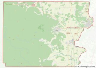
Fort Hill location map. Where is Fort Hill CDP?
Fort Hill Road Map
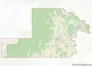
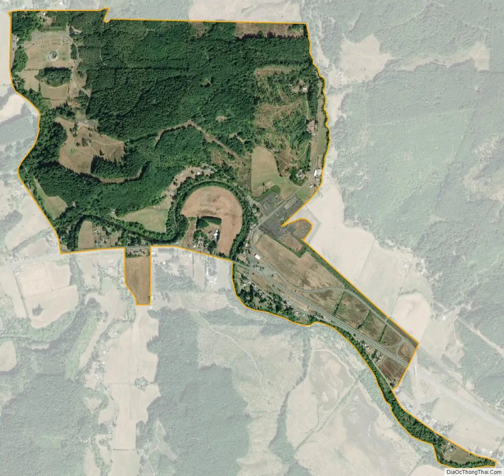
Fort Hill city Satellite Map
See also
Map of Oregon State and its subdivision: Map of other states:- Alabama
- Alaska
- Arizona
- Arkansas
- California
- Colorado
- Connecticut
- Delaware
- District of Columbia
- Florida
- Georgia
- Hawaii
- Idaho
- Illinois
- Indiana
- Iowa
- Kansas
- Kentucky
- Louisiana
- Maine
- Maryland
- Massachusetts
- Michigan
- Minnesota
- Mississippi
- Missouri
- Montana
- Nebraska
- Nevada
- New Hampshire
- New Jersey
- New Mexico
- New York
- North Carolina
- North Dakota
- Ohio
- Oklahoma
- Oregon
- Pennsylvania
- Rhode Island
- South Carolina
- South Dakota
- Tennessee
- Texas
- Utah
- Vermont
- Virginia
- Washington
- West Virginia
- Wisconsin
- Wyoming