Lakeside is a city in Coos County, Oregon, United States. The population was 1,699 at the 2010 census.
| Name: | Lakeside city |
|---|---|
| LSAD Code: | 25 |
| LSAD Description: | city (suffix) |
| State: | Oregon |
| County: | Coos County |
| Incorporated: | 1974 |
| Elevation: | 23 ft (7 m) |
| Total Area: | 2.29 sq mi (5.93 km²) |
| Land Area: | 2.00 sq mi (5.18 km²) |
| Water Area: | 0.29 sq mi (0.76 km²) |
| Total Population: | 1,904 |
| Population Density: | 952.48/sq mi (367.82/km²) |
| ZIP code: | 97449 |
| Area code: | 541 |
| FIPS code: | 4140650 |
| GNISfeature ID: | 1144789 |
Online Interactive Map
Click on ![]() to view map in "full screen" mode.
to view map in "full screen" mode.
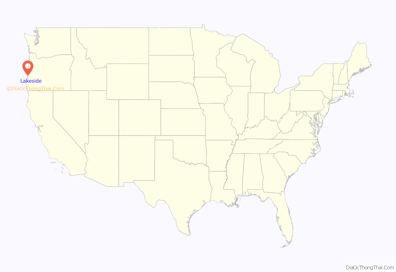
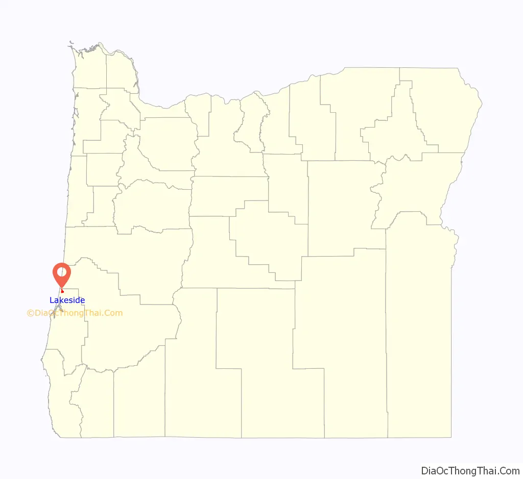
Lakeside location map. Where is Lakeside city?
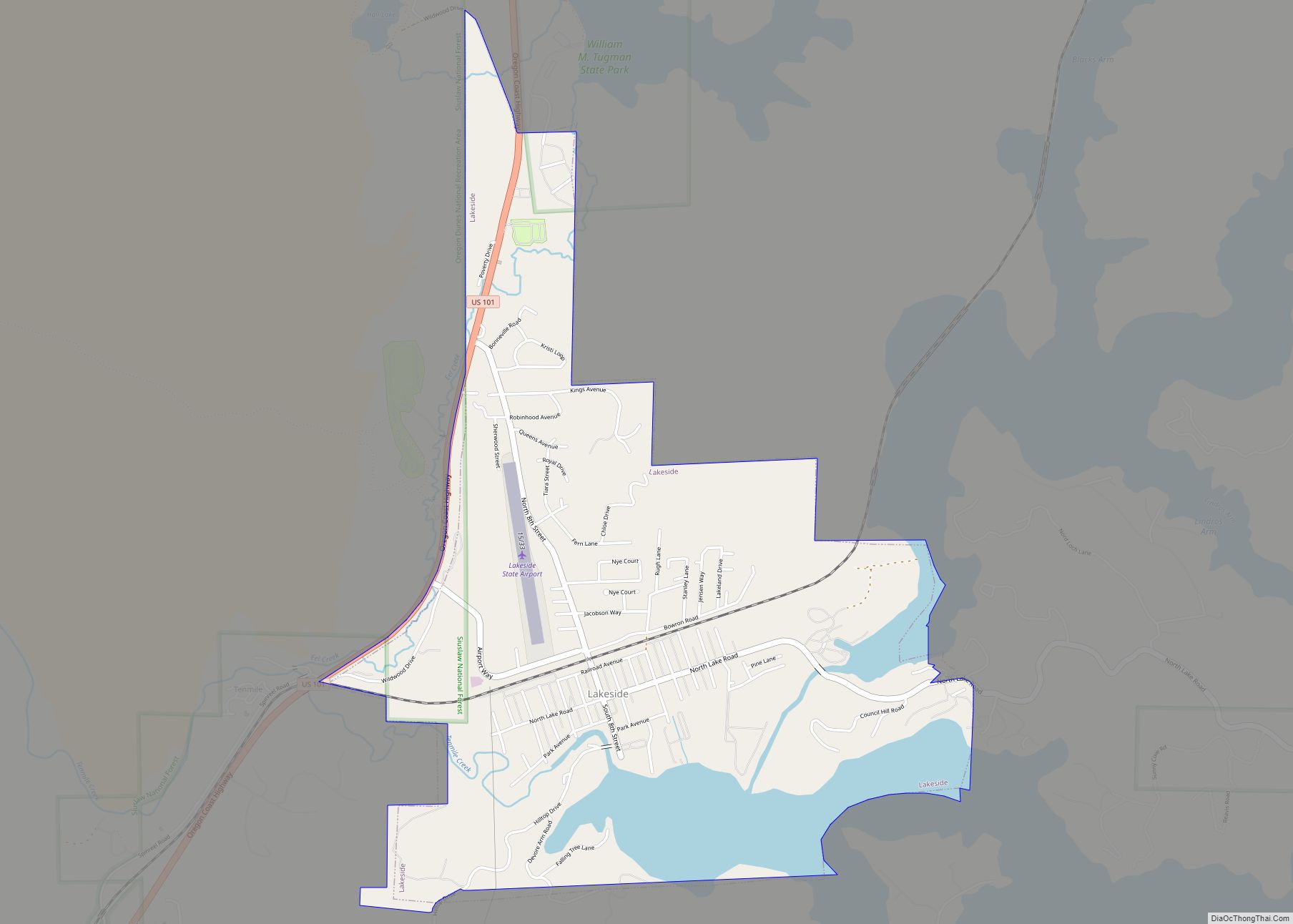
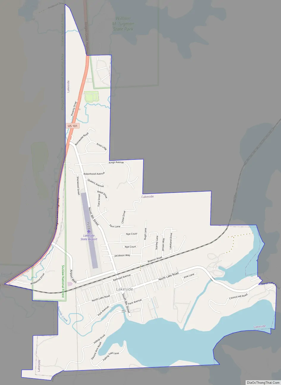
Lakeside Road Map
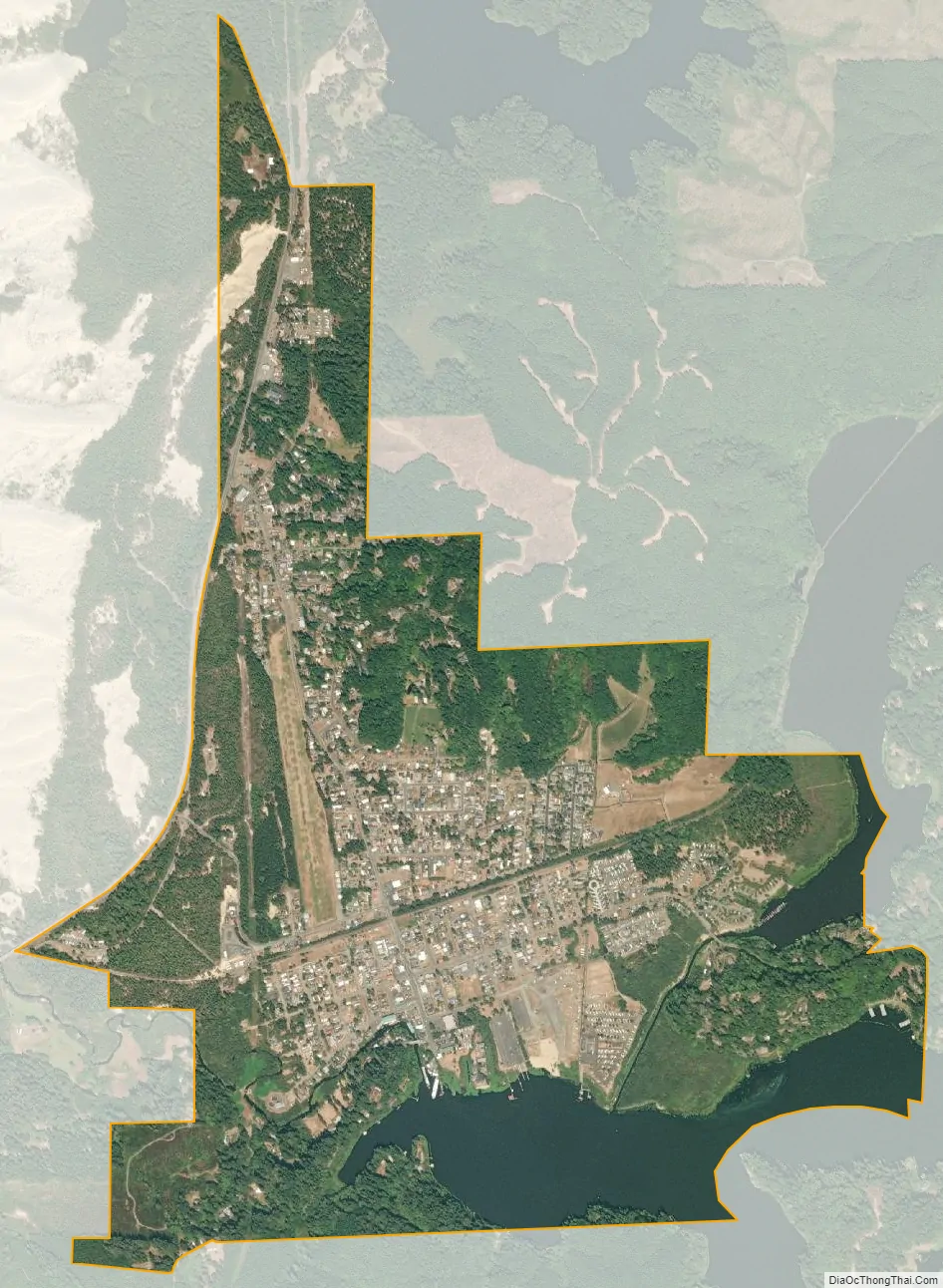
Lakeside city Satellite Map
Geography
Lakeside is in Coos County, Oregon, along U.S. Route 101, about 1 mile (2 km) inland from the Pacific Ocean. The city is 15 miles (24 km) north of Coos Bay and 197 miles (317 km) southwest of Portland.
Lakeside borders Tenmile Lake and Tenmile Creek, which flows from the lake to the ocean. The city is 23 feet (7.0 m) above sea level. According to the United States Census Bureau, the city has a total area of 2.29 square miles (5.93 km), of which 2.00 square miles (5.18 km) is land and 0.29 square miles (0.75 km) is water.
See also
Map of Oregon State and its subdivision: Map of other states:- Alabama
- Alaska
- Arizona
- Arkansas
- California
- Colorado
- Connecticut
- Delaware
- District of Columbia
- Florida
- Georgia
- Hawaii
- Idaho
- Illinois
- Indiana
- Iowa
- Kansas
- Kentucky
- Louisiana
- Maine
- Maryland
- Massachusetts
- Michigan
- Minnesota
- Mississippi
- Missouri
- Montana
- Nebraska
- Nevada
- New Hampshire
- New Jersey
- New Mexico
- New York
- North Carolina
- North Dakota
- Ohio
- Oklahoma
- Oregon
- Pennsylvania
- Rhode Island
- South Carolina
- South Dakota
- Tennessee
- Texas
- Utah
- Vermont
- Virginia
- Washington
- West Virginia
- Wisconsin
- Wyoming