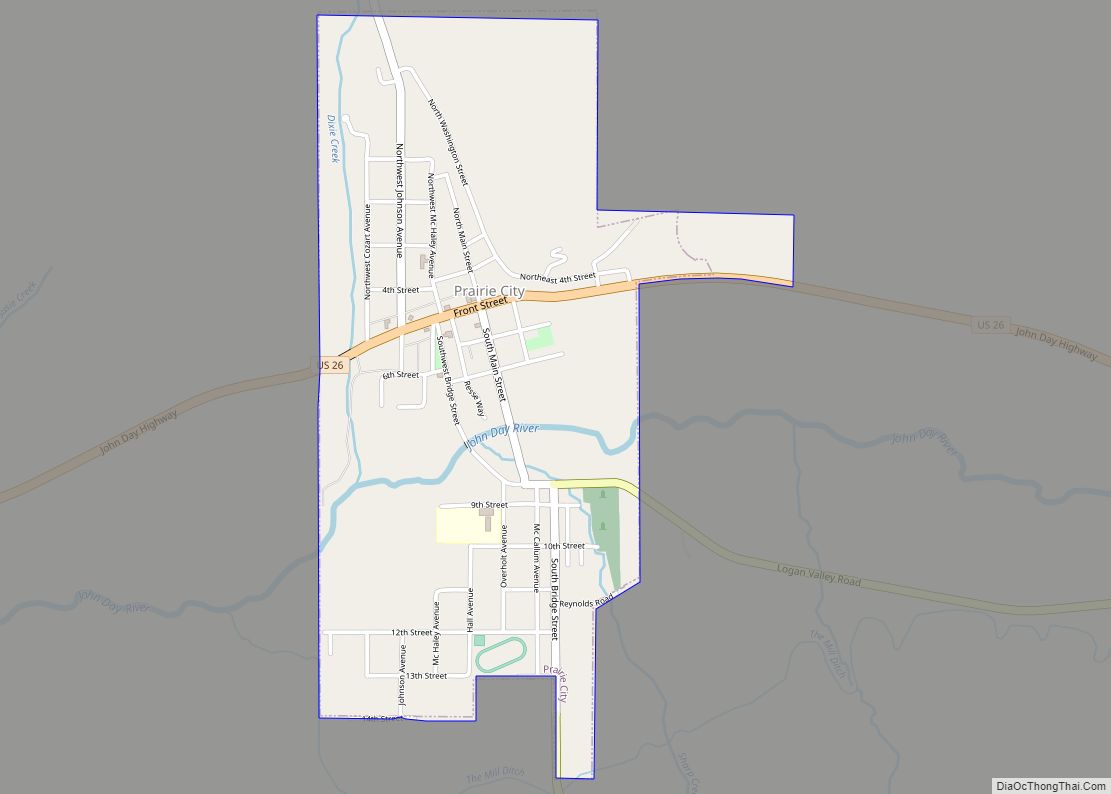
Prairie City is a city in Grant County, Oregon, United States. The population was 909 at the 2010 census. The community was incorporated by the Oregon Legislative Assembly on February 23, 1891.
| Name: | Prairie City city |
|---|---|
| LSAD Code: | 25 |
| LSAD Description: | city (suffix) |
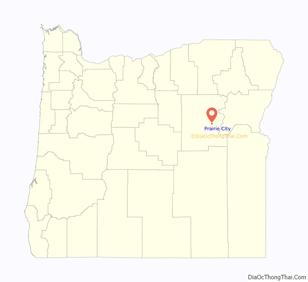
| State: | Oregon |
| County: | Grant County |
| Incorporated: | 1891 |
| Elevation: | 3,535 ft (1,077 m) |
| Total Area: | 0.99 sq mi (2.57 km²) |
| Land Area: | 0.99 sq mi (2.57 km²) |
| Water Area: | 0.00 sq mi (0.00 km²) |
| Total Population: | 841 |
| Population Density: | 847.78/sq mi (327.45/km²) |
| ZIP code: | 97869 |
| Area code: | 541 |
| FIPS code: | 4159650 |
| GNISfeature ID: | 1147975 |
| Website: | www.prairiecityoregon.com |
Online Interactive Map
Click on ![]() to view map in "full screen" mode.
to view map in "full screen" mode.
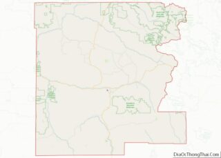
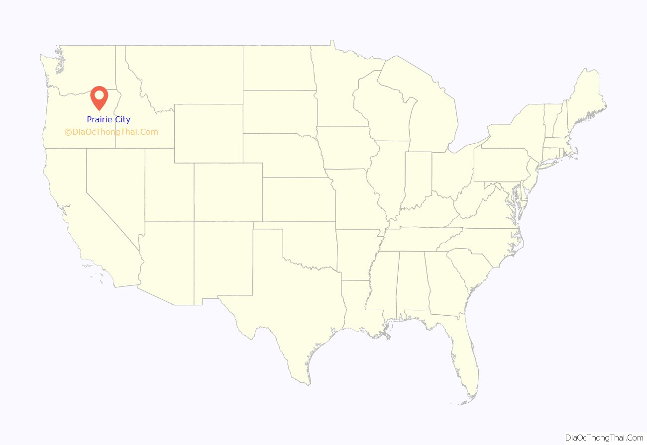
Prairie City location map. Where is Prairie City city?
History
Prairie City grew out of the former mining camp of Dixie, established in 1862 about 3 miles (5 km) up Dixie Creek from the John Day River. Prairie City, at the mouth of the creek, was chosen after placer mining rendered Dixie unsuitable for a townsite. The new city’s post office was established in 1870 with Jules Le Bret as postmaster.
A narrow gauge line, the Sumpter Valley Railway (SVR), ran 80 miles (130 km) from Baker City west to Sumpter and on to its western terminus at Prairie City, which it reached in 1907. It carried passengers as well as freight shipped by ranchers, mining interests, and timber companies until its piecemeal abandonment in the 1930s. In the 21st century, a heritage railway operates on a segment of the original line between Sumpter and McEwen.
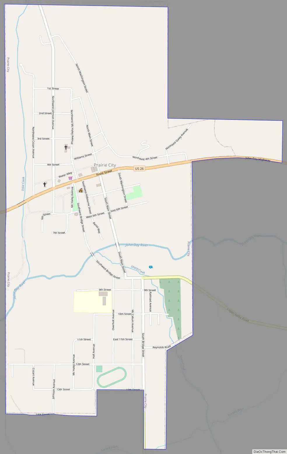
Prairie City Road Map
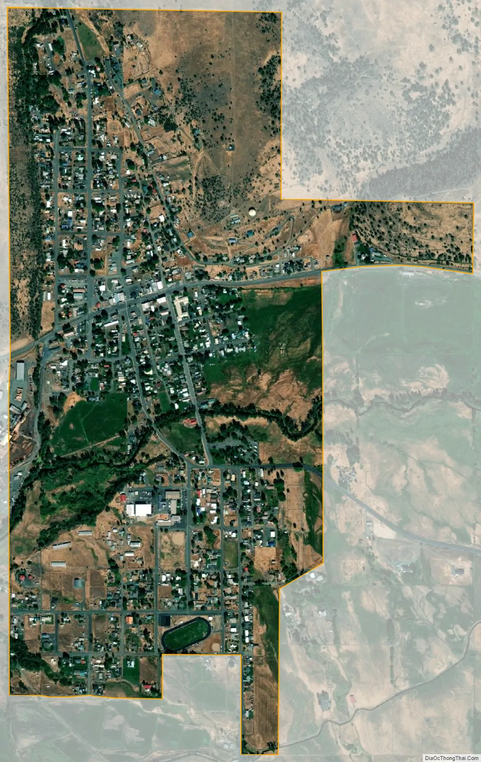
Prairie City city Satellite Map
Geography
Prairie City is in eastern Oregon at the upper end of the John Day River valley. It is about 50 miles (80 km) southwest of Baker City by highway and 13 miles (21 km) east of John Day along U.S. Route 26 in Grant County. Strawberry Mountain in the Strawberry Mountain Wilderness of the Malheur National Forest is directly south of the city.
According to the United States Census Bureau, the city has a total area of 0.99 square miles (2.56 km), all land.
See also
Map of Oregon State and its subdivision: Map of other states:- Alabama
- Alaska
- Arizona
- Arkansas
- California
- Colorado
- Connecticut
- Delaware
- District of Columbia
- Florida
- Georgia
- Hawaii
- Idaho
- Illinois
- Indiana
- Iowa
- Kansas
- Kentucky
- Louisiana
- Maine
- Maryland
- Massachusetts
- Michigan
- Minnesota
- Mississippi
- Missouri
- Montana
- Nebraska
- Nevada
- New Hampshire
- New Jersey
- New Mexico
- New York
- North Carolina
- North Dakota
- Ohio
- Oklahoma
- Oregon
- Pennsylvania
- Rhode Island
- South Carolina
- South Dakota
- Tennessee
- Texas
- Utah
- Vermont
- Virginia
- Washington
- West Virginia
- Wisconsin
- Wyoming