Summerville is a city in Union County, Oregon, United States. The population was 135 at the 2010 census.
| Name: | Summerville town |
|---|---|
| LSAD Code: | 43 |
| LSAD Description: | town (suffix) |
| State: | Oregon |
| County: | Union County |
| Incorporated: | 1885 |
| Elevation: | 2,705 ft (824 m) |
| Total Area: | 0.26 sq mi (0.68 km²) |
| Land Area: | 0.26 sq mi (0.68 km²) |
| Water Area: | 0.00 sq mi (0.00 km²) |
| Total Population: | 119 |
| Population Density: | 450.76/sq mi (173.78/km²) |
| ZIP code: | 97876 |
| Area code: | 541 |
| FIPS code: | 4170850 |
| GNISfeature ID: | 1150602 |
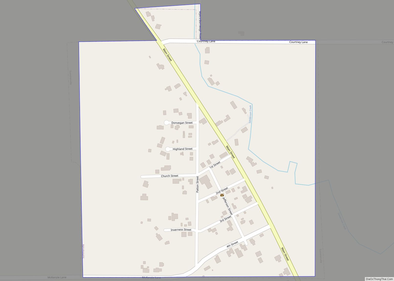
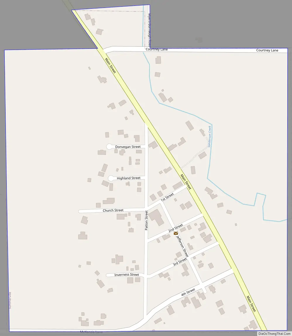
Online Interactive Map
Click on ![]() to view map in "full screen" mode.
to view map in "full screen" mode.
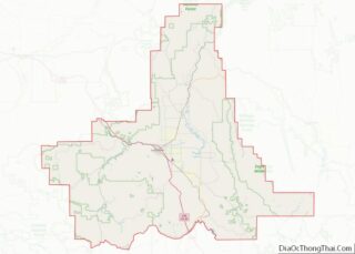
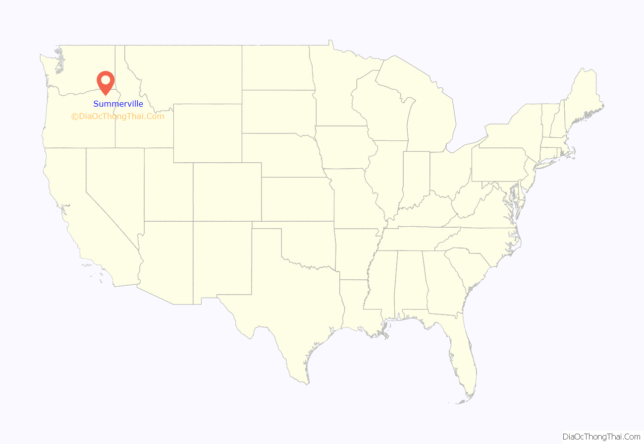
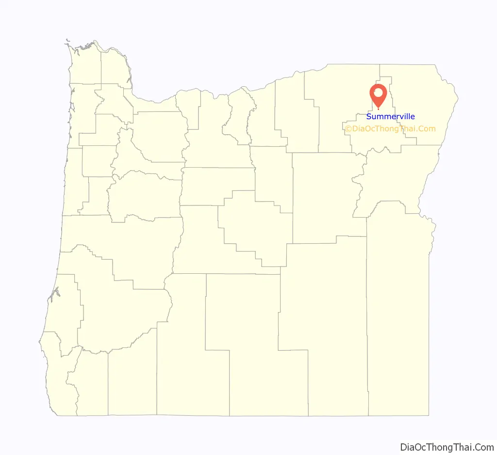
Summerville location map. Where is Summerville town?
History
Summerville was platted on September 20, 1873, along Ruckle Road by William H. Patten. Patten had a freight depot along Ruckles Road, only the second road over the Blue Mountains, which was a popular route over the Blue Mountains until it washed out in 1884. Speculators and investors then moved to Elgin, Oregon. An 1888 Sanborn map, the first of four of the city, shows an opera hall, bank, livery, drugstore, as well as other stores. In 1888, half of the main street buildings were destroyed in a fire, but were rebuilt soon after. As the town was already in a sharp commercial decline by 1910, buildings that were destroyed after then were not replaced. In 1890, the population was 280 people.
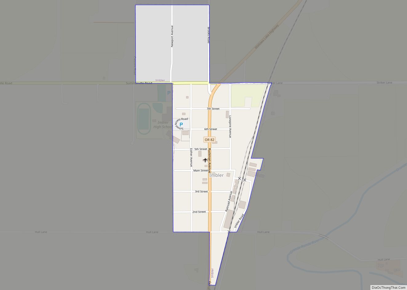
Summerville Road Map
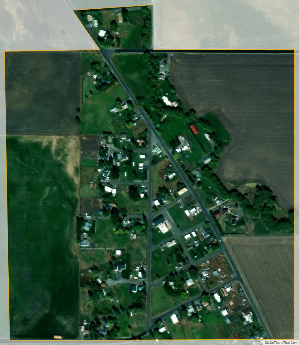
Summerville city Satellite Map
Geography
Summerville lies in the northern Grande Ronde Valley about 4 miles (6 km) northwest of Imbler along Summerville Road. Oregon Route 82 passes through Imbler, between La Grande to the southwest and Elgin to the northeast. Mill Creek, a tributary of Willow Creek, which itself is a tributary of the Grande Ronde River, flows through Summerville.
According to the United States Census Bureau, the town has a total area of 0.26 square miles (0.67 km), all of it land.
Climate
This region experiences warm (but not hot) and dry summers, with no average monthly temperatures above 71.6 °F (22.0 °C). According to the Köppen Climate Classification system, Summerville has a warm-summer Mediterranean climate, abbreviated “Csb” on climate maps.
See also
Map of Oregon State and its subdivision: Map of other states:- Alabama
- Alaska
- Arizona
- Arkansas
- California
- Colorado
- Connecticut
- Delaware
- District of Columbia
- Florida
- Georgia
- Hawaii
- Idaho
- Illinois
- Indiana
- Iowa
- Kansas
- Kentucky
- Louisiana
- Maine
- Maryland
- Massachusetts
- Michigan
- Minnesota
- Mississippi
- Missouri
- Montana
- Nebraska
- Nevada
- New Hampshire
- New Jersey
- New Mexico
- New York
- North Carolina
- North Dakota
- Ohio
- Oklahoma
- Oregon
- Pennsylvania
- Rhode Island
- South Carolina
- South Dakota
- Tennessee
- Texas
- Utah
- Vermont
- Virginia
- Washington
- West Virginia
- Wisconsin
- Wyoming