Mukilteo (/ˌmʌkəlˈtiːoʊ/ MUK-əl-TEE-oh) is a city in Snohomish County, Washington, United States. It is located on the Puget Sound between Edmonds and Everett, approximately 25 miles (40 km) north of Seattle. The city had a population of 20,254 at the 2010 census and an estimated 2019 population of 21,441.
The current site of Old Town Mukilteo was inhabited by the Snohomish people prior to the arrival of American settlers in the 19th century. The Treaty of Point Elliott was signed in Mukilteo in 1855, opening the region to settlement. A new town was founded at Mukilteo and became the provisional county seat of Snohomish County in early 1861. The area remained a trading post for loggers and was home to other industries, but was overshadowed by Everett and grew slowly.
Mukilteo was used during World War II as an auxiliary fueling facility, due to its proximity to the newly built Snohomish County Airport (now Paine Field). Mukilteo was incorporated as a city in 1947 and saw new suburban development, which accelerated after the opening of the nearby Boeing Everett Factory in the late 1960s. The city annexed large suburban areas on the west side of Paine Field in the 1980s and 1990s, including Harbour Pointe and the State Route 525 corridor, while also revitalizing the Old Town area in the 2000s.
Today, Mukilteo is a bedroom community with a small job base centered around manufacturing industries. It is also a major transportation hub, with connections to Whidbey Island via the Washington State Ferries system, Sounder commuter trains to Seattle, and public transit services to nearby cities. The city is recognized for its quality of life and is one of the most affluent in Washington state, with a high median income.
| Name: | Mukilteo city |
|---|---|
| LSAD Code: | 25 |
| LSAD Description: | city (suffix) |
| State: | Washington |
| County: | Snohomish County |
| Incorporated: | May 8, 1947 |
| Elevation: | 0−596 ft (0−182 m) |
| Total Area: | 7.44 sq mi (19.26 km²) |
| Land Area: | 6.26 sq mi (16.20 km²) |
| Water Area: | 1.18 sq mi (3.06 km²) |
| Total Population: | 20,254 |
| Population Density: | 3,426.72/sq mi (1,323.13/km²) |
| ZIP code: | 98275 |
| Area code: | 425 |
| FIPS code: | 5347735 |
| GNISfeature ID: | 1512491 |
| Website: | mukilteowa.gov |
Online Interactive Map
Click on ![]() to view map in "full screen" mode.
to view map in "full screen" mode.
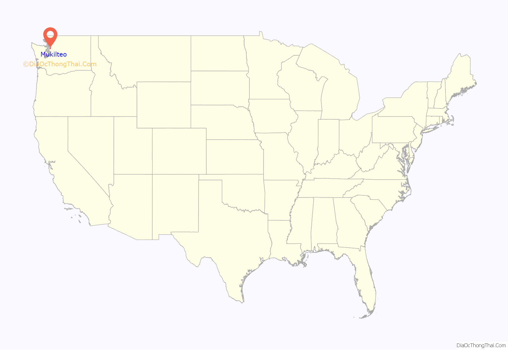
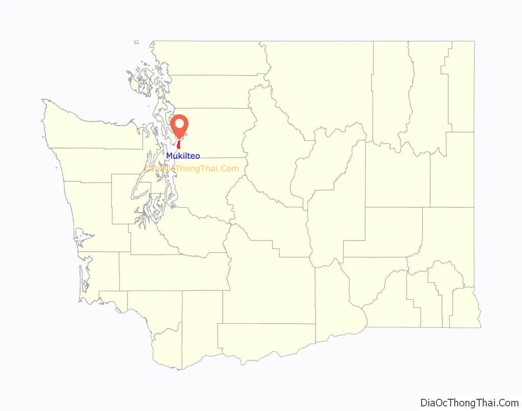
Mukilteo location map. Where is Mukilteo city?
History
Establishment and early history
The Lushootseed name Muckl-te-oh or Buk-wil-tee-whu (bəqɬtiyuʔ), meaning “good camping ground” or “narrow passage” according to some sources, was given to the headland and nearby waters by the Snohomish people. The Snohomish had a year-round village in the area for at least 600 years before the arrival of European and American explorers in the 19th century. Early artifacts uncovered during waterfront construction in the 2010s were carbon dated to 1,000 years before present.
The Vancouver Expedition, led by British explorer George Vancouver, visited the area on May 30, 1792, and landed at modern-day Mukilteo the following day. Lieutenant William Robert Broughton and botanist Archibald Menzies named the site “Rose Point” after the wild Nootka roses that grew along the shore. An American expedition led by Charles Wilkes in 1841 renamed the headland “Point Elliott” for Samuel Elliott, a midshipman.
After its 1853 establishment, the Washington territorial government looked to negotiate treaties with the local tribes of the Puget Sound region to secure land for settlement. On January 22, 1855, representatives from the territorial government and 82 local tribes signed the Treaty of Point Elliott, which ceded tribal territories in exchange for compensation, the establishment of Indian reservations, and access to traditional hunting and fishing areas. An American settlement at Point Elliott was established two years later by Morris H. Frost and J. D. Fowler, two merchants from New York. The two men established a store and saloon on the southwest side of Point Elliott, which was renamed to Mukilteo in 1860 by Fowler, using an anglicized name of the Lushootseed campsite.
Mukilteo was the area’s first trading post and served as the interim county seat of the newly created Snohomish County beginning January 14, 1861. In the first county elections on July 8, 1861, the county seat was moved to Cadyville (now Snohomish) by a 17–10 vote. Mukilteo remained the county’s only port and a major trading post for the Possession Sound region, and soon after received the county’s first post office and telegraph station. The town was relocated to another, more protected side of Point Elliott and supported the regional lumber industry, including regular shipments to Whidbey Island and a sawmill of its own. By the 1880s, it had also gained a brewery, a gunpowder plant, and the Puget Sound region’s first cannery. Mukilteo was planned to become the largest port on Possession Sound, with a summer resort accessible by steamship, but the efforts ceased after the establishment of nearby Everett by East Coast industrialists.
Early 20th century
The Seattle and Montana Railroad (later part of the Great Northern Railway) was completed in 1891, connecting Mukilteo with Everett, Edmonds, and Seattle. Mukilteo was platted in anticipation of the railroad and was on the shortlist of towns considered for the terminus of the Northern Pacific Railway, but lost out to Tacoma in 1873. Following the 1890s economic depression, the town experienced a major employment and population boom, with a larger lumber mill and gunpowder factory both built along the shore. The iconic Mukilteo Lighthouse was built in 1906 by the federal Lighthouse Service to serve the increased maritime traffic in the area.
Japanese immigrants arrived to work in Mukilteo’s mills after the turn of the century, establishing a Japantown in modern-day Japanese Gulch. Passenger ferry service between Mukilteo and Whidbey Island began in 1911 and was followed by the introduction of automobile ferry service in 1919. The town also gained a highway connection in 1914 with the completion of Mukilteo Boulevard, which traveled east to Everett. Until the closure of the lumber mill in 1930, Mukilteo was a company town that relied on the Crown Lumber Company to assist in civic endeavors, including its parks, fire department, and water district; at its peak, it employed 250 men.
During the Prohibition Era, Mukilteo became a major transiting point for rum-running and was a stopover for smugglers transporting alcohol from British Columbia to Seattle. The town’s gunpowder plant was destroyed on September 17, 1930, in an after-hours explosion that leveled or damaged dozens of homes, causing $500,000 in damage. It was felt as far as downtown Everett and injured eight people, but none were killed. On August 30, 1938, the vacant lumber mill was destroyed in a fire during dismantling work. The fire came weeks after a mail ferry rammed into the town’s wharf, which was destroyed in the collision.
After the United States entered World War II, the site of the former lumber mill was acquired by the federal government and rebuilt as a 1,500-foot-long (460 m) ammunition loading dock for warships. The recently built Snohomish County Airport (later renamed Paine Field) southeast of the city was converted into a military base while retaining some civilian uses, including passenger service provided by Alaska Airlines. During the early 1950s, the loading dock was expanded with ten large storage tanks that were used to store jet fuel for military planes until 1989.
Incorporation and late 20th century
On April 29, 1947, Mukilteo residents voted 223 to 137 in favor of incorporating as a fourth-class city and elected school administrator Alfred Tunem as its first mayor. The incorporation was certified by the state government on May 8; at the time, Mukilteo had an estimated population of 775 people and encompassed 794 acres (321 ha). The new municipal government took over services that were previously handled by the self-organized Mukilteo Improvement Club, which was established in the 1930s. The area experienced additional population and commercial growth after the opening of Boeing’s Paine Field factory for passenger jetliners in 1967, which was connected to Mukilteo by a short railroad along the floor of Japanese Gulch. The Boeing Freeway was opened in 1969, linking southern Mukilteo and the Boeing plant to a junction with Interstate 5 near the newly built Everett Mall.
Mukilteo completed its first major annexation in November 1980, adding 2,500 people living on 2 square miles (5.2 km) to the south along State Route 525. This annexation nearly tripled the city’s population and doubled its land area. Additional annexations and natural growth by the end of the decade brought the city’s population to 6,000. The annexation of the large Harbour Pointe community was completed in 1991 and doubled the city’s size to 6.6 square miles (17.09 km). A competing proposal had sought to incorporate the planned community into a new city of 24,000 people, tentatively named Highland Bay, but residents supported annexation as a mutually agreeable option to reduce their taxes and benefit from city services. The annexation was also influenced by the county government’s plans to allow passenger flights from Paine Field, which residents in Mukilteo and Harbour Pointe opposed alongside other nearby cities. The county ultimately withdrew their proposal to introduce passenger flights.
Several parties that opposed the annexation, including the county fire district, withdrew their complaints and allowed Mukilteo to annex Harbour Pointe on March 26, 1991. The annexation added 4,779 residents and 3.4 square miles (8.8 km) to Mukilteo, doubling the city’s population to 6,662 and size to 6.6 square miles (17 km). It required the construction of two new fire stations, three schools, and a new city hall to house new employees. Kamiak High School was built in the Harbour Pointe area and opened in 1993 to serve Mukilteo, which had outgrown Mariner High School, and featured a technology-oriented curriculum. The full build-out of Harbour Pointe increased the city’s population to over 18,000 by 2000, a 1,164 percent increase from 1980. The geographic and commercial center of Mukilteo was shifted further south towards Harbour Pointe, leading to cultural clashes with residents of older neighborhoods.
21st century
An agreement to transfer ownership of the Mukilteo Lighthouse from the U.S. Coast Guard to the city government was signed in 1999 after a decade of partial use as a museum by the local historical society. The changeover was made on August 19, 2001, with the Coast Guard retaining use of the working lights and the city government planning rehabilitation work to support the building’s use as a tourist landmark. The adjacent Mukilteo State Park was transferred to the city government in February 2003, following an offer from the Washington State Parks and Recreation Commission to donate the park in order to stave off a budget shortfall. The new city park, named Mukilteo Lighthouse Park, underwent $6.6 million in renovations that were completed in 2008 to add a playground and other park amenities.
The 22-acre (8.9 ha) decommissioned fuel storage tank complex on the city’s waterfront was identified for potential redevelopment in the 1990s, including use for a new ferry terminal. The Port of Everett led environmental cleanup of the site and constructed a new pier to transport large airplane sections for the Boeing 787 project, replacing the existing pier. The cleanup was completed in late 2006 after several delays due to the discovery of Indian artifacts that triggered an archaeological investigation. The existing pier was demolished in 2015 to make way for the new ferry terminal, which opened on December 29, 2020. The new terminal includes connections to an adjacent commuter rail station, which opened in 2008 and was expanded in 2016 by Sound Transit. A research station for the Northwest Fisheries Science Center (part of NOAA) on the tank farm site was closed in 2020 and planned to be demolished in 2020 until the onset of the COVID-19 pandemic halted work. A project to build a new facility by 2022 was cancelled in March 2021 after NOAA received no bids below $40 million, which had been appropriated by the U.S. Congress; ownership of the property is expected to revert to the Port of Everett, which NOAA took over ownership from in 2001.
On July 30, 2016, a mass shooting occurred at a house party in the Chennault Beach neighborhood of Mukilteo, around midnight. Three people were killed using an AR-15 style rifle and another was left with serious injuries. The perpetrator, a graduate of Kamiak High School, was sentenced to life imprisonment without the possibility of parole. The Mukilteo shooting—along with other high-profile mass shootings during the 2010s—was cited as the inspiration for an assault weapons restriction that was rejected by the state legislature and passed by voters in 2018 as Initiative 1639. In February 2018, an Everett resident was arrested prior to a planned school shooting that would have targeted ACES Alternative High or Kamiak High School.
On May 2, 2017, a small airplane taking off from Paine Field crashed into several cars and an overhead power line at the intersection of Harbour Pointe Boulevard and the Mukilteo Speedway. There were no fatalities and only two minor injuries, while the pilot and sole passenger were unhurt.
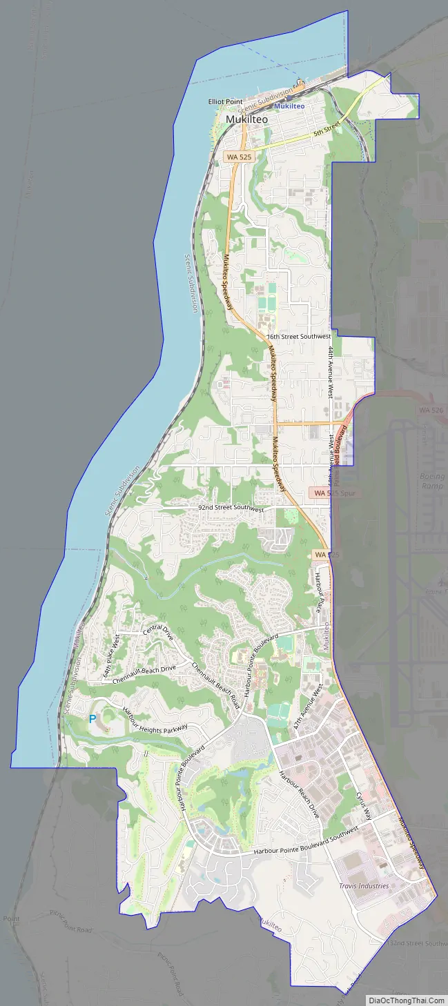
Mukilteo Road Map
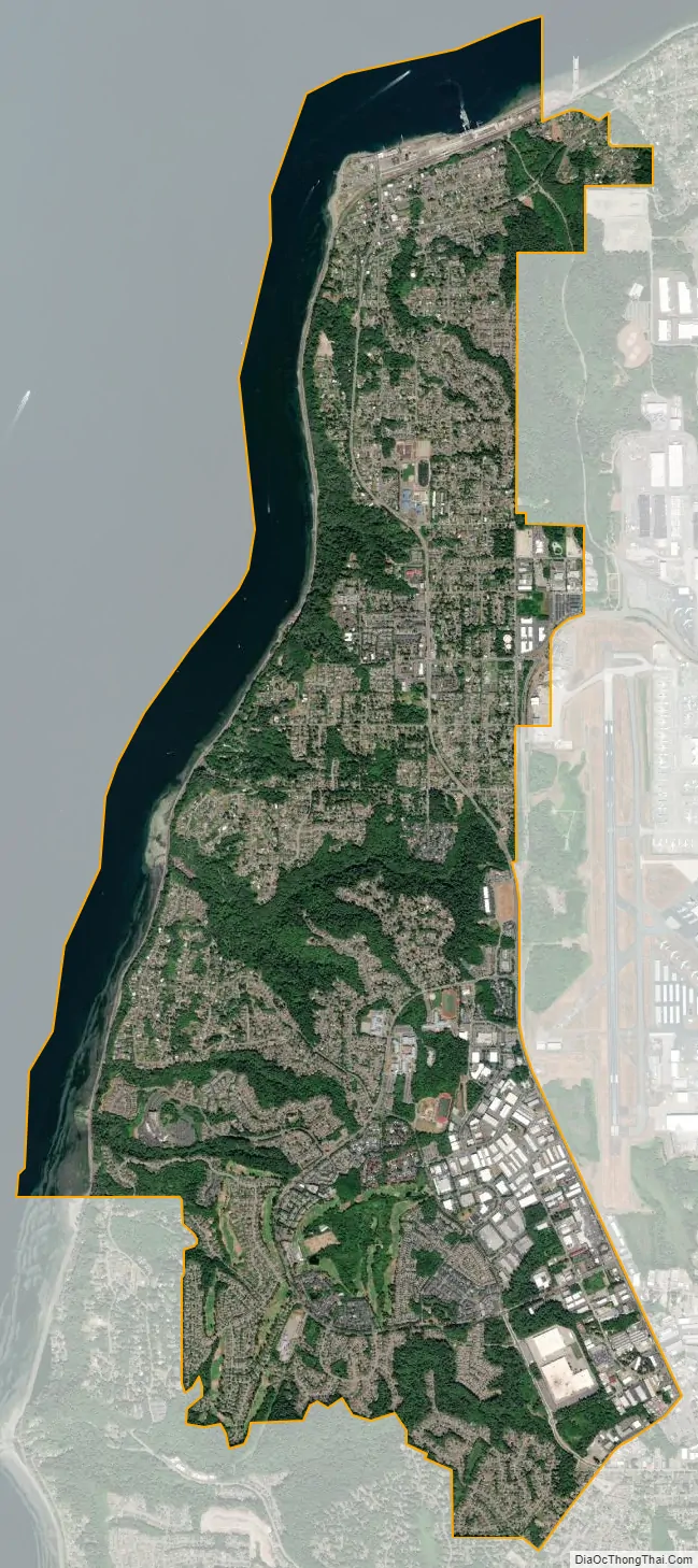
Mukilteo city Satellite Map
Geography
Mukilteo is located in southwestern Snohomish County, approximately 25 miles (40 km) north of Seattle. The city generally runs north–south, with a length of 5.4 miles (8.7 km) and a width of 0.8 to 2.1 miles (1.3 to 3.4 km). It is bordered to the west by the Possession Sound, a section of the Puget Sound, and to the north by Port Gardner Bay. Mukilteo’s eastern border with Everett is defined by 44th Avenue and Japanese Gulch until it reaches State Route 526. From there, the city’s eastern boundary continues along State Route 525 along the west side of Paine Field in unincorporated Snohomish County. Mukilteo’s southern border, also facing unincorporated neighborhoods, is defined by Beverly Park Road, the Picnic Point Ravine, and Hulk Creek, which drains into Possession Sound.
According to the United States Census Bureau, the city has a total area of 9.50 square miles (24.60 km), of which 6.40 square miles (16.58 km) is land and 3.10 square miles (8.03 km) is water. Mukilteo also has a designated urban growth area that extends south to 148th Street Southwest, bordering Lynnwood, and east to State Route 99. An advisory vote on whether to annex the entire urban growth area (with a population of 11,000 people) was rejected by city voters in 2010.
The majority of Mukilteo is located on a plateau overlooking Possession Sound and the Olympic Mountains to the west and Port Gardner Bay to the north. A major railroad runs along the shore, which is situated below a set of tall bluffs that are divided by ravines and gulches along several creeks. The bluffs were formed approximately 5,000 years before present and eroded away over time to form beaches and Point Elliott itself. The city has several recognized drainage basins, including Japanese Gulch, Big Gulch, the Chennault Ravines, and Picnic Point Gulch. Mukilteo is also traversed from northwest to southeast by the Southern Whidbey Island Fault, a shallow earthquake fault zone discovered in 1996.
Neighborhoods
With the exception of Old Town Mukilteo, the city is divided into several large neighborhoods that are named for various developed subdivisions that were annexed in the late 20th century. Among these subdivision neighborhoods are Chennault Beach, Harbour Pointe, Olympus Terrace, and Picnic Point. Mukilteo’s urban growth area includes the neighborhoods of Lake Serene, Meadowdale, and Lake Stickney.
Old Town Mukilteo is located at the north end of the city, between Port Gardner Bay and 5th Street (Mukilteo Boulevard). The city’s landmark lighthouse is located on Point Elliott at the northwest corner of Old Town, adjacent to the Washington State Ferries terminal and commuter train station. The waterfront’s sole connection to the rest of Mukilteo is via the Mukilteo Speedway (State Route 525), which also serves ferry traffic; a second street, Mukilteo Lane, was closed in 2008 after severe erosion was discovered along the road.
Mukilteo’s largest neighborhood is Harbour Pointe, located on 2,341 acres (947 ha) in the south-central part of the city between Possession Sound and State Route 525. It is bordered to the south by South Gulch and Picnic Point and to the north by Big Gulch and Olympus Terrace. The site was originally owned by the Port Gamble Lumber Company and was sold to Standard Oil in 1952 as part of a plan to build an oil refinery at Picnic Point. After protests over a similar proposal for Kayak Point in the 1960s, Standard Oil abandoned plans to build refineries in Snohomish County and turned over the Picnic Point site to the county government and private real estate developers. Development of Harbour Pointe began in 1978 and its first phase was completed in 1989 with the opening of the neighborhood’s golf course. A public marina was proposed for the development’s Chenault Beach section in 1983, but was rejected due to concerns from fisheries officials over potential impacts on Indian fishing. Harbour Pointe was annexed by Mukilteo in 1991 and is now home to Kamiak High School, the city library, and a large industrial district.
Climate
Mukilteo has a general climate similar to most of the Puget Sound lowlands, with dry summers and mild, rainy winters moderated by a marine influence from the Pacific Ocean. On average, the area gets 38.55 inches (979 mm) of annual precipitation, spread over approximately seven months. Mukilteo lies within the Puget Sound Convergence Zone, a local weather phenomenon that affects areas of Snohomish County.
See also
Map of Washington State and its subdivision:- Adams
- Asotin
- Benton
- Chelan
- Clallam
- Clark
- Columbia
- Cowlitz
- Douglas
- Ferry
- Franklin
- Garfield
- Grant
- Grays Harbor
- Island
- Jefferson
- King
- Kitsap
- Kittitas
- Klickitat
- Lewis
- Lincoln
- Mason
- Okanogan
- Pacific
- Pend Oreille
- Pierce
- San Juan
- Skagit
- Skamania
- Snohomish
- Spokane
- Stevens
- Thurston
- Wahkiakum
- Walla Walla
- Whatcom
- Whitman
- Yakima
- Alabama
- Alaska
- Arizona
- Arkansas
- California
- Colorado
- Connecticut
- Delaware
- District of Columbia
- Florida
- Georgia
- Hawaii
- Idaho
- Illinois
- Indiana
- Iowa
- Kansas
- Kentucky
- Louisiana
- Maine
- Maryland
- Massachusetts
- Michigan
- Minnesota
- Mississippi
- Missouri
- Montana
- Nebraska
- Nevada
- New Hampshire
- New Jersey
- New Mexico
- New York
- North Carolina
- North Dakota
- Ohio
- Oklahoma
- Oregon
- Pennsylvania
- Rhode Island
- South Carolina
- South Dakota
- Tennessee
- Texas
- Utah
- Vermont
- Virginia
- Washington
- West Virginia
- Wisconsin
- Wyoming


