Orchards is a census-designated place (CDP) in Clark County, Washington, United States. The population was 19,556 at the 2010 census.
| Name: | Orchards CDP |
|---|---|
| LSAD Code: | 57 |
| LSAD Description: | CDP (suffix) |
| State: | Washington |
| County: | Clark County |
| Elevation: | 226 ft (69 m) |
| Total Area: | 5.4 sq mi (14.0 km²) |
| Land Area: | 5.4 sq mi (14.0 km²) |
| Water Area: | 0.0 sq mi (0.0 km²) |
| Total Population: | 19,556 |
| Population Density: | 3,620/sq mi (1,397.8/km²) |
| ZIP code: | 98662 |
| Area code: | 360 |
| FIPS code: | 5351795 |
| GNISfeature ID: | 1512536 |
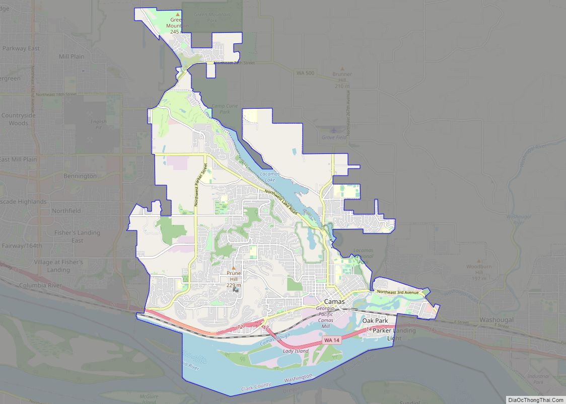
Online Interactive Map
Click on ![]() to view map in "full screen" mode.
to view map in "full screen" mode.
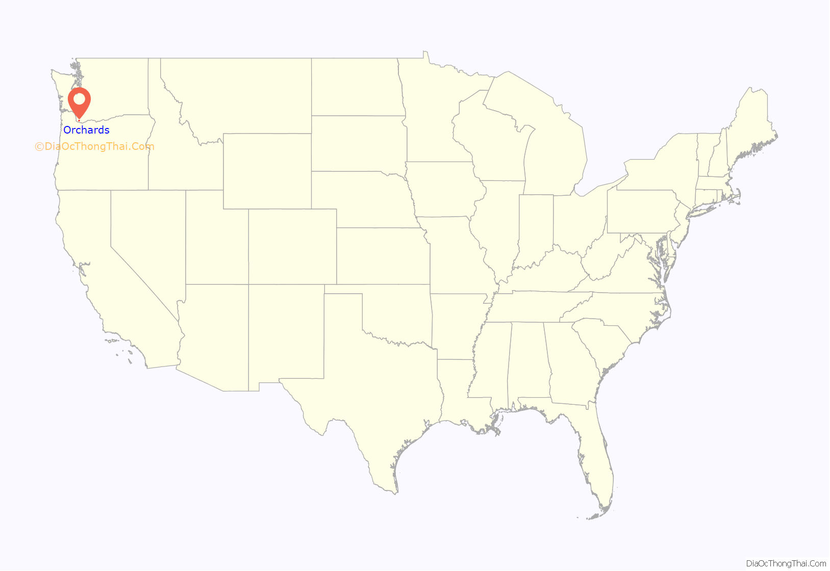
Orchards location map. Where is Orchards CDP?

History
According to one account, in 1846 an employee of the Hudson’s Bay Company named Dugald McTavish surveyed land near the fur trading post Fort Vancouver. McTavish described four plains in the area of thick woods. Officials at the trading post numbered the plains, and so the area was originally known as Fourth Plain. Wanting a more unique name, residents voted in 1904 to change the name to Orchards, after the many fruit trees in the area.
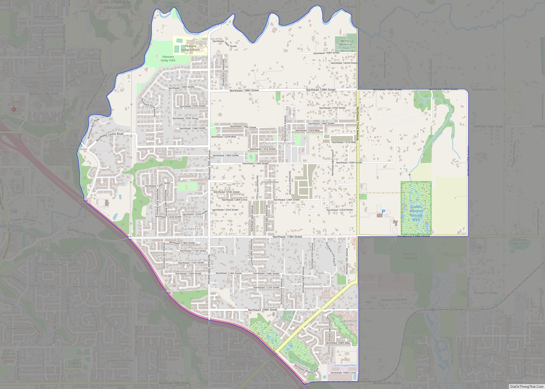
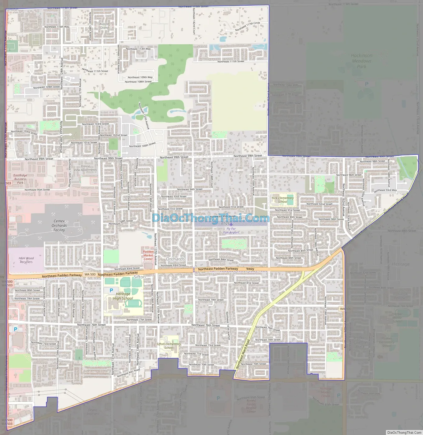
Orchards Road Map
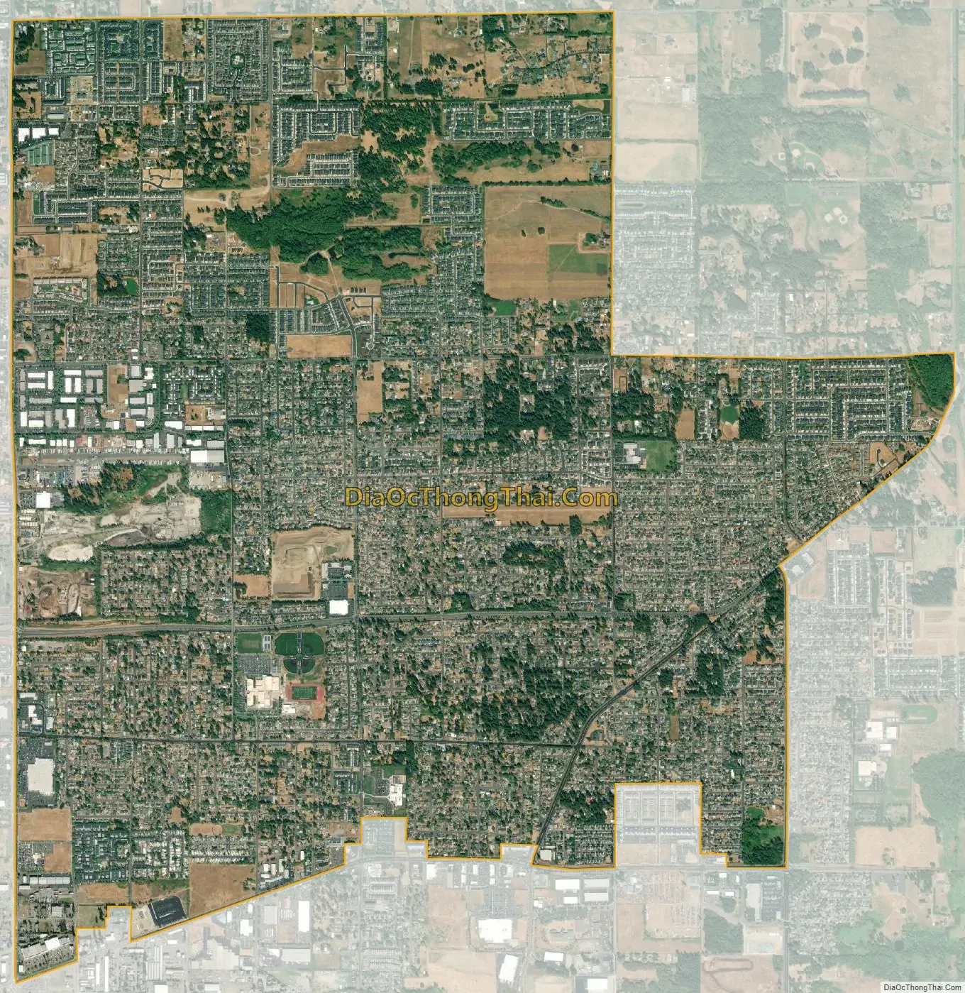
Orchards city Satellite Map
Geography
Orchards is located in southern Clark County at 45°41′2″N 122°31′45″W / 45.68389°N 122.52917°W / 45.68389; -122.52917 (45.683873, -122.529267). It is bordered to the northeast by Hockinson, to the north by Brush Prairie, to the west by Five Corners, and to the south by the city limits of Vancouver. The neighborhood of Sifton is in the southern part of the CDP.
According to the United States Census Bureau, the Orchards CDP has a total area of 5.4 square miles (14.0 km), all of it land.
See also
Map of Washington State and its subdivision:- Adams
- Asotin
- Benton
- Chelan
- Clallam
- Clark
- Columbia
- Cowlitz
- Douglas
- Ferry
- Franklin
- Garfield
- Grant
- Grays Harbor
- Island
- Jefferson
- King
- Kitsap
- Kittitas
- Klickitat
- Lewis
- Lincoln
- Mason
- Okanogan
- Pacific
- Pend Oreille
- Pierce
- San Juan
- Skagit
- Skamania
- Snohomish
- Spokane
- Stevens
- Thurston
- Wahkiakum
- Walla Walla
- Whatcom
- Whitman
- Yakima
- Alabama
- Alaska
- Arizona
- Arkansas
- California
- Colorado
- Connecticut
- Delaware
- District of Columbia
- Florida
- Georgia
- Hawaii
- Idaho
- Illinois
- Indiana
- Iowa
- Kansas
- Kentucky
- Louisiana
- Maine
- Maryland
- Massachusetts
- Michigan
- Minnesota
- Mississippi
- Missouri
- Montana
- Nebraska
- Nevada
- New Hampshire
- New Jersey
- New Mexico
- New York
- North Carolina
- North Dakota
- Ohio
- Oklahoma
- Oregon
- Pennsylvania
- Rhode Island
- South Carolina
- South Dakota
- Tennessee
- Texas
- Utah
- Vermont
- Virginia
- Washington
- West Virginia
- Wisconsin
- Wyoming