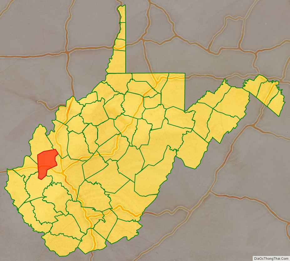
Putnam County is a county in the U.S. state of West Virginia. As of the 2020 census, the population was 57,440. Its county seat is Winfield and its largest city is Hurricane. Putnam County is part of the Huntington-Ashland, WV-KY-OH Metropolitan Statistical Area, across the Kanawha River from Charleston, West Virginia.
| Name: | Putnam County |
|---|---|
| FIPS code: | 54-079 |
| State: | West Virginia |
| Founded: | March 11, 1848 |
| Named for: | Israel Putnam |
| Seat: | Winfield |
| Largest city: | Hurricane |
| Total Area: | 350 sq mi (900 km²) |
| Land Area: | 346 sq mi (900 km²) |
| Total Population: | 57,440 |
| Population Density: | 160/sq mi (63/km²) |
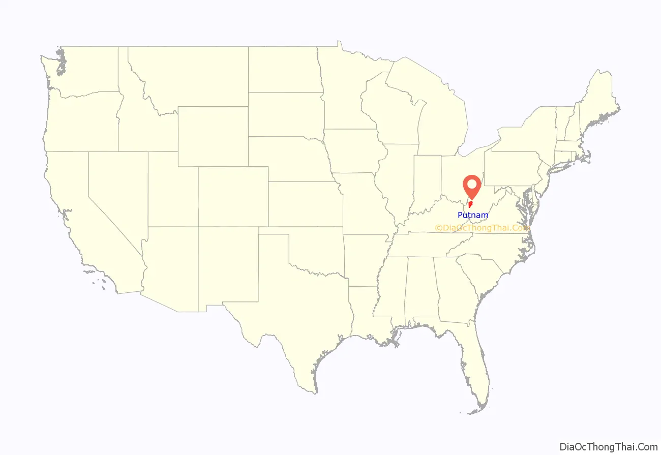
Putnam County location map. Where is Putnam County?
History
The Virginia General Assembly formed Putnam County on March 11, 1848, from parts of Cabell, Kanawha and Mason counties. It was named for Israel Putnam, who was a hero in the French and Indian War and a general in the American Revolutionary War. George Washington surveyed the area in 1770. Winfield, the county seat, had been founded in 1818 but was incorporated on February 21, 1868, and named to honor General Winfield Scott a General during the Mexican American War and early stage of the Civil War.
Slavery was a divisive issue in Putnam County before and during the Civil War. In the Virginia Secession Convention of 1861, Putnam County voters elected James W. Hoge to represent them, and he voted against secession on April 17, 1861, when the convention passed the secession ordinance. However, he returned to Richmond for the second session in June, and signed the ordinance. No one from Putnam county attended the Wheeling Convention which ultimately led to the creation of the state of West Virginia in 1863.
Two minor battles were fought in Putnam County during the Civil War. On July 17, 1861, Confederate soldiers defeated a Union force at the Battle of Scary Creek, before withdrawing to Charleston. The Confederates included a cavalry troop raised by Colonel Albert Gallatin Jenkins, who until Virginia’s secession from the Union had represented the area in Congress. Jenkins would be commissioned a brigadier general in 1862, but died of wounds received at the Battle of Cloyd’s Mountain in May, 1864. The second skirmish occurred on October 24, 1864, after West Virginia became a Union state. Confederate troops seized and sank a Union steamboat on the Kanawha River near Winfield, then attacked the courthouse, but the “Battle of Winfield” ended as a Union victory. Putnam County’s Civil War soldiers were about evenly split between Union and Confederate, with about four hundred on each side.
Putnam County was one of fifty Virginia counties admitted to the Union as the state of West Virginia on June 20, 1863. Later that year, its counties were divided into civil townships, with the intention of encouraging local government. This proved impractical in the heavily rural state, and in 1872 the townships were converted into magisterial districts. Putnam County was initially divided into six townships: Buffalo, Curry, Grant, Hutton, Scott, and Union. These became magisterial districts in 1872, and the following year two were renamed, with Grant becoming Teays Valley, while Hutton became Pocatalico. Except for minor adjustments, these districts were largely unchanged until the 1980s, when Buffalo and Union Districts were consolidated into Buffalo-Union District, and Teays Valley’s name abbreviated to “Teays”.
A railroad was rebuilt through Putnam County in 1875.
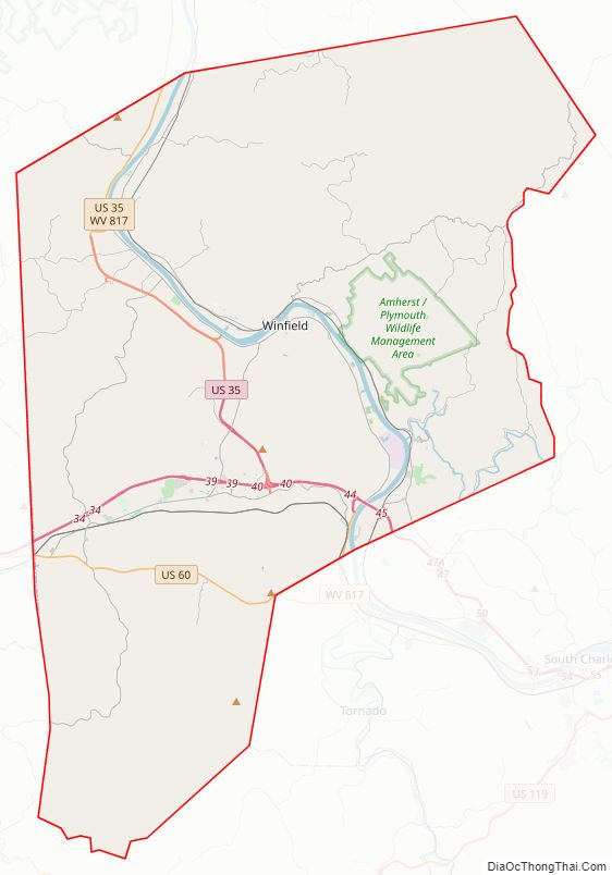
Putnam County Road Map
Geography
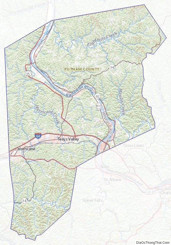
The Kanawha River flows north-northwestward through the center of Putnam County. The county terrain consists of wooded hills, carved with drainages. The terrain slopes to the north, with the highest point near its SW corner at 1,129′ (344m) ASL. The county has a total area of 350 square miles (910 km), of which 346 square miles (900 km) is land and 4.7 square miles (12 km) (1.3%) is water.
Major highways
- Interstate 64
- U.S. Route 35
- U.S. Route 60
- West Virginia Route 25
- West Virginia Route 34
- West Virginia Route 62
- West Virginia Route 817
- West Virginia Route 869
Adjacent counties
- Mason County – north
- Jackson County – northeast
- Kanawha County – east
- Lincoln County – south
- Cabell County – west
Putnam County Topographic Map
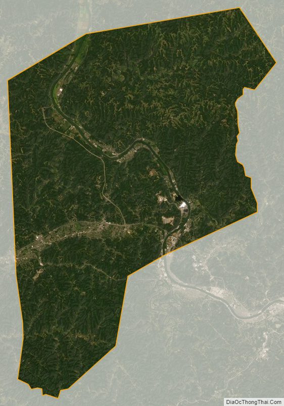
Putnam County Satellite Map
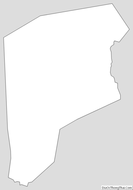
Putnam County Outline Map
See also
Map of West Virginia State and its subdivision:- Barbour
- Berkeley
- Boone
- Braxton
- Brooke
- Cabell
- Calhoun
- Clay
- Doddridge
- Fayette
- Gilmer
- Grant
- Greenbrier
- Hampshire
- Hancock
- Hardy
- Harrison
- Jackson
- Jefferson
- Kanawha
- Lewis
- Lincoln
- Logan
- Marion
- Marshall
- Mason
- McDowell
- Mercer
- Mineral
- Mingo
- Monongalia
- Monroe
- Morgan
- Nicholas
- Ohio
- Pendleton
- Pleasants
- Pocahontas
- Preston
- Putnam
- Raleigh
- Randolph
- Ritchie
- Roane
- Summers
- Taylor
- Tucker
- Tyler
- Upshur
- Wayne
- Webster
- Wetzel
- Wirt
- Wood
- Wyoming
- Alabama
- Alaska
- Arizona
- Arkansas
- California
- Colorado
- Connecticut
- Delaware
- District of Columbia
- Florida
- Georgia
- Hawaii
- Idaho
- Illinois
- Indiana
- Iowa
- Kansas
- Kentucky
- Louisiana
- Maine
- Maryland
- Massachusetts
- Michigan
- Minnesota
- Mississippi
- Missouri
- Montana
- Nebraska
- Nevada
- New Hampshire
- New Jersey
- New Mexico
- New York
- North Carolina
- North Dakota
- Ohio
- Oklahoma
- Oregon
- Pennsylvania
- Rhode Island
- South Carolina
- South Dakota
- Tennessee
- Texas
- Utah
- Vermont
- Virginia
- Washington
- West Virginia
- Wisconsin
- Wyoming