Heber-Overgaard is a census-designated place (CDP) in Navajo County, Arizona, United States. Situated atop the Mogollon Rim, the community lies at an elevation of 6,627 feet (2,020 m). The population was 2,898 at the 2020 census. Heber and Overgaard are technically two unincorporated communities, but as of the 1990 census, their proximity led to the merged name of “Heber-Overgaard”.
Heber was settled in 1883, by members of the Church of Jesus Christ of Latter-day Saints (LDS Church), and the town is named after either Heber J. Grant or Heber C. Kimball, both prominent members of the LDS church. Overgaard, adjoining Heber, was settled ca. 1936 and was named after the owner of the first sawmill, Kristen Kristensen (Chris) Overgaard.
Heber-Overgaard’s early economy was founded on dry farming and ranching while tourism, retirement and timbering are the basis for present day industry.
| Name: | Heber-Overgaard CDP |
|---|---|
| LSAD Code: | 57 |
| LSAD Description: | CDP (suffix) |
| State: | Arizona |
| County: | Navajo County |
| Elevation: | 6,627 ft (2,020 m) |
| Total Area: | 6.86 sq mi (17.77 km²) |
| Land Area: | 6.86 sq mi (17.77 km²) |
| Water Area: | 0.00 sq mi (0.00 km²) |
| Total Population: | 2,898 |
| Population Density: | 422.45/sq mi (1,094.14/km²) |
| Area code: | 928 |
| FIPS code: | 0432310 |
| Website: | heberovergaard.org |
Online Interactive Map
Click on ![]() to view map in "full screen" mode.
to view map in "full screen" mode.
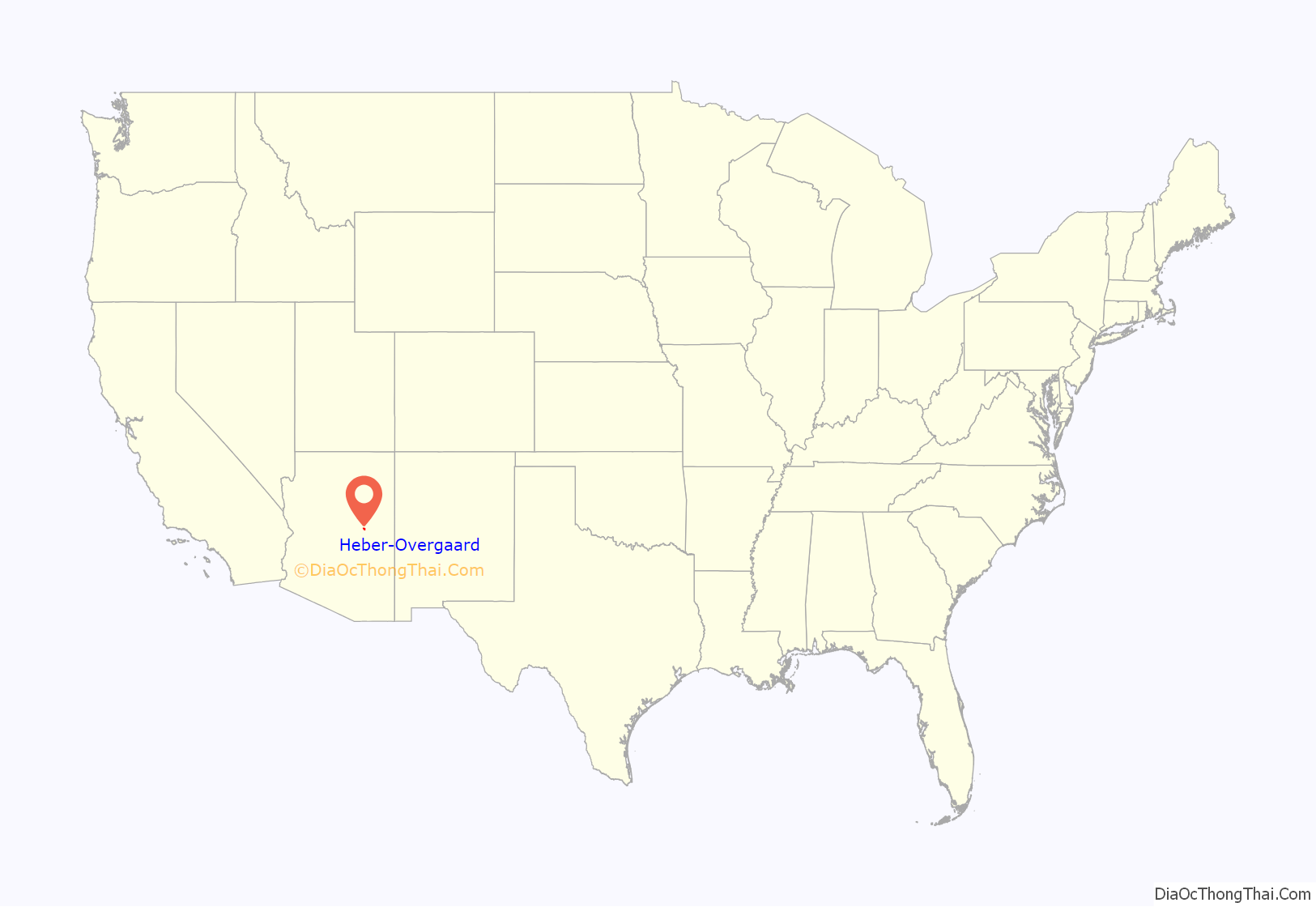
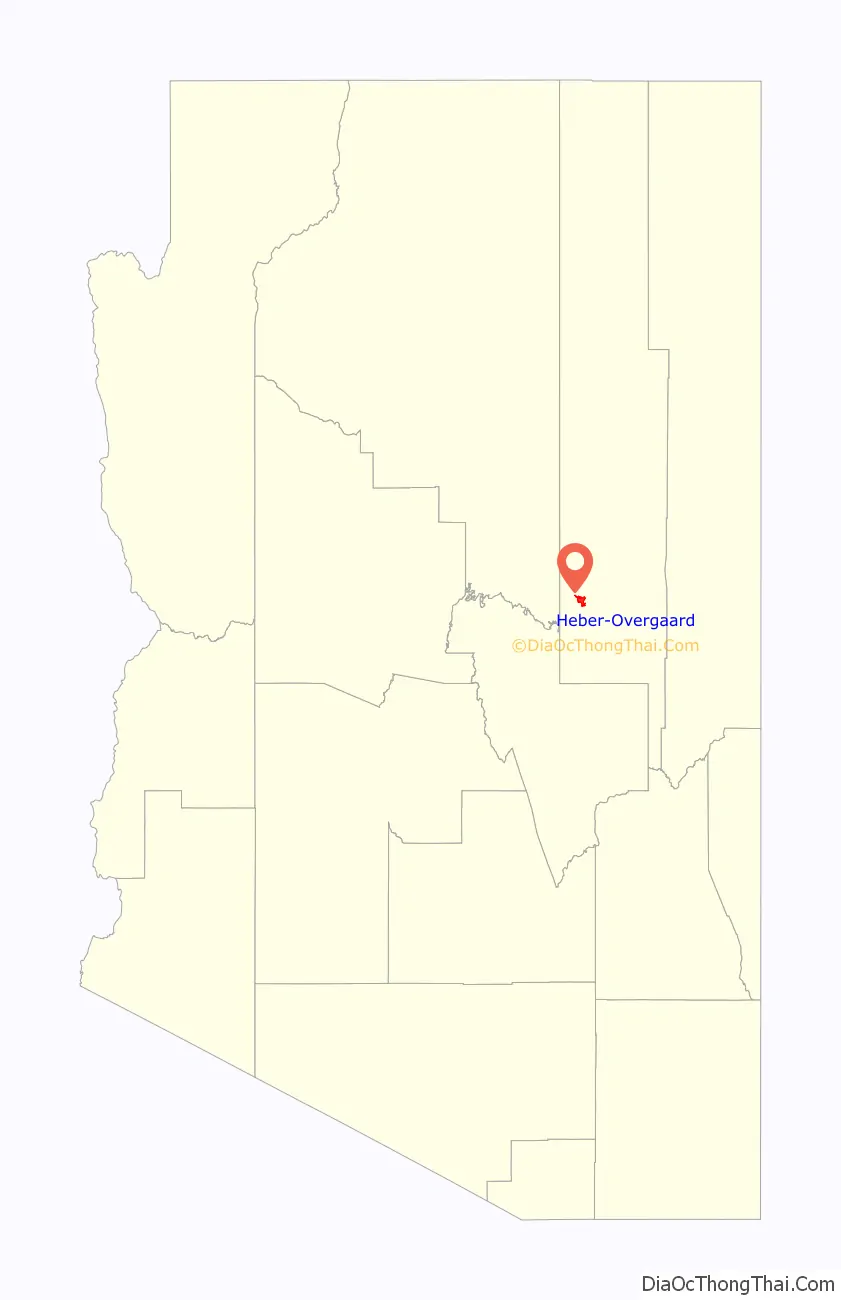
Heber-Overgaard location map. Where is Heber-Overgaard CDP?
History
Founding
In March 1873, Mormon pioneers from Utah were sent to the Little Colorado River area under the direction of Horton D. Height. In 1876, a large group of these settlers established four settlements on the Little Colorado River, which they named Brigham City, Sunset, Obed and Allen’s Camp (Joseph City). In Allen’s Camp, a dam had been built on the Little Colorado River in April, but high waters in July washed it out. By August, many settlers had returned to Utah. Eight married couples and six single men were all that remained in Allen’s Camp. By 1882, the Obed settlement had collapsed and both Brigham City and Sunset were near collapse due to several years of drought. At this time, John Bushman, of Allen’s Camp, was sent by Lot Smith, then president of the Little Colorado Stake, to scout the forests to the south in anticipation of relocation. Dry farming in the forested mountains was thought to be easier due to higher rain fall, lush grasses, and plentiful timber.
On December 6, 1882, Bushman set out for the forest with five brethren: W.C. Allen; J.H. Richards; J.C. Hansen; H. Tanner; and J.E. Shelley. Upon arrival they began digging wells in search of water. These men were later joined by Hans Nielson, Lehi Heward and John Scarlet. By April 13, 1883, two cabins had been built and grain planted, but only four families remained (Lehi Heward, John Scarlet, Hans Nielson, and James Shelley). John Bushman never settled in the area, but he and his family contributed time and encouragement to the local settlers. The first summer, houses were built, land cleared, and corrals constructed. Crops were planted not only for food, but also to barter for goods that could not be made at home. The growing season was four months long.
In 1887, Lehi Heward abandoned the settlement and relocated to Pine, Arizona. He was urged to do so, because of the Pleasant Valley War. Buckskin Canyon, where he had settled, was named after the buckskin chaps his wife Elisabeth had made for him. John Scarlet was next to leave in 1888. His wife Lulu had become ill in June 1885. This may have contributed to his subsequent departure. In 1887, he was mentioned to have joined the posses of Joe McKiney’s, under-sheriff for C.P. Owens. In 1889, Nathan, Alva, and Samuel Uriah Porter, arrived in Heber from St. Joseph (Joseph City). They grew crops of corn and potatoes between Heber and St. Joseph. The following year brought the Penrod and Sharp families from nearby Wilford. Samuel Porter would later describe the Penrods as anti-Mormon, and the Sharps as dishonest. In 1898, Hans Nielson abandoned his estate on the west bank of the Black Canyon where today’s SR 260 enters town. Childless, Hans Nielson had been the first presiding elder for what became the Heber branch of the Joseph City Ward. James Shelley homesteaded land comprising the center of Heber and south down the Black Canyon. Of the original four pioneer families, starting out with four head of cattle, three daughters, and a few worldly possessions, James and Margaret Shelley were the only family to make Heber a long term commitment.
Early Heber
In 1882, Heber J. Grant was called as a member of the Quorum of the Twelve. Early on in his service in the quorum he made many trips to Arizona earning the title “The Arizona Apostle”. On one such trip, he passed through the settlement on his way to Phoenix, and stayed with the Shelleys in their cabin. The townspeople latter named their settlement after Mr. Grant.
An alternative version of Heber’s namesake history is that John W. N. Scarlett named the settlement after Heber C. Kimball, former Chief Justice of the State of Deseret.
The post office in Heber was established in 1890, and on September 11, 1890, James Shelley was appointed the first postmaster of Heber. Mail was brought by buckboard every Wednesday from Holbrook to Heber. It was then sorted and distributed. This duty was performed by James Shelley, in addition to being a farmer, cattleman, husband and father.
Marion and Clarence Owens came to farm in Heber with their families in 1891. The following year, two practicing polygamists arrived from Utah to escape prosecution. One was called “Brother Luck”. In 1893, Joseph Porter arrived in Heber to help his brother, Samuel Porter, with his farm. Also in 1893, John Nelson occupied a ranch in Brookbank Canyon, and the Baca family had settled near the head of Black Canyon. John Nelson and partner, Nicholas Valentine, were in the sheep business, and the Porters hauled their wool to the Holbrook railroad. Nicholas Valentin died four years later from a rabies bite acquired from a skunk.
Many settlements were located in the fertile cattle ranching and farmlands of Black Canyon. Potatoes, corn, milk, eggs and large gardens were the livelihood of many families. Potato fields could be found down Buckskin Canyon, near the present day “Buckskin Artist Community”. Cornfields and large gardens could be found where the present day High School ball fields and “Tenney’s Trailer Park” are located. All available land near town and in forests clearings was converted to farmland. Wilford, Jersey Gulch, Baca ranch and present day “Potato Patch” were favorite locations.
During this time period, locals were said to be fearful of the Apache Native Americans. Food was said to be given to all natives, that passed through town, in order to “keep the peace”. At this time, travel to and from St. Joseph was sometimes perilous due to outlaws and quicksand. Horses were the primary mode of transportation, and horse thieves were a major problem.
On August 28, 1895, Joseph Porter and Mary Maude Shelley were married. Many locals with the surname of Porter, can trace their family roots to them. In 1896 Samuel, Alva and Nathan Porter divided up their farm. In addition to farming, Samuel Porter was often called upon to administer to the residents of Heber to alleviate pain and suffering by using prayer and petitions. A drought affected the residents of Heber that Summer, followed by crop destroying hail storms in August. In January 1897, Wickliff Bushman, while delivering mail to Heber from Holbrook during a snow storm, contracted the measles and died at 23 years old. Three of Samuel Porter’s children also contracted the disease, but survived. Margaret Shelley had twin boys that June, but only one son survived.
In 1891 John Hoyle, Johann Frederick Heil, an immigrant from Baden, Germany, and former cook for the Hashknife Outfit, opened the first Heber store. He was called “Hoyle” rather than “Heil” because some cowboys had trouble pronouncing his name. In addition to his store, he had a farm located down Buckskin Wash. John Hoyle had relocated to Heber from the failed Wilford, Arizona settlement, 7 miles south of Heber, where he had a store and ranch. Samuel Porter helped him on his farm, and hauled freight to and from Holbrook. He ran the store until his death on August 2, 1912 of paralysis (possibly polio). He had no heirs to claim the land in the United States. Through a German consulate, twenty-eight distant heirs were located and $3,046 was divided among them.
May 1898 was so dry that water was hauled from wells in Wilford for household use. Heber wells still had enough for livestock. A small reservoir had been built below town, and filled up when water ran down the Black Canyon. A diversion dam was built to divert water from the wash to the ditch. When the rains finally came in July, the Independence Day celebration had cause for additional celebration. Residents celebrated by firing guns, fire crackers, Pie Nie, and a dance that evening. Years later, The 4th of July would remain just as large a celebration in Heber. Alva Porter’s Farm eventually became the rodeo grounds, where present day Mogollon High School sits. During celebrations, the community roped calves, rode bucking horses, held pistol shooting contests, foot races, and dances.
20th century
Alva Porter was married to Charlotte Shelly, in 1899, and homesteaded just north of Heber in the Black Canyon. In 1901, Samuel Porter handed his farm over to his brother Alva, and departed from Heber. Porter’s farm was located where today’s Tenney trailer park, and the Mogollon ball fields stand.
In 1904, severe drought caused hundreds of cattle belonging to the Aztec Land and Cattle Co. to die from thirst and hunger. During the spring, drinking water had to be hauled from 15 miles away. Many pioneers became disheartened and left the area. In late June, James Shelly and 2 sons desperately drove their cattle to “Blue Lake”, found on the Apache reservation. They remained there until the rains came on July 20. Despite trespassing, the natives gave them no trouble.
In 1912, after John Hoyle’s death, Alva Porter purchased much of John Hoyle’s merchandise and he and his brother-in-law Thomas Shelley started a new store close to John Hoyle’s old one. Alva eventually sold his share to Thomas who ran the store with his wife, Eva Tanner, until 1957. The store would later become the “Heber Country Store” and later “IGA Supermarket”.
In 1916, James, and Margaret Shelley returned to Joseph City, their final home. Three Shelley children: Sarah Ellen Shelley (husband Harvey Wimmer), Walter Shelley (wife Roxie Smith), and Eliza Marie Shelley (husband Loran Webb) joined them later. Two Shelley children: Amon Shelley (wife Elva Bigler), and John Edward Shelley (wife Fern Oliver), remained in Heber.
Joseph Porter and Maude Shelley were granted a patent on John Hoyle’s land in 1920. They homesteaded this land located in Buckskin Wash, just south of the Black Canyon. Thomas Shelly homesteaded south of Joseph Porter in Buckskin wash. Maude Shelley would later die in 1929.
By the 1930s, Heber had become a logging town. Horses were used to haul logs up until 1965. Logging and ranching were the predominant industries until the mid-90s, at which time the Mexican spotted owl injunction was put on the Sitgreaves National Forest. Bill Porter built the first sawmill in Heber just south of present-day HWY260 along the Black Canyon. This ran until 1935 when it burned down. In 1946 Lorin Donald (Donnie) Porter relocated his “Wagon Draw” sawmill to Heber. It ran until 1984 when a change of ownership was soon followed by bankruptcy.
In the year 1900, when Kristen Kristensen “Chris” Overgaard was 19 years old, he moved to the United States with the intention of earning his living in the lumber mill business. He was born March 23, 1881, the second son of a Danish family, in a little danish town called Veddum, in Aalborg County, Denmark. After two or three years in Nebraska, he returned to Denmark were he became a carpenter. Before he left Denmark again in 1910, he owned a sawmill in Solbjerg, Aalborg County, Denmark. Before Chris Overgaard’s time in Overgaard Camp (later Overgaard Village), Navajo County, Arizona, he lived in and owned a sawmill in Keystone, South Dakota. From South Dakota, Chris moved to Arizona, “lured by the lush stands of Ponderosa”. Modular mill pieces were hauled by train to nearby Holbrook, and then transported by wagon to “Overgaard’s stop”. Originally called “Oklahoma Flats”, the town later changed its name in honor of Mr. Overgaard. The sawmill was assembled across SR 260 from the present day “Overgaard Food Center”. Mr. Overgaard ran the sawmill until financial reversals resulted in its sale. He then moved with his wife, Lillian, to Ripley Ohio, and lived to the age of 85. The sawmill was eventually replaced by a senior center that was later lost in the Rodeo–Chediski Fire in the summer of 2002. The “Rim Country Senior/Community Center” has since been rebuilt. The post office in Overgaard was established on October 14, 1938. William T. Shockley served as the first postmaster in 1938, followed by Christ Overgaard in 1939.
On February 1, 1971, the local Sheriff’s Posse formed a committee to promote the construction of a Fire Department for the Heber-Overgaard area. By March of the same year, land was secured for the location of the new Fire Department. In February 1972, the Sheriff Posse disbanded because some members had moved out of the area. In early 1973, the newly formed American Legion Post 86 took over the task of forming a Fire Department and Fire District for the area. They were able to obtain the signatures necessary to have an election called to form a Fire District. A petition was put together and used to propose the formation of a Fire District to the County Board of Supervisors. The American Legion put up the necessary funds to have an election. On June 4, 1973, by unanimous vote, the Heber-Overgaard Fire District was established. It had an area of 102 square miles. On June 14, Ivan Wilson was elected as the first Fire Chief of the new District and Larry Rhodes as the Secretary-Treasurer. Walt Downs and John Shaffery Sr. were the first two men to sign up as Firefighters.
The first Fourth of July parade was held in 1976. Since its inaugural year, the parade has become one of Heber’s most popular ways to celebrate independence day, drawing crowds upwards of 20,000. In recent years, the parade and fireworks displays have been moved to the weekend nearest the 4th of July as a convenience to non-locals.
On July 4, 1980, Les Parham, of Heber-Overgaard, put on his first of 39 years worth of fireworks displays, his last being on July 6 of 2019. Fundraising was spearheaded by the Heber-Overgaard Chamber of Commerce and was solely paid for by the contributions of viewers who enjoyed the show. The first show was held in what was once known as the Porter softball field, SW corner of Parkview and HW260, to an audience of several hundred. A country fried steak dinner fundraiser was held to cover expenses. Today, an audience in the thousands views the display at the Mogollon High School fields. This is primarily paid for by parking lot donations at the Tall Timbers County Park festivities and the Mogollon High School fireworks display.
In 1988, Heber-Overgaard celebrated its first Oktoberfest event at Tall Timbers County Park. Originally taking place in October, the festivities were eventually moved to September as a convenience to seasonal visitors. The event primarily consists of food, live music, a beer garden and arts and crafts booths.
On August 24, 1995, federal Judge Carl Muecke ordered the 11 national forests of Arizona and New Mexico to halt all logging until their forest plans adequately protect the Mexican spotted owl. The injunction was placed after a lawsuit was filed by Robin Silver, conservation chairman of the Southwest Center for Biological Diversity. The controversial shutdown affected 8 large mills, several small mills and hundreds of jobs. Many Heber-Overgaard residents were forced to relocate and find work elsewhere. Black ribbons were placed throughout town to raise awareness of the situation, and to show support for the loggers and their families. Environmentalists argued that “jobs would vanish no matter what, for if cutting continued at its current rate, the old-growth forests would be gone within thirty years and the mills forced to close anyhow”. The forests remained closed for over eight years. In 2002, the Parker Mill, in Clay Springs (16 miles away), and the Snowflake Mill (35 miles east) were two of the first mills to start up again.
21st century
In 2002, the Rodeo–Chediski Fire was a wildfire that burned in Heber-Overgaard beginning on June 18, 2002, and was not controlled until July 7. It was the second worst forest fire in Arizona to date, destroying 268 structures in Heber-Overgaard, (mainly in Overgaard) and consuming 467,066 acres (1,890.15 km). Overgaard was evacuated for nearly two weeks while the fire was fought.
Founded in 2005 and opening to the public in 2017, the Apache-Sitgreaves Observatory offers public viewing of the night sky using the largest dedicated public telescope in Arizona. The 36-inch diameter telescope at Apache-Sitgreaves Observatory, bordering the Apache-Sitgreaves National Forest on Overgaard’s east side, has some of the darkest skies and is the closest observatory to the Phoenix metro area.
Today, Heber-Overgaard has evolved into a retirement and tourism destination. Recreational and lifestyle activities such as hiking and fishing can be enjoyed in the summer, and cross-country skiing in the winter. With a four-seasons climate, the town is a haven for those wishing to escape the heat of Phoenix. Land ownership in the Heber-Overgaard area is private, but surrounded by federally owned lands. As of 2010, nearly 66% of the houses are second homes. While the full-time resident population is 2,822, summertime population numbers climb to nearly 12,000.
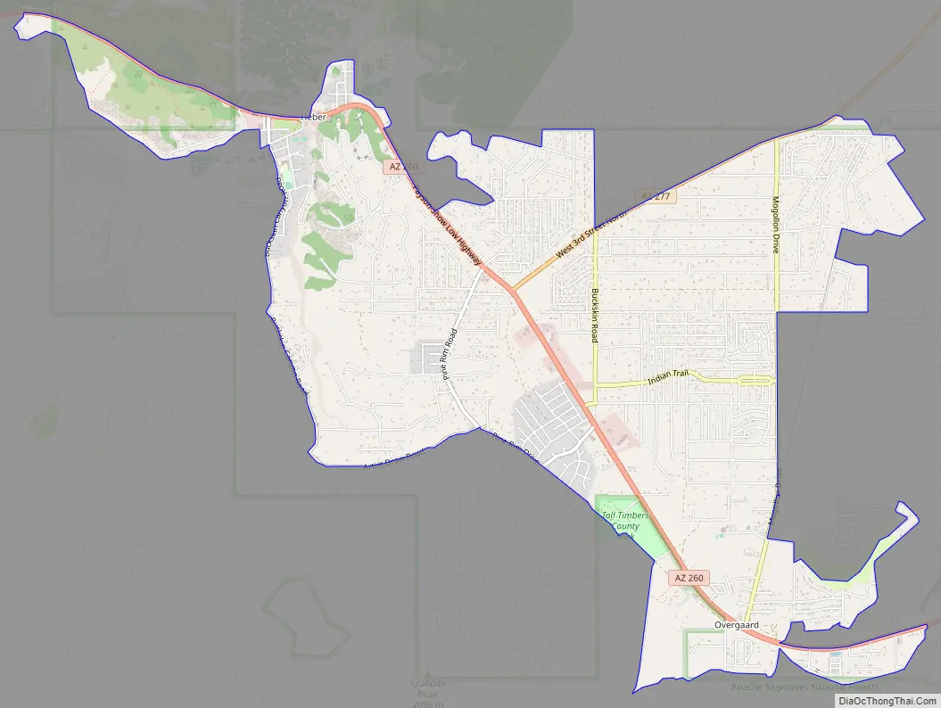
Heber-Overgaard Road Map
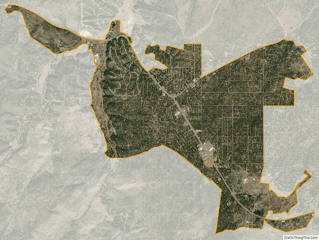
Heber-Overgaard city Satellite Map
Geography
Heber-Overgaard is located in the southwestern United States, in the central-eastern portion of Arizona; about halfway between Payson to the southwest and Show Low to the southeast. By car, the town is approximately 144 miles (231.74 km) north of Phoenix, at the junction of SR 260 and SR 277. It lies at a mean elevation of 6,627 feet (2,020 m), in the Apache–Sitgreaves National Forest. The town is located in the White Mountains on the southern border of the Colorado Plateau and is surrounded by forest service land.
Other than Black Canyon and Buckskin Canyon in Heber, the topography of Heber-Overgaard ranges from rolling hills to flat meadows. Public roadways are maintained by “Navajo County Public Works” with graded dirt roads making up the majority of outlying roads. SR 260 and SR 277 are maintained by ADOT.
According to the United States Census Bureau, the CDP has a total area of 6.9 square miles (18 km), all land. With a population of 2,822, the density rate is approximately 411 people per square mile.
Nearest cities and towns
- Aripine
- Clay Springs
- Forest Lakes
- Holbrook
- Show Low
- Snowflake
Climate
Heber-Overgaard has an atypical version of a warm-summer Mediterranean climate (Köppen: Csb) with a dry period in early summer followed by heavy monsoonal thunderstorms and rain from frontal cloudbands in the cooler months. Like more typical Mediterranean climates, however, forest fires tend to be extremely prevalent during dry summer periods.
Flora and fauna
While some of the native flora and fauna of the Apache–Sitgreaves National Forest can be found within town limits, most are found in the rural and the undeveloped forest areas surrounding Heber-Overgaard.
Native mammal species include antelope, Arizona gray squirrel, beaver, black bear, coyote, deer mouse, desert cottontail rabbit, elk, gopher, ground squirrel, gray fox, harvest mouse, hog-nosed skunk, jackrabbit, javelina, kit fox, Mexican wolf, mountain cottontail, mountain lion, mule deer, porcupine, raccoon, red squirrel, rock squirrel, striped skunk, white-footed mouse, white-tailed deer, and various bats.
There are many species of native birds, including the acorn woodpecker, crow, bald eagle, broad-tailed hummingbird, cooper’s hawk, flammulated owl, gambel’s quail, golden eagle, greater roadrunner, great horned owl, hairy woodpecker, hooded oriole, pinon jay, red-tailed hawk, kestrel, northern cardinal, robin, steller’s jay, raven, turkey vulture, wild turkey, and western bluebird as well as a variety of songbirds.
The area is also home to a number of native reptile species including several types of venomous rattlesnakes (Arizona black rattlesnake, prairie rattlesnake, and western black-tailed rattlesnake); mildly venomous snakes (black-necked gartersnake, narrowhead garter snake and western terrestrial garter snake); and non-venomous snakes California kingsnake, glossy snake, gopher snake, long-nosed snake, striped whipsnake, and the ring-necked snake. Lizards include eastern collared lizard, greater short-horned lizard, ornate tree lizard, plateau fence lizard, sagebrush lizard and several types of whiptails. Skinks include the Great Plains skink and the many-lined skink.
Native amphibian species include the American bullfrog, Arizona toad, Arizona tree frog, canyon tree frog, chiricahua leopard frog, Couch’s spadefoot toad, Great Plains toad, Mexican spadefoot, northern leopard frog, Plains spadefoot toad, red-spotted toad, western tiger salamander and the Woodhouse’s toad.
The town and the surrounding areas are also home to a wide variety of native invertebrates including the Arizona blond tarantula, black widow, cottonwood stag beetle, Grant’s hercules beetle, gray bird grasshopper, gray hairstreak butterfly, monarch butterfly, painted lady butterfly, sonoran desert centipede, tarantula hawk wasp, ten-lined June beetle, and wolf spider as well as a variety of moths.
Heber-Overgaard is located in the transition zone between montane conifer forest and pinyon-juniper woodland. Local flora include open forest dominated by ponderosa pine pines, pinyon pines (Colorado pinion and single-leaf pinyon) and low, bushy, evergreen junipers (alligator juniper, California juniper, sierra juniper, and Utah juniper). Other flora include the Arizona thistle, birdbill dayflower, blue grama, camphorweed, cardinal catchfly, Colorado four o’clock, Cooley’s bundleflower, desert portulaca, dwarf stickpea, fragrant sumac, hairy grama, horsetail milkweed, narrowleaf yucca, pinewoods geranium, pygmy bluet, ragleaf bahia, redroot buckwheat, sideoats grama, southwestern cosmos, southwestern prickly poppy, starvation prickly-pear, threadleaf groundsel, thyme-leafed spurge, twist spine prickly pear, upright prairie coneflower, virgate scorpionweed, viviparous foxtail cactus, western spiderwort, wholeleaf Indian paintbrush, wild potato, winged buckwheat, woolly locoweed, and Wyoming Indian paintbrush. Local noxious and invasive weeds include morning-glory, mullein, oxeye daisy, tansy ragwort, whitetop, and various thistles.
See also
Map of Arizona State and its subdivision: Map of other states:- Alabama
- Alaska
- Arizona
- Arkansas
- California
- Colorado
- Connecticut
- Delaware
- District of Columbia
- Florida
- Georgia
- Hawaii
- Idaho
- Illinois
- Indiana
- Iowa
- Kansas
- Kentucky
- Louisiana
- Maine
- Maryland
- Massachusetts
- Michigan
- Minnesota
- Mississippi
- Missouri
- Montana
- Nebraska
- Nevada
- New Hampshire
- New Jersey
- New Mexico
- New York
- North Carolina
- North Dakota
- Ohio
- Oklahoma
- Oregon
- Pennsylvania
- Rhode Island
- South Carolina
- South Dakota
- Tennessee
- Texas
- Utah
- Vermont
- Virginia
- Washington
- West Virginia
- Wisconsin
- Wyoming