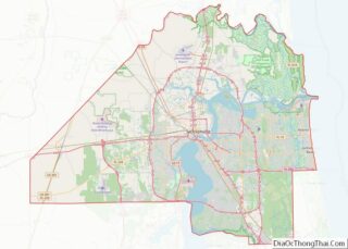
Baldwin is a town in Duval County, Florida, United States. When the majority of communities in Duval County were consolidated with the city of Jacksonville in 1968, Baldwin, along with Jacksonville Beach, Atlantic Beach and Neptune Beach, remained partly independent. Like the other towns, it maintains its own municipal government, but its residents vote in the Jacksonville mayoral election and vote for the Jacksonville City Council; unlike the others, Baldwin no longer supports its own police force. The population was 1,396 at the 2020 census.
| Name: | Baldwin town |
|---|---|
| LSAD Code: | 43 |
| LSAD Description: | town (suffix) |
| State: | Florida |
| County: | Duval County |
| Elevation: | 85 ft (26 m) |
| Total Area: | 2.02 sq mi (5.24 km²) |
| Land Area: | 2.02 sq mi (5.23 km²) |
| Water Area: | 0.00 sq mi (0.01 km²) |
| Total Population: | 1,396 |
| Population Density: | 690.75/sq mi (266.70/km²) |
| ZIP code: | 32234 |
| Area code: | 904 |
| FIPS code: | 1203250 |
| GNISfeature ID: | 0278061 |
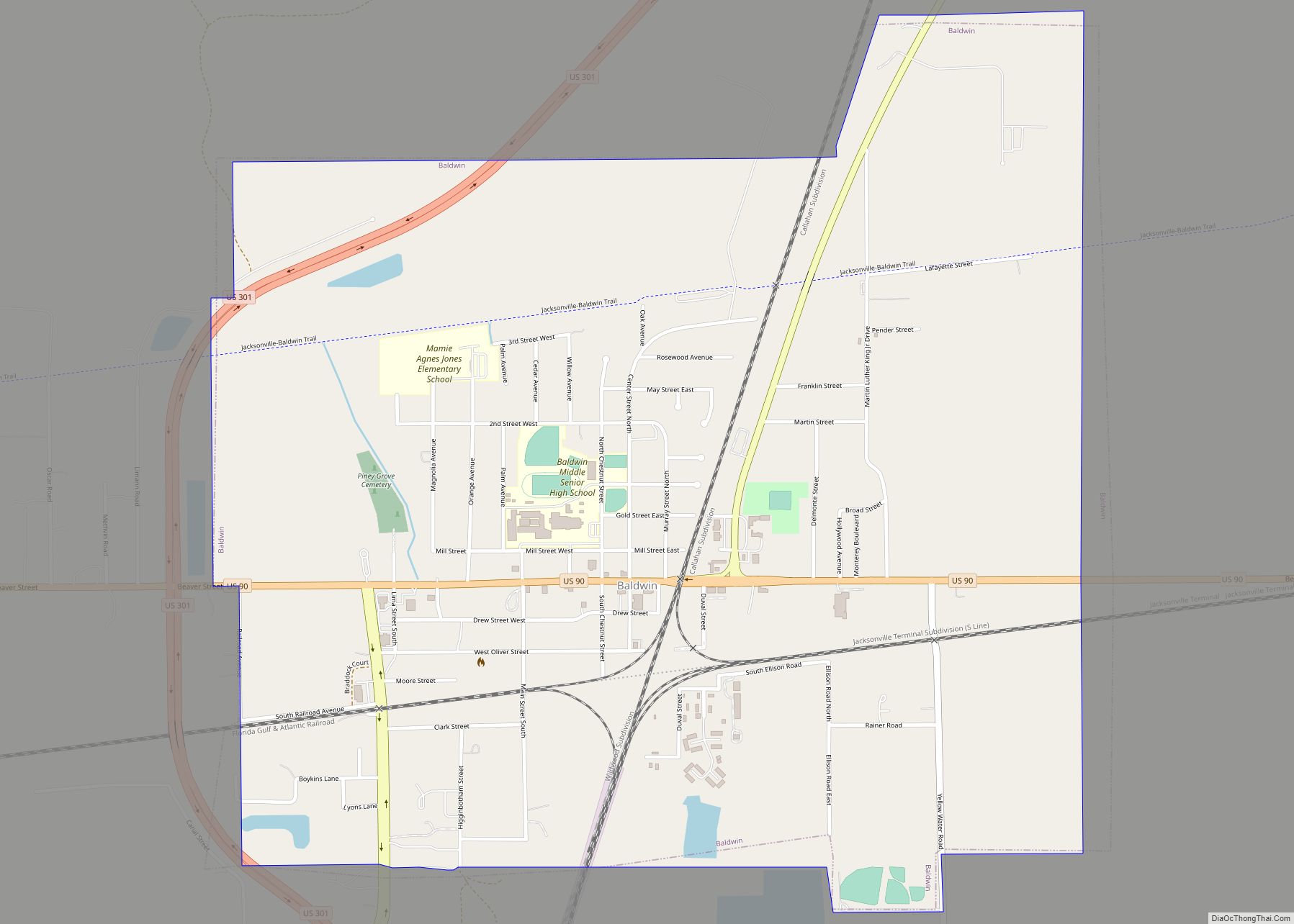
Online Interactive Map
Click on ![]() to view map in "full screen" mode.
to view map in "full screen" mode.
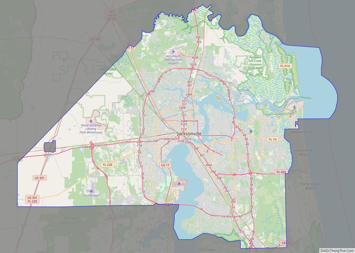
Baldwin location map. Where is Baldwin town?


History
The town was first settled under the name of Thigpen in 1846. Mr. Thigpen had opened a tavern to benefit the stagecoach line at the crossroads of what is today Baldwin. He supplied horses for the stage and shelter and food for the passengers. The first railroad was built through Thigpen in 1857 with a second crossing it in 1859. The name was changed to Baldwin in honor of Dr. Abel Seymour Baldwin, the president of the Florida, Atlantic and Gulf Central Railroad, a railroad that ran from Lake City to Jacksonville. Further development in Baldwin led to the establishment of a telegraphic line running from Jacksonville to Baldwin. Baldwin lies between Macclenny and Jacksonville
During the Civil War, Baldwin was captured by Federal forces early in 1864. Northern troops and correspondents noted that the citizens of Baldwin were “wretchedly poor.”
On August 10, 1864 a skirmish occurred between a Confederate cavalry and the 102nd Regiment United States Colored Troops. A section of railroad track was destroyed by the Federal troops. Two days later the Federals dispatched cavalry troops from Baldwin to drive Confederate forces back. One Federal soldier was killed and four were captured in the process. Baldwin was then burned down by the Federals. From 1865 to 1875 Baldwin was rebuilt reaching a population of 250.
In 1947, the original school building serving the white population burned to the ground. There was no fire department to control it, and it was completely destroyed. The students from the school were temporarily housed in a variety of public buildings, including churches and the city hall. Later, barracks buildings from nearby army training base Camp Blanding were moved to the site of the burned school, where classes continued for about two years while a new school was being built. A school for the black population was located in a building located near the old ice plant that served the railroad. The school was occupied for a number of years after the new white school was built.
Florida State law in 1948 required new school buildings be placed on parcels not less than 10 acres (40,000 m) in size. As the property under the existing school was not large enough, a site on Mill Street was chosen. A $50,000 school was erected during the winter and summers of 1948 and 1949. In 1950, an auditorium was completed. At that time the school enrollment was 365. In 1964, a Music Suite was added.
In 1965 Baldwin became the first Duval County school to be integrated.
Baldwin Road Map

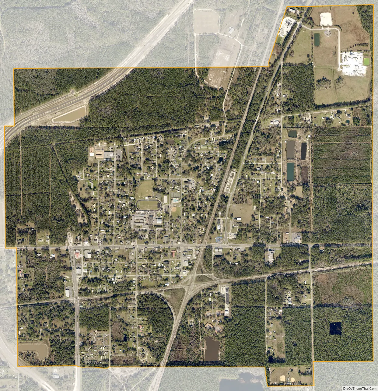
Baldwin city Satellite Map
Geography
Baldwin is located at 30°18′14″N 81°58′30″W / 30.30389°N 81.97500°W / 30.30389; -81.97500 (30.303788, –81.975029).
According to the United States Census Bureau, the town has a total area of 2.0 square miles (5.3 km), all land.
See also
Map of Florida State and its subdivision:- Alachua
- Baker
- Bay
- Bradford
- Brevard
- Broward
- Calhoun
- Charlotte
- Citrus
- Clay
- Collier
- Columbia
- Desoto
- Dixie
- Duval
- Escambia
- Flagler
- Franklin
- Gadsden
- Gilchrist
- Glades
- Gulf
- Hamilton
- Hardee
- Hendry
- Hernando
- Highlands
- Hillsborough
- Holmes
- Indian River
- Jackson
- Jefferson
- Lafayette
- Lake
- Lee
- Leon
- Levy
- Liberty
- Madison
- Manatee
- Marion
- Martin
- Miami-Dade
- Monroe
- Nassau
- Okaloosa
- Okeechobee
- Orange
- Osceola
- Palm Beach
- Pasco
- Pinellas
- Polk
- Putnam
- Saint Johns
- Saint Lucie
- Santa Rosa
- Sarasota
- Seminole
- Sumter
- Suwannee
- Taylor
- Union
- Volusia
- Wakulla
- Walton
- Washington
- Alabama
- Alaska
- Arizona
- Arkansas
- California
- Colorado
- Connecticut
- Delaware
- District of Columbia
- Florida
- Georgia
- Hawaii
- Idaho
- Illinois
- Indiana
- Iowa
- Kansas
- Kentucky
- Louisiana
- Maine
- Maryland
- Massachusetts
- Michigan
- Minnesota
- Mississippi
- Missouri
- Montana
- Nebraska
- Nevada
- New Hampshire
- New Jersey
- New Mexico
- New York
- North Carolina
- North Dakota
- Ohio
- Oklahoma
- Oregon
- Pennsylvania
- Rhode Island
- South Carolina
- South Dakota
- Tennessee
- Texas
- Utah
- Vermont
- Virginia
- Washington
- West Virginia
- Wisconsin
- Wyoming