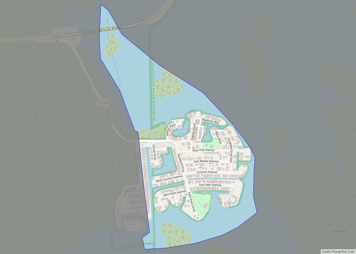
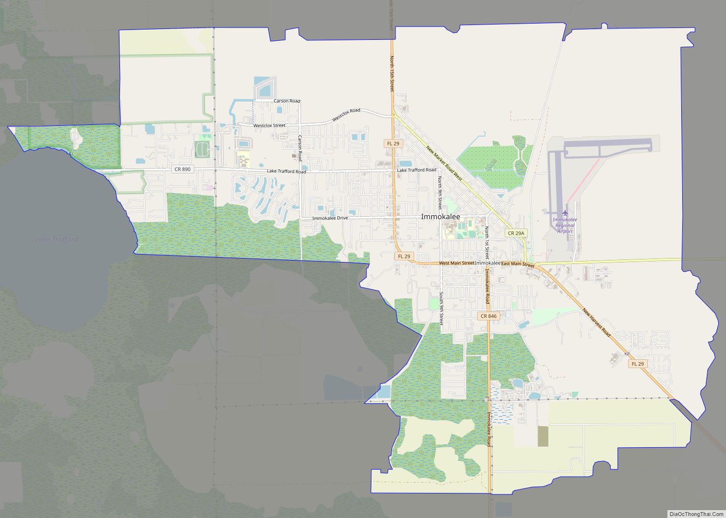
Naples is a city in Collier County, Florida, United States. As of the 2020 census, the population was 19,115. Naples is a principal city of the Naples-Marco Island, Florida Metropolitan Statistical Area, which had a population of about 375,752 as of 2020. Naples’ USPS City population (i.e. the total population that lists Naples as the city on their postal address and who consider themselves residents of Naples) includes most of the communities in Collier County with the notable exceptions of Immokalee, Marco Island, Ave Maria, Everglades City and a few others, and thus Naples’ USPS City population is approximately 333,083.
The city is mostly known for its high-priced homes, white-sand beaches, and numerous golf courses. Naples is the self-titled “Golf Capital of the World”, as it has the second most holes per capita out of all communities, and the most holes of any city in Florida. The city is also known for being appealing to retirees, and a large percent of the population is made up of them.
| Name: | Naples city |
|---|---|
| LSAD Code: | 25 |
| LSAD Description: | city (suffix) |
| State: | Florida |
| County: | Collier County |
| Elevation: | 3 ft (1 m) |
| Land Area: | 12.30 sq mi (31.87 km²) |
| Water Area: | 4.16 sq mi (10.77 km²) 25.09% |
| Population Density: | 1,553.56/sq mi (599.83/km²) |
| ZIP code: | 34101-34120 |
| Area code: | 239 |
| FIPS code: | 1247625 |
| GNISfeature ID: | 0287528 |
| Website: | www.naplesgov.com |
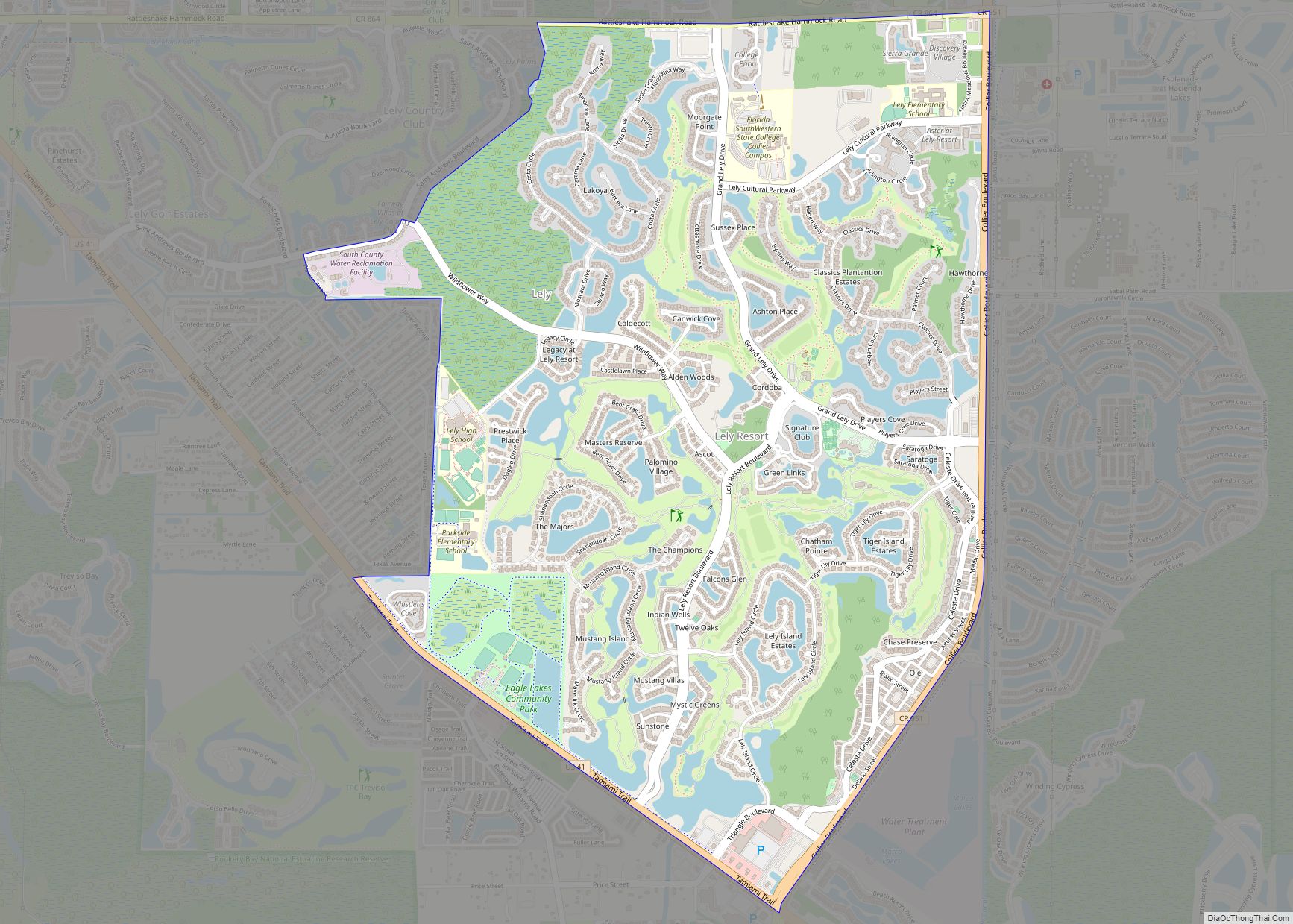
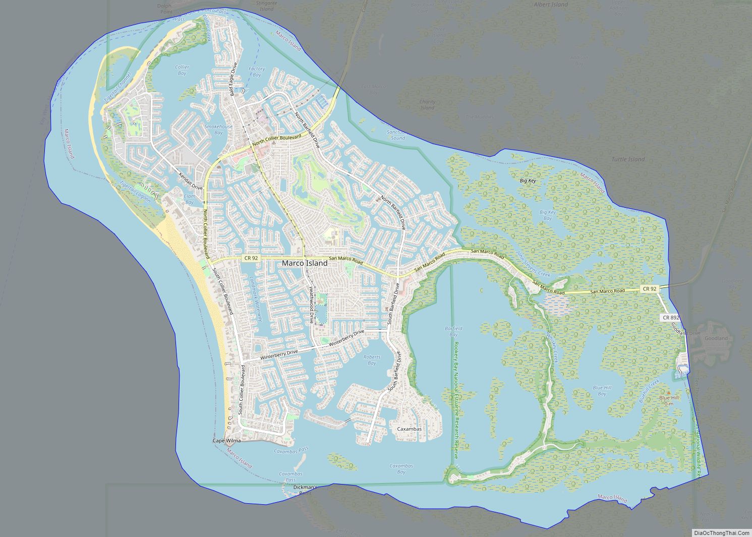
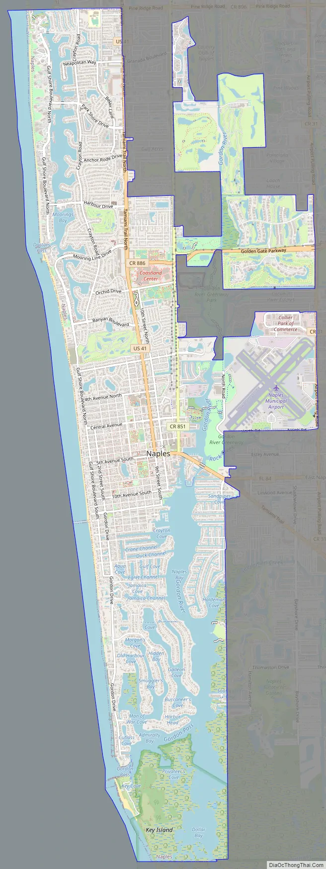
Online Interactive Map
Click on ![]() to view map in "full screen" mode.
to view map in "full screen" mode.
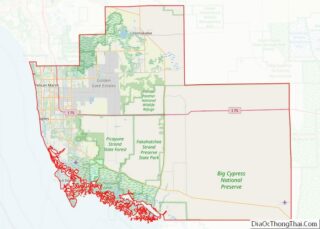
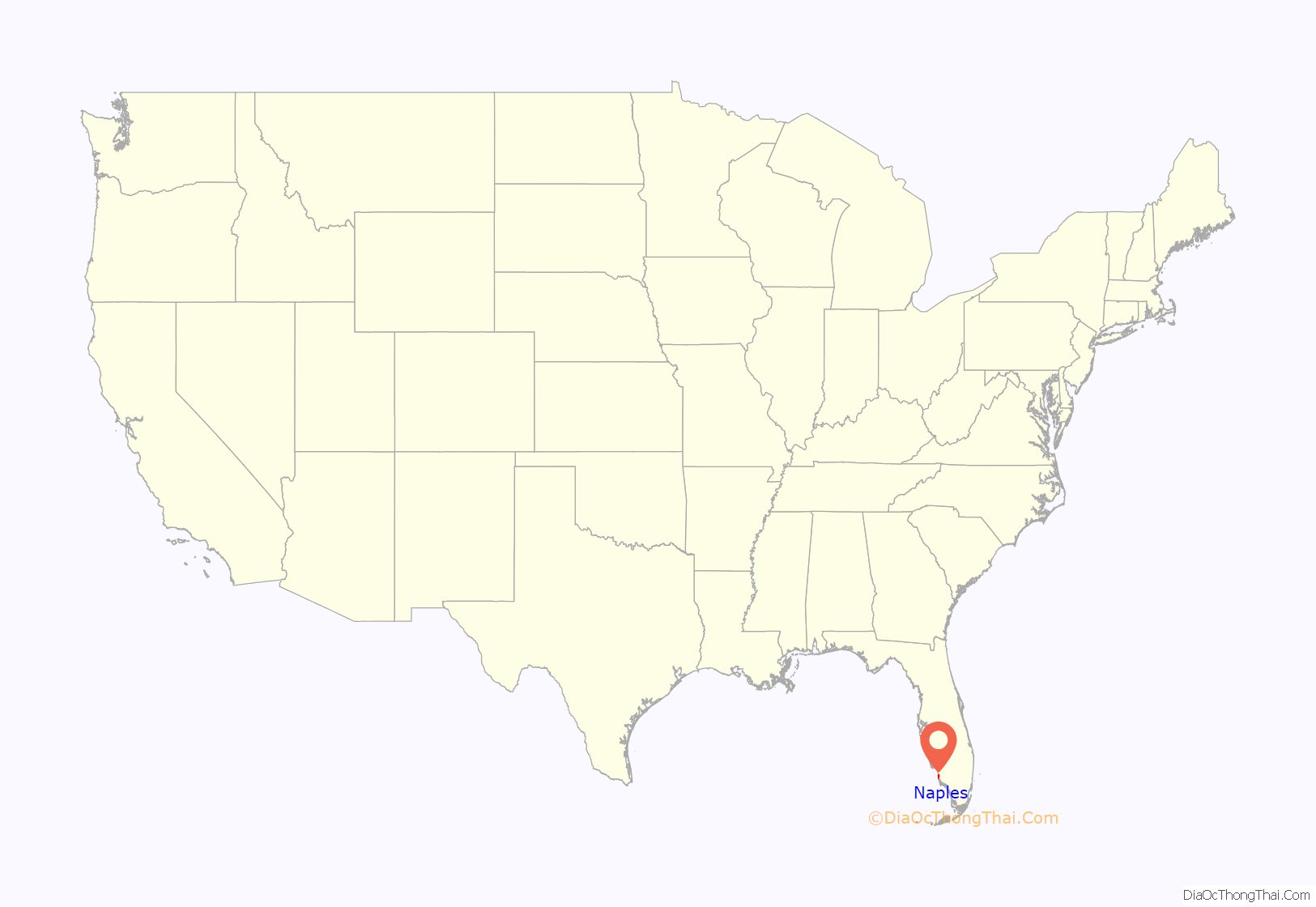
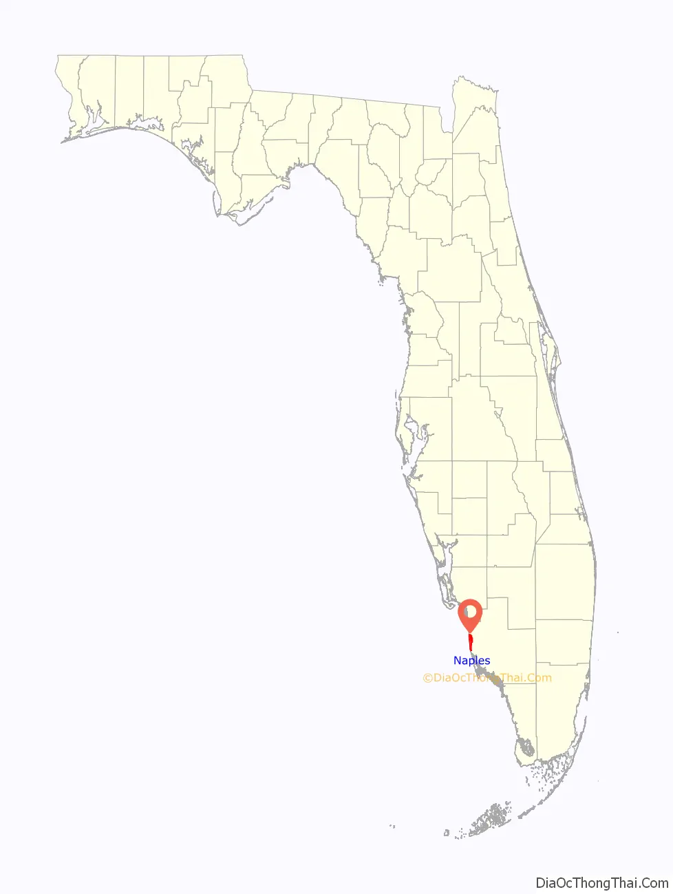
Naples location map. Where is Naples city?
History
Before the period of European colonization, the indigenous Calusa lived in Florida (including the region of present-day Naples) for thousands of years, from Charlotte Harbor to Cape Sable. In 1513, Spanish conquistador Juan Ponce de León explored the region and encountered the Calusa, who resisted attempts by de León to establish a Spanish colony in Florida. This initiated nearly two hundred years of conflict between the Spanish and the Calusa. In the early 18th century, following slave raids from Muscogee and Yamasee raiders allied with European settlers in Carolina, the majority of the remaining Calusa moved south and east to escape the raids.
The city of Naples was founded in 1886 by former Confederate general and Kentucky U.S. Senator John Stuart Williams and his partner, Louisville businessman Walter N. Haldeman, the publisher of the Louisville Courier-Journal. Throughout the 1870s and 1880s, magazine and newspaper stories ran stories about the area’s mild climate and abundant fish and likened it to the sunny Italian peninsula. The name Naples caught on when promoters described the bay as “surpassing the bay in Naples, Italy”. By the summer of 1888, Naples had a population of about 80 people, and the first hotel opened in 1889. Major development was anticipated after Collier County was established in 1923, the completion of the Seaboard Air Line Railroad extension in 1927, and the completion of the Tamiami Trail linking Naples to Miami in 1928, but did not begin until after the 1929 Stock market crash, the Great Depression, and World War II. During the war the U.S. Army Air Forces built a small airfield and used it for training purposes; it is now the Naples Municipal Airport.
After a hurricane in 1945, a fill was required to repair the damage. A local dredging company, Wyatt Brothers, created a lake north of 16th Avenue S, between Gordon Drive and Gulf Shore Boulevard. In 1949, Reginald Wyatt II asked Mr. Rust to sell him the 296 acres (120 ha) from Jamaica Channel to today’s 14th Avenue S. The Jamaica Channel was widened, one canal was dredged, and 14th Avenue S was created. That same year, Naples officially became a city.
Today, the Wyatt family is credited with the construction of Naples’ first beach. Additional channels were eventually added to the south of 14th Avenue S and are named alphabetically for local water birds. The first channel south of 14th Avenue S is Anhinga Channel, then Bittern Channel is south of 15th Avenue S, Crane Channel is south of 16th Avenue S, Duck Channel is south of 17th Avenue S, and Egret Channel is north of 21st Avenue S. From the channels there are coves named Flamingo, Gull, Heron, and Ibis, as well as the original Aqua Cove. These initial channels, canals, and coves were dredged and bulldozed from the mangrove swamps. Where shallow rock precluded digging, the land was filled to create lots with navigable water.
The Aqualane Shores Association was incorporated as a non-profit corporation on February 3, 1966. It served lot owners in the area roughly bounded by the Bay of Naples to the east, Gordon Drive to the west, and the land between 14th Avenue and 21st Avenue S, as well as Marina Drive, Forrest Lane, and Southwinds Drive. Thirty years later, in 1996, a state-mandated city master plan renamed the area the Aqualane Shores Neighborhood and extended its boundary west to the Gulf of Mexico, east to the Bay of Naples, and the area from 14th Avenue S all the way south to Jamaica Channel. The numerous canals and waterfront homes add a distinctive feature to the south portion of Naples and provide access to the Gulf of Mexico for many homeowners.
Naples Road Map
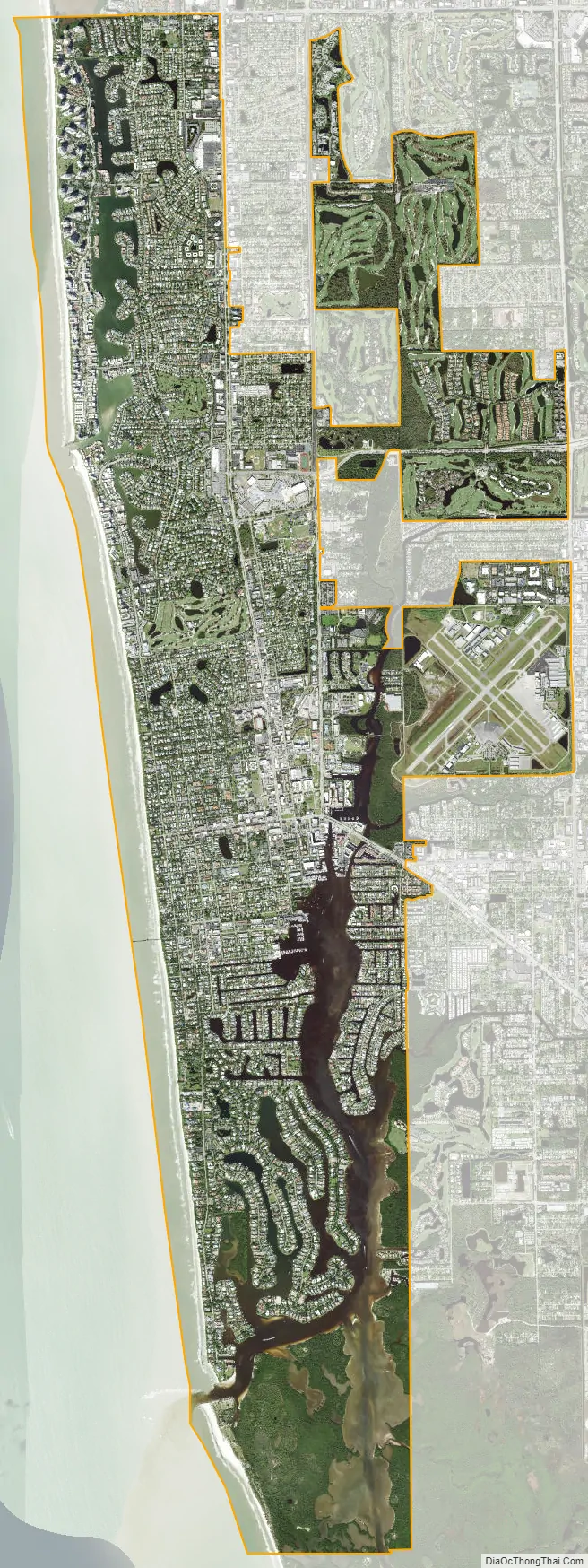
Naples city Satellite Map
Geography
Naples is located in southwest Florida at (26.139, −81.795) on U.S. Highway 41 between Miami to the east and Fort Myers to the north.
According to the United States Census Bureau, the city has a total area of 16.4 square miles (42.5 km), of which 12.3 square miles (31.9 km) is land and 4.1 square miles (10.7 km), or 25.09%, is water.
Hurricanes
National Weather Service records that date back to 1851, indicate 74 tropical storms have passed within 85 nautical miles of Naples, or once every 2.2 years (as of a 2014 data).
2005 Hurricane Wilma (Category 5) – Wilma reached maximum wind strength of 185 mph but its winds were 125 mph when it made landfall near Cape Romano (below Naples, just beyond the southwestern tip of Marco Island and northwest of the Ten Thousand Islands in Collier County). Wilma caused 87 deaths and $22.4 billion in damage.
2017 Hurricane Irma (Category 5) – Irma had maximum wind strength of 180 mph but when it made landfall near Marco Island, its winds were 115 mph. As Irma hit Florida, tropical-storm-force winds extended out to 400 miles from the center and had hurricane-force winds that extended up to 80 miles. This storm left over 7.5 million homes (70% of the state) without electricity for days. Irma caused 134 deaths and $50 billion in damage.
2022 Hurricane Ian (Category 5) – Ian had a maximum wind strength of 160 mph (348 km/h) while approaching Florida, and it made landfall at Cayo Costa slightly below peak strength as a Category 4 hurricane with sustained winds of 150 mph. Power was lost to much of the Naples, FL area including Pelican Bay and Bay Colony for several days, but repairs began to allow power to be turned back on starting on October 1, 2022. Ian caused 149 deaths in the state of Florida and an estimated $989 million in damages to the city of Naples and approximately $2.2 billion in damages to buildings in Collier County.
Climate
Naples experiences a tropical savanna climate (Köppen climate classification Aw). Naples is normally frost-free and the growing season is 365 days. Of the two tropical seasons, Naples’ wet season is from approximately June through September with frequent afternoon rains, while the dry season is from approximately October through May. Of the six ecological seasons, Naples experiences only two: Vernal (spring) from approximately October through May and Estival (high summer) from approximately June through September. Within the Vernal (spring) season, October, November, February, March, April and May are mild temperate, while December and January are cool temperate. Of the six ecological seasons, Naples does not experience Prevernal (pre-spring), Serotinal (late summer), Autumnal (autumn) and Hibernal (winter) because its trees and vegetation are in a perpetual state of leaf replenishment and bloom; and large numbers of bird species are settled in Naples year-round.
See also
Map of Florida State and its subdivision:- Alachua
- Baker
- Bay
- Bradford
- Brevard
- Broward
- Calhoun
- Charlotte
- Citrus
- Clay
- Collier
- Columbia
- Desoto
- Dixie
- Duval
- Escambia
- Flagler
- Franklin
- Gadsden
- Gilchrist
- Glades
- Gulf
- Hamilton
- Hardee
- Hendry
- Hernando
- Highlands
- Hillsborough
- Holmes
- Indian River
- Jackson
- Jefferson
- Lafayette
- Lake
- Lee
- Leon
- Levy
- Liberty
- Madison
- Manatee
- Marion
- Martin
- Miami-Dade
- Monroe
- Nassau
- Okaloosa
- Okeechobee
- Orange
- Osceola
- Palm Beach
- Pasco
- Pinellas
- Polk
- Putnam
- Saint Johns
- Saint Lucie
- Santa Rosa
- Sarasota
- Seminole
- Sumter
- Suwannee
- Taylor
- Union
- Volusia
- Wakulla
- Walton
- Washington
- Alabama
- Alaska
- Arizona
- Arkansas
- California
- Colorado
- Connecticut
- Delaware
- District of Columbia
- Florida
- Georgia
- Hawaii
- Idaho
- Illinois
- Indiana
- Iowa
- Kansas
- Kentucky
- Louisiana
- Maine
- Maryland
- Massachusetts
- Michigan
- Minnesota
- Mississippi
- Missouri
- Montana
- Nebraska
- Nevada
- New Hampshire
- New Jersey
- New Mexico
- New York
- North Carolina
- North Dakota
- Ohio
- Oklahoma
- Oregon
- Pennsylvania
- Rhode Island
- South Carolina
- South Dakota
- Tennessee
- Texas
- Utah
- Vermont
- Virginia
- Washington
- West Virginia
- Wisconsin
- Wyoming