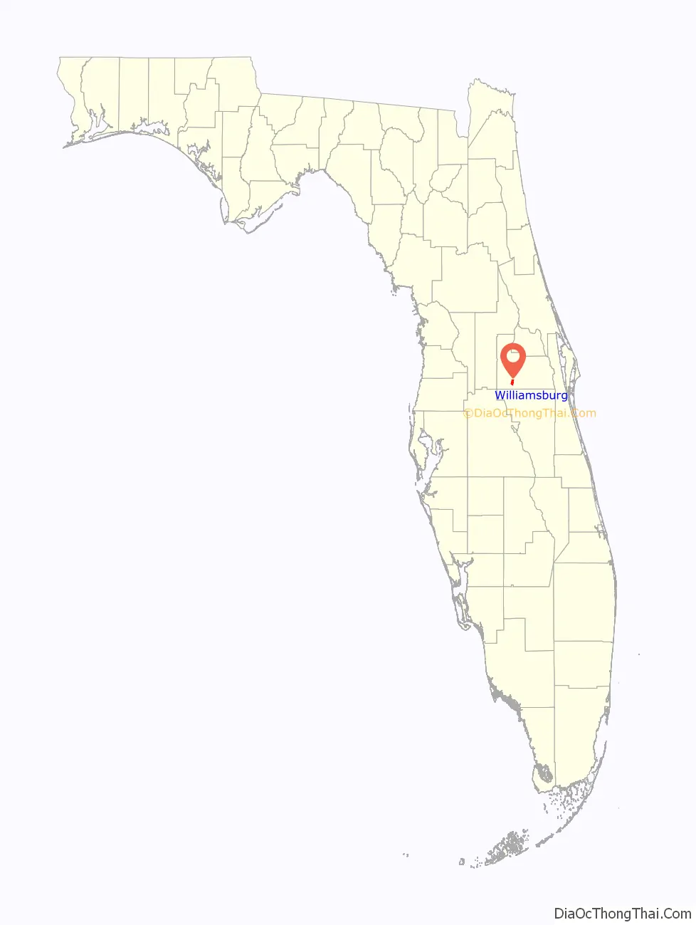
Williamsburg is a census-designated place (CDP) in Orange County, Florida, United States. The population was 7,646 at the 2010 census. It is part of the Orlando–Kissimmee Metropolitan Statistical Area.
| Name: | Williamsburg CDP |
|---|---|
| LSAD Code: | 57 |
| LSAD Description: | CDP (suffix) |
| State: | Florida |
| County: | Orange County |
| Elevation: | 89 ft (27 m) |
| Total Area: | 3.65 sq mi (9.45 km²) |
| Land Area: | 3.55 sq mi (9.20 km²) |
| Water Area: | 0.10 sq mi (0.25 km²) |
| Total Population: | 7,908 |
| Population Density: | 2,226.98/sq mi (859.73/km²) |
| FIPS code: | 1277735 |
| GNISfeature ID: | 1867237 |
Online Interactive Map
Click on ![]() to view map in "full screen" mode.
to view map in "full screen" mode.
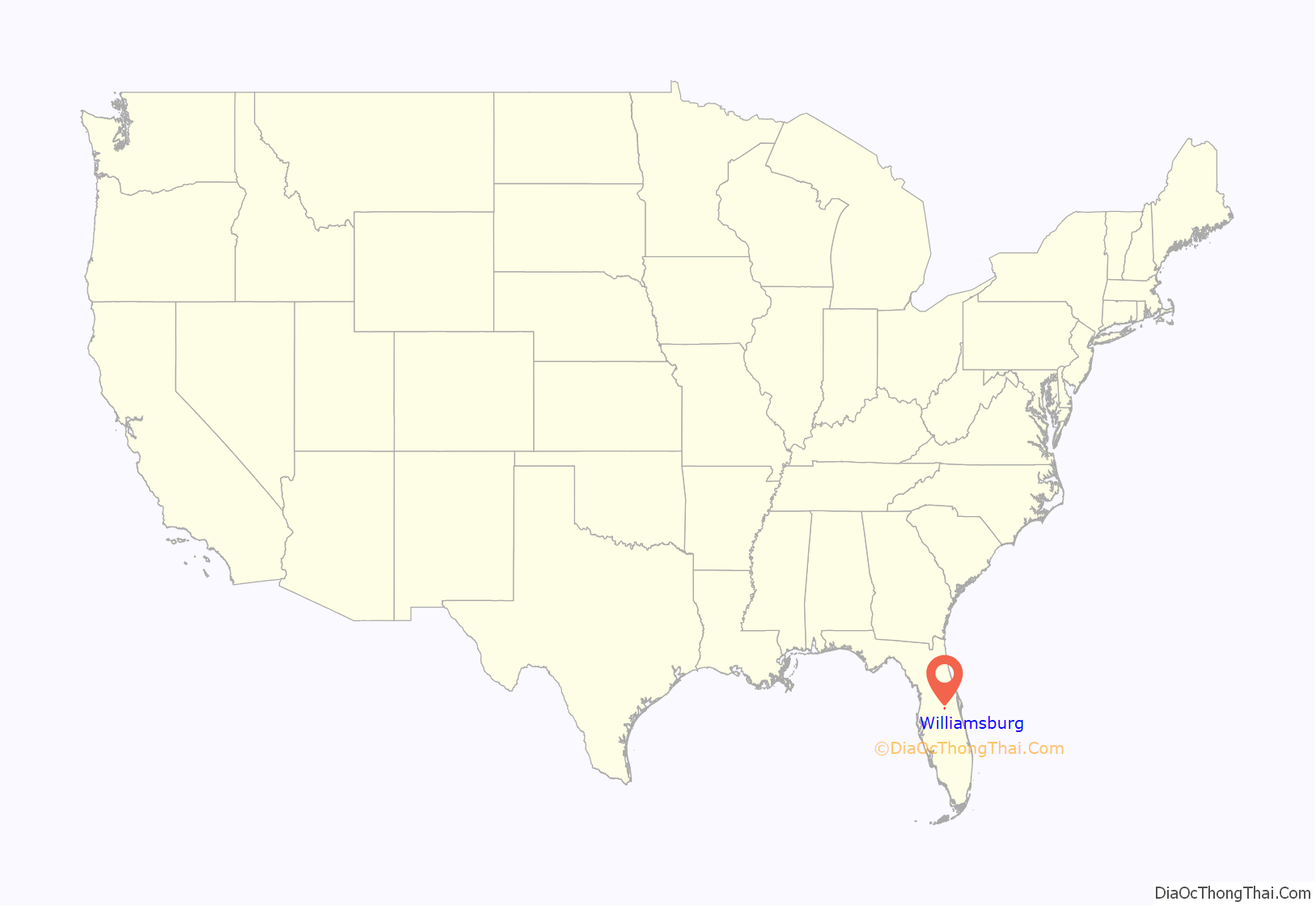
Williamsburg location map. Where is Williamsburg CDP?
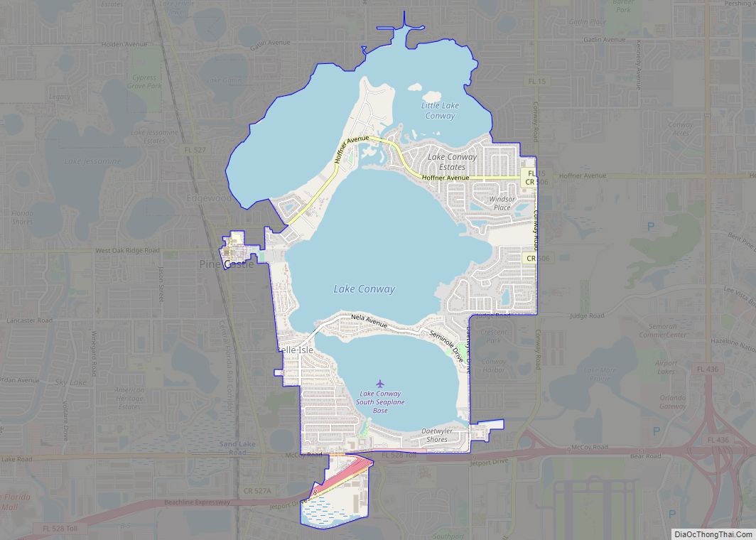
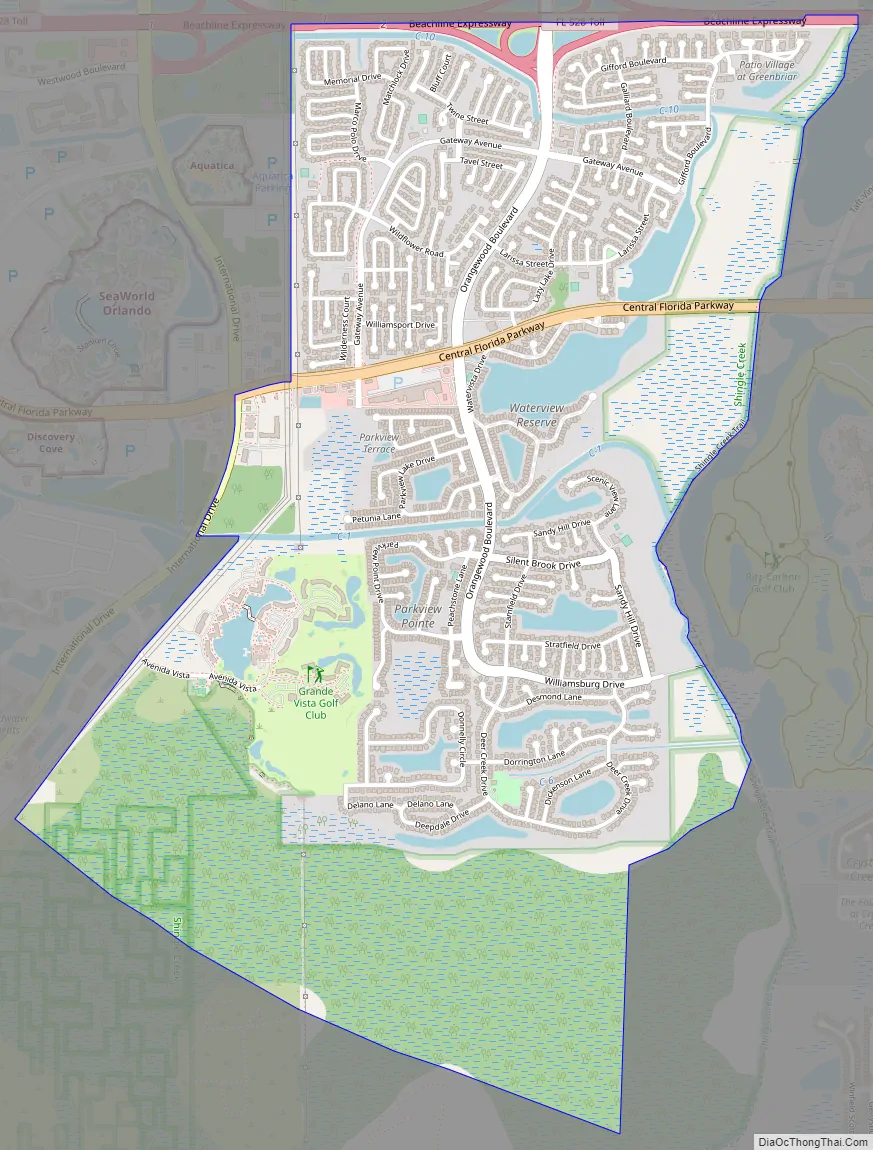
Williamsburg Road Map
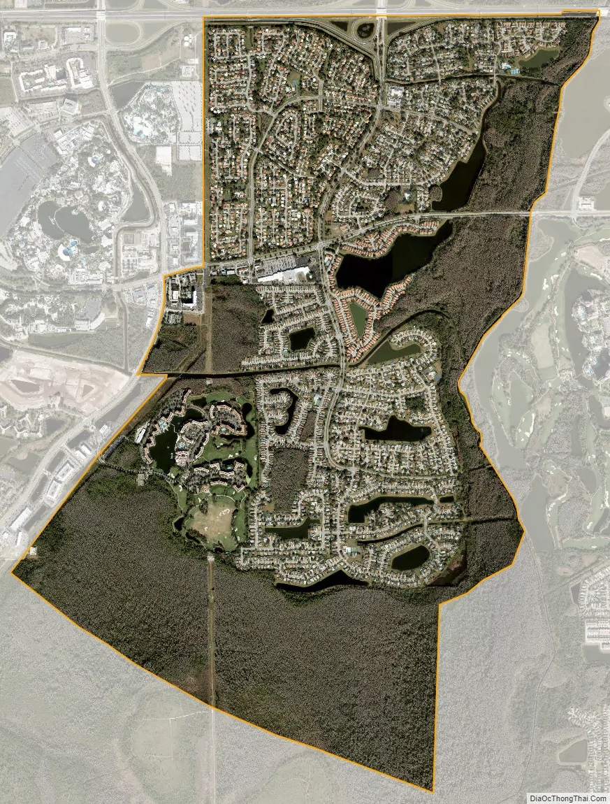
Williamsburg city Satellite Map
Geography
Williamsburg is located at 28°24′35″N 81°26′45″W / 28.40972°N 81.44583°W / 28.40972; -81.44583 (28.409817, -81.445917).
According to the United States Census Bureau, the CDP has a total area of 9.7 km (3.8 mi), of which 9.5 km (3.7 mi) is land and 0.2 km (0.1 mi) (1.87%) is water.
Williamsburg is a large subdivision bounded roughly on the north by the Beachline Expressway, on the south by the Central Florida GreeneWay, on the east by Shingle Creek and on the west by International Drive. The main intersection of the community is at Orangewood Blvd. and Central Florida Parkway.
In the early 2000s, Williamsburg’s Homeowners Association worked with the Orange County Board of County Commissioners to ensure that traffic from the Orange County Convention Center did not pass through the interchange between Orangewood Boulevard and the Beachline, which would expand to connect to a southern extension of Universal Boulevard. The result was an interchange that directed a bulk of southbound Universal Boulevard traffic onto the Beachline, with only one lane passing under to connect to Orangewood Boulevard.
See also
Map of Florida State and its subdivision:- Alachua
- Baker
- Bay
- Bradford
- Brevard
- Broward
- Calhoun
- Charlotte
- Citrus
- Clay
- Collier
- Columbia
- Desoto
- Dixie
- Duval
- Escambia
- Flagler
- Franklin
- Gadsden
- Gilchrist
- Glades
- Gulf
- Hamilton
- Hardee
- Hendry
- Hernando
- Highlands
- Hillsborough
- Holmes
- Indian River
- Jackson
- Jefferson
- Lafayette
- Lake
- Lee
- Leon
- Levy
- Liberty
- Madison
- Manatee
- Marion
- Martin
- Miami-Dade
- Monroe
- Nassau
- Okaloosa
- Okeechobee
- Orange
- Osceola
- Palm Beach
- Pasco
- Pinellas
- Polk
- Putnam
- Saint Johns
- Saint Lucie
- Santa Rosa
- Sarasota
- Seminole
- Sumter
- Suwannee
- Taylor
- Union
- Volusia
- Wakulla
- Walton
- Washington
- Alabama
- Alaska
- Arizona
- Arkansas
- California
- Colorado
- Connecticut
- Delaware
- District of Columbia
- Florida
- Georgia
- Hawaii
- Idaho
- Illinois
- Indiana
- Iowa
- Kansas
- Kentucky
- Louisiana
- Maine
- Maryland
- Massachusetts
- Michigan
- Minnesota
- Mississippi
- Missouri
- Montana
- Nebraska
- Nevada
- New Hampshire
- New Jersey
- New Mexico
- New York
- North Carolina
- North Dakota
- Ohio
- Oklahoma
- Oregon
- Pennsylvania
- Rhode Island
- South Carolina
- South Dakota
- Tennessee
- Texas
- Utah
- Vermont
- Virginia
- Washington
- West Virginia
- Wisconsin
- Wyoming