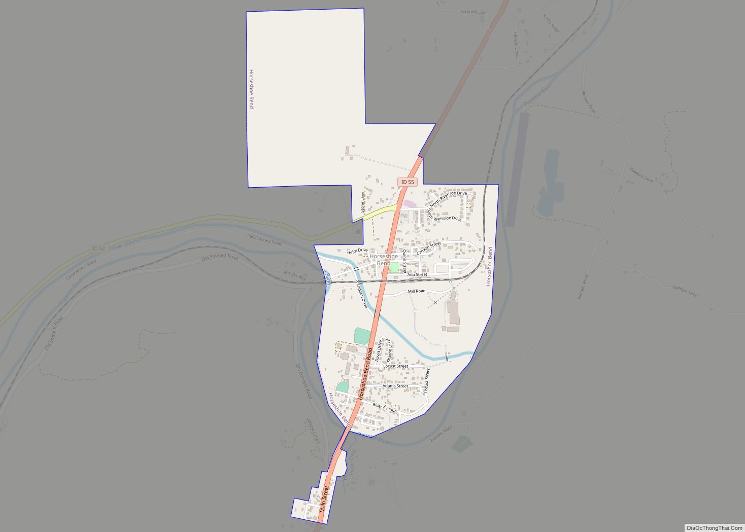
Horseshoe Bend is the largest city in rural Boise County, in the southwestern part of the U.S. state of Idaho. Its population of 707 at the 2010 census was the largest in the county, though down from 770 in 2000.
It is part of the Boise City–Nampa, Idaho Metropolitan Statistical Area. It is named for its location at the horseshoe-shaped U-turn of the Payette River, whose flow direction changes from south to north before heading west to the Black Canyon Reservoir.
| Name: | Horseshoe Bend city |
|---|---|
| LSAD Code: | 25 |
| LSAD Description: | city (suffix) |
| State: | Idaho |
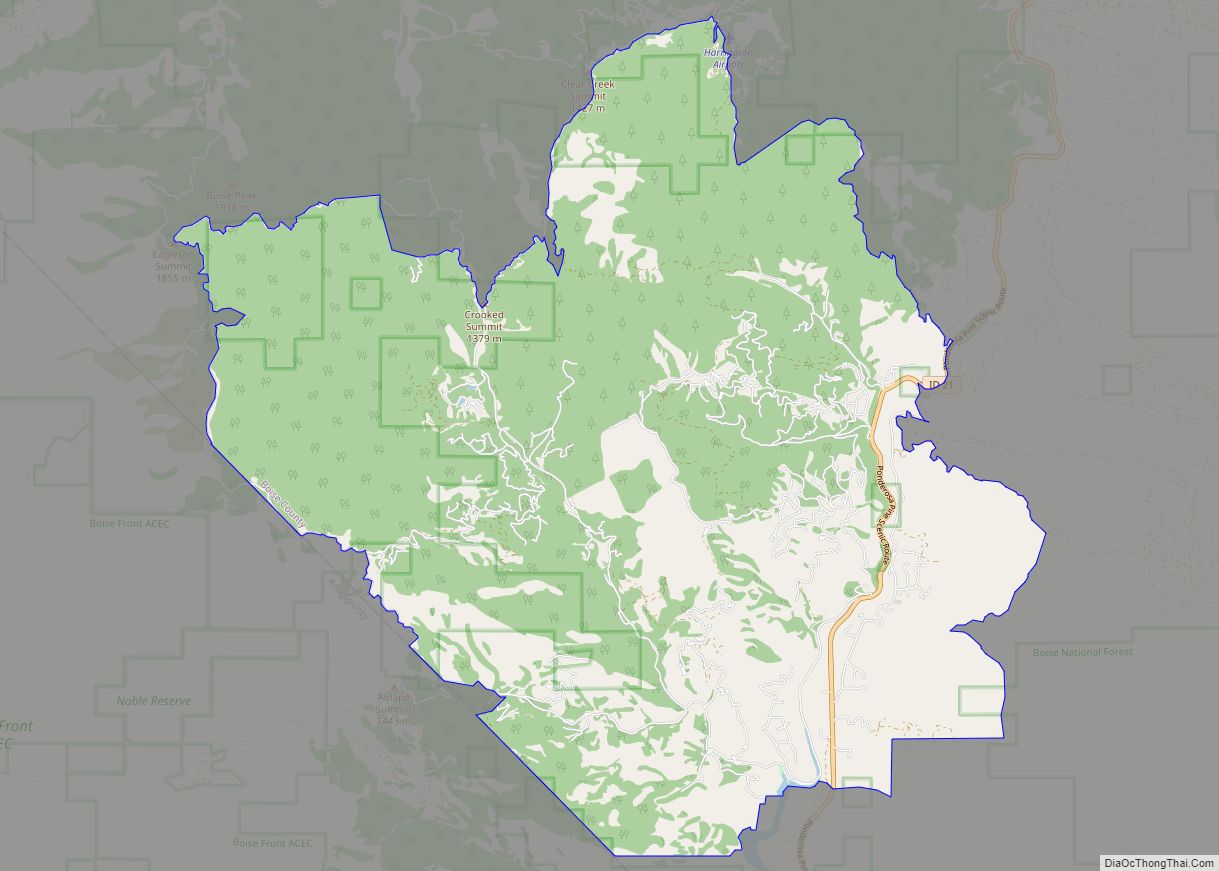
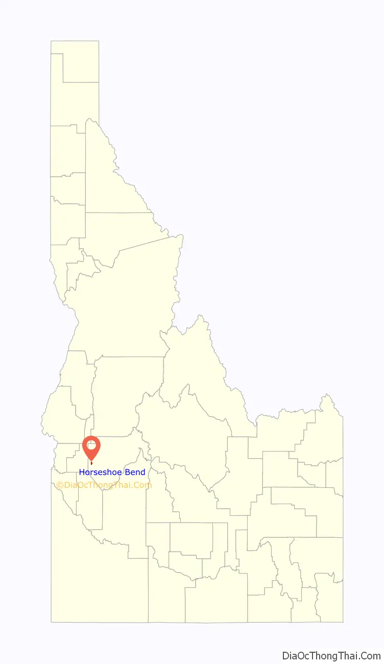
| County: | Boise County |
| Elevation: | 2,631 ft (802 m) |
| Total Area: | 1.10 sq mi (2.85 km²) |
| Land Area: | 1.09 sq mi (2.81 km²) |
| Water Area: | 0.01 sq mi (0.04 km²) |
| Total Population: | 707 |
| Population Density: | 724.01/sq mi (279.66/km²) |
| ZIP code: | 83629 |
| Area code: | 208, 986 |
| FIPS code: | 1638620 |
| GNISfeature ID: | 0396669 |
Online Interactive Map
Click on ![]() to view map in "full screen" mode.
to view map in "full screen" mode.
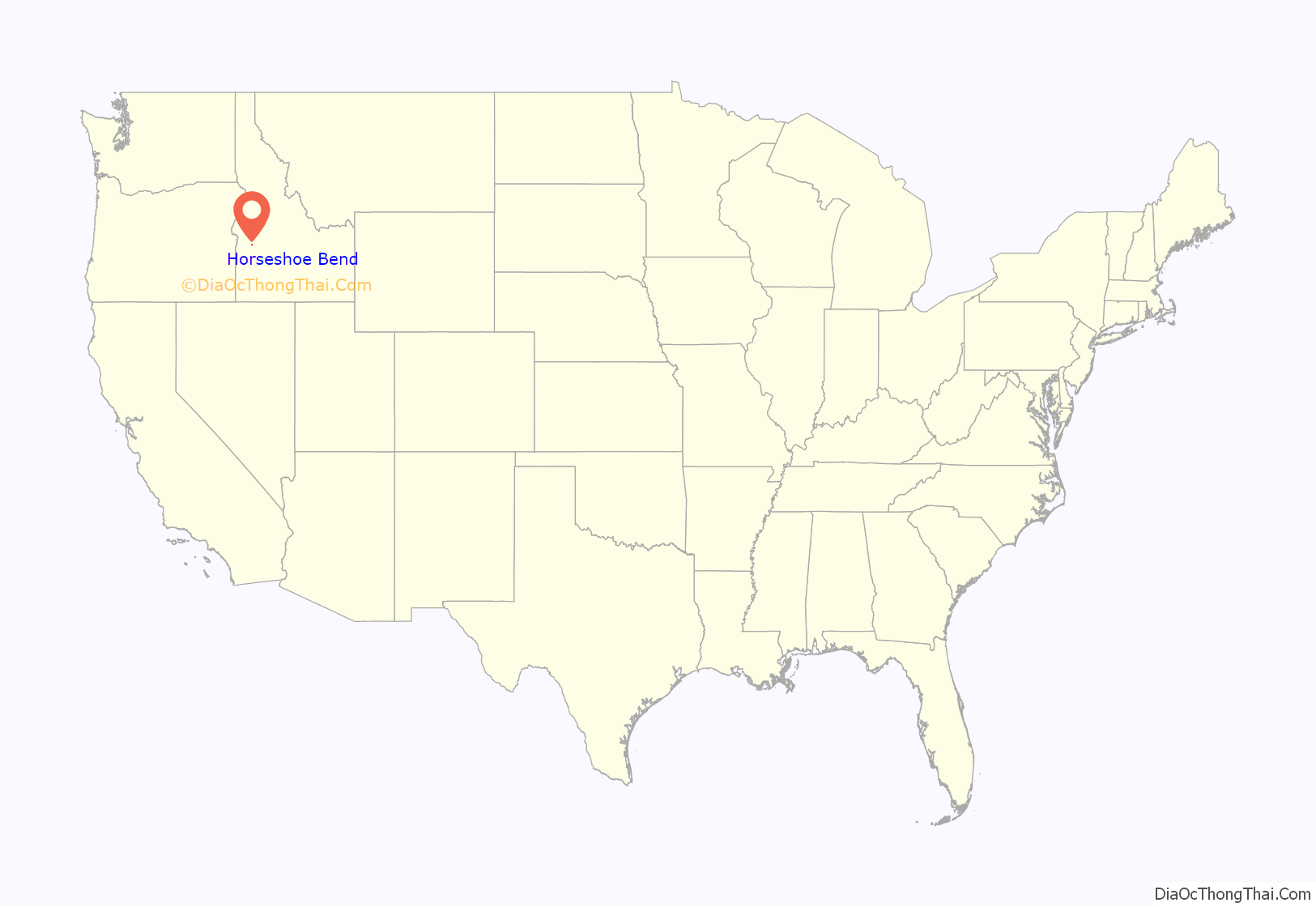
Horseshoe Bend location map. Where is Horseshoe Bend city?
History
The area was originally settled as a gold miners’ staging area, as prospectors waited along the river for snows to thaw at the higher elevations. Gold had been discovered in 1862 in the Boise Basin mountains to the east, near Idaho City.
The settlement became known as Warrinersville, after a local sawmill operator. The name was changed to Horseshoe Bend in 1867, and after the gold rush quieted, the city became a prosperous ranching and logging community. The railroad, from Emmett up to Long Valley following the Payette River (its North Fork above Banks), was completed in 1913.
In 1998 the city’s primary employer, Boise Cascade, closed its sawmill on September 30. Horseshoe Bend has attempted to become the county seat of Boise County, replacing historic Idaho City.
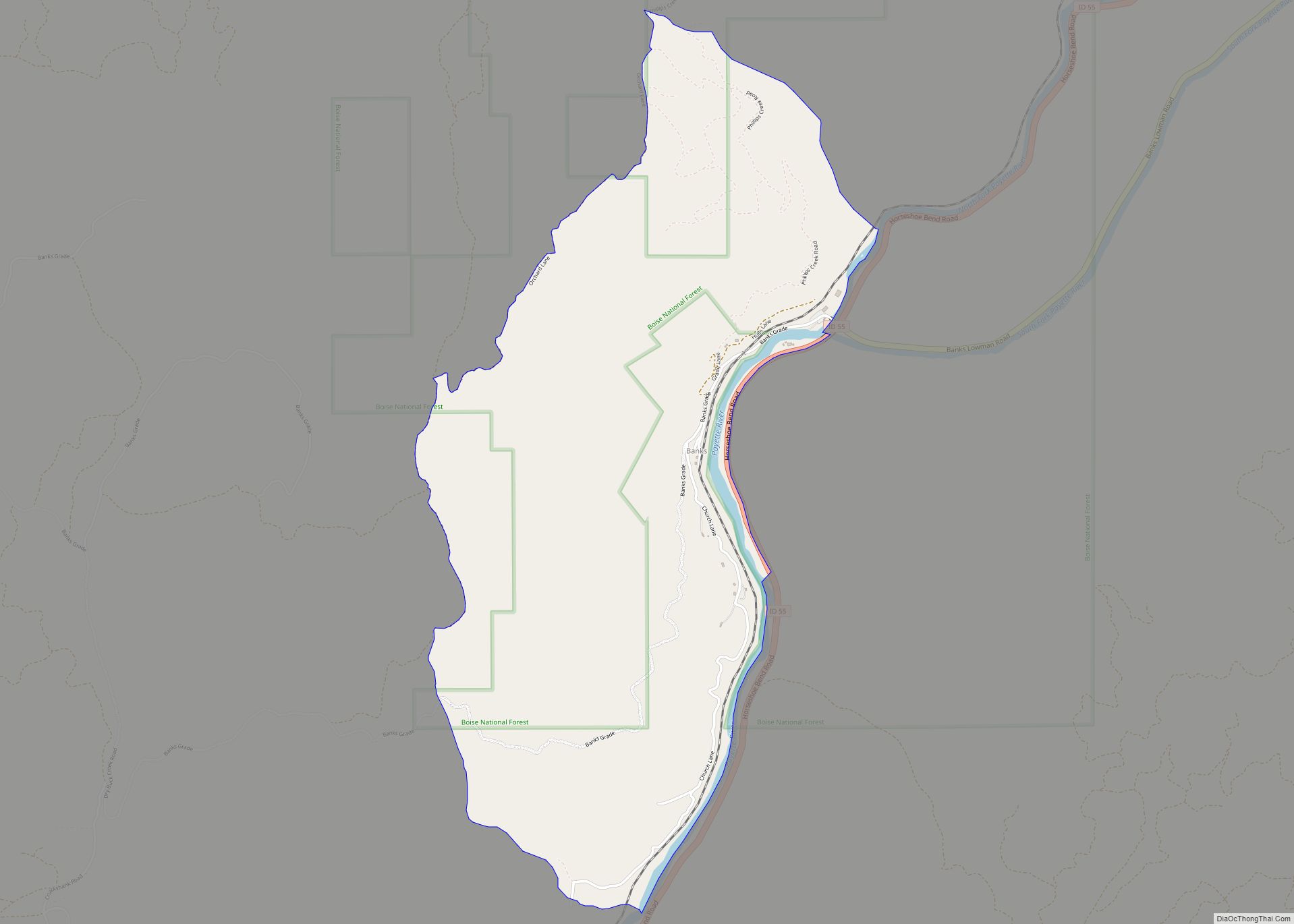
Horseshoe Bend Road Map
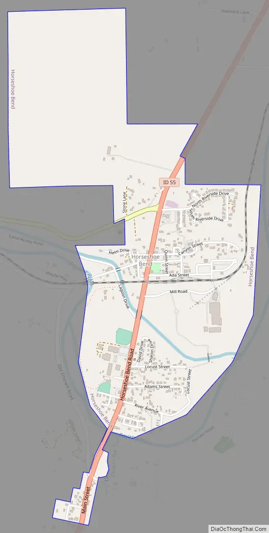
Horseshoe Bend city Satellite Map

Geography
Horseshoe Bend is located at 43°54′46″N 116°11′57″W / 43.91278°N 116.19917°W / 43.91278; -116.19917 (43.912740, -116.199290), at an elevation of 2,631 feet (802 m) above sea level.
According to the United States Census Bureau, the city has a total area of 1.09 square miles (2.82 km), of which, 1.08 square miles (2.80 km) is land and 0.01 square miles (0.03 km) is water.
Climate
According to the Köppen climate classification, Horseshoe Bend has either a hot-summer Mediterranean climate (Csa) or a hot-summer Continental Mediterranean Climate (Dsa) depending on isotherm used.
See also
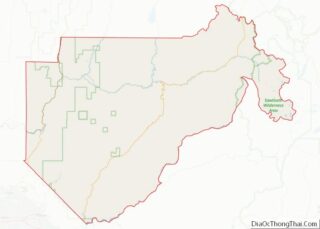
Map of Idaho State and its subdivision:- Ada
- Adams
- Bannock
- Bear Lake
- Benewah
- Bingham
- Blaine
- Boise
- Bonner
- Bonneville
- Boundary
- Butte
- Camas
- Canyon
- Caribou
- Cassia
- Clark
- Clearwater
- Custer
- Elmore
- Franklin
- Fremont
- Gem
- Gooding
- Idaho
- Jefferson
- Jerome
- Kootenai
- Latah
- Lemhi
- Lewis
- Lincoln
- Madison
- Minidoka
- Nez Perce
- Oneida
- Owyhee
- Payette
- Power
- Shoshone
- Teton
- Twin Falls
- Valley
- Washington
- Alabama
- Alaska
- Arizona
- Arkansas
- California
- Colorado
- Connecticut
- Delaware
- District of Columbia
- Florida
- Georgia
- Hawaii
- Idaho
- Illinois
- Indiana
- Iowa
- Kansas
- Kentucky
- Louisiana
- Maine
- Maryland
- Massachusetts
- Michigan
- Minnesota
- Mississippi
- Missouri
- Montana
- Nebraska
- Nevada
- New Hampshire
- New Jersey
- New Mexico
- New York
- North Carolina
- North Dakota
- Ohio
- Oklahoma
- Oregon
- Pennsylvania
- Rhode Island
- South Carolina
- South Dakota
- Tennessee
- Texas
- Utah
- Vermont
- Virginia
- Washington
- West Virginia
- Wisconsin
- Wyoming