Wakefield is a town in Middlesex County, Massachusetts, in the Greater Boston metropolitan area, incorporated in 1812 and located about 12.5 mi (20.1 km) north-northwest of Downtown Boston. Wakefield’s population was 27,090 at the 2020 census. Wakefield offers an assortment of activities around the local lake, Lake Quannapowitt.
| Name: | Wakefield CDP |
|---|---|
| LSAD Code: | 57 |
| LSAD Description: | CDP (suffix) |
| State: | Massachusetts |
| County: | Middlesex County |
| Incorporated: | 1812 |
| Elevation: | 30 m (100 ft) |
| Total Area: | 20.5 km² (7.9 sq mi) |
| Land Area: | 19.3 km² (7.5 sq mi) |
| Water Area: | 1.1 km² (0.4 sq mi) |
| Total Population: | 27,090 |
| Population Density: | 1,300/km² (3,400/sq mi) |
| ZIP code: | 01880 |
| Area code: | 339 / 781 |
| FIPS code: | 2572250 |
| GNISfeature ID: | 0619410 |
| Website: | http://www.wakefield#&.ma.us/ |
Online Interactive Map
Click on ![]() to view map in "full screen" mode.
to view map in "full screen" mode.
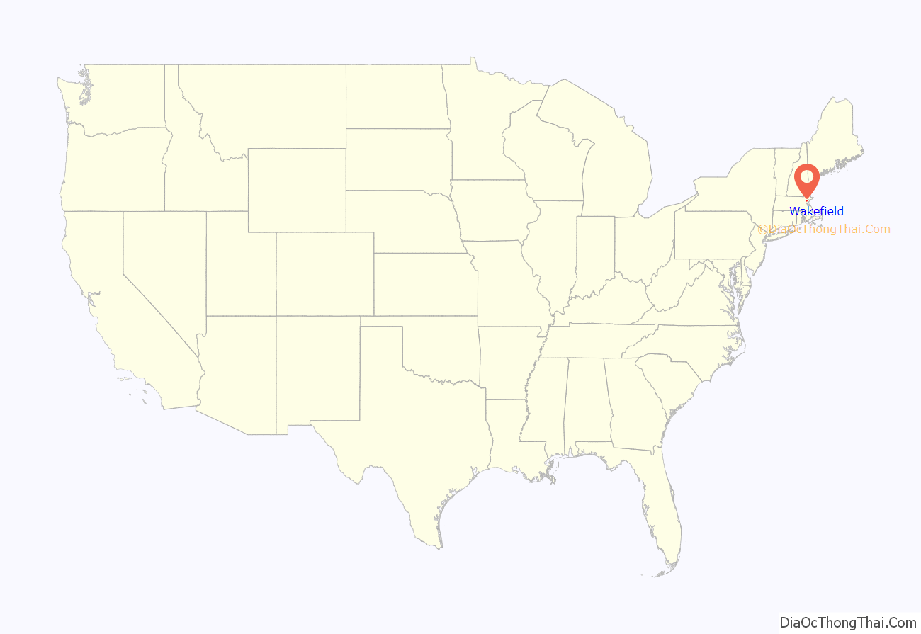
Wakefield location map. Where is Wakefield CDP?
History
Wakefield was first settled in 1638 and was originally known as Lynn Village. It officially separated from Lynn and incorporated as Reading in 1644 when the first church (First Parish Congregational Church) and the first mill were established. This first corn mill was built on the Mill River on Water Street, and later small saw mills were built on the Mill River and the Saugus River.
Thomas Parker (1609–1683) was one of the founders of Reading, and his home was in what is now downtown Wakefield (on the east side of Crescent Street where it intersects Princess Street). He also was a founder of the 12th Congregational Church (now the First Parish Congregational Church), and served as deacon there. He was a selectman of Reading and was appointed a judicial commissioner. There is evidence that Parker was “conspicuous in naming the town” and that he was related to the Parker family of Little Norton, England, who owned land by the name of Ryddinge.
The old parish church became known as the Old or South Parish when in 1713 the North Parish was established. This North Parish later became the town of North Reading. In 1769 the West Parish was established. In 1812 the Old or South Parish of Reading separated from Reading and was officially incorporated as South Reading. At the time it was spelled South Redding, not South Reading.
The railroad was chartered and built in 1844 between Wilmington and Boston. This later became the main line of the Boston and Maine Railroad. The Boston and Maine Foundry was built in 1854 and was later reincorporated as the Smith and Anthony Stove Company. The Boston Ice Company cut and shipped ice from Lake Quannapowitt starting in 1851.
The Rattan Works (which made wicker furniture) was established in 1856 by Cyrus Wakefield. This later grew into the Wakefield Rattan Company and at one time had a thousand employees. In 1868 Cyrus Wakefield donated land and money for a new town hall, and in thanks the town voted to change its name from South Reading to Wakefield. The town hall, currently named for William J. Lee, is located at 1 Lafayette Street.
In 1856 the South Reading Public Library was established, which later became the Beebe Town Library. In 1923, the Lucius Beebe Memorial Library was built and established by Junius Beebe, the son of Lucius Beebe (1810–1884).
The first weekly newspaper in Wakefield was established in 1858.
One of the oldest and largest manufacturers of flying model airplane toys in the world, Paul K. Guillow, Inc. is located in Wakefield. The company is particularly notable for its extensive line of balsa wood model airplane kits.
Route 128 was built along the north edge of the town by 1958, and the American Mutual Insurance Company built its headquarters between Lake Quannapowitt and Route 128. American Mutual had over 1000 employees, most of them commuting to work via Route 128. By the late 1980s American Mutual was in liquidation due to the Woburn W. R. Grace litigation. The headquarters building was sold to the Beal Company and was home to Boston Technology Inc. which invented and manufactured corporate voice mail systems that operated on computer systems. Boston Technology merged in 1997 with Comverse Technology, a digital telecommunications equipment manufacturer, which later bought the building; Wakefield became headquarters of its eventual spinoff, Comverse.
The northeastern part of Wakefield was home to an amusement park, Pleasure Island, billed as “The Disneyland of the Northeast,” but the park closed in 1969 after only ten years of operation due to unseasonably cold weather that brought diminishing returns among tourists. In April 1971, a fire burned down much of the amusement park. The area now consists of several office buildings and is called “Edgewater Park”.
The bicentennial of the incorporation of Wakefield took place in 2012, whereas 2018 was the sesquicentennial of the 1868 town name change from “South Reading” to “Wakefield.”
2000 shooting spree
On December 26, 2000, seven workers at Edgewater Technology in Wakefield, Massachusetts were shot and killed by an Edgewater Tech employee. The 42-year-old gunman was an application supporter at Edgewater Technology.
During his trial, he stated that he was born without a soul and that God had allowed him to earn a soul by traveling back in time to kill Nazis. However, the prosecution asserted that the killings were motivated by his employer’s garnishing of his wages to the IRS, as he failed to pay back taxes. He was found guilty of seven counts of first degree murder and sentenced to seven consecutive life sentences without the possibility of parole.
In 2008 this case was studied on the psychology program Most Evil.
2021 incident on Interstate 95 (I-95)
On July 3, 2021, armed members of the group “Rise of the Moors” were approached by police resulting in a standoff, blocking traffic along a section of I-95 that runs through Wakefield. Eleven individuals were peacefully detained, ending the incident.
Wakefield Road Map
Wakefield city Satellite Map
Geography
Wakefield is located at 42°30′4″N 71°4′16″W / 42.50111°N 71.07111°W / 42.50111; -71.07111 (42.501345, −71.071324).
Reading, Massachusetts (northwest), Melrose, Massachusetts (south), Stoneham, Massachusetts (southwest), Lynnfield, Massachusetts (northeast), and Saugus, Massachusetts (southeast) border Wakefield.
Route 129 runs through Wakefield as its Main Street. I-95/Route 128 skirt the northwestern border of Wakefield as one road known as the “Yankee Division Highway”.
According to the United States Census Bureau, the town has a total area of 7.9 square miles (20 km), of which 7.5 square miles (19 km) is land and 0.4 square miles (1.0 km), or 5.56%, is water.
Wakefield has two lakes, Crystal Lake and Lake Quannapowitt. Crystal Lake is used as a reservoir for some of the town’s drinking water; as such, recreation is prohibited on Crystal Lake. Lake Quannapowitt, meanwhile, is used for a wide variety of recreational activities, including boating, windsurfing, kayaking, and fishing, and is the primary source of the Saugus River.
In 1847, Lake Quannapowitt was named for the Native American James Quannapowitt, one of the signers of the old Indian Deed of 1686. The earliest settlers referred to the lake simply as the “Greate Pond” or “Reading Pond.”
Lake Quannapowitt is also home to the oldest inland yacht club in the United States, Quannapowitt Yacht Club, which was founded in 1886.
Long regarded as “Wakefield’s greatest natural resource,” Lake Quannapowitt covers an area of 247 acres (1.00 km; 100 ha). Its outlet is the Saugus River to the Atlantic Ocean. Wakefield Common sits to the south of the lake, and is the site of many recreational activities and events throughout the year. In 1991, a group of local citizens formed “The Friends of Lake Quannapowitt” to advocate for the lake and to educate the public about this natural resource. The group has also raised money for projects that benefit the lake and the surrounding areas.
Wakefield has been recognized as an Arbor Day Foundation Tree City USA annually since 2001.
See also
Map of Massachusetts State and its subdivision: Map of other states:- Alabama
- Alaska
- Arizona
- Arkansas
- California
- Colorado
- Connecticut
- Delaware
- District of Columbia
- Florida
- Georgia
- Hawaii
- Idaho
- Illinois
- Indiana
- Iowa
- Kansas
- Kentucky
- Louisiana
- Maine
- Maryland
- Massachusetts
- Michigan
- Minnesota
- Mississippi
- Missouri
- Montana
- Nebraska
- Nevada
- New Hampshire
- New Jersey
- New Mexico
- New York
- North Carolina
- North Dakota
- Ohio
- Oklahoma
- Oregon
- Pennsylvania
- Rhode Island
- South Carolina
- South Dakota
- Tennessee
- Texas
- Utah
- Vermont
- Virginia
- Washington
- West Virginia
- Wisconsin
- Wyoming
