Glassmanor is an unincorporated community and census-designated place in Prince George’s County, Maryland, United States. As of the 2020 census, it had a population of 18,430. In the 1990 and 2000 censuses, the United States Census Bureau had placed Glassmanor and the adjacent community of Oxon Hill in the “Oxon Hill-Glassmanor” census-designated place for statistical purposes. Glassmanor was last delineated separately in 1980, when the CDP recorded a population of 7,751.
The original Glassmanor apartments were built circa 1950 by the Glassman company, just outside the border of southeast Washington. In the mid-1950s, the Eastover shopping center was built across the highway, followed by other adjoining apartment projects in the 1960s. U.S. Senator George McGovern, who was the Democratic Party’s presidential candidate in 1972, lived briefly in Glassmanor while a freshman congressman. The area has undergone tremendous demographic and social changes since that time.
| Name: | Glassmanor CDP |
|---|---|
| LSAD Code: | 57 |
| LSAD Description: | CDP (suffix) |
| State: | Maryland |
| County: | Prince George’s County |
| Total Area: | 2.33 sq mi (6.02 km²) |
| Land Area: | 2.33 sq mi (6.02 km²) |
| Water Area: | 0.00 sq mi (0.00 km²) |
| Total Population: | 18,430 |
| Population Density: | 7,926.88/sq mi (3,060.09/km²) |
| FIPS code: | 2432350 |
| GNISfeature ID: | 597451 |
Online Interactive Map
Click on ![]() to view map in "full screen" mode.
to view map in "full screen" mode.
Glassmanor location map. Where is Glassmanor CDP?
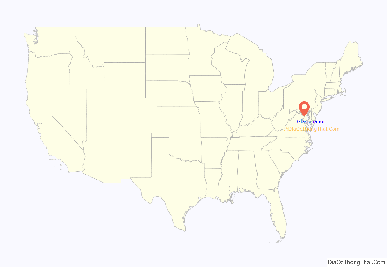
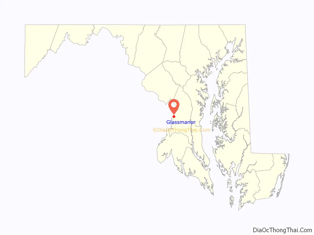
Glassmanor Road Map

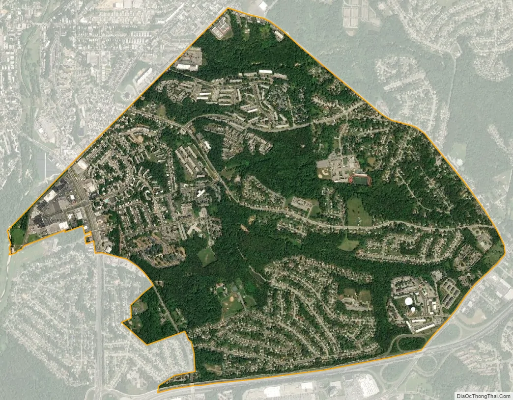
Glassmanor city Satellite Map
Geography
According to the U.S. Census Bureau, Glassmanor has a total area of 2.4 square miles (6.1 km), all land. The CDP is bordered by Washington, D.C. to the northwest, the town of Forest Heights to the west, Oxon Hill to the south, Temple Hills to the southeast, Marlow Heights to the east, and Hillcrest Heights to the northeast. Interstate 495/95, the Capital Beltway, forms the southern boundary of the Glassmanor CDP.
See also
Map of Maryland State and its subdivision: Map of other states:- Alabama
- Alaska
- Arizona
- Arkansas
- California
- Colorado
- Connecticut
- Delaware
- District of Columbia
- Florida
- Georgia
- Hawaii
- Idaho
- Illinois
- Indiana
- Iowa
- Kansas
- Kentucky
- Louisiana
- Maine
- Maryland
- Massachusetts
- Michigan
- Minnesota
- Mississippi
- Missouri
- Montana
- Nebraska
- Nevada
- New Hampshire
- New Jersey
- New Mexico
- New York
- North Carolina
- North Dakota
- Ohio
- Oklahoma
- Oregon
- Pennsylvania
- Rhode Island
- South Carolina
- South Dakota
- Tennessee
- Texas
- Utah
- Vermont
- Virginia
- Washington
- West Virginia
- Wisconsin
- Wyoming


