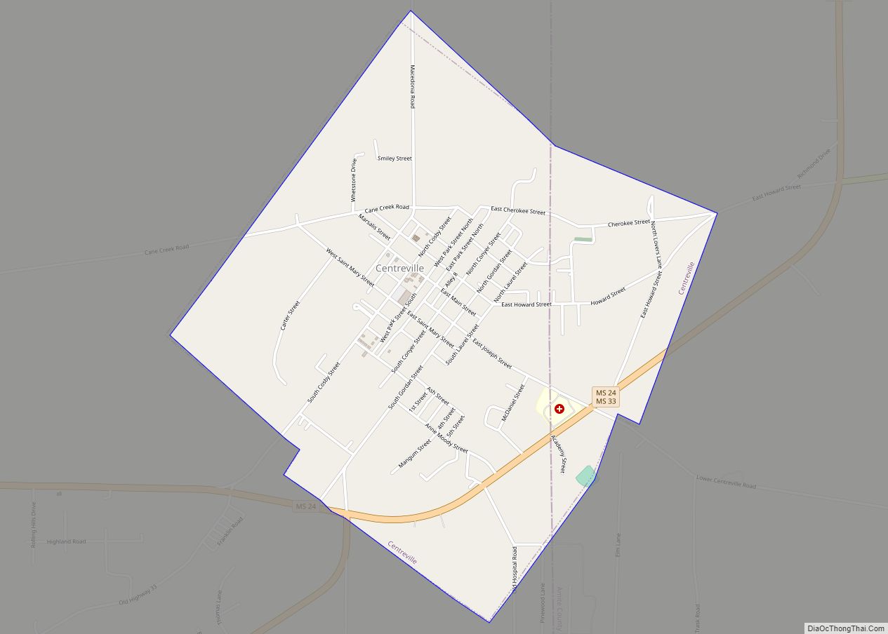
Centreville is a town in Amite and Wilkinson counties, Mississippi, United States. It is part of the McComb, Mississippi micropolitan statistical area. Its population was 1,258 in 2020.
Bethany Presbyterian Church is a historic church in Centreville, built in 1855, and added to the National Register of Historic Places in 2003.
The town was incorporated in 1880, and it was a small settlement in the years prior. In 1880, the Yazoo and Mississippi Valley R.R. ran along the border between Wilkinson and Amite counties. Because the station was approximately midway between Liberty and Woodville and about midway between Natchez and Baton Rouge, it was appropriately named Centreville.
| Name: | Centreville town |
|---|---|
| LSAD Code: | 43 |
| LSAD Description: | town (suffix) |
| State: | Mississippi |
| County: | Amite County, Wilkinson County |
| Elevation: | 384 ft (117 m) |
| Total Area: | 2.32 sq mi (6.00 km²) |
| Land Area: | 2.32 sq mi (6.00 km²) |
| Water Area: | 0.00 sq mi (0.00 km²) |
| Total Population: | 1,258 |
| Population Density: | 543.18/sq mi (209.72/km²) |
| ZIP code: | 39631 |
| Area code: | 601 |
| FIPS code: | 2812740 |
| GNISfeature ID: | 0668288 |
| Website: | townofcentrevillems.org |
Online Interactive Map
Click on ![]() to view map in "full screen" mode.
to view map in "full screen" mode.
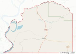
Centreville location map. Where is Centreville town?
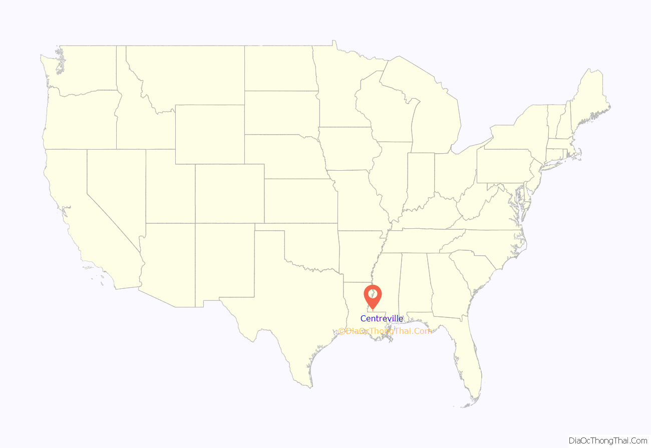
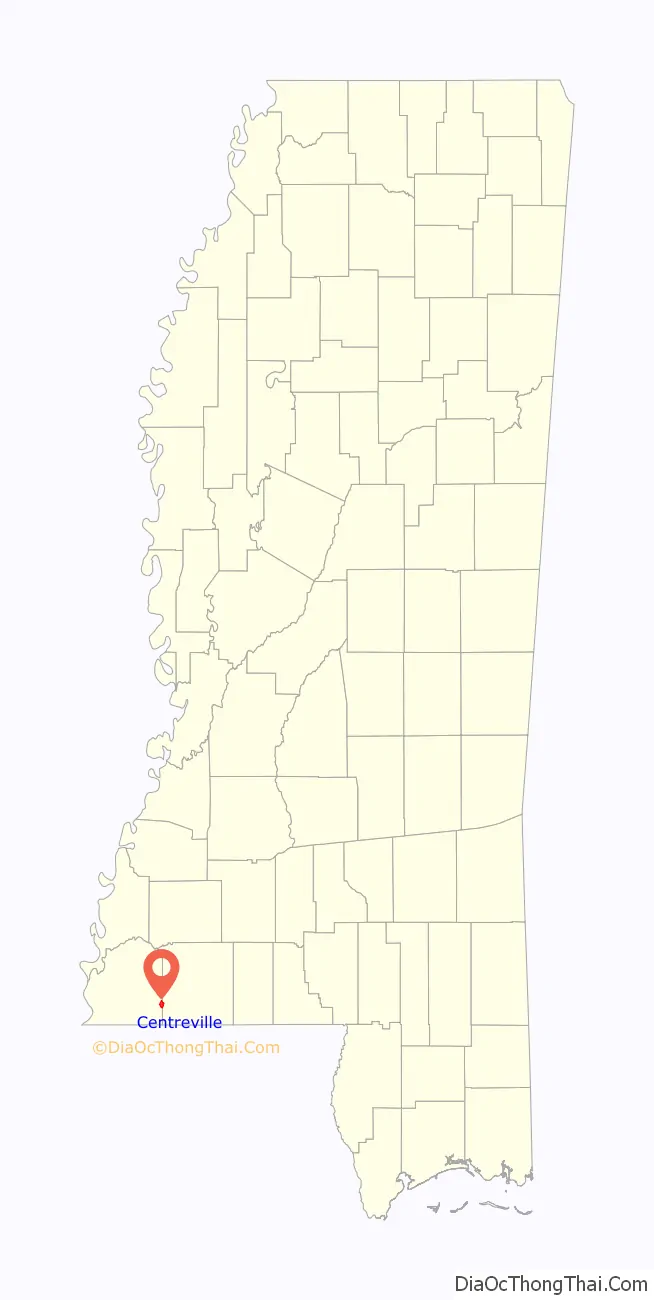
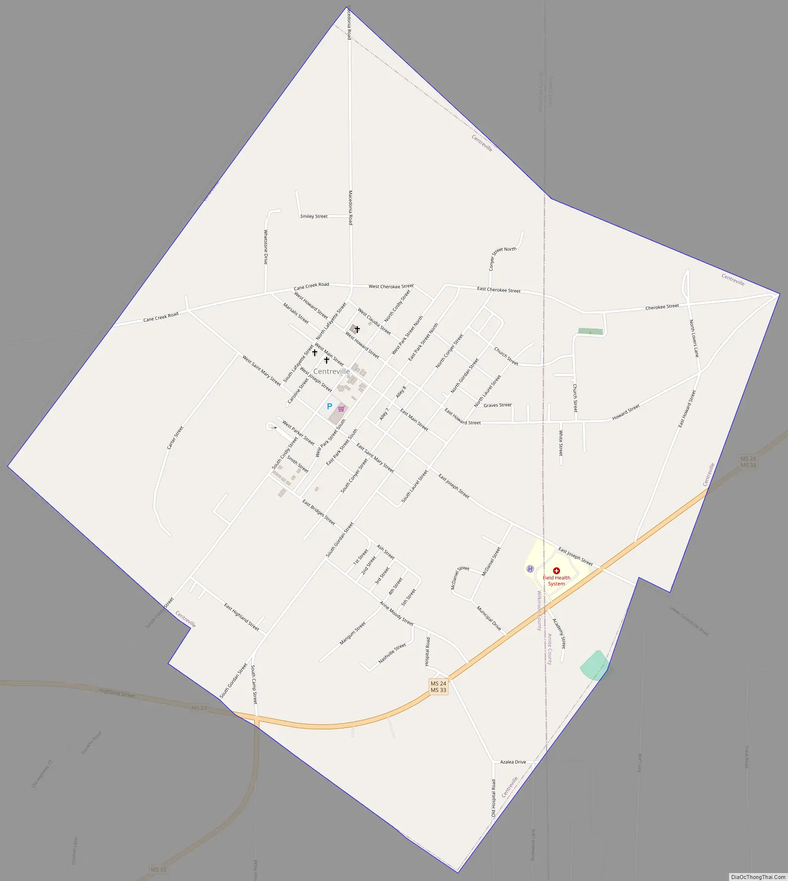
Centreville Road Map
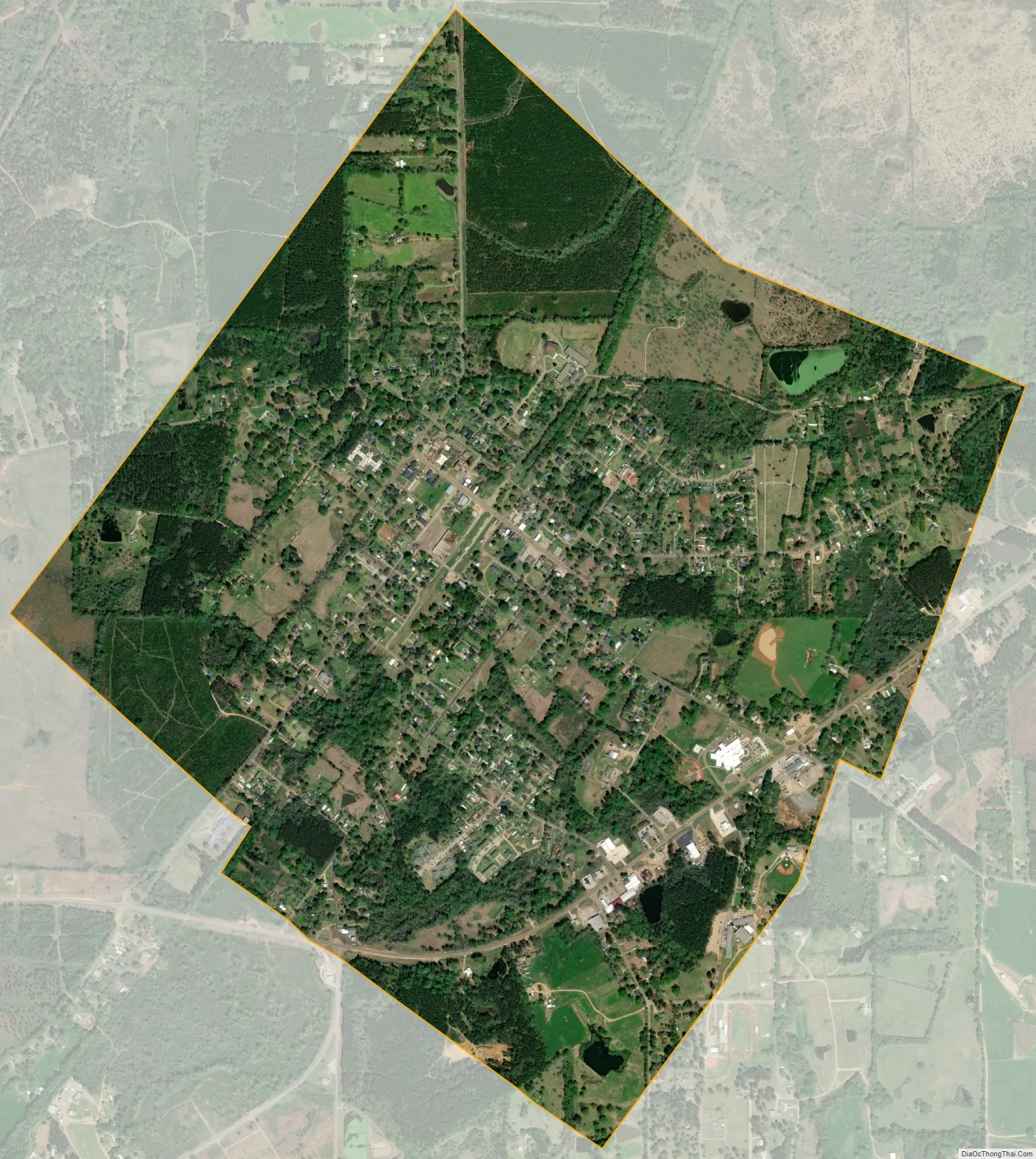
Centreville city Satellite Map
Geography
Centreville is located within Wilkinson County, with a portion in adjacent Amite County. In the 2000 census, 1,433 of the town’s 1,680 residents (85.3%) lived in Wilkinson County and 247 (14.7%) in Amite County.
According to the United States Census Bureau, the town has a total area of 2.3 square miles (6.0 km), all land.
See also
Map of Mississippi State and its subdivision:- Adams
- Alcorn
- Amite
- Attala
- Benton
- Bolivar
- Calhoun
- Carroll
- Chickasaw
- Choctaw
- Claiborne
- Clarke
- Clay
- Coahoma
- Copiah
- Covington
- Desoto
- Forrest
- Franklin
- George
- Greene
- Grenada
- Hancock
- Harrison
- Hinds
- Holmes
- Humphreys
- Issaquena
- Itawamba
- Jackson
- Jasper
- Jefferson
- Jefferson Davis
- Jones
- Kemper
- Lafayette
- Lamar
- Lauderdale
- Lawrence
- Leake
- Lee
- Leflore
- Lincoln
- Lowndes
- Madison
- Marion
- Marshall
- Monroe
- Montgomery
- Neshoba
- Newton
- Noxubee
- Oktibbeha
- Panola
- Pearl River
- Perry
- Pike
- Pontotoc
- Prentiss
- Quitman
- Rankin
- Scott
- Sharkey
- Simpson
- Smith
- Stone
- Sunflower
- Tallahatchie
- Tate
- Tippah
- Tishomingo
- Tunica
- Union
- Walthall
- Warren
- Washington
- Wayne
- Webster
- Wilkinson
- Winston
- Yalobusha
- Yazoo
- Alabama
- Alaska
- Arizona
- Arkansas
- California
- Colorado
- Connecticut
- Delaware
- District of Columbia
- Florida
- Georgia
- Hawaii
- Idaho
- Illinois
- Indiana
- Iowa
- Kansas
- Kentucky
- Louisiana
- Maine
- Maryland
- Massachusetts
- Michigan
- Minnesota
- Mississippi
- Missouri
- Montana
- Nebraska
- Nevada
- New Hampshire
- New Jersey
- New Mexico
- New York
- North Carolina
- North Dakota
- Ohio
- Oklahoma
- Oregon
- Pennsylvania
- Rhode Island
- South Carolina
- South Dakota
- Tennessee
- Texas
- Utah
- Vermont
- Virginia
- Washington
- West Virginia
- Wisconsin
- Wyoming