Woodville is one of the oldest towns in Mississippi and is the county seat of Wilkinson County, Mississippi, United States. Its population as of 2020 was 928.
| Name: | Woodville town |
|---|---|
| LSAD Code: | 43 |
| LSAD Description: | town (suffix) |
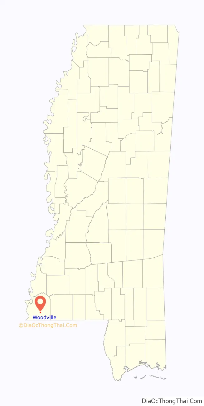
| State: | Mississippi |
| County: | Wilkinson County |
| Elevation: | 404 ft (123 m) |
| Total Area: | 1.04 sq mi (2.68 km²) |
| Land Area: | 1.04 sq mi (2.68 km²) |
| Water Area: | 0.00 sq mi (0.00 km²) |
| Total Population: | 928 |
| Population Density: | 895.75/sq mi (345.83/km²) |
| ZIP code: | 39669 |
| Area code: | 601 |
| FIPS code: | 2881120 |
| GNISfeature ID: | 0679870 |
| Website: | www.woodvillems.org |
Online Interactive Map
Click on ![]() to view map in "full screen" mode.
to view map in "full screen" mode.
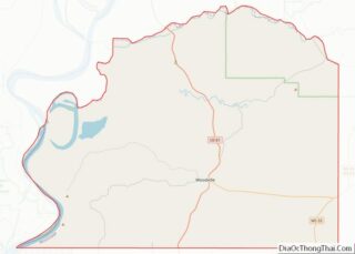
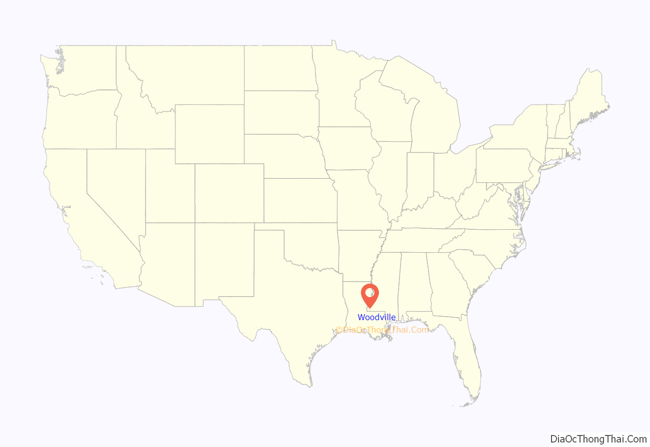
Woodville location map. Where is Woodville town?
History
This historic town, one of the oldest in Mississippi, is set among the rolling hills and pastures of Wilkinson County, just north of the Louisiana-Mississippi border in the southwest corner of the state. It was incorporated in 1811, after the Louisiana Purchase of 1803 and not long before Mississippi’s admission to the United States in 1817.
It was developed along the historic corridor between St. Francisville, Louisiana, 24 miles to the south and Natchez, Mississippi, 34 miles to the north. Since pre-colonial times, communities within this corridor have been linked, first by the Lower Natchez Trace, a footpath and portage developed by Native Americans and serving the east bank of the Mississippi River. In the 20th century, U.S. Highway 61, the “Blues Highway,” was later built along this route; it is considered the spine of blues music.
Painter John James Audubon visited Woodville during his sojourn in St. Francisville in the 1820s. Here he found more than 26 of the species which he documented and painted for his Birds of America series.
Numerous residents are descended from 18th-century settlers. Much of its significant architecture was built in the 19th century when cotton was the chief commodity crop and generating great profits for major planters. The community has organized the Woodville Main Street Association; the Wilkinson County – Woodville Public Library; and the Wilkinson County Museum and the African-American Museum, both restored and owned by the Woodville Civic Club.
Among the Main Street Association’s initiatives are the Woodville Hospitality Station, providing tourist information and a rest stop to travelers on Highway 61, near the town boundary. The annual Deer and Wildlife Festival is staged each October on and around the Courthouse Square. The Civic Club has published three volumes of The Journal of Wilkinson County. A fourth book is in the works.
A public school system (Wilkinson County School District) and a private alternative, the Wilkinson County Christian Academy (WCCA), offer co-educational grades K through 12. The town has a medical clinic and churches with active Catholic, Episcopal, Methodist, Baptist, and Presbyterian congregations.
Woodville was developed based on two commodities: cotton and timber. The first was most important during the antebellum period. Planters developed numerous Wilkinson County cotton plantations, based on the intensive labor of enslaved Africans, with many relocated to the region from the Upper South.
Merchants served the planters’ families and freedmen after the Civil War. To get cotton to market, planters supported construction of the West Feliciana Railroad, the oldest standard-gauge system in the country, which once extended from Woodville to Bayou Sara, on the Mississippi River just south of St. Francisville. The West Feliciana Railroad had a terminus on Depot Street, where the railroad’s office was located.
The planter community thrived from the 1830s until the Civil War. It began to recover in the late 19th century, as the labor system settled into most freedmen working as sharecroppers or tenant farmers. Cotton continued to be important until 1920, by which time the boll weevil had decimated the cotton crop. In that second period of prosperity, the town was called “Little Jerusalem.” Sephardic Jewish businessmen came for economic opportunities and made significant contributions to the town’s built environment and culture. Most of them later moved away. Woodville’s synagogue burned in the 1930s, but its Jewish cemetery remains.
Woodville’s timber industry continues. Many residents are third and fourth generation. The town has 19th-century buildings in various classic styles and outdoor recreation opportunities including hunting and fishing. Exploratory oil and gas drilling is taking place in the county.
The town is home to the oldest continuously operating newspaper in Mississippi, the Woodville Republican, founded by W. A. Chisholm in 1821. It is published weekly by a great-grandson of John S. Lewis. who settled here in 1810. His family acquired the paper in 1878. The grocery store is Treppendahl’s Super Foods, operated by a great-grandson of the first owner. The Treppendahls are now sixth-generation Woodvillians.
Woodville’s town plan is centered on a courthouse square planted with ancient oaks. The turn-of-the-20th century Beaux Arts-style courthouse has a spire. More than 100 buildings contribute to Woodville’s National Register Historic District: they include structures from the first quarter of the 19th century, with examples of Federal, Eastlake, Arts and Crafts, Greek Revival, Beaux Arts, and Neo-classical architecture. Fronting Courthouse Square are the monumental office and banking house of the West Feliciana Railroad (c. 1834).
The former railroad office now serves as the Wilkinson County Museum. The classic Federal-style former Branch Banking House of the State of Mississippi (c. 1819), the state’s oldest existing bank building, has been adapted to serve as the African-American Museum.
Notable domestic architecture includes the Neo-classical Lewis house (c. 1832) at 458 Church St., the monumental Feltus-Catchings House (c. 1820) at the southwest corner of First South and Depot, the Greek Revival Carnot Posey House (c. 1845) at 432 Church St., and the John William Goddard house at 940 Main Street.
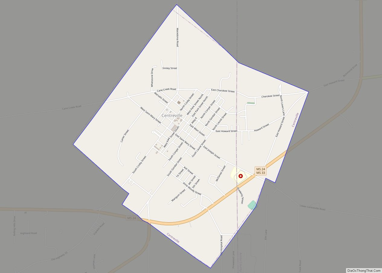
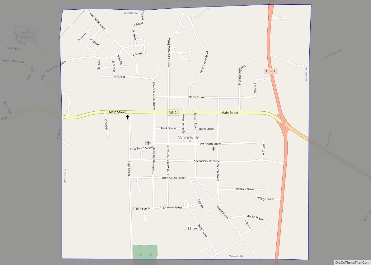
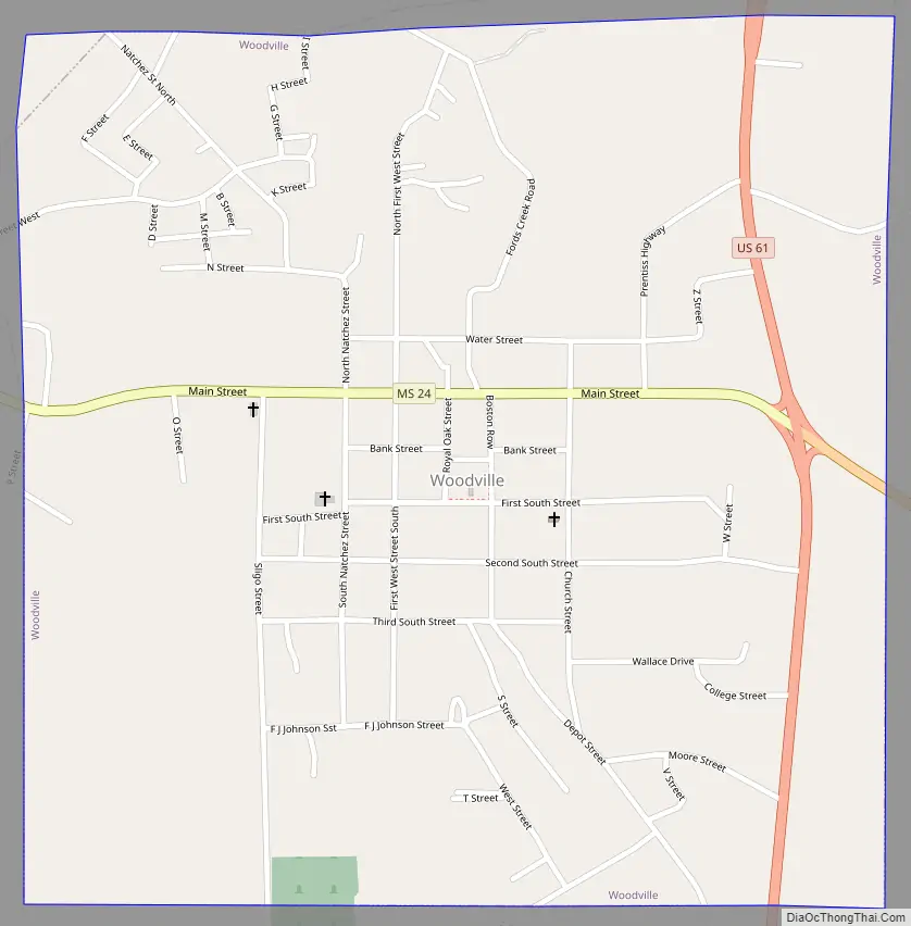
Woodville Road Map
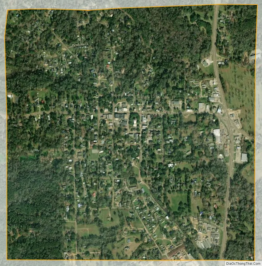
Woodville city Satellite Map
Geography
According to the United States Census Bureau, the town has a total area of 1.1 square miles (2.8 km), all land.
See also
Map of Mississippi State and its subdivision:- Adams
- Alcorn
- Amite
- Attala
- Benton
- Bolivar
- Calhoun
- Carroll
- Chickasaw
- Choctaw
- Claiborne
- Clarke
- Clay
- Coahoma
- Copiah
- Covington
- Desoto
- Forrest
- Franklin
- George
- Greene
- Grenada
- Hancock
- Harrison
- Hinds
- Holmes
- Humphreys
- Issaquena
- Itawamba
- Jackson
- Jasper
- Jefferson
- Jefferson Davis
- Jones
- Kemper
- Lafayette
- Lamar
- Lauderdale
- Lawrence
- Leake
- Lee
- Leflore
- Lincoln
- Lowndes
- Madison
- Marion
- Marshall
- Monroe
- Montgomery
- Neshoba
- Newton
- Noxubee
- Oktibbeha
- Panola
- Pearl River
- Perry
- Pike
- Pontotoc
- Prentiss
- Quitman
- Rankin
- Scott
- Sharkey
- Simpson
- Smith
- Stone
- Sunflower
- Tallahatchie
- Tate
- Tippah
- Tishomingo
- Tunica
- Union
- Walthall
- Warren
- Washington
- Wayne
- Webster
- Wilkinson
- Winston
- Yalobusha
- Yazoo
- Alabama
- Alaska
- Arizona
- Arkansas
- California
- Colorado
- Connecticut
- Delaware
- District of Columbia
- Florida
- Georgia
- Hawaii
- Idaho
- Illinois
- Indiana
- Iowa
- Kansas
- Kentucky
- Louisiana
- Maine
- Maryland
- Massachusetts
- Michigan
- Minnesota
- Mississippi
- Missouri
- Montana
- Nebraska
- Nevada
- New Hampshire
- New Jersey
- New Mexico
- New York
- North Carolina
- North Dakota
- Ohio
- Oklahoma
- Oregon
- Pennsylvania
- Rhode Island
- South Carolina
- South Dakota
- Tennessee
- Texas
- Utah
- Vermont
- Virginia
- Washington
- West Virginia
- Wisconsin
- Wyoming