Heidelberg is a town in Jasper County, Mississippi, United States. The population was 718 at the 2010 census, down from 840 at the 2000 census.
| Name: | Heidelberg town |
|---|---|
| LSAD Code: | 43 |
| LSAD Description: | town (suffix) |
| State: | Mississippi |
| County: | Jasper County |
| Elevation: | 344 ft (105 m) |
| Total Area: | 5.13 sq mi (13.29 km²) |
| Land Area: | 5.11 sq mi (13.24 km²) |
| Water Area: | 0.02 sq mi (0.05 km²) |
| Total Population: | 637 |
| Population Density: | 124.58/sq mi (48.10/km²) |
| ZIP code: | 39439 |
| Area code: | 601 |
| FIPS code: | 2831420 |
| GNISfeature ID: | 0671086 |
| Website: | townofheidelberg.com |
Online Interactive Map
Click on ![]() to view map in "full screen" mode.
to view map in "full screen" mode.
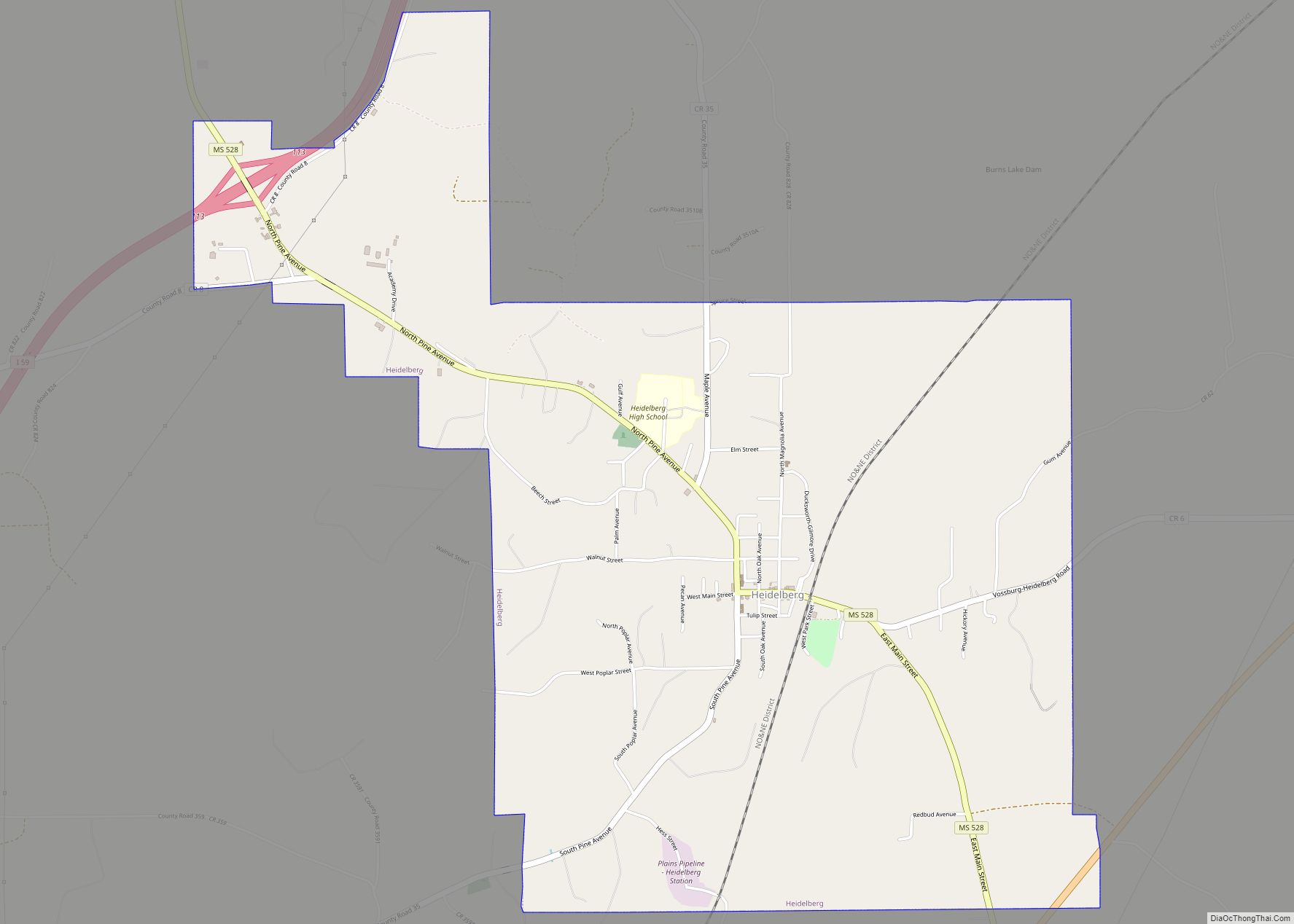
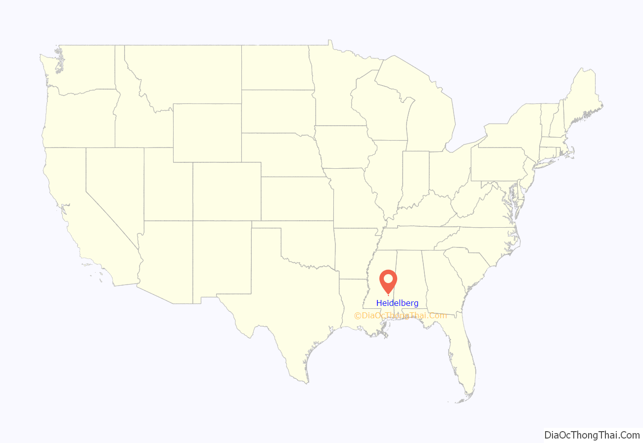
Heidelberg location map. Where is Heidelberg town?
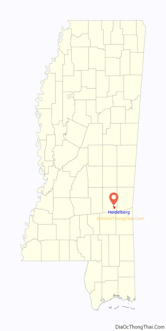
Heidelberg Road Map
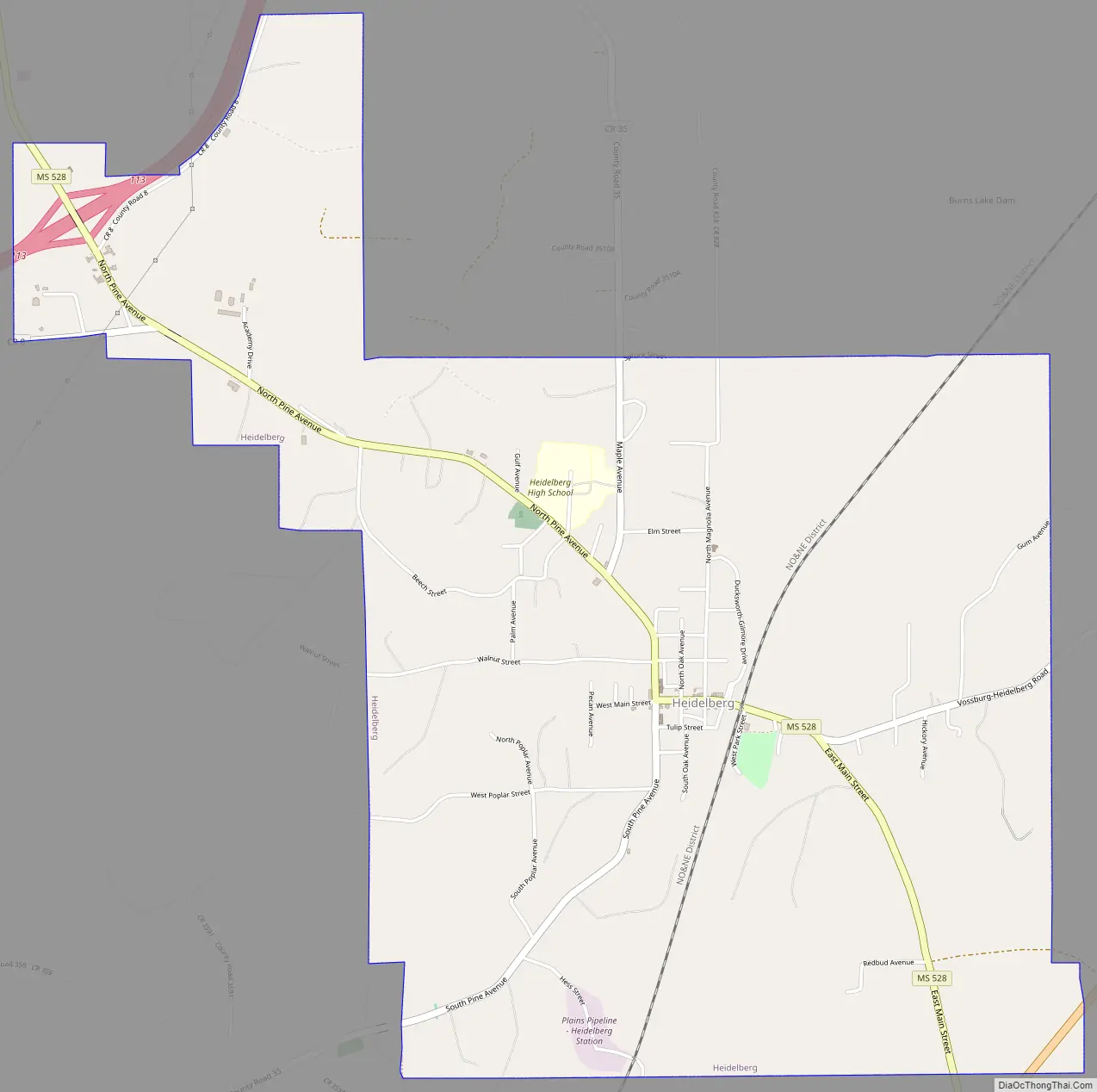
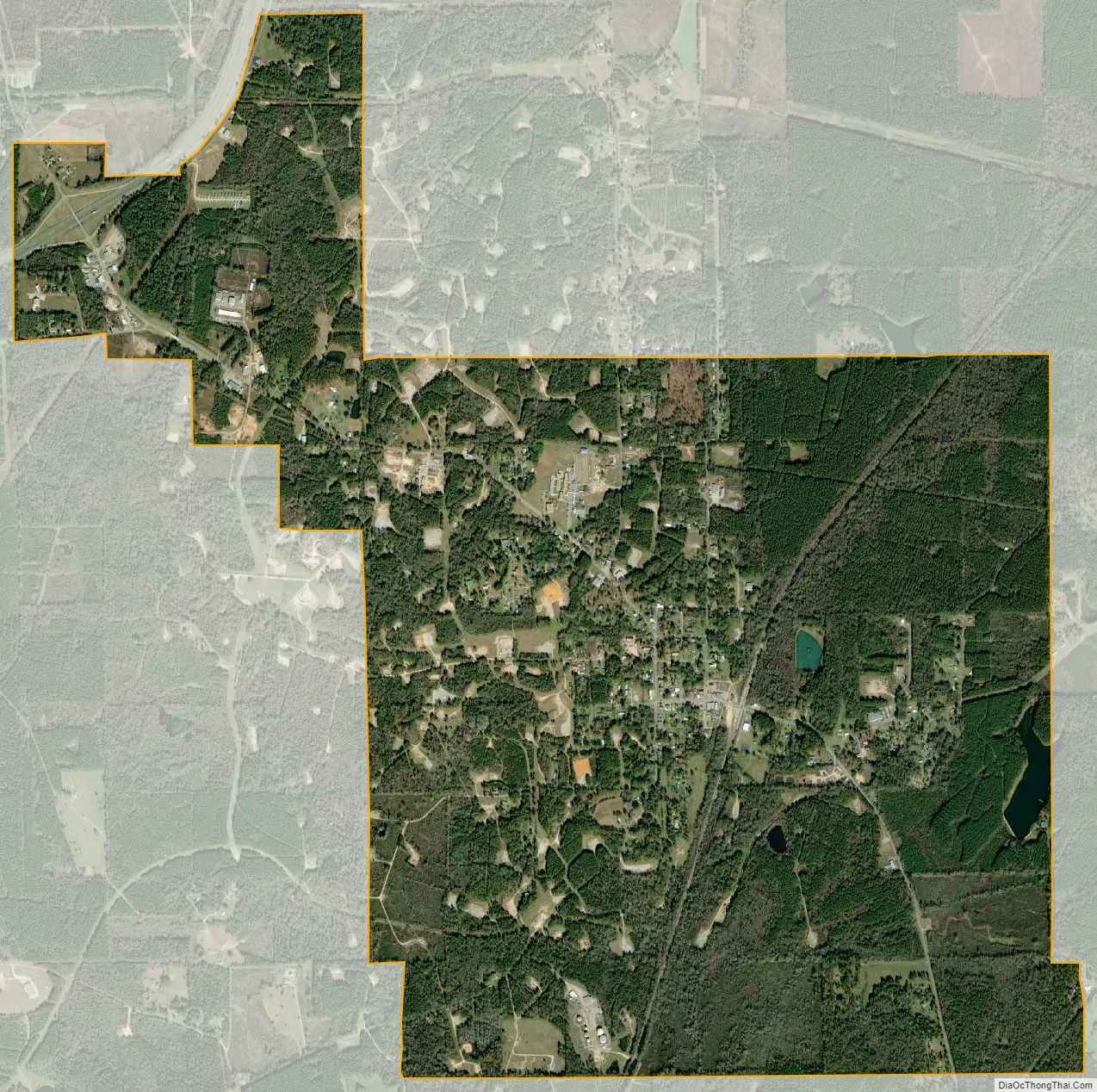
Heidelberg city Satellite Map
Geography
Heidelberg is located in southeastern Jasper County at 31°53′28″N 88°59′27″W / 31.89111°N 88.99083°W / 31.89111; -88.99083 (31.891249, -88.990952). The town limits extend northwest to encompass Exit 113 on Interstate 59. U.S. Route 11, running parallel to I-59, crosses the southeastern corner of the town. Both highways lead northeast 40 miles (64 km) to Meridian and southwest 16 miles (26 km) to Laurel.
According to the United States Census Bureau, Heidelberg has a total area of 5.1 square miles (13.3 km), of which 0.02 square miles (0.05 km), or 0.38%, are water. Beaver Creek, a tributary of Bogue Homo, runs through the town. Via Bogue Homo, the town is part of the Leaf River and thence the Pascagoula River watershed.
The area around Heidelberg has abundant natural resources, including nearby oil and gas reserves. Jasper County is the highest producer of oil in Mississippi.
See also
Map of Mississippi State and its subdivision:- Adams
- Alcorn
- Amite
- Attala
- Benton
- Bolivar
- Calhoun
- Carroll
- Chickasaw
- Choctaw
- Claiborne
- Clarke
- Clay
- Coahoma
- Copiah
- Covington
- Desoto
- Forrest
- Franklin
- George
- Greene
- Grenada
- Hancock
- Harrison
- Hinds
- Holmes
- Humphreys
- Issaquena
- Itawamba
- Jackson
- Jasper
- Jefferson
- Jefferson Davis
- Jones
- Kemper
- Lafayette
- Lamar
- Lauderdale
- Lawrence
- Leake
- Lee
- Leflore
- Lincoln
- Lowndes
- Madison
- Marion
- Marshall
- Monroe
- Montgomery
- Neshoba
- Newton
- Noxubee
- Oktibbeha
- Panola
- Pearl River
- Perry
- Pike
- Pontotoc
- Prentiss
- Quitman
- Rankin
- Scott
- Sharkey
- Simpson
- Smith
- Stone
- Sunflower
- Tallahatchie
- Tate
- Tippah
- Tishomingo
- Tunica
- Union
- Walthall
- Warren
- Washington
- Wayne
- Webster
- Wilkinson
- Winston
- Yalobusha
- Yazoo
- Alabama
- Alaska
- Arizona
- Arkansas
- California
- Colorado
- Connecticut
- Delaware
- District of Columbia
- Florida
- Georgia
- Hawaii
- Idaho
- Illinois
- Indiana
- Iowa
- Kansas
- Kentucky
- Louisiana
- Maine
- Maryland
- Massachusetts
- Michigan
- Minnesota
- Mississippi
- Missouri
- Montana
- Nebraska
- Nevada
- New Hampshire
- New Jersey
- New Mexico
- New York
- North Carolina
- North Dakota
- Ohio
- Oklahoma
- Oregon
- Pennsylvania
- Rhode Island
- South Carolina
- South Dakota
- Tennessee
- Texas
- Utah
- Vermont
- Virginia
- Washington
- West Virginia
- Wisconsin
- Wyoming