McLain is a town in Greene County, Mississippi, United States. The population was 441 at the 2010 census, down from 603 at the 2000 census.
| Name: | McLain town |
|---|---|
| LSAD Code: | 43 |
| LSAD Description: | town (suffix) |
| State: | Mississippi |
| County: | Greene County |
| Elevation: | 72 ft (22 m) |
| Total Area: | 3.45 sq mi (8.95 km²) |
| Land Area: | 3.39 sq mi (8.78 km²) |
| Water Area: | 0.06 sq mi (0.16 km²) |
| Total Population: | 313 |
| Population Density: | 92.30/sq mi (35.63/km²) |
| ZIP code: | 39456 |
| Area code: | 601 |
| FIPS code: | 2843840 |
| GNISfeature ID: | 0693928 |
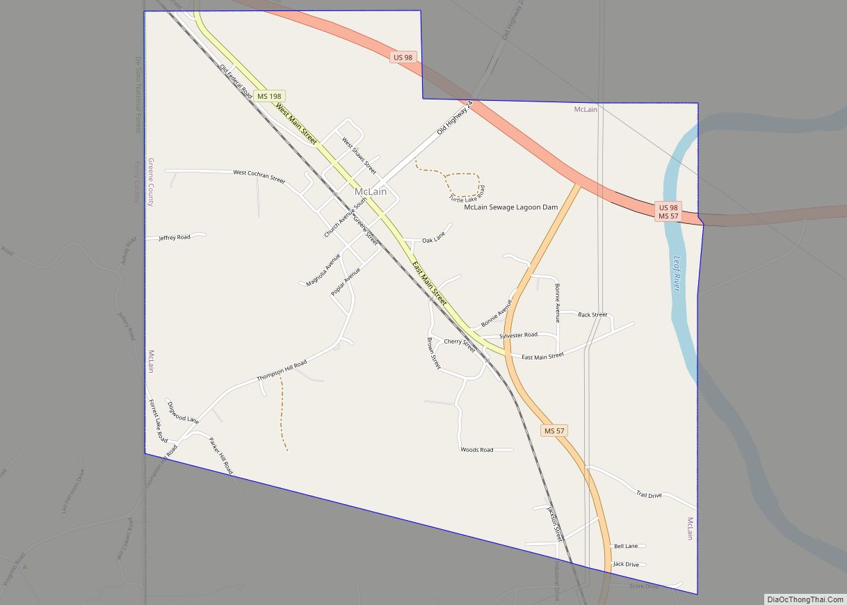
Online Interactive Map
Click on ![]() to view map in "full screen" mode.
to view map in "full screen" mode.
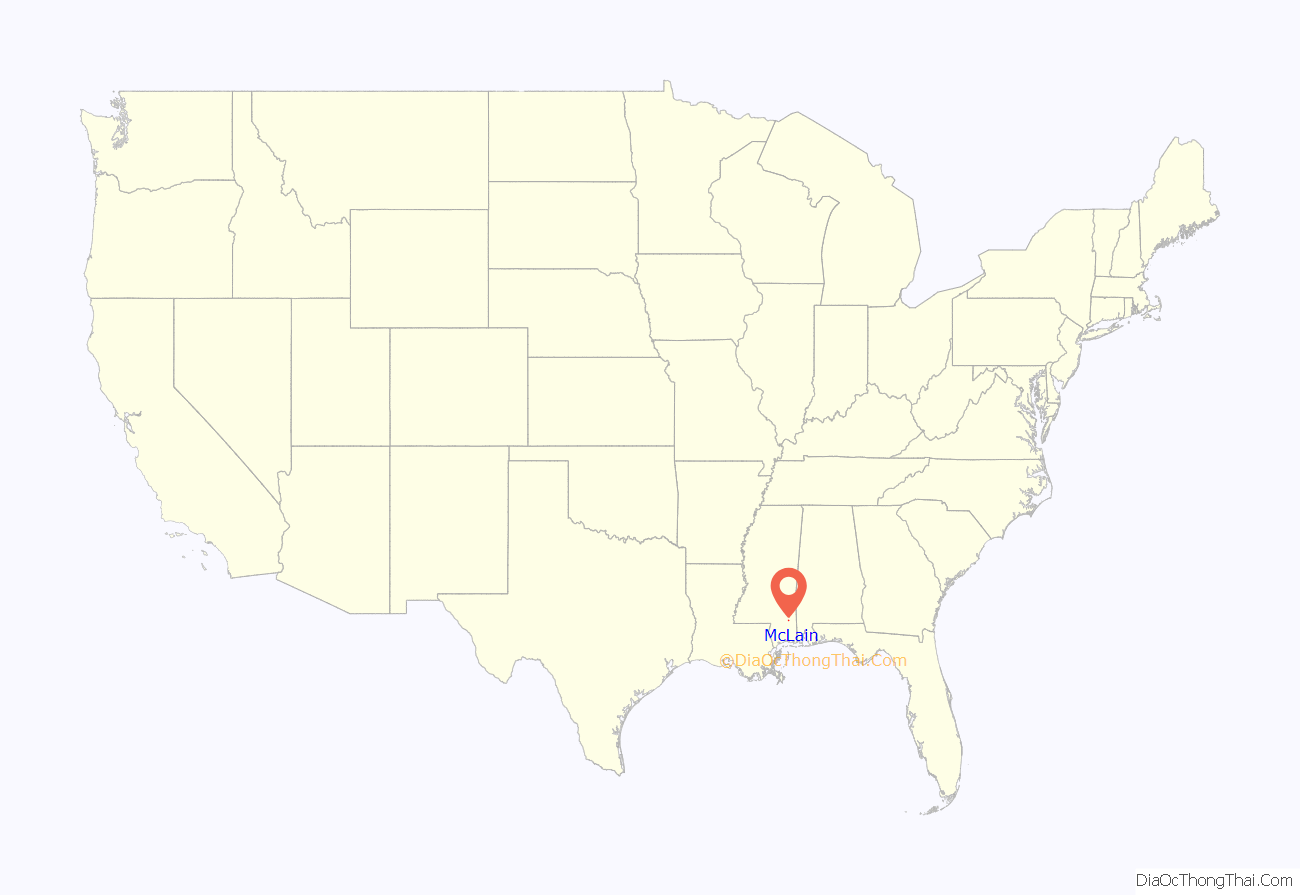
McLain location map. Where is McLain town?

History
Natural disasters
In early spring 2016, McLain had major flooding which closed many roads and the school. On March 30, 2022, an EF2 tornado struck the town, causing considerable damage.
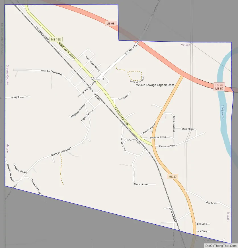
McLain Road Map
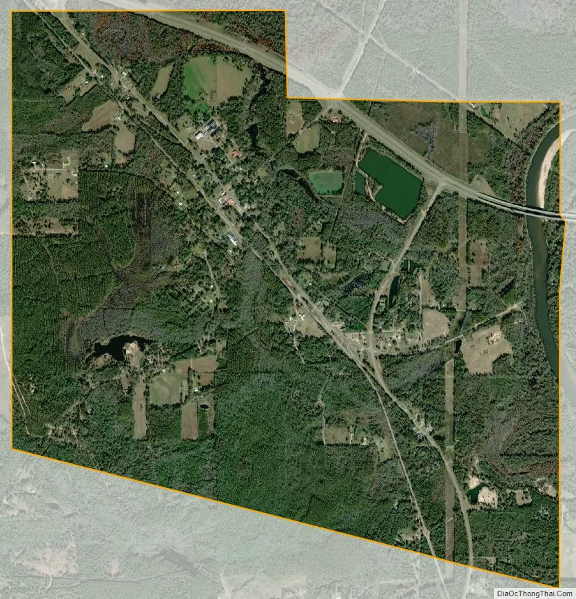
McLain city Satellite Map
Geography
McLain is located in southwestern Greene County; the western border of the town follows the Perry County line. The town is on the western side of the valley of the Leaf River, a south-flowing tributary of the Pascagoula River.
U.S. Route 98 passes through the northern part of the town; the four-lane highway leads northwest 33 miles (53 km) to Hattiesburg and southeast 60 miles (97 km) to Mobile, Alabama. Mississippi Highway 57 passes through the east side of McLain, leading south 54 miles (87 km) to U.S. Route 90 near Gautier and east 17 miles (27 km) to Leakesville, the Greene County seat.
According to the United States Census Bureau, McLain has a total area of 3.4 square miles (8.9 km), of which 3.4 square miles (8.8 km) is land and 0.077 square miles (0.2 km), or 1.82%, is water, consisting largely of the Leaf River, which flows along part of the eastern edge of the town.
Climate
The climate in this area is characterized by relatively high temperatures and evenly distributed precipitation throughout the year. According to the Köppen Climate Classification system, McLain has a Humid subtropical climate, abbreviated “Cfa” on climate maps.
See also
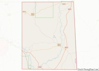
Map of Mississippi State and its subdivision:- Adams
- Alcorn
- Amite
- Attala
- Benton
- Bolivar
- Calhoun
- Carroll
- Chickasaw
- Choctaw
- Claiborne
- Clarke
- Clay
- Coahoma
- Copiah
- Covington
- Desoto
- Forrest
- Franklin
- George
- Greene
- Grenada
- Hancock
- Harrison
- Hinds
- Holmes
- Humphreys
- Issaquena
- Itawamba
- Jackson
- Jasper
- Jefferson
- Jefferson Davis
- Jones
- Kemper
- Lafayette
- Lamar
- Lauderdale
- Lawrence
- Leake
- Lee
- Leflore
- Lincoln
- Lowndes
- Madison
- Marion
- Marshall
- Monroe
- Montgomery
- Neshoba
- Newton
- Noxubee
- Oktibbeha
- Panola
- Pearl River
- Perry
- Pike
- Pontotoc
- Prentiss
- Quitman
- Rankin
- Scott
- Sharkey
- Simpson
- Smith
- Stone
- Sunflower
- Tallahatchie
- Tate
- Tippah
- Tishomingo
- Tunica
- Union
- Walthall
- Warren
- Washington
- Wayne
- Webster
- Wilkinson
- Winston
- Yalobusha
- Yazoo
- Alabama
- Alaska
- Arizona
- Arkansas
- California
- Colorado
- Connecticut
- Delaware
- District of Columbia
- Florida
- Georgia
- Hawaii
- Idaho
- Illinois
- Indiana
- Iowa
- Kansas
- Kentucky
- Louisiana
- Maine
- Maryland
- Massachusetts
- Michigan
- Minnesota
- Mississippi
- Missouri
- Montana
- Nebraska
- Nevada
- New Hampshire
- New Jersey
- New Mexico
- New York
- North Carolina
- North Dakota
- Ohio
- Oklahoma
- Oregon
- Pennsylvania
- Rhode Island
- South Carolina
- South Dakota
- Tennessee
- Texas
- Utah
- Vermont
- Virginia
- Washington
- West Virginia
- Wisconsin
- Wyoming