Terry is a town in Hinds County, Mississippi, United States. The population was 1,063 at the 2010 census, up from 664 at the 2000 census. It is located along Interstate 55, about 15 miles (24 km) southwest of Jackson and located in Supervisors District Five of Hinds County. The town is part of the Jackson Metropolitan Statistical Area.
| Name: | Terry town |
|---|---|
| LSAD Code: | 43 |
| LSAD Description: | town (suffix) |
| State: | Mississippi |
| County: | Hinds County |
| Elevation: | 292 ft (89 m) |
| Total Area: | 3.83 sq mi (9.93 km²) |
| Land Area: | 3.81 sq mi (9.88 km²) |
| Water Area: | 0.02 sq mi (0.05 km²) |
| Total Population: | 1,304 |
| Population Density: | 341.99/sq mi (132.03/km²) |
| ZIP code: | 39170 |
| Area code: | 601 |
| FIPS code: | 2872680 |
| GNISfeature ID: | 0678644 |
| Website: | terryms.org |
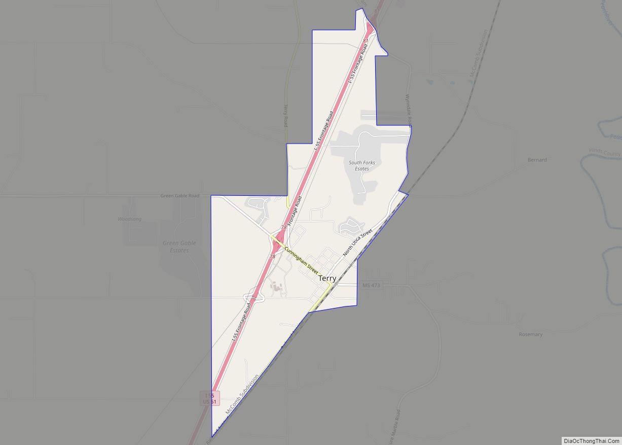
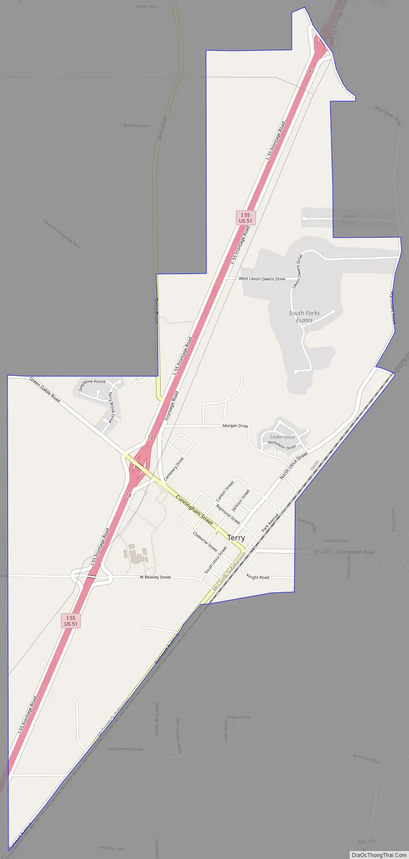
Online Interactive Map
Click on ![]() to view map in "full screen" mode.
to view map in "full screen" mode.
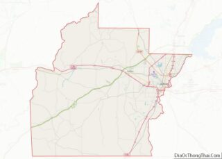
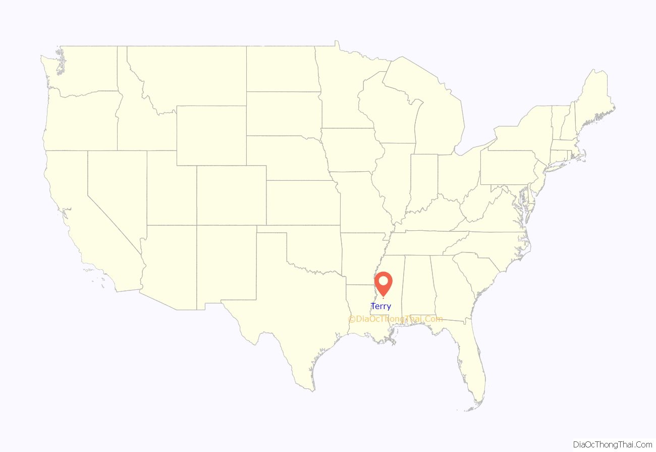
Terry location map. Where is Terry town?
History
The town of Terry, originally known as Dry Grove, changed its name in honor of W. D. Terry, whose land the town was built on. This information comes from the bronze plaque in the town’s center at Utica and Cunningham streets. The area was established in 1811 by settlers from Virginia. In 1867, the town of Terry was established as a depot when the railroad was built through the area.
For a number of years, Terry was the home of Mississippi governor Albert G. Brown.
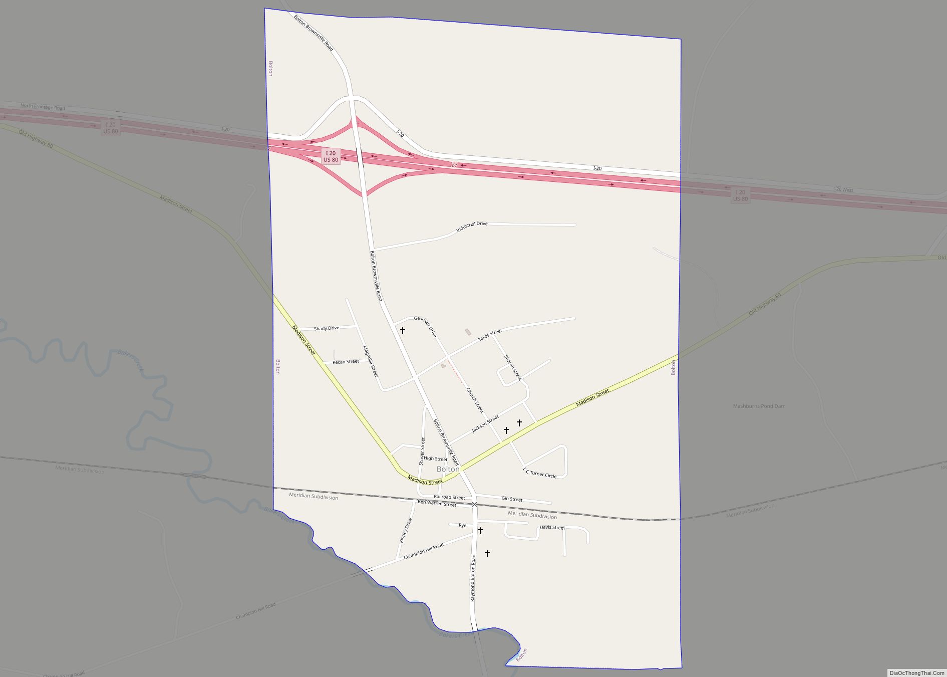
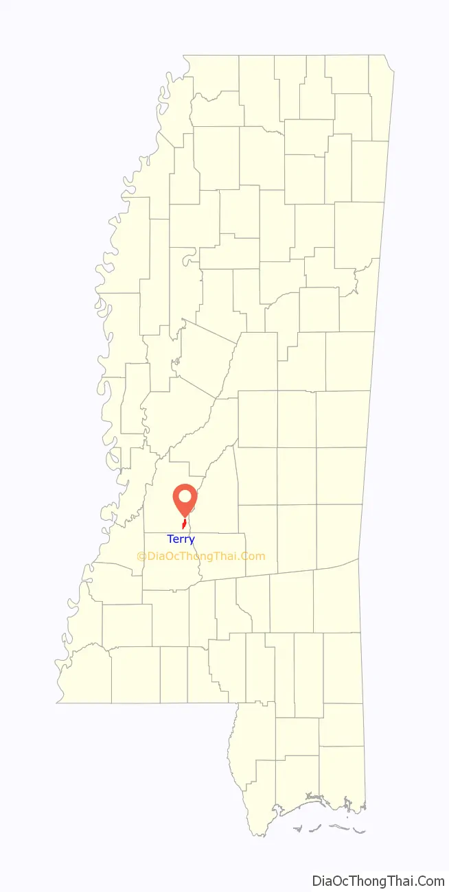
Terry Road Map
Terry city Satellite Map

Geography
Terry is in southeastern Hinds County and is bordered to the north by the city of Byram. Interstate 55 passes through the west side of the town, with access from Exit 78. I-55 leads north 16 miles (26 km) to Jackson and south 9 miles (14 km) to Crystal Springs.
According to the United States Census Bureau, the town of Terry has a total area of 3.8 square miles (9.9 km), of which 0.02 square miles (0.05 km), or 0.50%, are water. The town is drained to the east by Rhodes Creek and Vaughn Creek, tributaries of the Pearl River.
See also
Map of Mississippi State and its subdivision:- Adams
- Alcorn
- Amite
- Attala
- Benton
- Bolivar
- Calhoun
- Carroll
- Chickasaw
- Choctaw
- Claiborne
- Clarke
- Clay
- Coahoma
- Copiah
- Covington
- Desoto
- Forrest
- Franklin
- George
- Greene
- Grenada
- Hancock
- Harrison
- Hinds
- Holmes
- Humphreys
- Issaquena
- Itawamba
- Jackson
- Jasper
- Jefferson
- Jefferson Davis
- Jones
- Kemper
- Lafayette
- Lamar
- Lauderdale
- Lawrence
- Leake
- Lee
- Leflore
- Lincoln
- Lowndes
- Madison
- Marion
- Marshall
- Monroe
- Montgomery
- Neshoba
- Newton
- Noxubee
- Oktibbeha
- Panola
- Pearl River
- Perry
- Pike
- Pontotoc
- Prentiss
- Quitman
- Rankin
- Scott
- Sharkey
- Simpson
- Smith
- Stone
- Sunflower
- Tallahatchie
- Tate
- Tippah
- Tishomingo
- Tunica
- Union
- Walthall
- Warren
- Washington
- Wayne
- Webster
- Wilkinson
- Winston
- Yalobusha
- Yazoo
- Alabama
- Alaska
- Arizona
- Arkansas
- California
- Colorado
- Connecticut
- Delaware
- District of Columbia
- Florida
- Georgia
- Hawaii
- Idaho
- Illinois
- Indiana
- Iowa
- Kansas
- Kentucky
- Louisiana
- Maine
- Maryland
- Massachusetts
- Michigan
- Minnesota
- Mississippi
- Missouri
- Montana
- Nebraska
- Nevada
- New Hampshire
- New Jersey
- New Mexico
- New York
- North Carolina
- North Dakota
- Ohio
- Oklahoma
- Oregon
- Pennsylvania
- Rhode Island
- South Carolina
- South Dakota
- Tennessee
- Texas
- Utah
- Vermont
- Virginia
- Washington
- West Virginia
- Wisconsin
- Wyoming