Tutwiler is a town in Tallahatchie County, Mississippi, United States. The population at the 2010 census was 3,550.
| Name: | Tutwiler town |
|---|---|
| LSAD Code: | 43 |
| LSAD Description: | town (suffix) |
| State: | Mississippi |
| County: | Tallahatchie County |
| Elevation: | 154 ft (47 m) |
| Total Area: | 2.77 sq mi (7.17 km²) |
| Land Area: | 2.77 sq mi (7.17 km²) |
| Water Area: | 0.00 sq mi (0.00 km²) |
| Total Population: | 2,476 |
| Population Density: | 894.19/sq mi (345.28/km²) |
| ZIP code: | 38963 |
| Area code: | 662 |
| FIPS code: | 2875040 |
| GNISfeature ID: | 0678994 |
| Website: | tutwilerms.com |
Online Interactive Map
Click on ![]() to view map in "full screen" mode.
to view map in "full screen" mode.
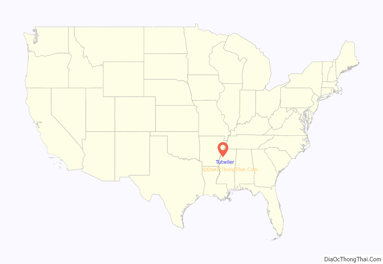
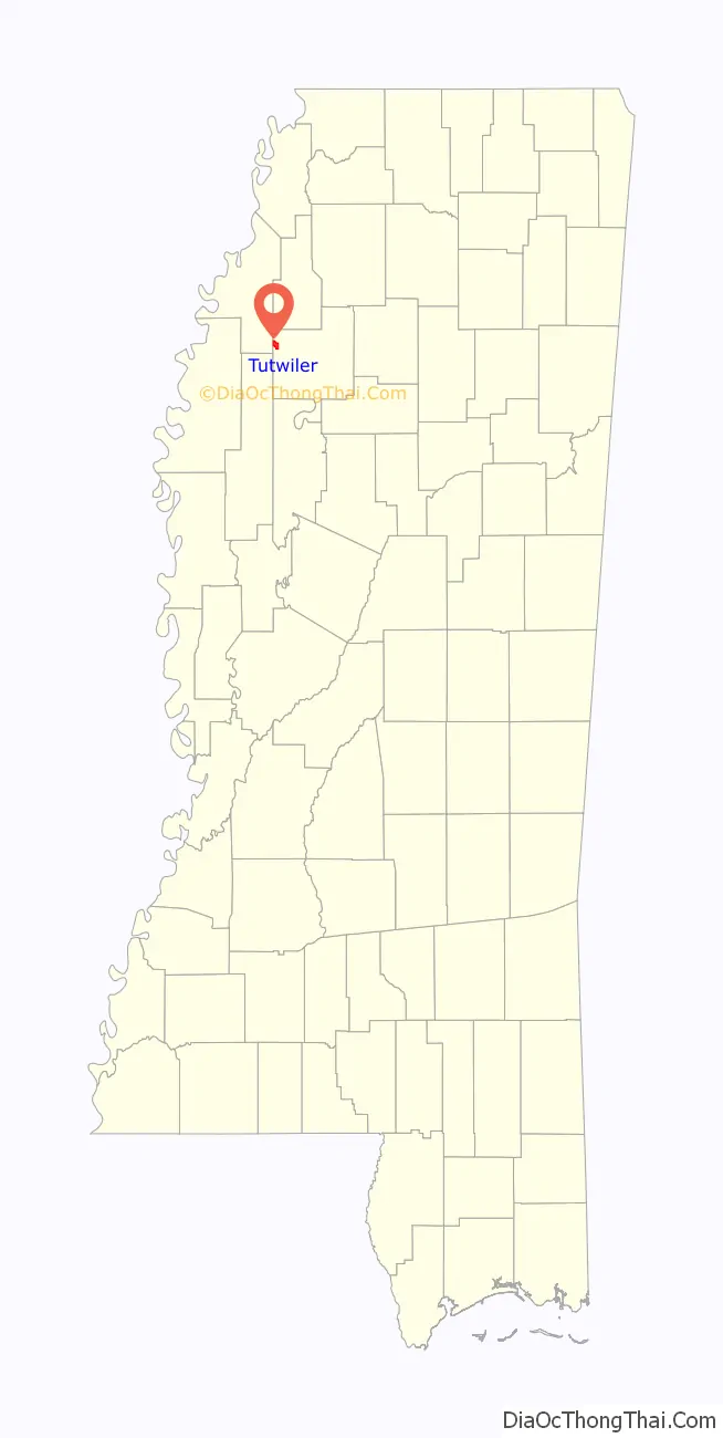
Tutwiler location map. Where is Tutwiler town?
History
In 1899, Tom Tutwiler, a civil engineer for a local railroad, made his headquarters seven miles northwest of Sumner. The town of Tutwiler was founded and named for him. When the railroad was built, the first depot erected was a two-story building. The railroad gave the town use of the top floor as a public school. Captain H.B. Fitch built and operated the first store in town. His wife took charge of the school, which began with five pupils.
In 1900, a Black mob murdered a Black man remembered as “Dago Pete.” He was suspected of attacking local women.
In 1905, the town was incorporated, and W.E. Fite elected Mayor. J.O. Clay was the station depot agent. In 1900, the Illinois Central Railroad, running from Yazoo City to Lambert, crossed at Tutwiler, where the company built a railroad yard.
In 1928, a high school was built at a cost of $40,000. The town grew rapidly until 1929 when the railroad yard was moved to Clarksdale. At that time businesses and finally the population began to decline. The population in 1929 before the railroad yard was moved was 1,010 people.
Like many other towns in the Mississippi Delta, Tutwiler stakes a claim to being the “birthplace of the blues”. This is the site where W. C. Handy reportedly “discovered” the blues in 1903, on a train platform in the town. Handy had heard something akin to the blues as early as 1892, but it was while waiting for an overdue train to Memphis that he heard an itinerant bluesman (legend says it was a local field hand named Henry Sloan). The man was playing slide guitar and singing about “goin’ where the Southern cross the Dog”, referring to the junction of the Southern Railway and Yazoo and Mississippi Valley Railroad farther south. (The Y&D railroad was locally called the “Yellow Dog”). Handy called it “the weirdest music I had ever heard”. A Mississippi Blues Trail marker honoring Handy was erected at the site on November 25, 2009. The historic marker was paid for by Robert Plant and Robert attended the dedication and gave a speech about the Blues and how he was influenced by Sonny Boy Williamson II. Robert Plant said “The first record my mom bought me was by Sonny Boy, I played it until there were no more groves on the record”. Sonny Boy’s resting place is just at the edge of the Tutwiler City limits. Robert and Jimmy Page visit Tutwiler often, it is a wonderful place to connect to the music that changed my life and musical direction, a magic place. Tutwiler was also the childhood home of bluesmen John Lee Hooker and Frank Stokes.
Handy and his family lived there for six years. In 1903, while waiting for a train in Tutwiler, in the Mississippi Delta, Handy had the following experience:
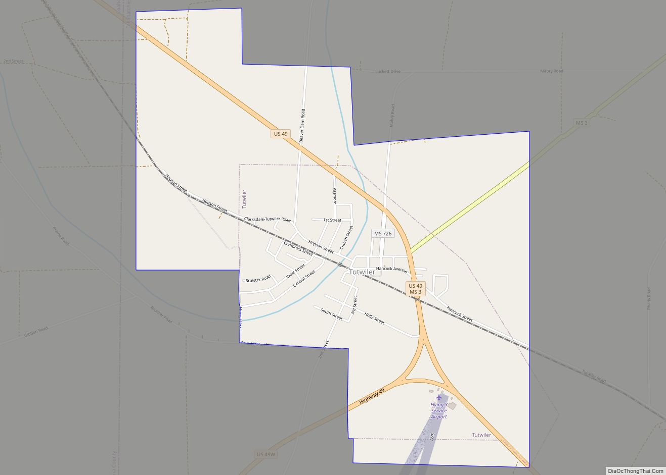
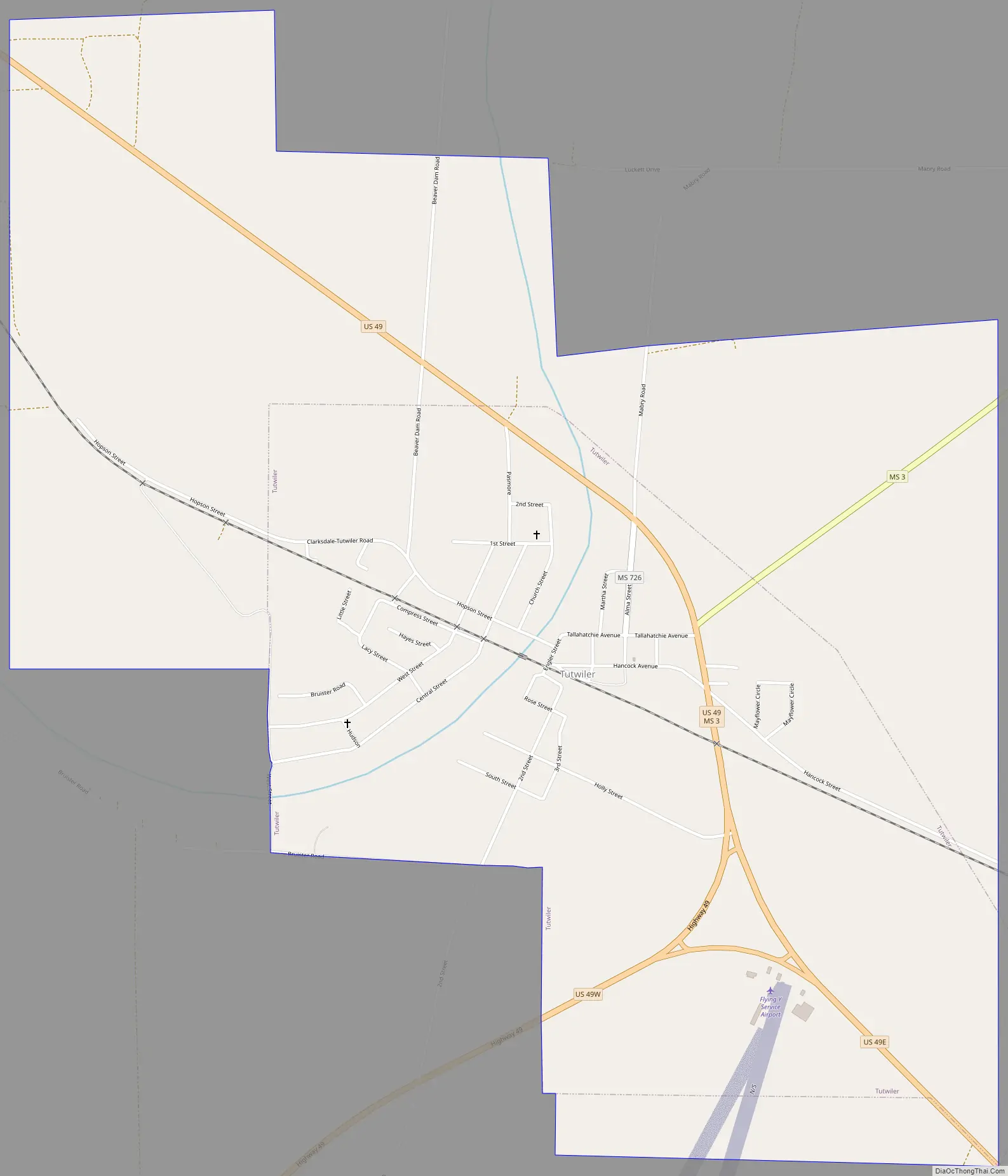
Tutwiler Road Map
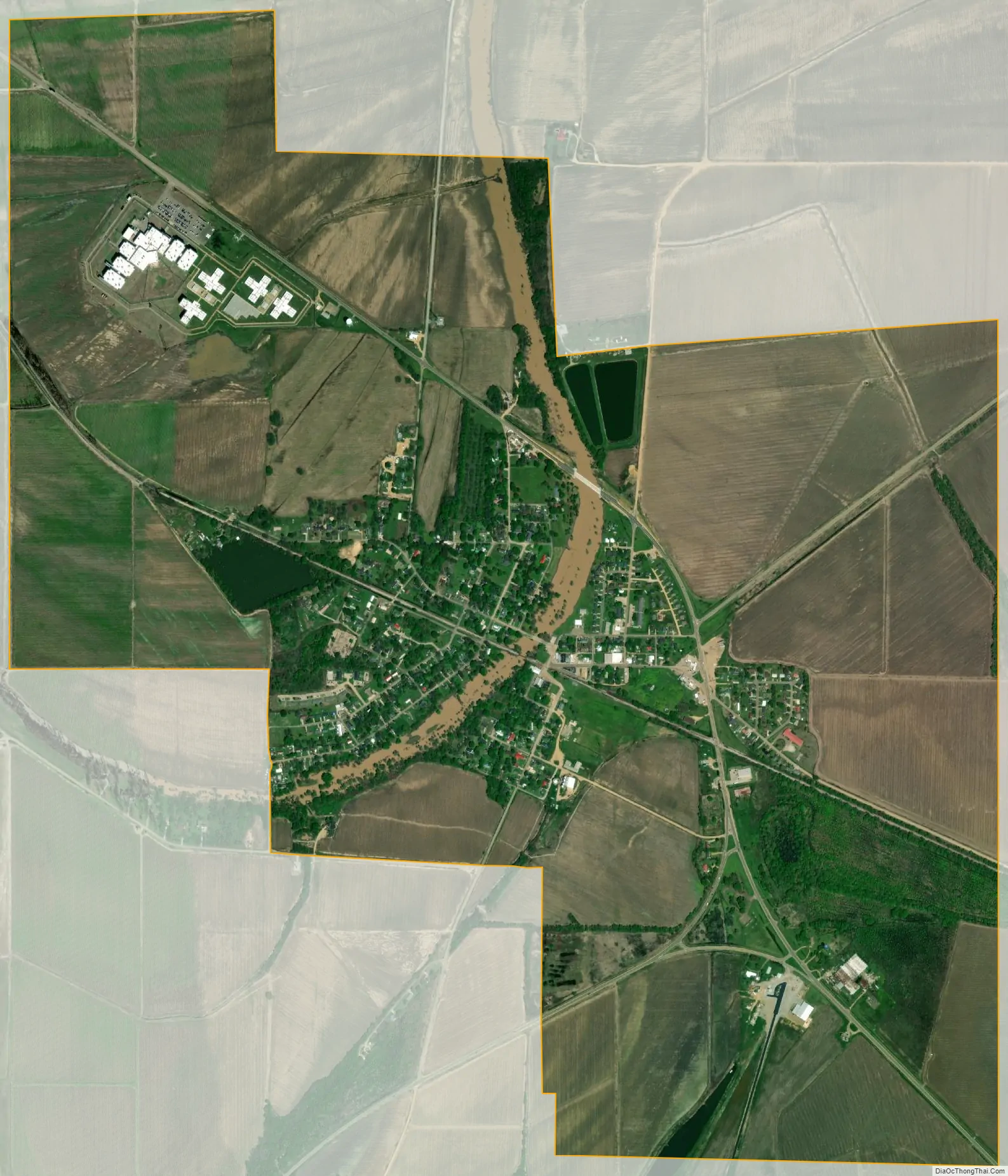
Tutwiler city Satellite Map
Geography
Tutwiler is located at 34°0′53″N 90°25′54″W / 34.01472°N 90.43167°W / 34.01472; -90.43167 (34.014797, -90.431642).
According to the United States Census Bureau, the town has a total area of 1.3 square miles (3.4 km), all land. Tutwiler is 70 miles (110 km) south of Memphis, Tennessee.
See also
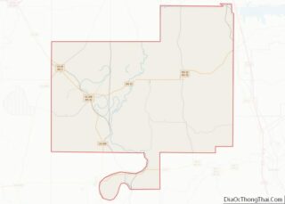
Map of Mississippi State and its subdivision:- Adams
- Alcorn
- Amite
- Attala
- Benton
- Bolivar
- Calhoun
- Carroll
- Chickasaw
- Choctaw
- Claiborne
- Clarke
- Clay
- Coahoma
- Copiah
- Covington
- Desoto
- Forrest
- Franklin
- George
- Greene
- Grenada
- Hancock
- Harrison
- Hinds
- Holmes
- Humphreys
- Issaquena
- Itawamba
- Jackson
- Jasper
- Jefferson
- Jefferson Davis
- Jones
- Kemper
- Lafayette
- Lamar
- Lauderdale
- Lawrence
- Leake
- Lee
- Leflore
- Lincoln
- Lowndes
- Madison
- Marion
- Marshall
- Monroe
- Montgomery
- Neshoba
- Newton
- Noxubee
- Oktibbeha
- Panola
- Pearl River
- Perry
- Pike
- Pontotoc
- Prentiss
- Quitman
- Rankin
- Scott
- Sharkey
- Simpson
- Smith
- Stone
- Sunflower
- Tallahatchie
- Tate
- Tippah
- Tishomingo
- Tunica
- Union
- Walthall
- Warren
- Washington
- Wayne
- Webster
- Wilkinson
- Winston
- Yalobusha
- Yazoo
- Alabama
- Alaska
- Arizona
- Arkansas
- California
- Colorado
- Connecticut
- Delaware
- District of Columbia
- Florida
- Georgia
- Hawaii
- Idaho
- Illinois
- Indiana
- Iowa
- Kansas
- Kentucky
- Louisiana
- Maine
- Maryland
- Massachusetts
- Michigan
- Minnesota
- Mississippi
- Missouri
- Montana
- Nebraska
- Nevada
- New Hampshire
- New Jersey
- New Mexico
- New York
- North Carolina
- North Dakota
- Ohio
- Oklahoma
- Oregon
- Pennsylvania
- Rhode Island
- South Carolina
- South Dakota
- Tennessee
- Texas
- Utah
- Vermont
- Virginia
- Washington
- West Virginia
- Wisconsin
- Wyoming