St. Francisville is a town in and the parish seat of, West Feliciana Parish, Louisiana, United States. The population was 1,765 at the 2010 U.S. census, and 1,589 at the 2020 population estimates program. It is part of the Baton Rouge metropolitan statistical area.
| Name: | St. Francisville town |
|---|---|
| LSAD Code: | 43 |
| LSAD Description: | town (suffix) |
| State: | Louisiana |
| County: | West Feliciana Parish |
| Elevation: | 148 ft (45 m) |
| Total Area: | 1.84 sq mi (4.77 km²) |
| Land Area: | 1.82 sq mi (4.73 km²) |
| Water Area: | 0.02 sq mi (0.05 km²) |
| Total Population: | 1,557 |
| Population Density: | 853.15/sq mi (329.32/km²) |
| ZIP code: | 70775 |
| Area code: | 225 |
| FIPS code: | 2267215 |
| GNISfeature ID: | 2407267 |
| Website: | stfrancisville.net |
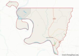
Online Interactive Map
Click on ![]() to view map in "full screen" mode.
to view map in "full screen" mode.
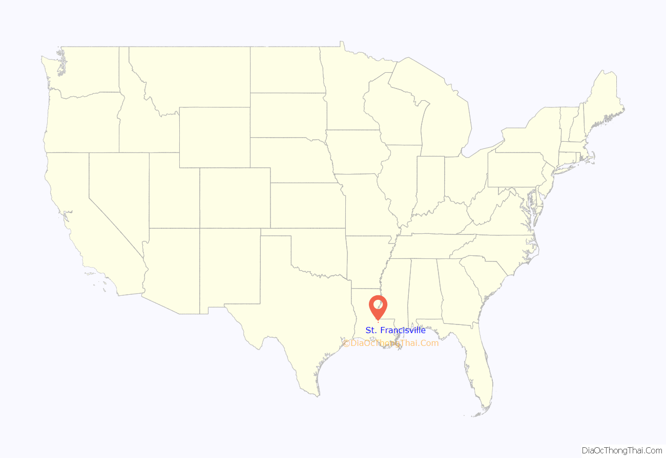
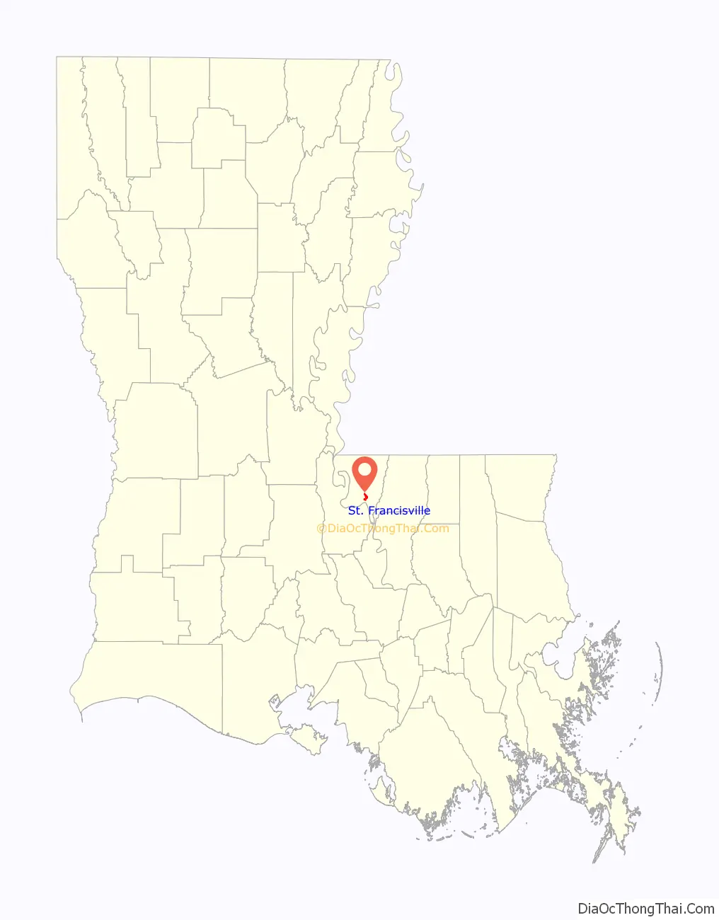
St. Francisville location map. Where is St. Francisville town?
History
The current town of St. Francisville was established on May 11, 1807, by John H. Johnson, and was originally known as the Villa of St. Francis. A number of historic structures from that period still exist. Called “the town two miles long and two yards wide” because it was developed atop a narrow ridge overlooking the Mississippi River, it was the commercial and cultural center of the surrounding plantation country. Below St. Francisville’s bluffs, another early settlement called Bayou Sara had been established by French colonists in the early 1790s. It was at one time the largest antebellum Mississippi River port between New Orleans and Memphis, but was superseded by Natchez. The settlement was gradually destroyed by repeated flooding and fires, and nothing exists of Bayou Sara today. A few of its surviving structures were hauled up the hill into St. Francisville in the 1920s. This area and other former French-controlled territories east of the Mississippi River was taken over by Great Britain after it defeated France in the Seven Years’ War in 1763.
At the end of the American Revolutionary War, Great Britain ceded what it called West Florida to Spain in 1783, as part of the Treaty of Paris. There were years of contention as to exactly where the eastern boundary of the 1803 Louisiana Purchase was—depending on which treaty was cited, as France, Great Britain, and Spain had redrawn the boundaries among themselves during the second half of the 18th century. Spain continued to claim territory on the eastern side of the Mississippi River until it and the United States settled this issue in the Pinckney Treaty. This region is today called the Florida Parishes.
In 1810, St. Francisville served as the capital of the Republic of West Florida, when area planters ousted the Spanish government of the Baton Rouge District and set up their own independent republic for 74 days, before being annexed to the Territory of Orleans, as a possession of the United States.
In 1824, when Feliciana Parish was split into East and West, St. Francisville became the seat of West Feliciana Parish‘s government.
In June 1863, Confederate Army officer William Walter Leake arranged for the burial here of Union Navy officer John E. Hart, who had died aboard his ship while taking part in the Union blockade of the Mississippi River. This event is re-enacted every June during a three-day commemoration called “The Day the War Stopped.”
After the American Civil War, some Jewish emigrants fleeing religious persecution in Germany settled here. They made important contributions to commerce in the lean years following the war. Becoming successful merchants, they provided credit when the banks failed and built impressive Victorian homes, such as the Wolf-Schlessinger House. It is now operated as the St. Francisville Inn Bed and Breakfast.
2000 to present
In recent years, community efforts have focused on restoration and preservation of the town’s historic homes. St. Francisville is a popular tourist destination, with a number of restored historic plantations open for tours, including Rosedown Plantation State Historic Site, Audubon State Historic Site, Butler Greenwood Plantation, the Myrtles, and the Cottage Plantation, as well as several antebellum gardens.
In June 2011, the John James Audubon Bridge was constructed as the new crossing of the Mississippi River. This was the successor to the ferry 3 miles up-river. It connected New Roads to St. Francisville via Louisiana highway 10. Louisiana 10 then connected to US-61 3 miles south of St. Francisville. On the opposite side of the bridge Louisiana 10 crosses into Pointe Coupee Parish and connects with Louisiana highway 1 to connect New Roads to St. Francisville
In May 2011, low-lying parts of Saint Francisville flooded in the Mississippi River floods of that year.
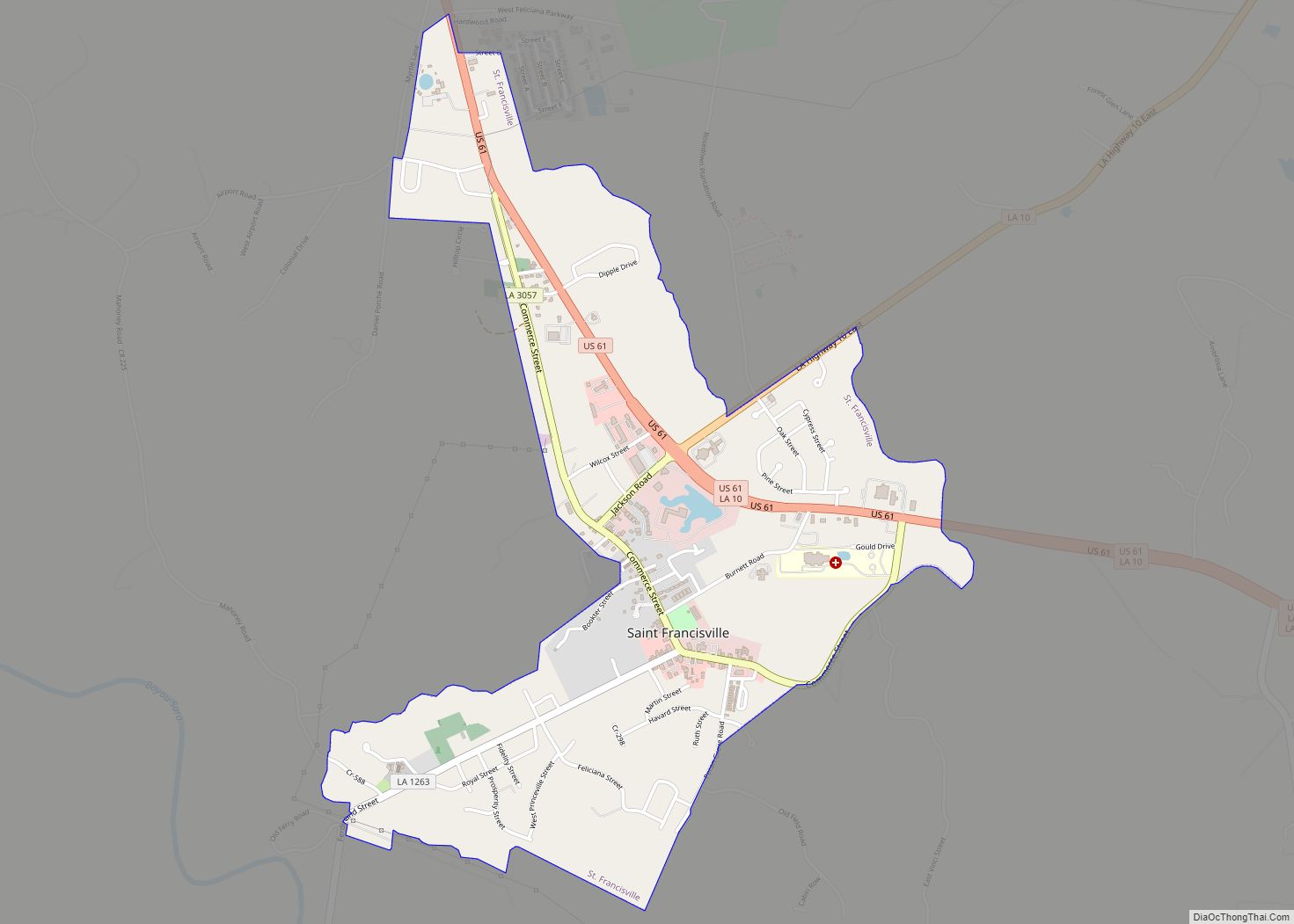
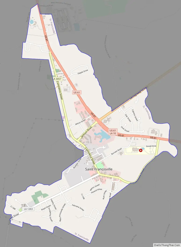
St. Francisville Road Map
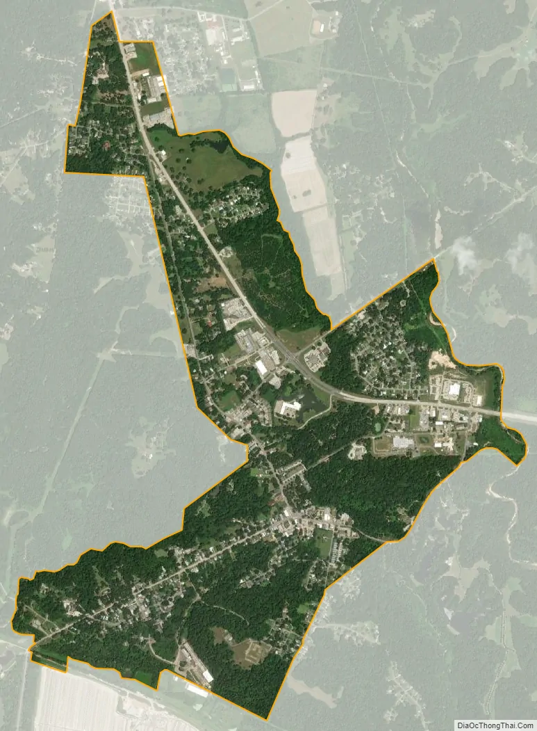
St. Francisville city Satellite Map
Geography
St. Francisville is located at 30°47′5″N 91°22′50″W / 30.78472°N 91.38056°W / 30.78472; -91.38056. According to the United States Census Bureau, the town has a total area of 1.8 square miles (4.7 km), all land.
See also
Map of Louisiana State and its subdivision:- Acadia
- Allen
- Ascension
- Assumption
- Avoyelles
- Beauregard
- Bienville
- Bossier
- Caddo
- Calcasieu
- Caldwell
- Cameron
- Catahoula
- Claiborne
- Concordia
- De Soto
- East Baton Rouge
- East Carroll
- East Feliciana
- Evangeline
- Franklin
- Grant
- Iberia
- Iberville
- Jackson
- Jefferson
- Jefferson Davis
- La Salle
- Lafayette
- Lafourche
- Lincoln
- Livingston
- Madison
- Morehouse
- Natchitoches
- Orleans
- Ouachita
- Plaquemines
- Pointe Coupee
- Rapides
- Red River
- Richland
- Sabine
- Saint Bernard
- Saint Charles
- Saint Helena
- Saint James
- Saint John the Baptist
- Saint Landry
- Saint Martin
- Saint Mary
- Saint Tammany
- Tangipahoa
- Tensas
- Terrebonne
- Union
- Vermilion
- Vernon
- Washington
- Webster
- West Baton Rouge
- West Carroll
- West Feliciana
- Winn
- Alabama
- Alaska
- Arizona
- Arkansas
- California
- Colorado
- Connecticut
- Delaware
- District of Columbia
- Florida
- Georgia
- Hawaii
- Idaho
- Illinois
- Indiana
- Iowa
- Kansas
- Kentucky
- Louisiana
- Maine
- Maryland
- Massachusetts
- Michigan
- Minnesota
- Mississippi
- Missouri
- Montana
- Nebraska
- Nevada
- New Hampshire
- New Jersey
- New Mexico
- New York
- North Carolina
- North Dakota
- Ohio
- Oklahoma
- Oregon
- Pennsylvania
- Rhode Island
- South Carolina
- South Dakota
- Tennessee
- Texas
- Utah
- Vermont
- Virginia
- Washington
- West Virginia
- Wisconsin
- Wyoming