Yazoo City is a U.S. city in Yazoo County, Mississippi. It was named after the Yazoo River, which, in turn was named by the French explorer Robert La Salle in 1682 as “Rivière des Yazous” in reference to the Yazoo tribe living near the river’s mouth. It is the county seat of Yazoo County and the principal city of the Yazoo City Micropolitan Statistical Area, which is part of the larger Jackson–Yazoo City Combined Statistical Area. According to the 2010 census, the population was 11,403. The most important industry in 2021 is a group of federal prisons.
| Name: | Yazoo City city |
|---|---|
| LSAD Code: | 25 |
| LSAD Description: | city (suffix) |
| State: | Mississippi |
| County: | Yazoo County |
| Elevation: | 112 ft (34 m) |
| Total Area: | 10.21 sq mi (26.44 km²) |
| Land Area: | 10.08 sq mi (26.12 km²) |
| Water Area: | 0.13 sq mi (0.32 km²) |
| Total Population: | 10,316 |
| Population Density: | 1,023.01/sq mi (394.97/km²) |
| ZIP code: | 39194 |
| Area code: | 662 |
| FIPS code: | 2881520 |
| GNISfeature ID: | 0679921 |
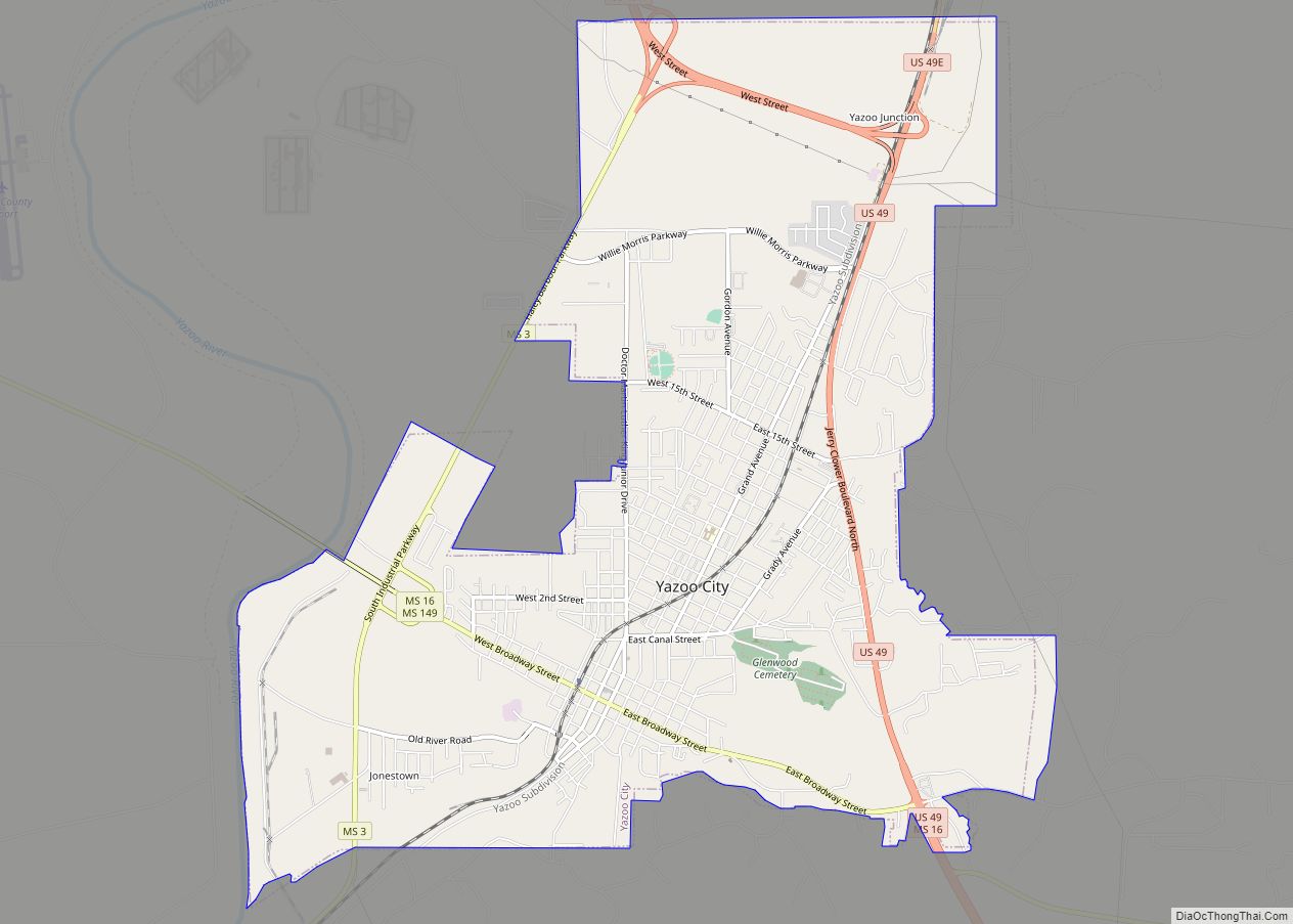
Online Interactive Map
Click on ![]() to view map in "full screen" mode.
to view map in "full screen" mode.
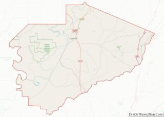
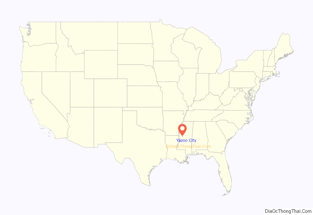
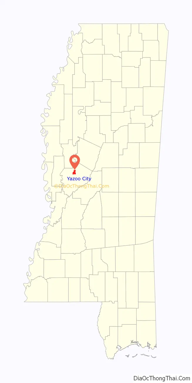
Yazoo City location map. Where is Yazoo City city?
History
The community now known as Yazoo City was founded in 1824 with the name Hannan’s Bluff. It was later renamed Manchester, then changed to Yazoo City in 1841. Yazoo City became the county seat in 1849. A yellow fever epidemic struck Yazoo City in 1853.
During the American Civil War, the Confederate ironclad CSS Arkansas was completed at a makeshift shipyard in Yazoo City after the Confederate loss of New Orleans and Memphis. During her short career, the Arkansas challenged the Union navy’s control of the Mississippi River and helped avert the early fall of Vicksburg. On May 21, 1863, as a Union fleet steamed up the Yazoo River, the Confederate forces burned down the shipyard to keep their foes from capturing the vessels being built there. The Federal forces then burned down the sawmill and lumberyard before withdrawing. After their capture of Vicksburg in July 1863, another Union raid briefly occupied Yazoo City, but this time the Union ironclad USS Baron DeKalb was sunk by a mine. Federal troops occupied the town in September and again in October 1863. Another occupation resulted in the Battle of Yazoo City on March 5, 1864 between the Union troops and Confederates led by Robert V. Richardson and Lawrence Sullivan Ross. The Union troops held their ground but departed the following day. The Federal forces returned again on May 19, 1864, doing more damage to the town.
Yazoo City was rebuilt, but yellow fever struck and took more victims in 1878. On May 25, 1904, a fire destroyed much of central Yazoo City. According to a local legend, the fire was caused by a witch avenging her death. In reality, a boy playing with matches accidentally set a house ablaze. The fire quickly spread, and three-fourths of the town was destroyed, including most of the homes. It was stopped by a canal, which saved the new courthouse (built in 1872 to replace the one burned by the Union forces) and 10 antebellum homes nearby. The town took almost two years to recover.
In 1915, the Orr Modern Motor Car Company was founded in Yazoo City by G.A. Wilson and C.D. Orr, with capital of $2,000,000 (equivalent to $53,572,368 in 2021). Despite its name, the company was focused just on making Orr’s innovative worm drive and assembled only one automobile as a prototype. Not long after, Orr shut its doors.
The Great Mississippi Flood of 1927 did much damage to the entire Delta, but Yazoo City was restored and is now protected by an effective flood-prevention system.
Tornado History
A strong tornado, rated EF4 on the Enhanced Fujita scale and with a path width of 1.75 mi (2.82 km), hit Yazoo County on April 24, 2010. Four people were killed in the Yazoo City area, and a number were seriously injured; four of the victims were airlifted to the University of Mississippi Medical Center in the capital city of Jackson, 40 mi (64 km) away. The Governor of Mississippi, Haley Barbour, toured the area in a National Guard helicopter and held a news conference on the disaster at 3:30 pm. The tornado and the aftermath were shown in an episode of the Discovery Channel series Storm Chasers, and several YouTube videos show considerable detail and descriptions.
On November 29, 2010 around 8:05 pm local time, Yazoo City was struck by two EF2 tornadoes: the first one tracked 3 mi (4.8 km) southwest of town. The second went right through downtown causing significant damage to several buildings.
A high-end EF1 tornado passed through the southeast side of the city on May 2, 2021. Multiple mobile homes were destroyed and trees, power lines, and homes were damaged.
Yazoo City Road Map
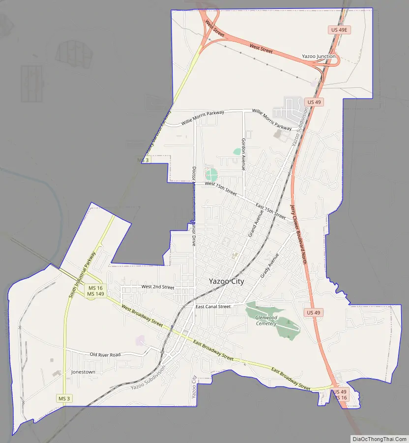
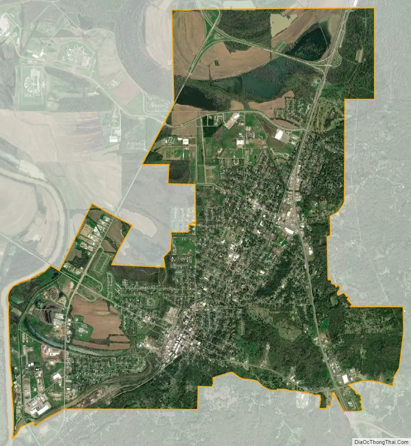
Yazoo City city Satellite Map
Geography
Yazoo City is located 40 mi (64 km) northwest of Jackson at the junctions of U.S. Routes 49, 49E, and 49W, and MS Highways 3, 16, and 149, on the banks of the Yazoo River, near the Panther Swamp National Wildlife Refuge.
U.S. Route 49W provides a fairly direct link between Yazoo City and Belzoni. The old highway segment, renamed Mississippi Highway 149, passes through Panther Swamp National Wildlife Refuge and the communities of Louise and Midnight before reconnecting with the new US 49W at Silver City, 7 mi (11 km) south of Belzoni. The new highway makes the town of Carter so near, it might be considered for annexation by Yazoo City. Two bridges now cross the Yazoo River at Yazoo City.
The section of MS 3 in Yazoo City is called Haley Barbour Parkway. Barbour, the former governor of Mississippi, grew up in Yazoo City and has a home on Wolf Lake, a lake north of Yazoo City. U.S. Route 49 (part of which was formerly U.S. 49E) through Yazoo City is named Jerry Clower Boulevard, after the famous comedian, a former resident of Yazoo City.
Yazoo City is also known as the “Gateway to the Delta” due to its location on the transition between the two great landforms that characterize the geography of Mississippi (the western part of the city lies in the Mississippi Delta and the eastern part lies in the loess bluffs that characterize most of eastern Mississippi).
According to the United States Census Bureau, the city has a total area of 10.9 sq mi (28 km), of which 10.8 sq mi (28 km) is land and 0.1 sq mi (0.26 km) (1.19%) is covered by water.
See also
Map of Mississippi State and its subdivision:- Adams
- Alcorn
- Amite
- Attala
- Benton
- Bolivar
- Calhoun
- Carroll
- Chickasaw
- Choctaw
- Claiborne
- Clarke
- Clay
- Coahoma
- Copiah
- Covington
- Desoto
- Forrest
- Franklin
- George
- Greene
- Grenada
- Hancock
- Harrison
- Hinds
- Holmes
- Humphreys
- Issaquena
- Itawamba
- Jackson
- Jasper
- Jefferson
- Jefferson Davis
- Jones
- Kemper
- Lafayette
- Lamar
- Lauderdale
- Lawrence
- Leake
- Lee
- Leflore
- Lincoln
- Lowndes
- Madison
- Marion
- Marshall
- Monroe
- Montgomery
- Neshoba
- Newton
- Noxubee
- Oktibbeha
- Panola
- Pearl River
- Perry
- Pike
- Pontotoc
- Prentiss
- Quitman
- Rankin
- Scott
- Sharkey
- Simpson
- Smith
- Stone
- Sunflower
- Tallahatchie
- Tate
- Tippah
- Tishomingo
- Tunica
- Union
- Walthall
- Warren
- Washington
- Wayne
- Webster
- Wilkinson
- Winston
- Yalobusha
- Yazoo
- Alabama
- Alaska
- Arizona
- Arkansas
- California
- Colorado
- Connecticut
- Delaware
- District of Columbia
- Florida
- Georgia
- Hawaii
- Idaho
- Illinois
- Indiana
- Iowa
- Kansas
- Kentucky
- Louisiana
- Maine
- Maryland
- Massachusetts
- Michigan
- Minnesota
- Mississippi
- Missouri
- Montana
- Nebraska
- Nevada
- New Hampshire
- New Jersey
- New Mexico
- New York
- North Carolina
- North Dakota
- Ohio
- Oklahoma
- Oregon
- Pennsylvania
- Rhode Island
- South Carolina
- South Dakota
- Tennessee
- Texas
- Utah
- Vermont
- Virginia
- Washington
- West Virginia
- Wisconsin
- Wyoming