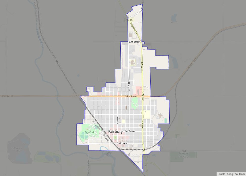
Fairbury is a city and county seat of Jefferson County, Nebraska, United States. The population was 3,942 at the 2010 census.
Fairbury has been closely connected with railroading for much of its history. It was founded on the projected route of a railway, and grew as a shipping center. For nearly 80 years, it was the location of the Western Division headquarters of the Rock Island Railroad. Fairbury prospered with the Rock Island, and lost business and residents as the railroad declined.
| Name: | Fairbury city |
|---|---|
| LSAD Code: | 25 |
| LSAD Description: | city (suffix) |
| State: | Nebraska |
| County: | Jefferson County |
| Elevation: | 1,325 ft (404 m) |
| Total Area: | 2.54 sq mi (6.58 km²) |
| Land Area: | 2.54 sq mi (6.57 km²) |
| Water Area: | 0.00 sq mi (0.01 km²) |
| Total Population: | 3,970 |
| Population Density: | 1,565.46/sq mi (604.48/km²) |
| ZIP code: | 68352 |
| Area code: | 402 |
| FIPS code: | 3116410 |
| GNISfeature ID: | 0829201 |
| Website: | fairburyne.org |
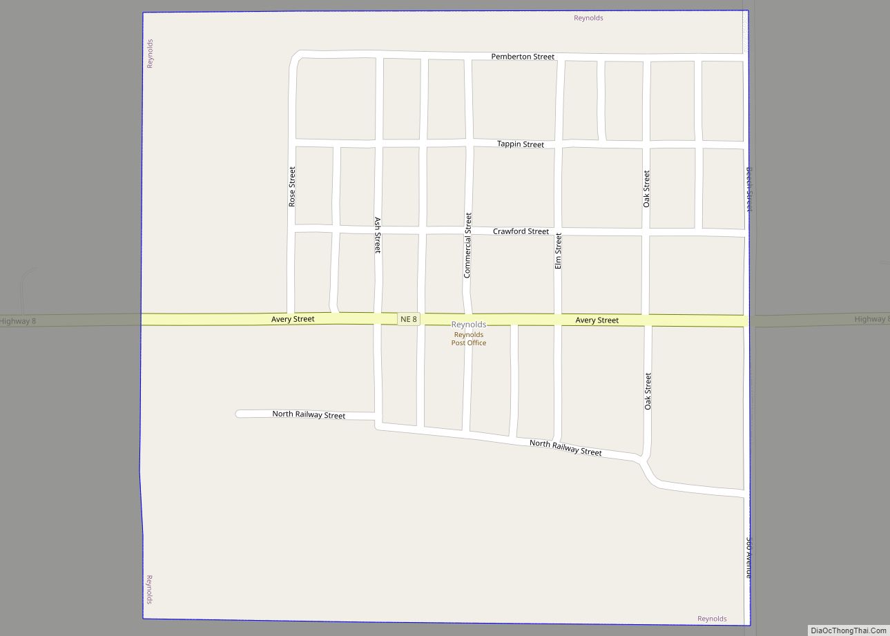
Online Interactive Map
Click on ![]() to view map in "full screen" mode.
to view map in "full screen" mode.
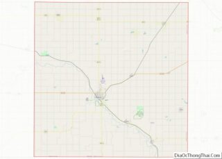
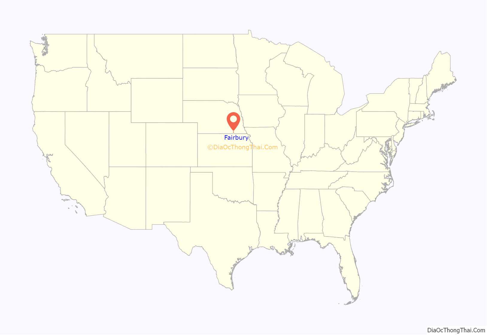
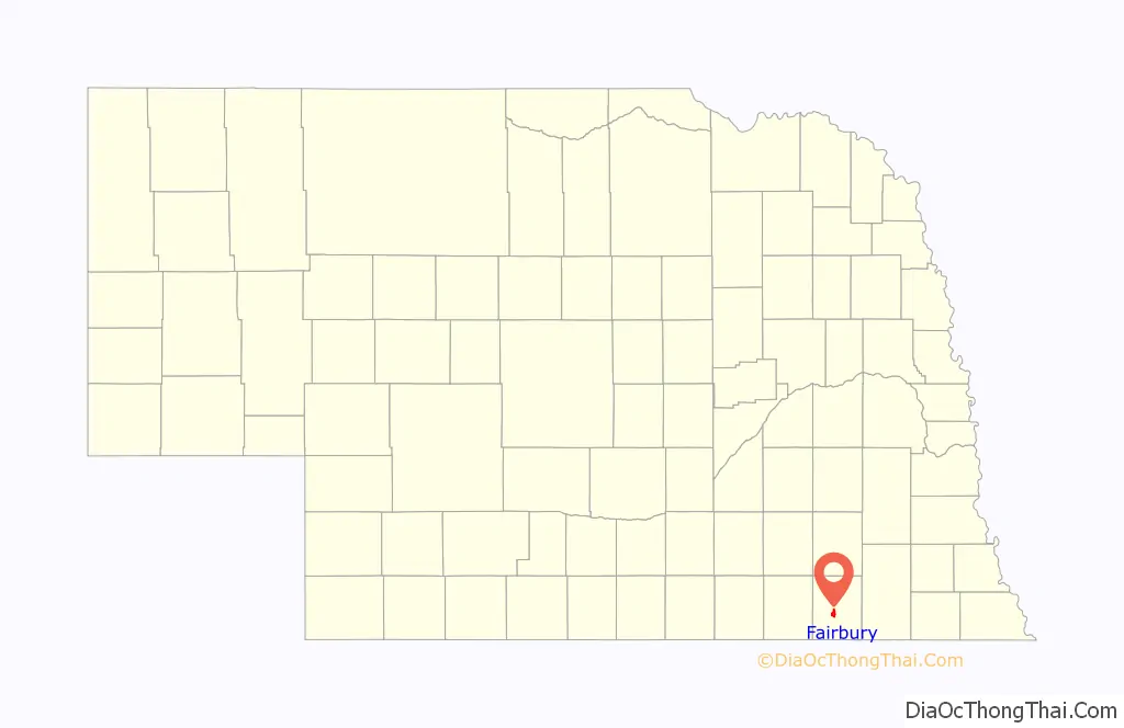
Fairbury location map. Where is Fairbury city?
History
19th century
In 1868, James B. Mattingly, a freighter originally from Kentucky, established a sawmill on the banks of the Little Blue River. Shortly thereafter, Woodford G. McDowell, a capitalist from Fairbury, Illinois, came to Nebraska to plat a town along the route of the St. Joseph and Denver City Railroad, which was to follow the Little Blue. In 1869, Mattingly and McDowell each contributed 80 acres (32 ha) for a new townsite, which they named after McDowell’s hometown.
The new town grew rapidly, even before the railroad’s arrival. In 1870, a population of 370 was reported; in that year, the Fairbury Gazette was established. A year later, Fairbury was chosen as the county seat; in early 1872, the city was incorporated. By this time, its businesses included three hotels and five blacksmith shops.
In 1872, the St. Joseph and Denver City reached Jefferson County. (The railroad was subsequently acquired by the Union Pacific and operated as the St. Joseph and Grand Island branch.) Fairbury became a shipping center: in the first half of 1873, it shipped 255 cars of grain and received 143 of lumber. By 1874, there were 600 residents; 44 businesses operated in the city.
An 1879 fire, “supposed to have been the work of an incendiary”, destroyed an estimated fourteen buildings, for a loss of $50,000, much of it uninsured. However, recovery was swift, and many of the destroyed frame buildings were replaced by more modern brick and stone structures. By 1882, the city’s population had grown to 1,600.
In 1885, the Campbell Brothers Circus began wintering in Fairbury. It continued to winter in and around the city until its closing in 1913. At its peak, the circus was the second-largest in the world.
In 1886, the Chicago, Rock Island and Pacific Railroad reached Fairbury. The city lay at the junction of the Rock Island’s north-south and east-west lines; because of this, it was designated the headquarters of the railroad’s Western Division. An extensive rail yard was constructed, including shops, storage and maintenance facilities, switching yards, and an 18-stall roundhouse. The railroad had a major impact on Fairbury: by 1890, the population had grown to 2,630.
The brick courthouse had survived the fire of 1879; but soon thereafter, it proved too small to handle the county’s increasing business and store its growing records. In 1882, the county began renting the top two floors of the newly constructed Opera House, and moved its offices there; but this too was quickly outgrown. In 1889, a $60,000 bond issue for the construction of a new courthouse passed; the new Romanesque Revival building was completed in 1892.
Fairbury continued to prosper as the home of the Rock Island headquarters, which employed many locals directly and in supporting businesses. Commercial and residential development continued apace in Fairbury. Both of the city’s banks survived the Panic of 1893. Boardwalks were replaced with brick sidewalks between 1892 and 1894; an electricity and waterworks powerhouse was constructed in 1895; and in 1898, electric street lights were installed. By 1900, the population had reached 3,140.
20th century
The decade from 1900 to 1910 saw the largest growth in Fairbury’s history; the census of 1910 reported a population of 5,294, representing a sixty percent increase over the ten years.
A major fire in 1903 swept the commercial district, destroying almost the entire block south of the courthouse square; the only building to survive was the original brick courthouse. Within a year, however, the entire block had been rebuilt.
In 1909, E. J. Hested opened his dime store, The Fair Store, in one of the new buildings. Two years later, the name of the store was changed to Hested’s. In 1925, the store moved into a new and larger building; the business expanded to over 150 stores in the Midwest and Mountain States before its acquisition by the J.J. Newberry chain in 1969.
The 1910s and 1920s were the peak years for the Rock Island Railroad, with fourteen passenger trains passing through Fairbury daily, and with hundreds of Fairbury residents on the payroll. To accommodate this traffic, the railroad constructed a new depot, at a cost of $40,000. The city’s commercial district underwent a considerable expansion, including two movie theaters and several large retail stores. In 1915, civic leaders began promoting the brick paving of Fairbury’s downtown streets; by 1930, there were 10 miles (16 km) of paved road. The 1920s and 1930s saw a proliferation of automobile-related businesses, such as garages, gas stations, and repair shops.
Fairbury was better situated than many communities to weather the Great Depression. Beside the railroad, it had a variety of industries, including the Fairbury Windmill Company, with a payroll of 50 people in 1930. The city continued to grow through the Depression, despite the difficulties of the Rock Island, which went into receivership in 1933 and did not emerge until 1948. The population of Fairbury peaked in 1950, at 6,395 residents.
The conversion of the Rock Island to diesel locomotives, completed by 1952, rendered portions of the Fairbury yards obsolete. The decrease in passenger railway traffic after World War II led to the reduction of service, the closing of stations, and the abandonment of track. In 1965, the Rock Island’s Chicago-to-Denver Rocky Mountain Rocket train ceased to run through Fairbury; in that same year, the railway relocated its Western Division headquarters from Fairbury to Des Moines, Iowa. 1965 was also the last year in which the Rock Island reported a profit. In 1975, it again entered receivership. A 1979 strike, unsuccessfully mediated by President Jimmy Carter, was the final nail in the railroad’s coffin. The railroad’s routes were operated for 60 days by the Kansas City Terminal Railway, to allow shipping of the 1979 Midwestern harvest; but in 1980, service to Fairbury ceased, and the depot was abandoned.
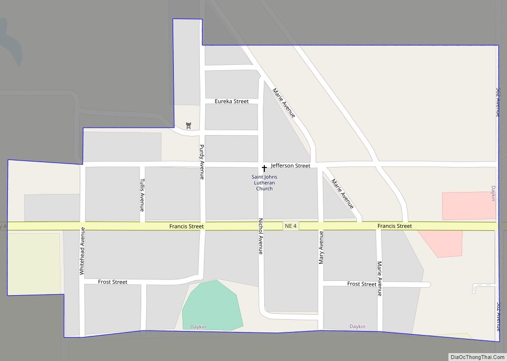
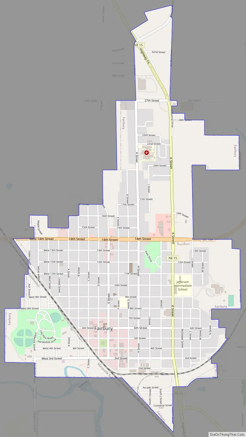
Fairbury Road Map
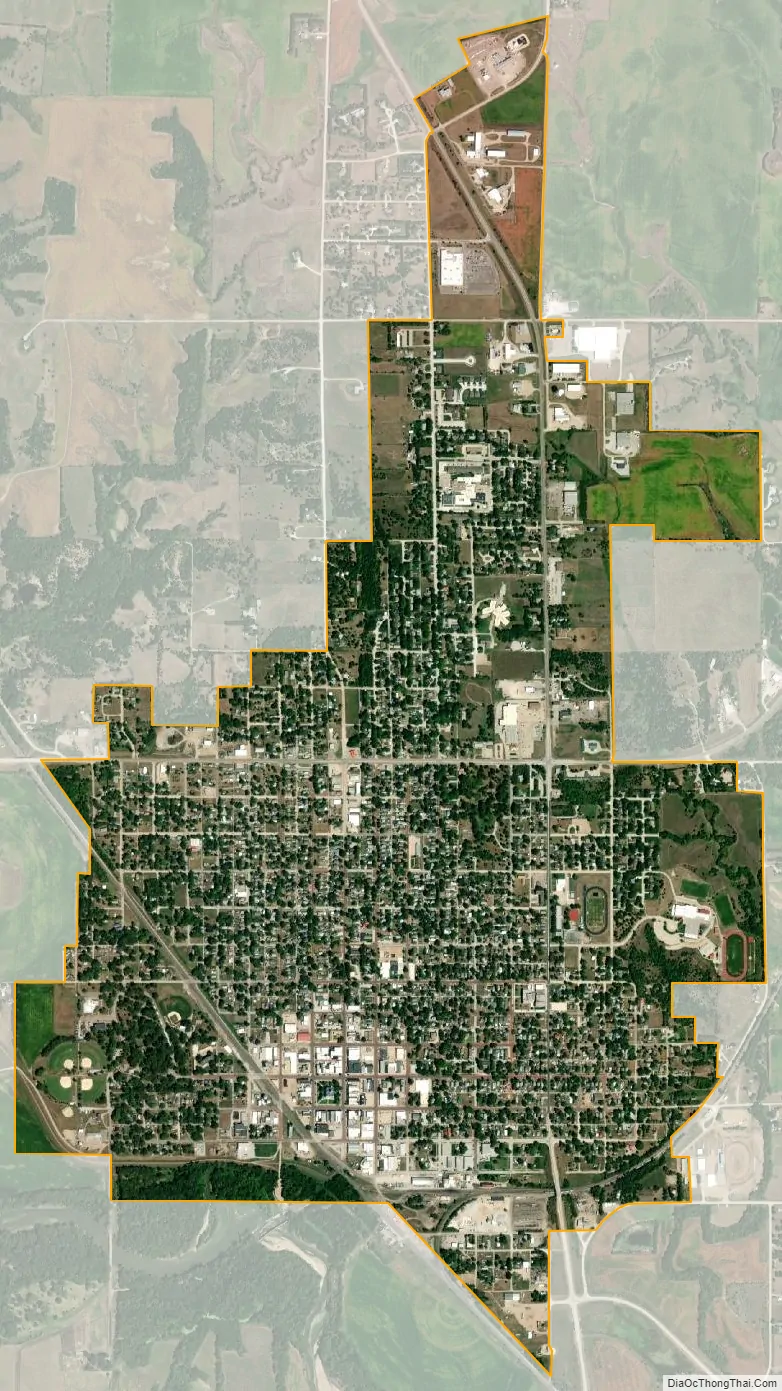
Fairbury city Satellite Map
Geography
Fairbury is located at 40°8′27″N 97°10′39″W / 40.14083°N 97.17750°W / 40.14083; -97.17750 (40.140917, -97.177545). The city lies on the Little Blue River. According to the United States Census Bureau, the city has a total area of 2.40 square miles (6.22 km), all land.
Climate
See also
Map of Nebraska State and its subdivision:- Adams
- Antelope
- Arthur
- Banner
- Blaine
- Boone
- Box Butte
- Boyd
- Brown
- Buffalo
- Burt
- Butler
- Cass
- Cedar
- Chase
- Cherry
- Cheyenne
- Clay
- Colfax
- Cuming
- Custer
- Dakota
- Dawes
- Dawson
- Deuel
- Dixon
- Dodge
- Douglas
- Dundy
- Fillmore
- Franklin
- Frontier
- Furnas
- Gage
- Garden
- Garfield
- Gosper
- Grant
- Greeley
- Hall
- Hamilton
- Harlan
- Hayes
- Hitchcock
- Holt
- Hooker
- Howard
- Jefferson
- Johnson
- Kearney
- Keith
- Keya Paha
- Kimball
- Knox
- Lancaster
- Lincoln
- Logan
- Loup
- Madison
- McPherson
- Merrick
- Morrill
- Nance
- Nemaha
- Nuckolls
- Otoe
- Pawnee
- Perkins
- Phelps
- Pierce
- Platte
- Polk
- Red Willow
- Richardson
- Rock
- Saline
- Sarpy
- Saunders
- Scotts Bluff
- Seward
- Sheridan
- Sherman
- Sioux
- Stanton
- Thayer
- Thomas
- Thurston
- Valley
- Washington
- Wayne
- Webster
- Wheeler
- York
- Alabama
- Alaska
- Arizona
- Arkansas
- California
- Colorado
- Connecticut
- Delaware
- District of Columbia
- Florida
- Georgia
- Hawaii
- Idaho
- Illinois
- Indiana
- Iowa
- Kansas
- Kentucky
- Louisiana
- Maine
- Maryland
- Massachusetts
- Michigan
- Minnesota
- Mississippi
- Missouri
- Montana
- Nebraska
- Nevada
- New Hampshire
- New Jersey
- New Mexico
- New York
- North Carolina
- North Dakota
- Ohio
- Oklahoma
- Oregon
- Pennsylvania
- Rhode Island
- South Carolina
- South Dakota
- Tennessee
- Texas
- Utah
- Vermont
- Virginia
- Washington
- West Virginia
- Wisconsin
- Wyoming