Fairmont is a village in Fillmore County, Nebraska, United States. The population was 602 at the 2020 census.
| Name: | Fairmont village |
|---|---|
| LSAD Code: | 47 |
| LSAD Description: | village (suffix) |
| State: | Nebraska |
| County: | Fillmore County |
| Elevation: | 1,640 ft (500 m) |
| Total Area: | 1.15 sq mi (2.98 km²) |
| Land Area: | 1.15 sq mi (2.98 km²) |
| Water Area: | 0.00 sq mi (0.00 km²) |
| Total Population: | 602 |
| Population Density: | 520/sq mi (200/km²) |
| ZIP code: | 68354 |
| Area code: | 402 |
| FIPS code: | 3116550 |
| GNISfeature ID: | 0829215 |
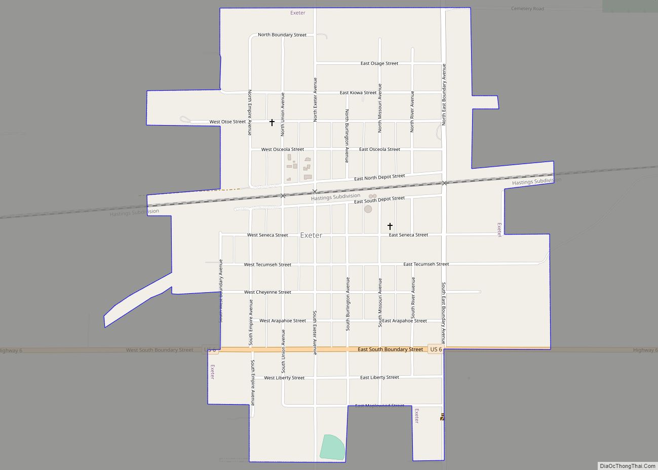
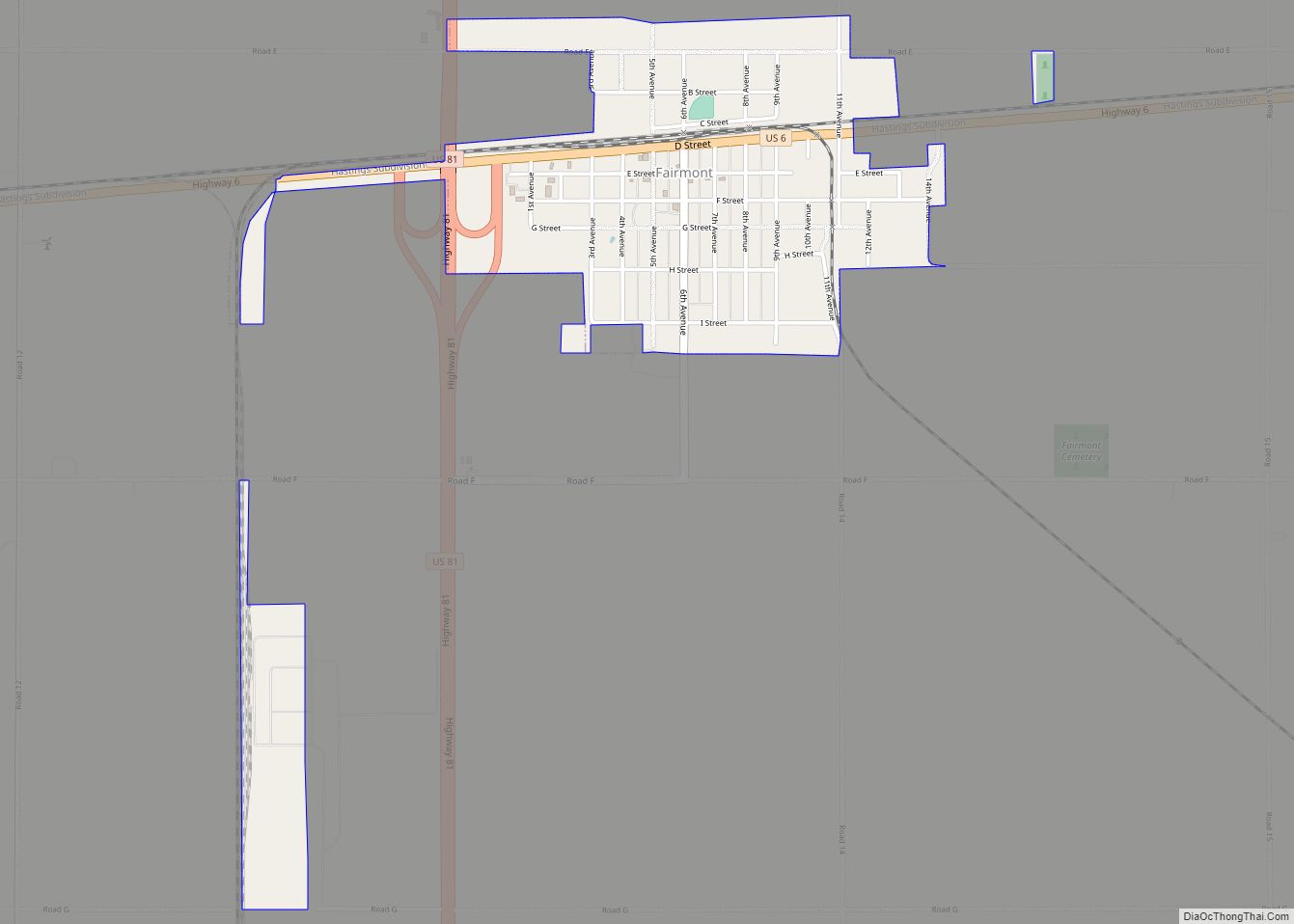
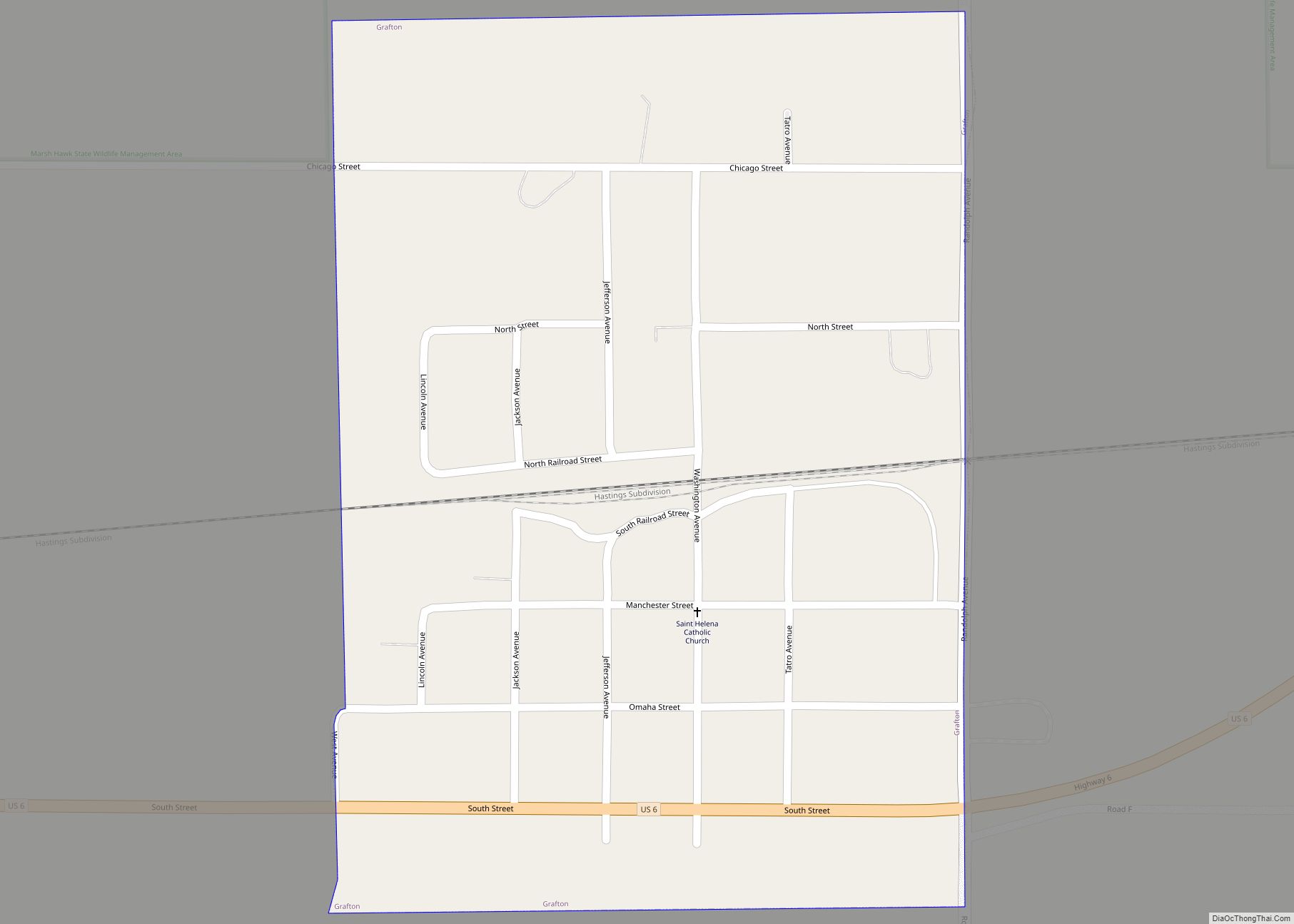
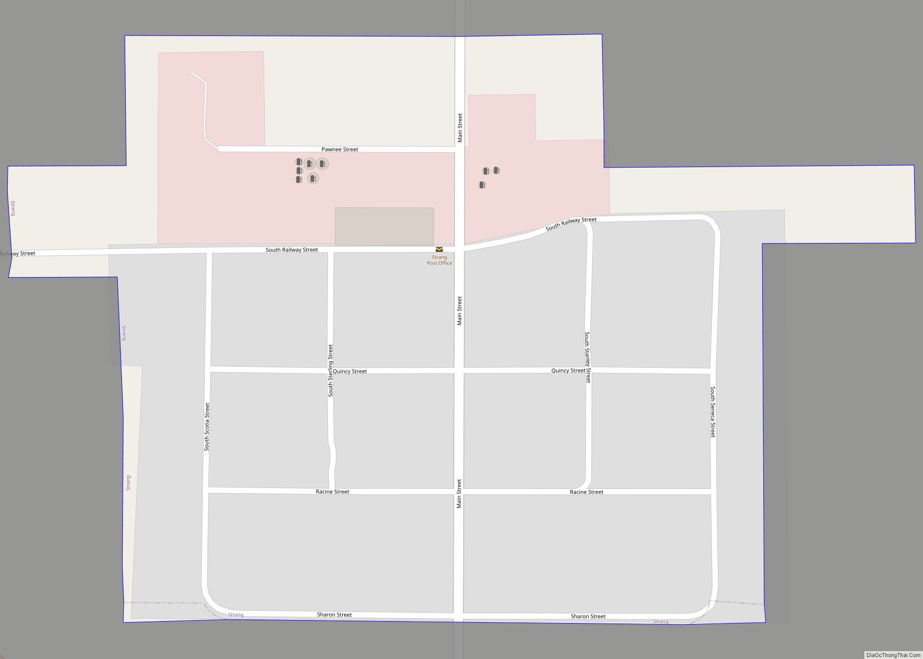
Online Interactive Map
Click on ![]() to view map in "full screen" mode.
to view map in "full screen" mode.
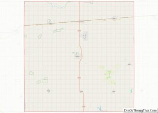
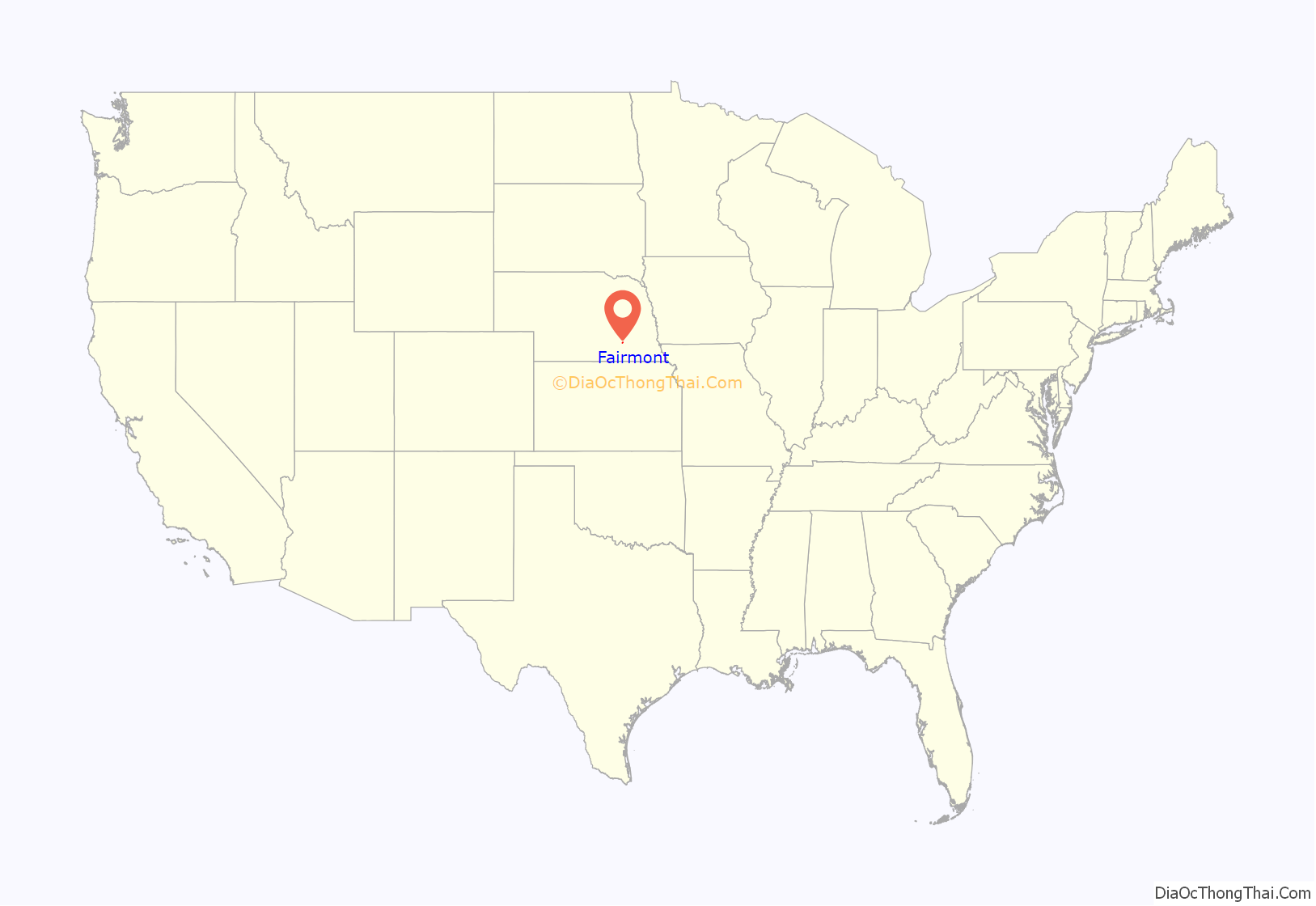
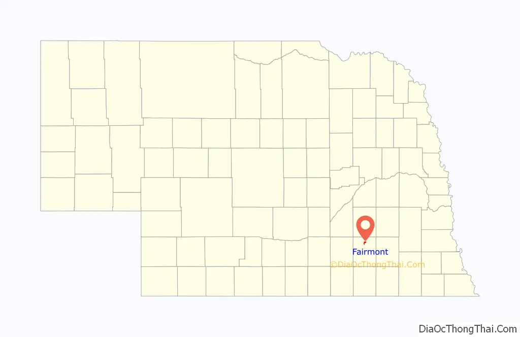
Fairmont location map. Where is Fairmont village?
History
Fairmont was platted in 1871 when the Burlington & Quincy Railroad was extended to that point. The name was chosen to conform with the alphabetical stops on the new line traveling westward from Lincoln: Berks, Crete, Dorchester, Exeter, Fairmont, Grafton, Huxley, etc. Fairmont is a descriptive name referring to the town’s scenic setting at a lofty elevation. By the fall of 1872 Fairmont had a school building, hotels, more stores, lumberyards, and coal and feed yards under construction. The first newspaper, “Fairmont Bulletin” was published in 1872. By 1881 there were three with the introduction of the “Nebraska Bulletin” and the “Nebraska Signal”.
One of the first major business enterprises, the Fairmont Creamery Company, was founded in 1884. Corporate offices were moved to Omaha in 1907.
Fairmont Road Map
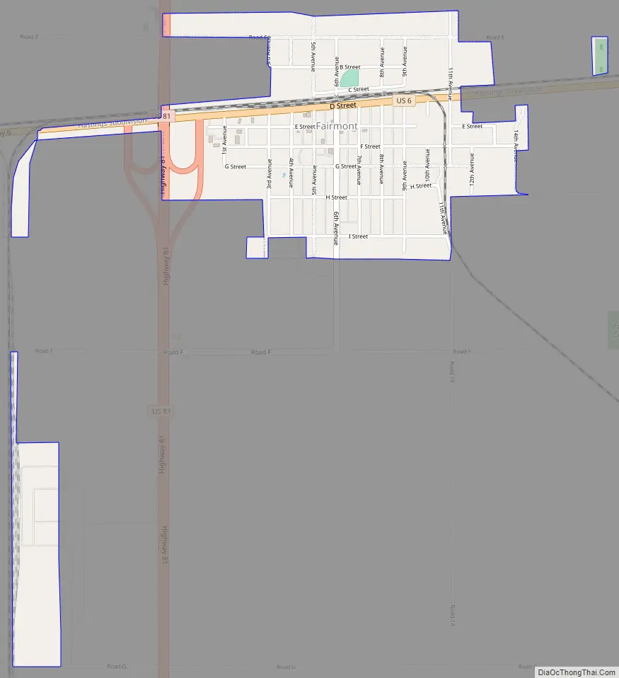
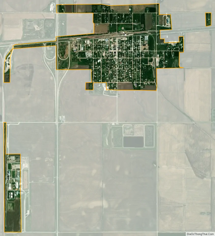
Fairmont city Satellite Map
Geography
Fairmont is located at 40°38′8″N 97°35′6″W / 40.63556°N 97.58500°W / 40.63556; -97.58500 (40.635526, -97.584928).
According to the United States Census Bureau, the village has a total area of 0.82 square miles (2.12 km), all land.
See also
Map of Nebraska State and its subdivision:- Adams
- Antelope
- Arthur
- Banner
- Blaine
- Boone
- Box Butte
- Boyd
- Brown
- Buffalo
- Burt
- Butler
- Cass
- Cedar
- Chase
- Cherry
- Cheyenne
- Clay
- Colfax
- Cuming
- Custer
- Dakota
- Dawes
- Dawson
- Deuel
- Dixon
- Dodge
- Douglas
- Dundy
- Fillmore
- Franklin
- Frontier
- Furnas
- Gage
- Garden
- Garfield
- Gosper
- Grant
- Greeley
- Hall
- Hamilton
- Harlan
- Hayes
- Hitchcock
- Holt
- Hooker
- Howard
- Jefferson
- Johnson
- Kearney
- Keith
- Keya Paha
- Kimball
- Knox
- Lancaster
- Lincoln
- Logan
- Loup
- Madison
- McPherson
- Merrick
- Morrill
- Nance
- Nemaha
- Nuckolls
- Otoe
- Pawnee
- Perkins
- Phelps
- Pierce
- Platte
- Polk
- Red Willow
- Richardson
- Rock
- Saline
- Sarpy
- Saunders
- Scotts Bluff
- Seward
- Sheridan
- Sherman
- Sioux
- Stanton
- Thayer
- Thomas
- Thurston
- Valley
- Washington
- Wayne
- Webster
- Wheeler
- York
- Alabama
- Alaska
- Arizona
- Arkansas
- California
- Colorado
- Connecticut
- Delaware
- District of Columbia
- Florida
- Georgia
- Hawaii
- Idaho
- Illinois
- Indiana
- Iowa
- Kansas
- Kentucky
- Louisiana
- Maine
- Maryland
- Massachusetts
- Michigan
- Minnesota
- Mississippi
- Missouri
- Montana
- Nebraska
- Nevada
- New Hampshire
- New Jersey
- New Mexico
- New York
- North Carolina
- North Dakota
- Ohio
- Oklahoma
- Oregon
- Pennsylvania
- Rhode Island
- South Carolina
- South Dakota
- Tennessee
- Texas
- Utah
- Vermont
- Virginia
- Washington
- West Virginia
- Wisconsin
- Wyoming