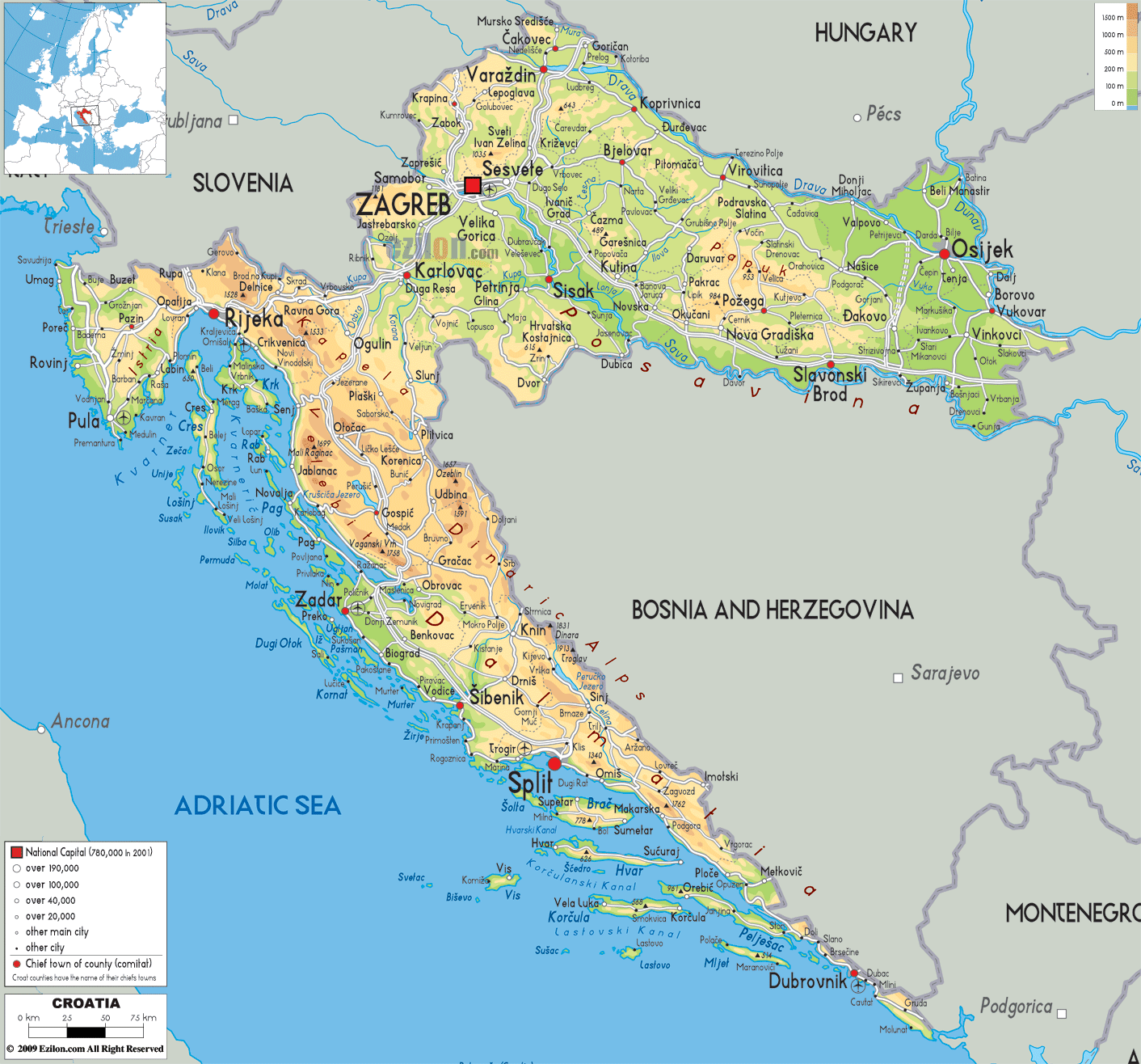
Croatia is a European country occupying an area of 56,594 km2(21,851 sq mi). As observed on the physical map of Croatia, despite its relatively small size, the landscape is considerably diverse.
It is made up of fertile and mostly flat plains in the north, and low mountains and highlands along the coast.
The Dinaric Alps and a few smaller mountain ranges (Velebit and Velika Kapela) slice through the country, with the highest point rising to 6,005 ft. (1,831m). The highest point has been marked on the map by a yellow upright triangle.
Along the Dalmatian coast, as well as on most of Croatia’s offshore islands, the land is hilly, rocky and steep.
Natural water sources are numerous, and the country’s biggest lake, Lake Vrana, extends over 12 sq. miles (30 sq. km). However, the Plitvice lakes are the most famous and are composed of a group of 16 different small lakes connected by waterfalls.
Europe’s second-largest river, the Danube, forms the far northeastern border with Serbia. Other major rivers include the Drava, Krka and Save.
| Flag: |  |
|---|---|
| Legal Name: | Republic of Croatia |
| Capital Value: | Zagreb |
| Largest City: |
Zagreb (684,878) |
| Official languages: | Croatian |
| Demonym(s): |
|
| Government: | Unitary parliamentary republic |
| Legislature: | Sabor |
| Total Area: | 56,594 km² |
| Land Area: | 55,974 km² |
| Water Area: | 620 km² |
| Population: | 4,067,500 |
| Density: | 68.4/km (177.2/sq mi) (152nd) |
| GDP: | $60.42 Billion |
| GDP Per Capita: | $14,853.24 |
| Currency Value: | Kuna (HRK) |
| Driving side: | right |
| Calling code: | +385 |
| Internet TLD: |
|
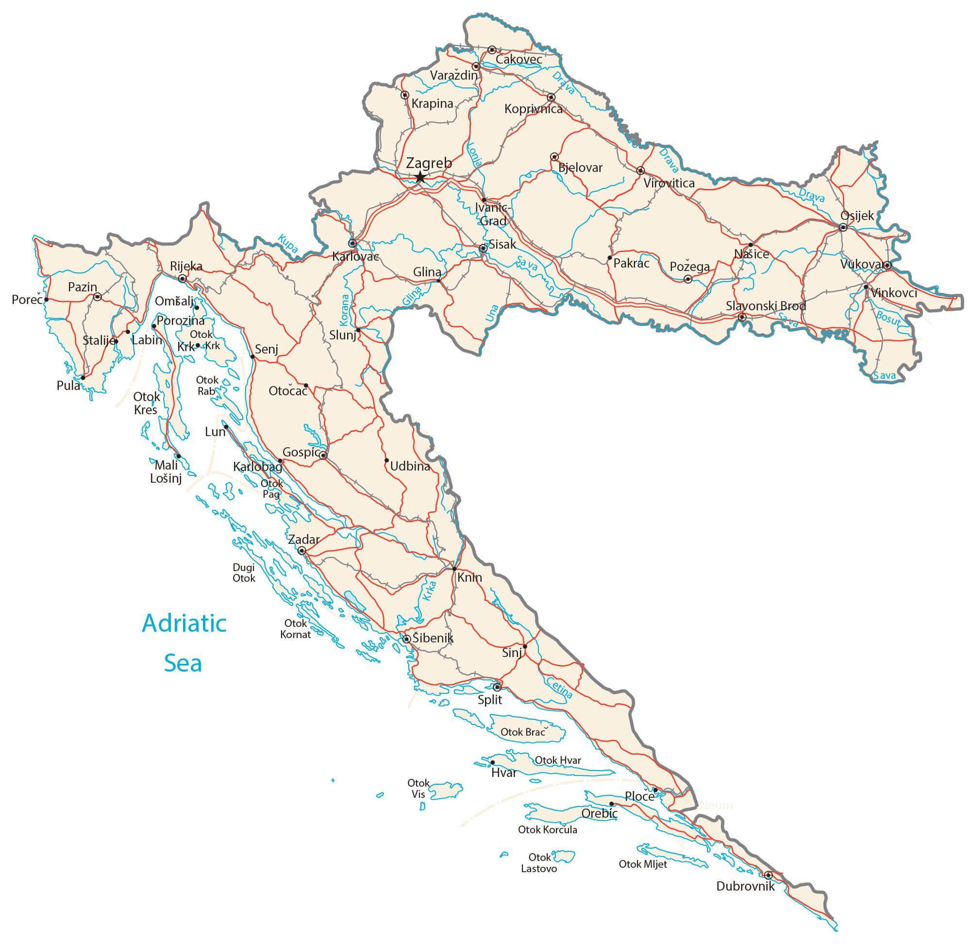
Explore Croatia with this interactive map. Discover the stunning landscapes, vibrant cities, and charming towns that make up this beautiful country. From the Pannonian Basin to the Dinaric Alps, this map of Croatia reveals the topography of the nation. Take a closer look at major cities, towns, highways, lakes, and rivers. Learn more about the country’s culture and history with this detailed map of Croatia.
Online Interactive Political Map
Click on ![]() to view map in "full screen" mode.
to view map in "full screen" mode.
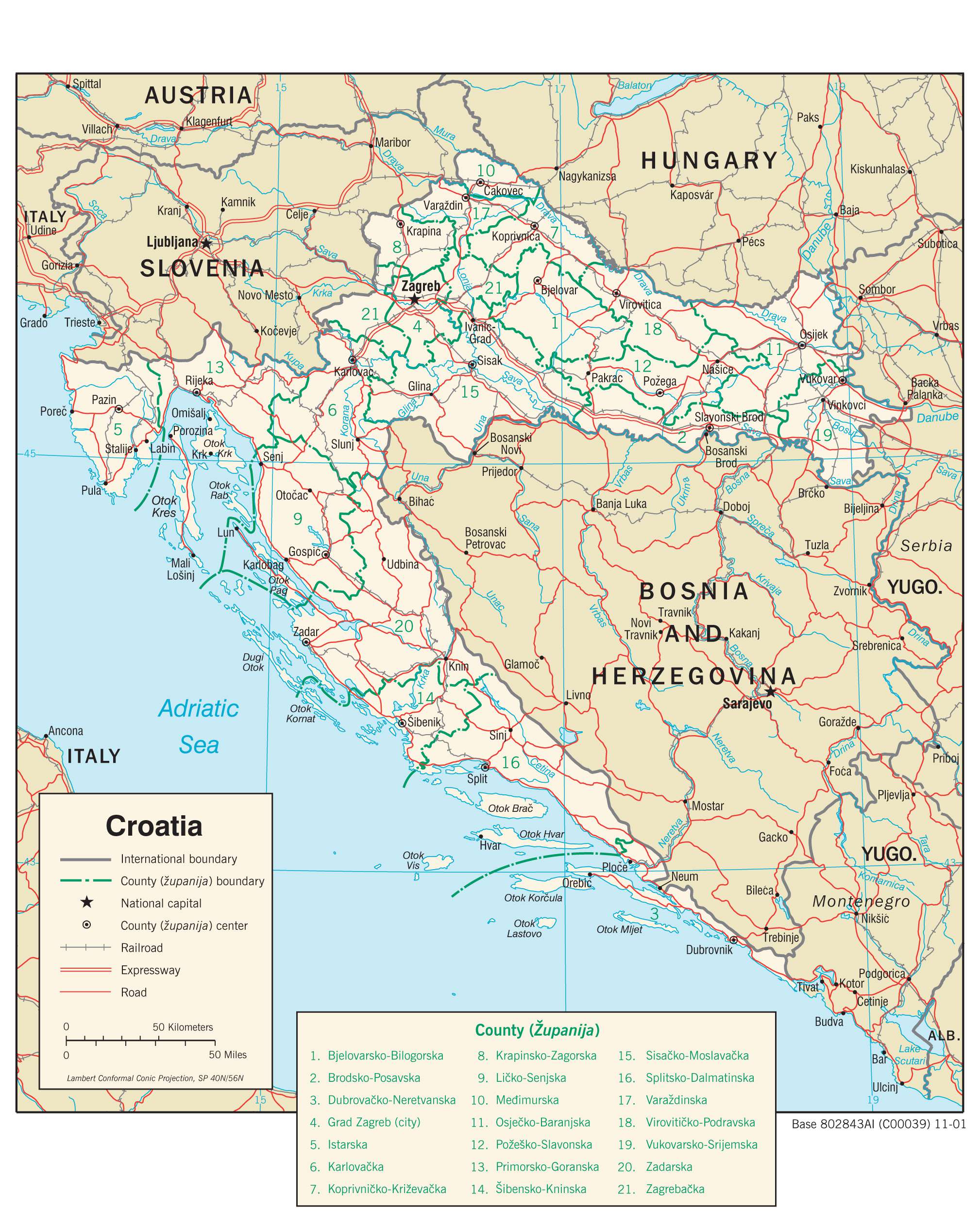
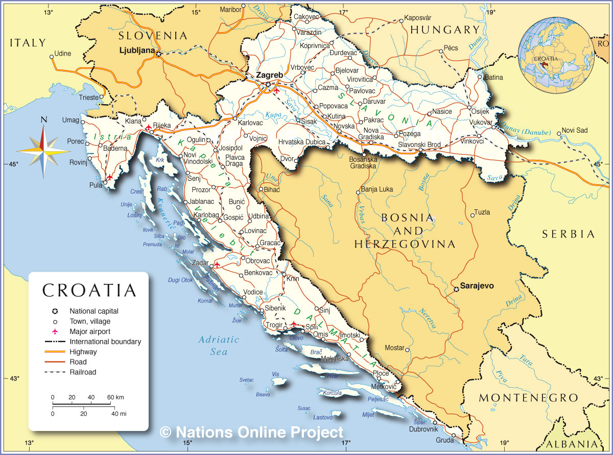
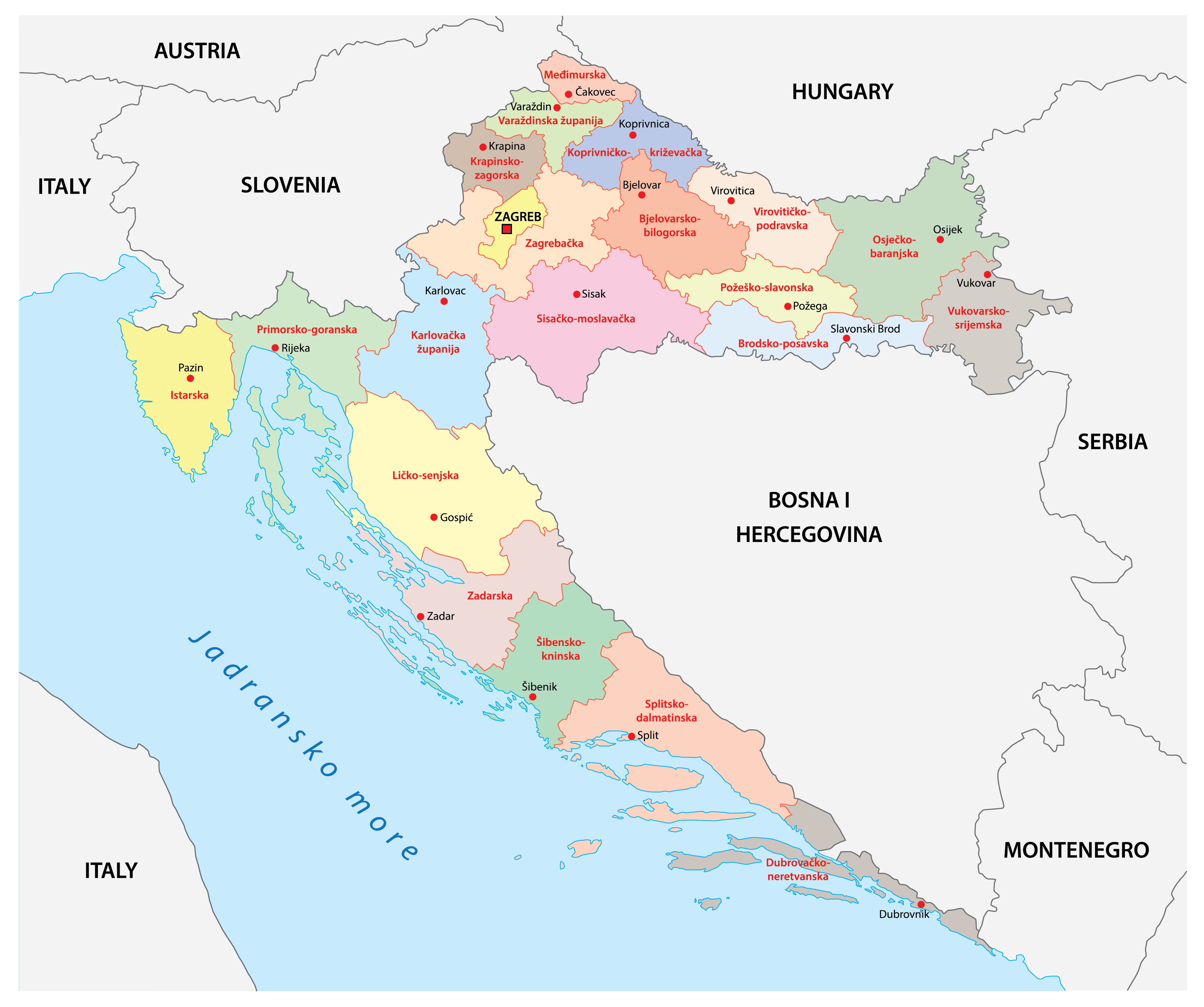
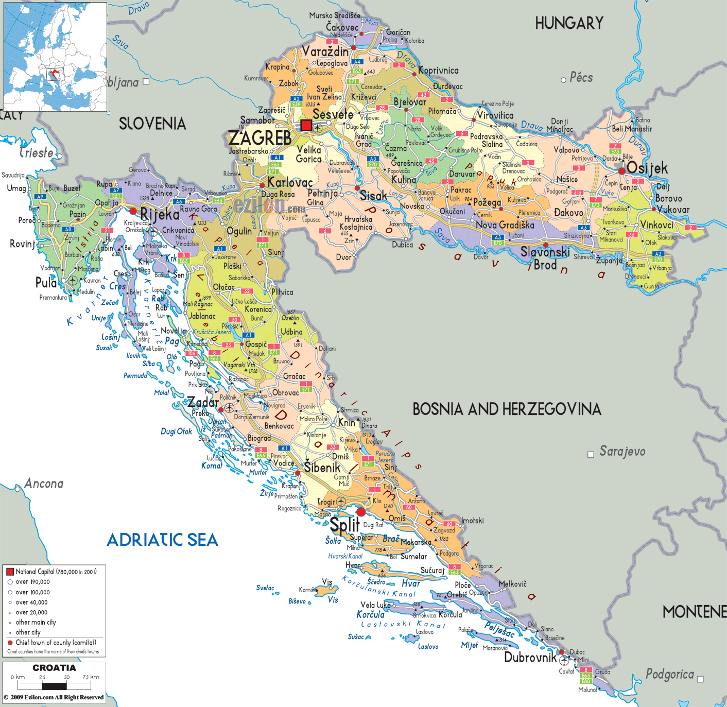
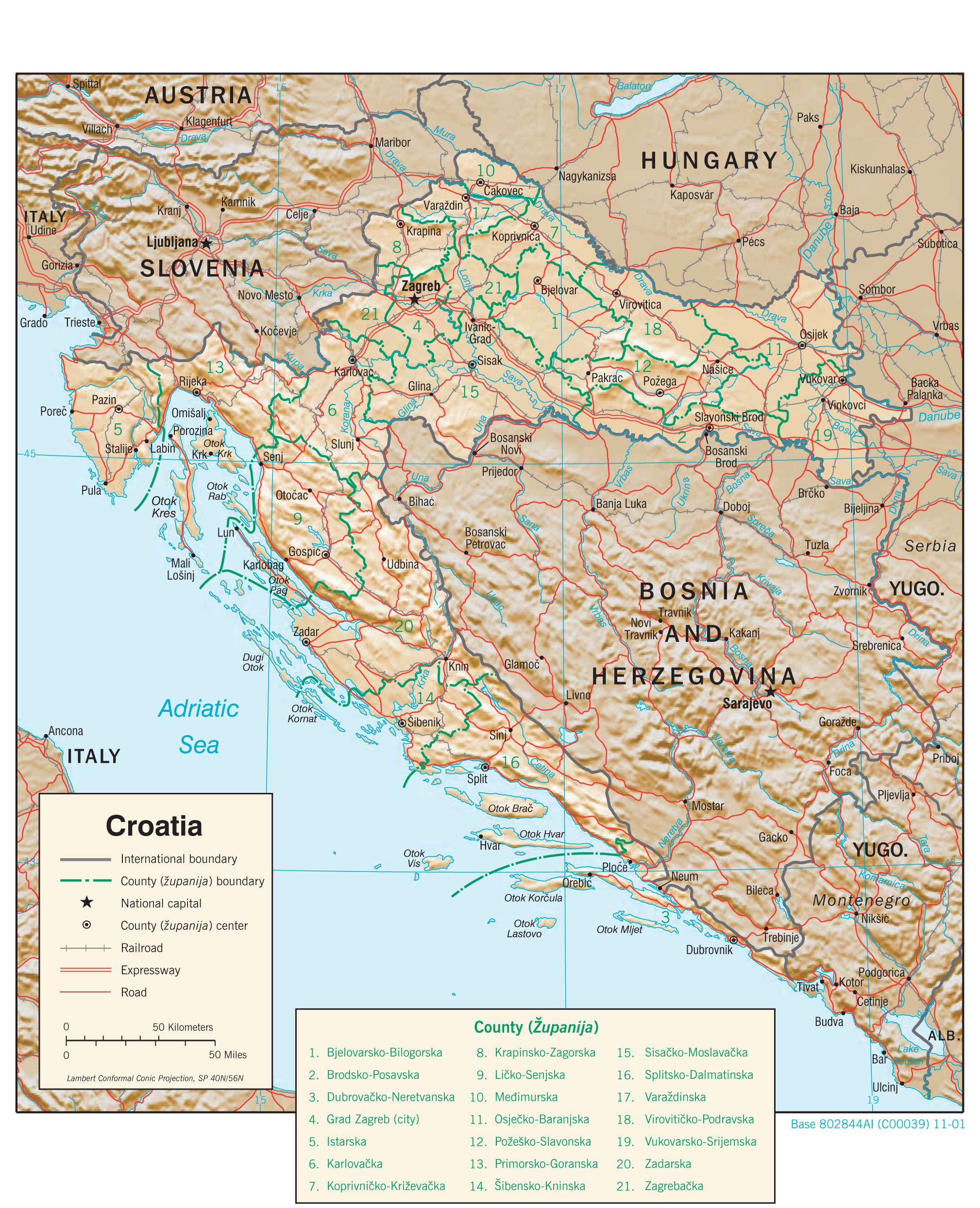
Croatia (officially, the Republic of Croatia) is administratively divided into 20 counties (zupanije, zupanija – singular) and 1 city with special county status (grad – singular). In alphabetical order,the counties are: Bjelovarsko-Bilogorska(Bjelovar-Bilogora), Brodsko-Posavska (Brod-Posavina), Dubrovacko-Neretvanska (Dubrovnik-Neretva), Istarska (Istria), Karlovacka (Karlovac), Koprivnicko-Krizevacka (Koprivnica-Krizevci), Krapinsko-Zagorska (Krapina-Zagorje), Licko-Senjska (Lika-Senj), Medimurska (Medimurje),Osjecko-Baranjska (Osijek-Baranja), Pozesko-Slavonska (Pozega-Slavonia), Primorsko-Goranska (Primorje-Gorski Kotar), Sibensko-Kninska (Sibenik-Knin), Sisacko-Moslavacka (Sisak-Moslavina), Splitsko-Dalmatinska (Split-Dalmatia), Varazdinska (Varazdin), Viroviticko-Podravska (Virovitica-Podravina),Vukovarsko-Srijemska (Vukovar-Syrmia), Zadarska (Zadar), and Zagrebacka (Zagreb county). Zagreb is a city with special county status.
The counties are further subdivided into 128 cities and 428 municipalities. The city of Zagreb is subdivided into 17 city districts.
Situated along the Sava River, at the southern slopes of the Medvednica Mountains, in the north western part of the country is, Zagreb – the capital and the largest city of Croatia. Zagreb is the country’s main administrative, cultural, industrial, economic and transport hub.
Location Maps
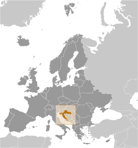
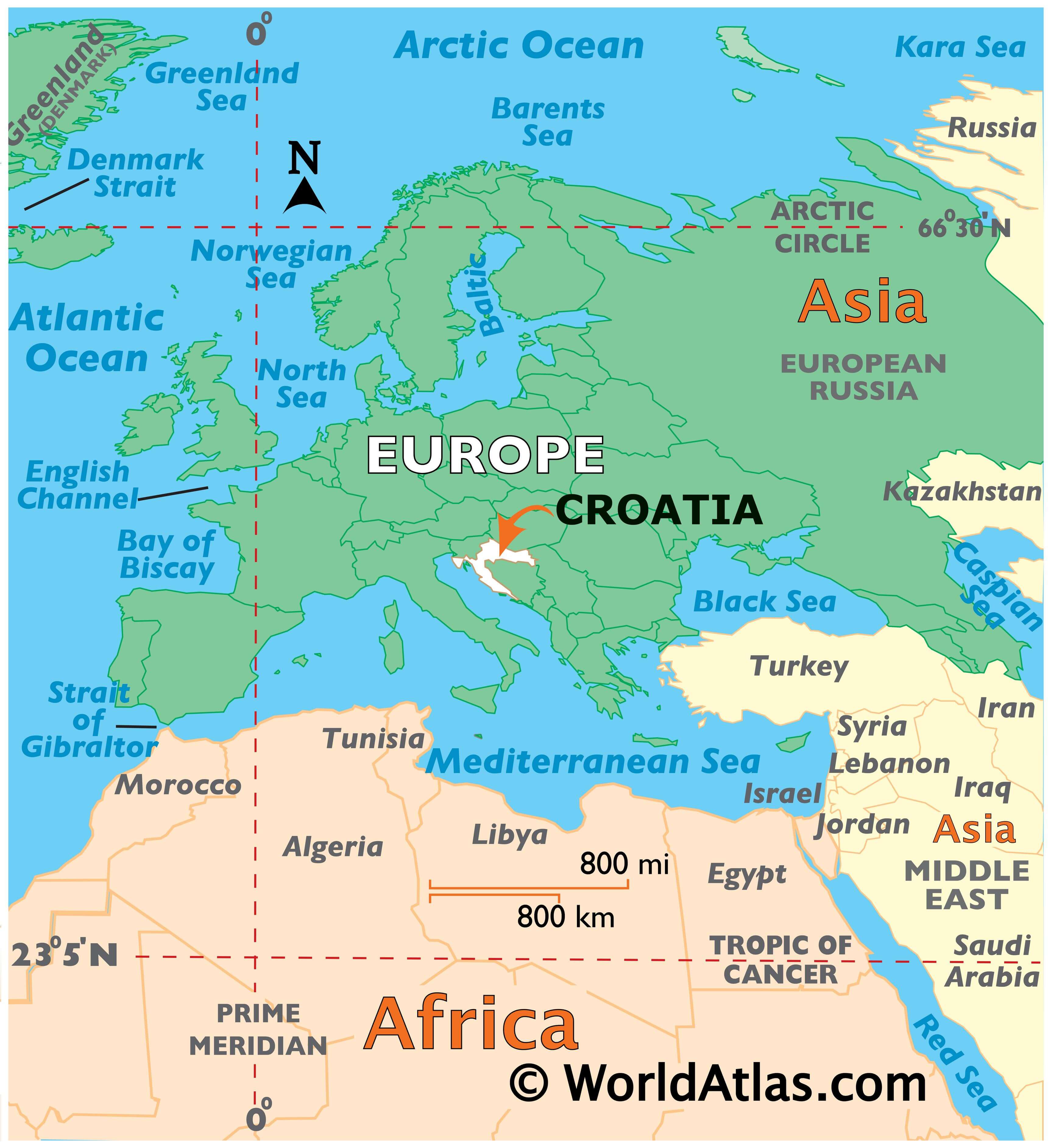
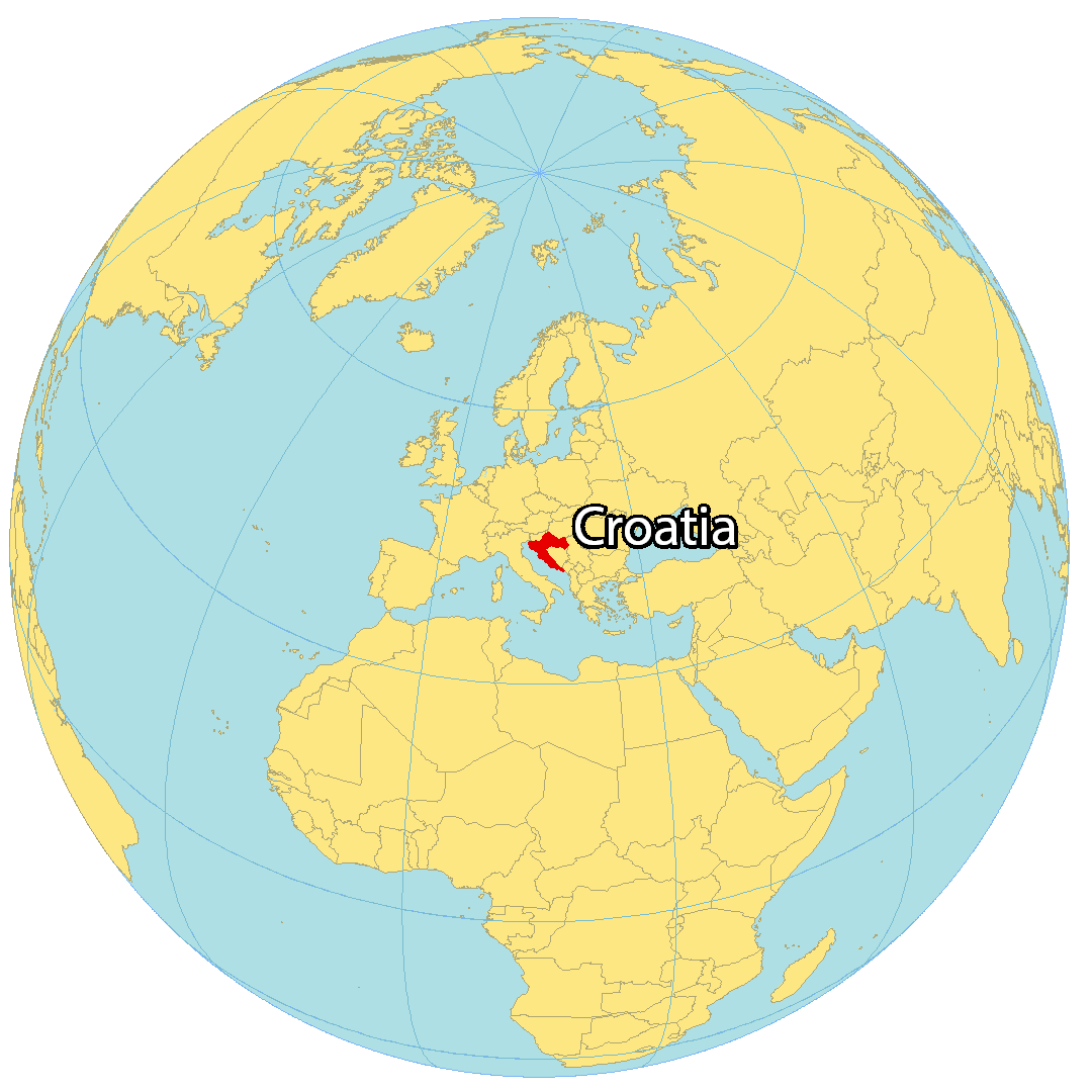
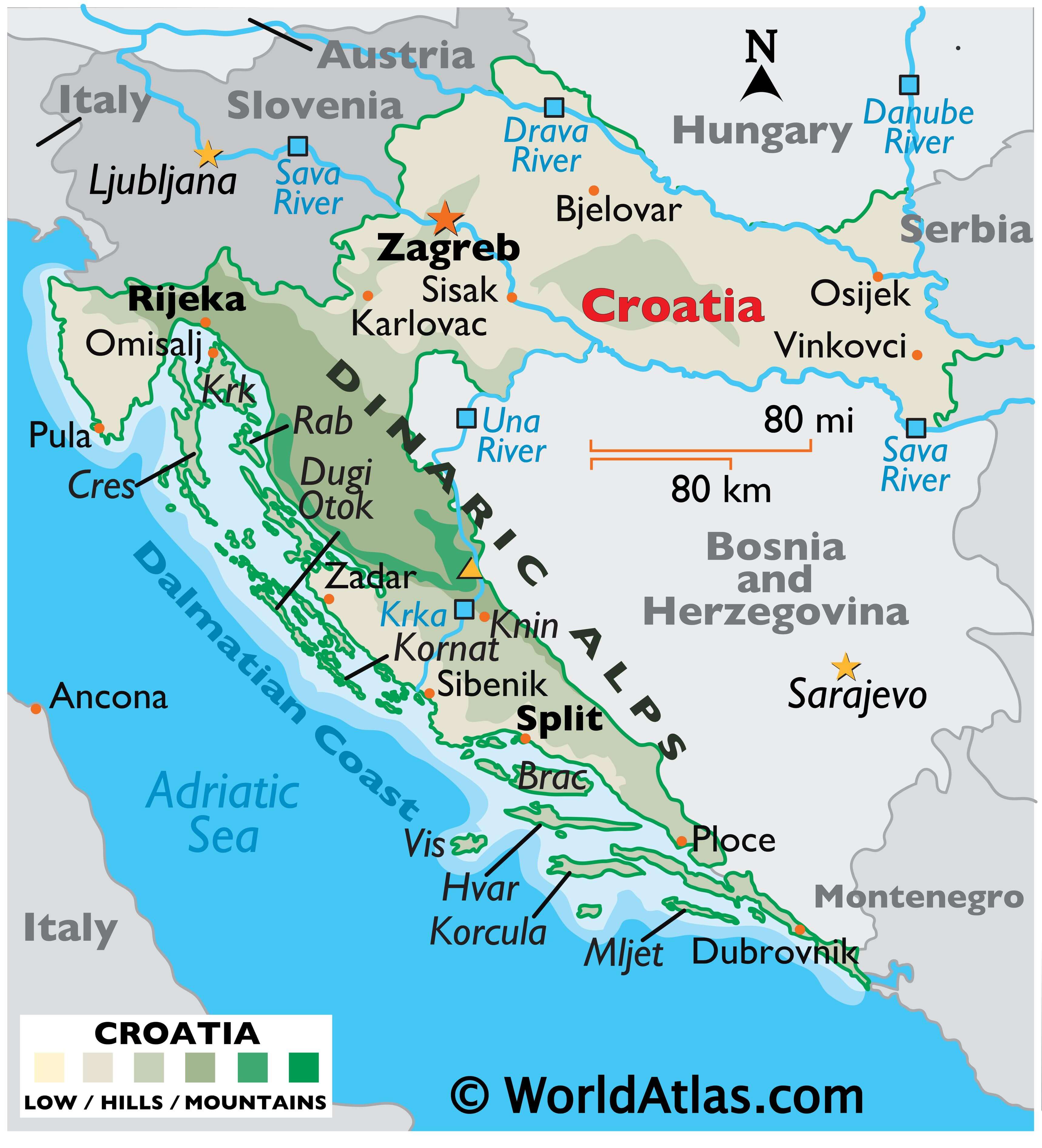
Where is Croatia?
Croatia is located in Southeast Europe next to the Adriatic Sea. It borders 5 other countries including Hungary to the northeast, Slovenia to the northwest, Serbia to the east, as well as Bosnia and Herzegovina and Montenegro to the southeast.
Croatia is known for being at the crossroads of Central and Southeast Europe due to its geographic position in Europe. Zagreb is the capital and largest city in Croatia. Other major cities include Split, Rijeka, and Osijek.
High Definition Political Map of Croatia
Physical Map of Croatia
Transportation Map of Croatia