Hermiston (/ˈhɜːrməstən/) is a city in Umatilla County, Oregon, United States. Its population of 19,973 makes it the largest city in Eastern Oregon. Hermiston is the largest and fastest-growing, city in the Hermiston-Pendleton Micropolitan Statistical Area, the eighth largest Core Based Statistical Area in Oregon with a combined population of 92,261 at the 2020 census. Hermiston sits near the junction of I-82 and I-84, and is 7 miles south of the Columbia River, Lake Wallula, and the McNary Dam. The Hermiston area has become a hub for logistics and data center activity due to the proximity of the I-82 and I-84 interchange, Pacific Northwest fiber optic backbone, and low power costs. The city is also known for its watermelons, which are part of its branding.
| Name: | Hermiston city |
|---|---|
| LSAD Code: | 25 |
| LSAD Description: | city (suffix) |
| State: | Oregon |
| County: | Umatilla County |
| Incorporated: | 1907 |
| Elevation: | 643 ft (196 m) |
| Land Area: | 8.43 sq mi (21.83 km²) |
| Water Area: | 0.00 sq mi (0.00 km²) |
| Population Density: | 2,296.12/sq mi (886.50/km²) |
| ZIP code: | 97838 |
| Area code: | 541 |
| FIPS code: | 4133700 |
| GNISfeature ID: | 1167708 |
| Website: | hermiston.or.us |
Online Interactive Map
Click on ![]() to view map in "full screen" mode.
to view map in "full screen" mode.
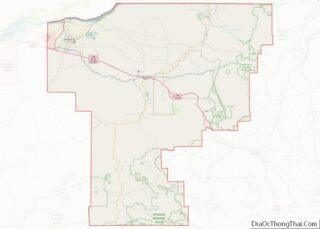
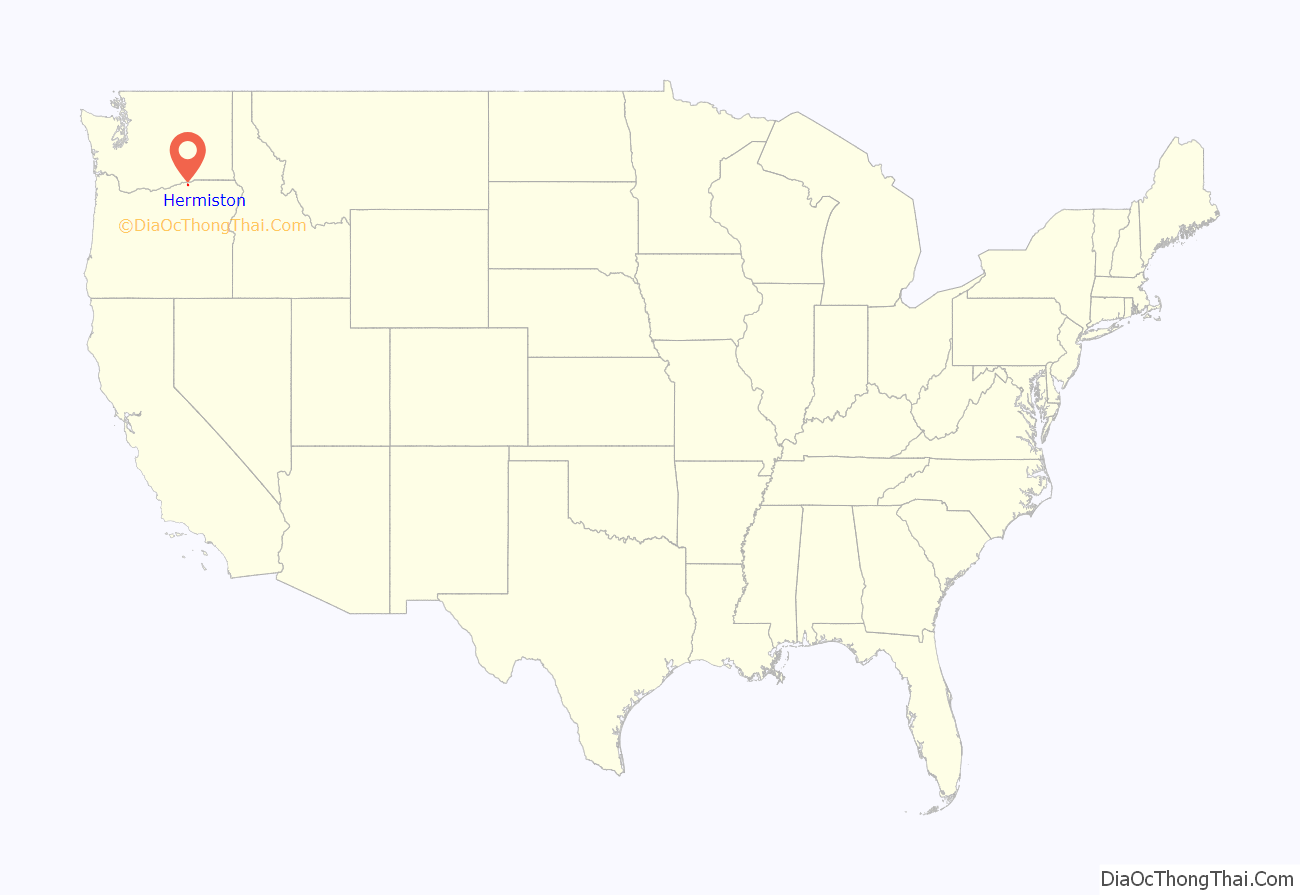
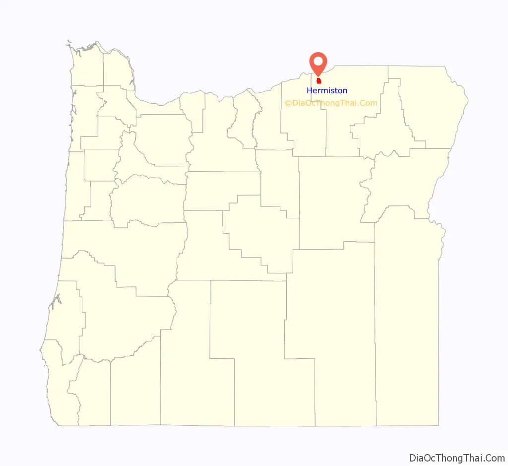
Hermiston location map. Where is Hermiston city?
History
The historic inhabitants of the area were the indigenous Umatilla, Cayuse, Walla Walla, and Columbia Indians, descendants of peoples who lived in this area for thousands of years. The earliest European settlers established a mission near Pendleton in 1847. The territorial government organized Umatilla County in 1862 from the larger Wasco County. On July 10, 1907, the town of Hermiston was incorporated. The original railroad station was named Maxwell, likely after a contemporary official at the railroad company. Colonel J. F. McNaught, an early settler in the region, later named it Hermiston from Robert Louis Stevenson’s unfinished novel Weir of Hermiston.
The greater Hermiston region began to see irrigated agriculture in 1908, with the completion of the U.S. Bureau of Reclamation’s Umatilla Basin Project in the form of Cold Springs Reservoir. The region saw modest growth until the outbreak of World War II, when the Umatilla Army Depot was constructed, causing Hermiston’s population to jump from 803 at the 1940 US Census to 3,804 in 1950. The region continued to experience modest growth for the next several decades until the 1970’s, when low power costs coupled with the development of center-pivot irrigation resulted in a significant expansion in agricultural acreage put in to potato production. The expansion of potato production coincided with the development of large potato processing plants by Lamb-Weston and Simplot, focusing on frozen potato products. The associated economic development drove Hermiston’s population to nearly double from 4,893 in 1970 to 9,408 by 1980. The 1990’s brought additional large employment developments to the Hermiston region in the form of Two Rivers Correctional Institution, a Wal-Mart Distribution Center, expansion of the Union Pacific Hinkle Rail Yard, and beginning of the Umatilla Army Depot’s Chemical Weapon Incineration process. The 2000’s have seen continued growth and diversification of the regional economy as Hermiston has grown to a population of 19,354 at the 2020 Census and has become a regional center for commercial and professional services.
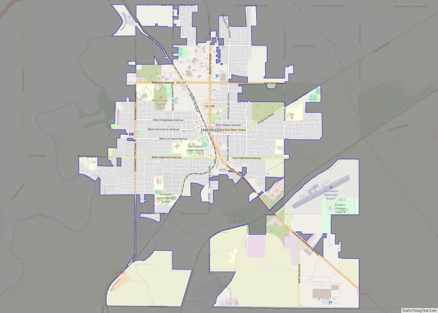
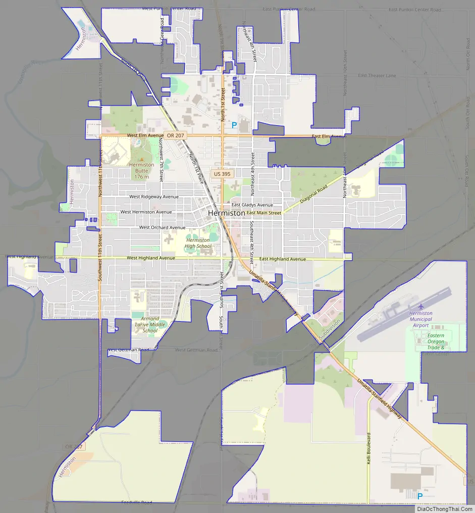
Hermiston Road Map
Hermiston city Satellite Map
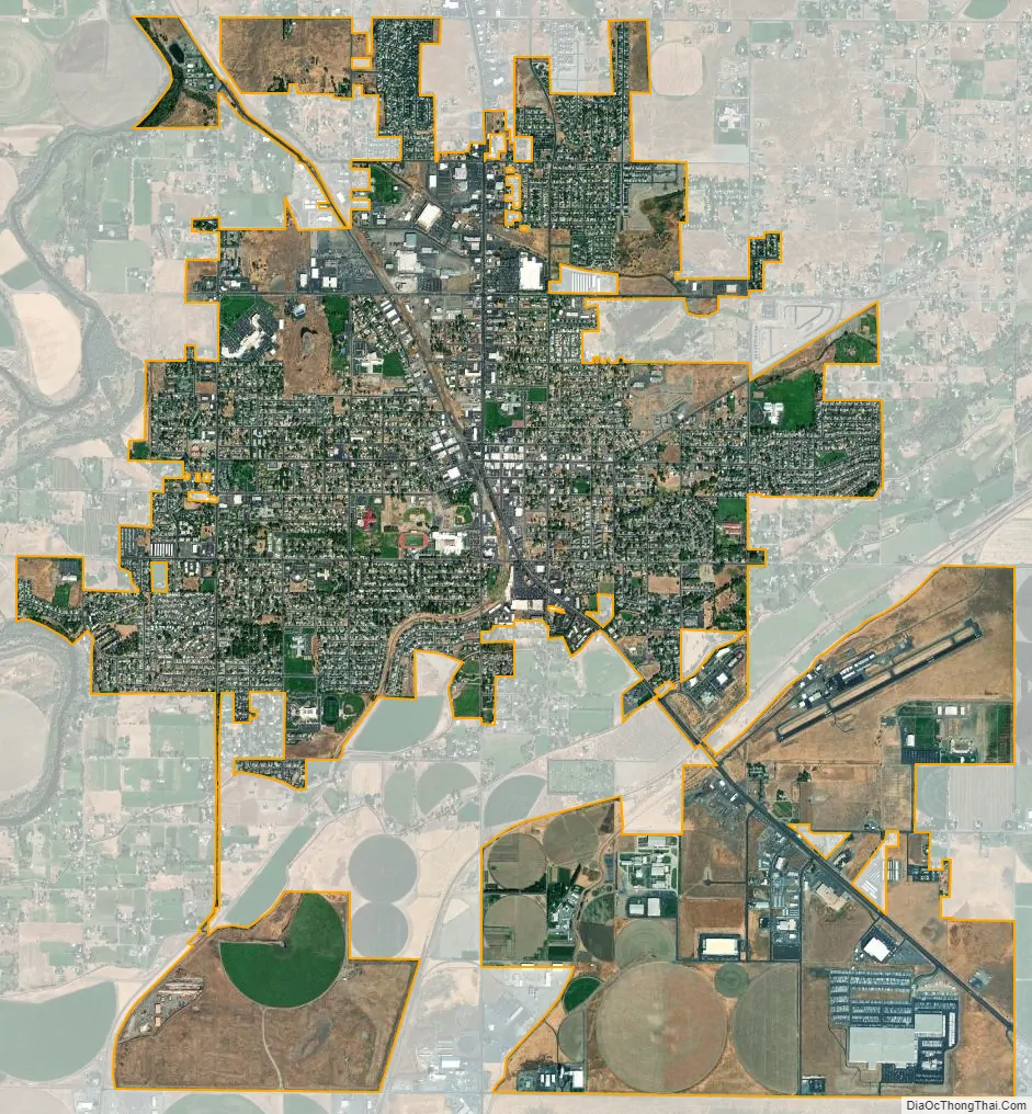
Geography
According to the United States Census Bureau, the city has a total area of 7.81 square miles (20.23 km), all land.
Distance to major cities:
- Tri-Cities, Washington – 30 to 45 miles (48 to 72 km)
- Portland, Oregon – 181 miles (291 km)
- Seattle, Washington – 259 miles (417 km)
- Spokane, Washington – 204 miles (328 km)
- Boise, Idaho – 259 miles (417 km)
- Salt Lake City, Utah – 587 miles (945 km)
- Missoula, Montana – 367 miles (591 km)
Hermiston’s recent population growth is due to its proximity to large cities in the Pacific Northwest and its location along two major freeways.
Climate
According to the Köppen climate classification system, Hermiston has a steppe climate (Köppen BSk). This gives the area hot dry summers with high daytime temperatures which do cool considerably overnight, and relatively cold winters which typically yield several snow storms per year with relatively minimal accumulation. On June 29, 2021 a max temperature of 118 °F (48 °C) was recorded in Hermiston, which is just one degree below the new all-time record high temperature for the State of Oregon, which was set in Jefferson County on the same day.
See also
Map of Oregon State and its subdivision: Map of other states:- Alabama
- Alaska
- Arizona
- Arkansas
- California
- Colorado
- Connecticut
- Delaware
- District of Columbia
- Florida
- Georgia
- Hawaii
- Idaho
- Illinois
- Indiana
- Iowa
- Kansas
- Kentucky
- Louisiana
- Maine
- Maryland
- Massachusetts
- Michigan
- Minnesota
- Mississippi
- Missouri
- Montana
- Nebraska
- Nevada
- New Hampshire
- New Jersey
- New Mexico
- New York
- North Carolina
- North Dakota
- Ohio
- Oklahoma
- Oregon
- Pennsylvania
- Rhode Island
- South Carolina
- South Dakota
- Tennessee
- Texas
- Utah
- Vermont
- Virginia
- Washington
- West Virginia
- Wisconsin
- Wyoming