Lakeview is a town in Lake County, Oregon, United States. The population was 2,418 at the 2020 census. It is the county seat of Lake County. The city bills itself as the “Tallest Town in Oregon” because of its elevation, 4,757 feet (1,450 m) above sea level. Lakeview is situated in the Goose Lake Valley at the foot of the Warner Mountains and at the edge of Oregon’s high desert country. Its economy is based on agriculture, lumber production, and government activities. In addition, tourism is an increasingly important part of the city’s economy. Oregon’s Outback Scenic Byway passes through Lakeview.
| Name: | Lakeview town |
|---|---|
| LSAD Code: | 43 |
| LSAD Description: | town (suffix) |
| State: | Oregon |
| County: | Lake County |
| Incorporated: | 1889 |
| Elevation: | 4,757 ft (1,450 m) |
| Total Area: | 2.45 sq mi (6.35 km²) |
| Land Area: | 2.44 sq mi (6.33 km²) |
| Water Area: | 0.01 sq mi (0.03 km²) |
| Total Population: | 2,418 |
| Population Density: | 989.77/sq mi (382.15/km²) |
| ZIP code: | 97630 |
| Area code: | 541 |
| FIPS code: | 4140700 |
| GNISfeature ID: | 2412870 |
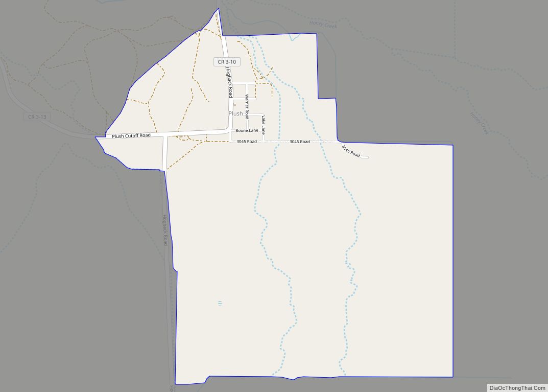
Online Interactive Map
Click on ![]() to view map in "full screen" mode.
to view map in "full screen" mode.
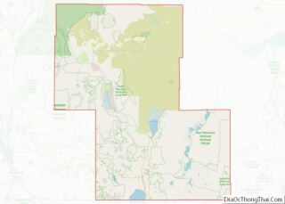
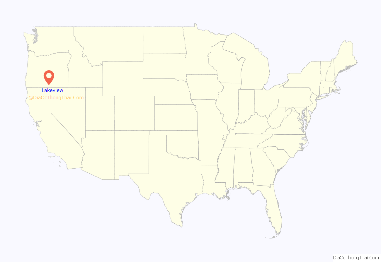
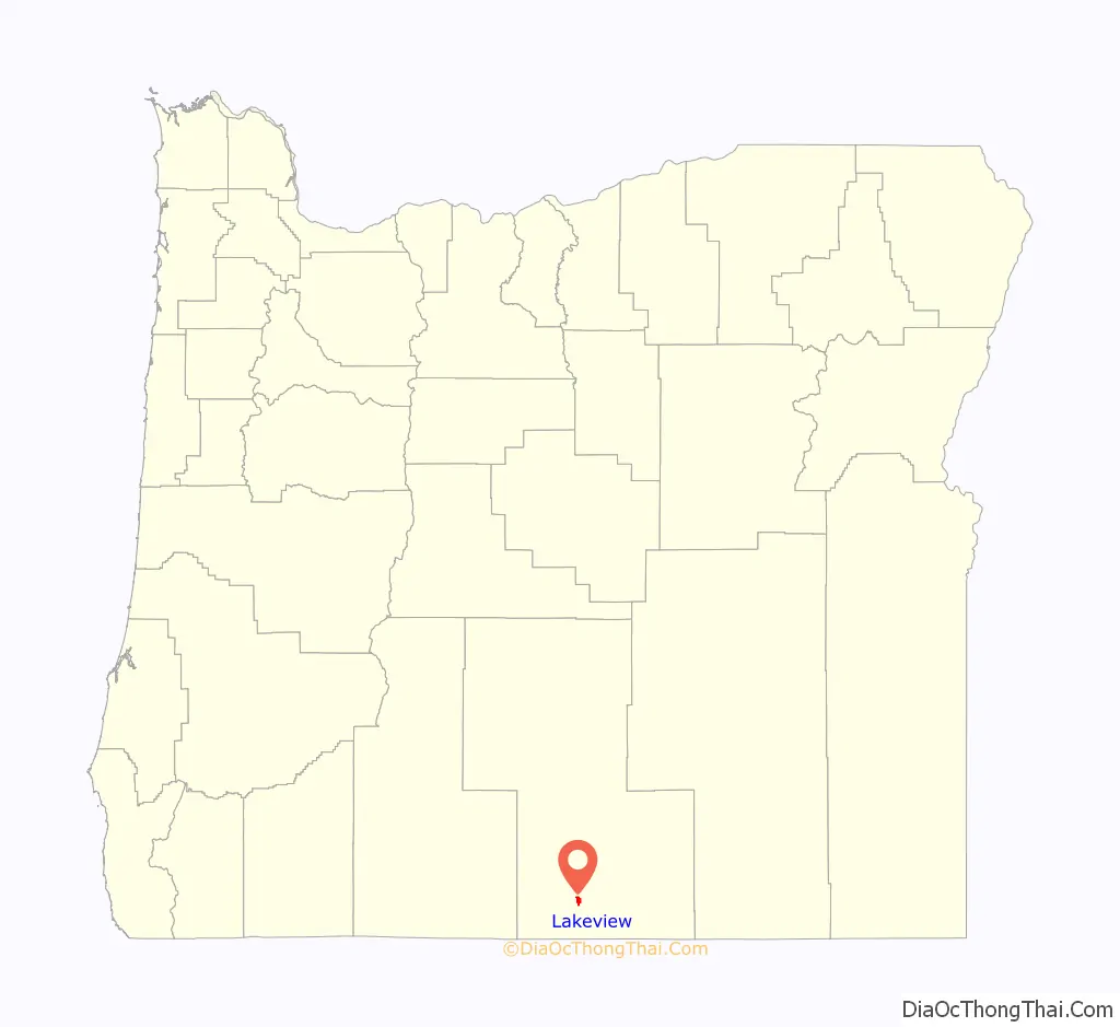
Lakeview location map. Where is Lakeview town?
History
Native Americans probably occupied the area around Lakeview for as early as 14,000 years ago, as evidenced by artifacts found in the Paisley Caves north of Lakeview. European explorers came through the Goose Lake Valley, Shoshone speaking people were living in the area.
In 1827, Peter Skene Ogden led a brigade of Hudson’s Bay Company trappers through the Goose Lake Valley. He was followed in 1832 by John Work and his trappers. Work noted the hot springs north of Goose Lake (now called Hunter’s Hot Springs) in his journal. The hot springs are approximately 2 miles (3.2 km) north of the Lakeview town site.
In 1867 and 1868, General George Crook led United States Army units and Indian scouts from the Wasco and Warm Springs tribes in a successful campaign against Northern Paiute bands in Eastern Oregon and northern California. This was part of the conflict known as the Snake War. Crook used Camp Warner as his supply depot and administrative headquarters. The camp was abandoned in 1874. Camp Warner was northeast of the site now known as Lakeview.
In 1869, M. W. Bullard settled along Bullard Creek at the mouth of Bullard Canyon at the northern end of the Goose Lake Valley. This became the town of Lakeview. William Heryford brought cattle into the Goose Lake Valley in 1872. In 1873, the area’s first post office was opened at the Tenbrook Ranch, south of present-day Lakeview.
Lake County was separated from Jackson County and Wasco County in 1874. The temporary county seat was in Linkville (now Klamath Falls, Oregon). In June 1876, an election was held to select a permanent county seat. Prior to the election, W. M. Bullard offered to donate 20 acres (8.1 ha) along Bullard Creek in the Goose Lake Valley as a site for the county courthouse. In the election, “Bullard Creek” received 120 votes while Linkville got only 88 votes. However, a majority of 384 votes was needed to determine the permanent county seat. Bullard Creek fell short because many voters wrote in names like “Goose Lake”, “Goose Lake Valley”, “Bullard’s ranch”, or “Bullard’s creek”. As a result, a second election was November 1876. Prior to that election, the town of Lakeview was organized at a meeting of Goose Lake Valley residents. The town site they selected was on Bullard Creek. In the second election, the new town site of Lakeview replaced Linkville as Lake County’s seat of government. After the election, Bullard donated 20 acres (8.1 ha) for the county courthouse as promised. Bullard sold an additional 300 acres (120 ha) to John A. Moon, who filed a town plat with the state of Oregon, officially creating the town of Lakeview. The Lakeview post office was opened on December 8, 1876.
On May 22, 1900, a fire burned most of Lakeview. There were no deaths, but 64 buildings were destroyed. Only two business structures in the downtown area survived the fire. However, the staff of the Lake County Examiner newspaper rescued enough equipment and material to publish a special edition the day after the fire. Most of the town was re-built by October of that year. The town’s rapid recovery was due in large part to the financing and leadership provided by Bernard Daly.
The federal government established the Goose Lake Forest Reserve in 1906. Later that year, the name was changed to Fremont National Forest Reserve to honor Captain John C. Fremont, an explorer of the area in 1843. In 1908, the Fremont National Forest was created, and is managed by the United States Forest Service. The forest headquarters was in Lakeview.
In 1909, the Oregon Valley Land Company conducted a week-long auction to dispose of land grants acquired from the construction of the Oregon Central Military Wagon Road in 1865 and 1869. The auction was advertised nationwide. The rural parcels also included a separate town lot in Lakeview. Thousands of people came to Lakeview for the auction, but others purchased plots sight-unseen. During the auction, a total of 340,000 acres (140,000 ha) were sold in approximately 14,000 parcels. Few buyers moved onto the land they purchased. Lake County used part of the taxes they collected from the sale to finance a new county courthouse. The new brick courthouse was built in the center of town, replacing the wooden building serving as the county court since 1876.
In 1911, a narrow gauge railway connected Lakeview with Reno, Nevada. The Nevada-California-Oregon Railway operated the line until 1927, then it was sold to the Southern Pacific Railroad. Southern Pacific converted the track to standard gauge. The new standard rail connection prompted several sawmills to operate in Lakeview, expanding the town’s economic base.
In 1913, William P. Heryford commissioned the construction of a three-story commercial building in downtown Lakeview, across the street from the Lake County courthouse. The Heryford Brothers Building cost approximately $100,000 to construct. After it was completed, the building was the largest and most expensive structure in Lakeview. It was also the most modern, with an electric generator, central steam-heat, elevators, electric lights, hot water, and telephones.
By 1940, Lakeview had seven sawmills operating in town. All of the mills had new dry kilns for year-around operations. This increased winter employment opportunities in Lakeview, increasing economic stability in the community. The number of sawmills decreased during World War II, leaving only three by 1946. That year, 39,000,000 board feet of timber was cut on the Fremont National Forest. However, that national forest’s timber harvest increased to 81,200,000 board feet per year by 1952. To accommodate this increase, Lakeview’s sawmills were expanded and modernized. In the 1950s, the payrolls and income from Lakeview’s sawmills accounted for more than half of the town’s economy.
In the mid-1950s, uranium mining claims were filed in the mountains north of Lakeview. However, only two mines, White King and Lucky Lass, were developed. In 1958, the Lakeview Mining Company uranium processing plant was built on the outskirts of Lakeview. The mill had the capacity to process 210 tons of uranium ore daily. The mill employed 50 people; another 120 people were employed at the two mines. The uranium plant closed in 1961.
In 1985, Southern Pacific announced they planned to abandon their spur line to Lakeview. However, the company continued to operate the line until it was purchased by Lake County in January 1986. Lake County contracted operation of the line to Great Western Railway. In 1996, Lake County took over the railroad operation, then renamed it the Lake County Railroad. From 2007, the Modoc Northern Railroad leased the line from the county. In 2009, Frontier Rail operated the line under the name Lake Railroad.
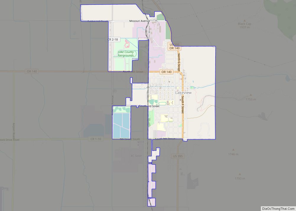
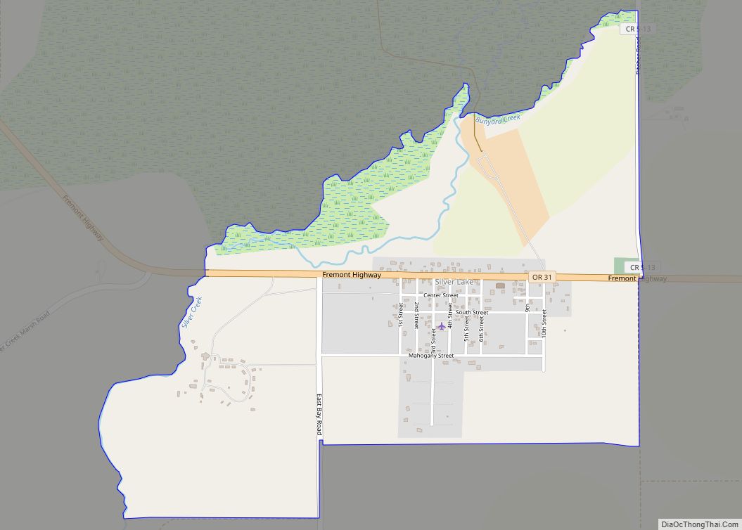
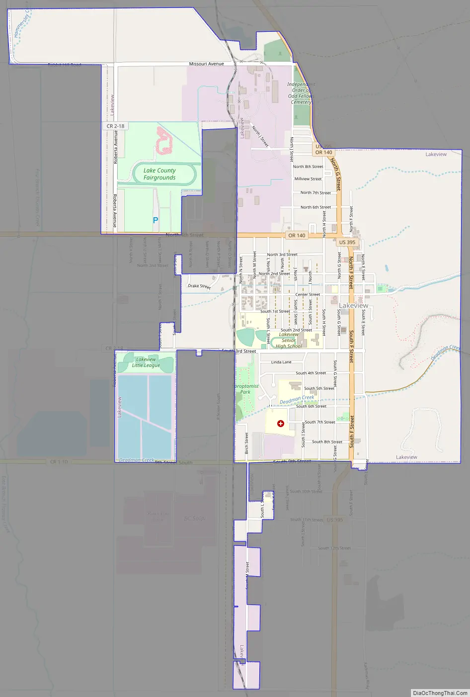
Lakeview Road Map
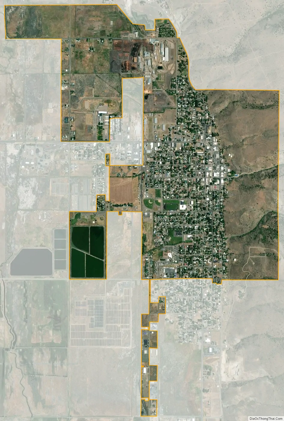
Lakeview city Satellite Map
Geography
Lakeview is in the Goose Lake Valley at the foot of the Warner Mountains to the east. It is on the edge of the high desert country of southeastern Oregon. At an elevation of 4,800 feet (1,500 m), Lakeview is one of the highest cities in Oregon.
According to the United States Census Bureau, the city has a total area of 2.34 square miles (6.06 km), of which, 2.33 square miles (6.03 km) is land and 0.01 square miles (0.03 km) is water.
Climate
Lakeview has a typical semiarid continental Mediterranean climate (Köppen Dsb) for the leeward side of the Cascades. Summers are hotter than western Oregon during the daytime, but nights are always cool and rare frosts can occur during July. Little rainfall occurs during the summers; winters are cold and frequently severe because of the latitude and elevation, although snowfall can sometimes be heavy – the maximum monthly snow cover being 31 inches (0.79 m) during January 1993 and 44 inches (1.12 m) on the thirteenth day of that month. Typically, temperatures fall below freezing (32 °F (0 °C)) half the year, and fall below 0 °F (−17.8 °C) on only five days a year. Extreme historical temperatures range from −27 °F (−32.8 °C) on December 8, 2013 to 108 °F (42.2 °C) on August 7, 1905.
Annual precipitation averaged 15.49 inches (393.4 mm) between 1971 and 2000. The wettest calendar year since record-keeping started in 1888 is 1998 with 24.13 inches (612.9 mm); the driest was 1924 with 7.03 inches (178.6 mm) – less than the total for the wettest month of December 1964 of 8.96 inches (227.6 mm) fall, including the melt from 20.50 inches (0.52 m) of snow. The most snowfall in a calendar month was 53.0 inches (1.35 m) in February 1894, and the most in a season at least 134.5 inches (3.42 m) (some days unavailable) between July 1893 and June 1894, in contrast to which as little as 15.40 inches (0.39 m) fell in the drought season between July 1923 and June 1924.
See also
Map of Oregon State and its subdivision: Map of other states:- Alabama
- Alaska
- Arizona
- Arkansas
- California
- Colorado
- Connecticut
- Delaware
- District of Columbia
- Florida
- Georgia
- Hawaii
- Idaho
- Illinois
- Indiana
- Iowa
- Kansas
- Kentucky
- Louisiana
- Maine
- Maryland
- Massachusetts
- Michigan
- Minnesota
- Mississippi
- Missouri
- Montana
- Nebraska
- Nevada
- New Hampshire
- New Jersey
- New Mexico
- New York
- North Carolina
- North Dakota
- Ohio
- Oklahoma
- Oregon
- Pennsylvania
- Rhode Island
- South Carolina
- South Dakota
- Tennessee
- Texas
- Utah
- Vermont
- Virginia
- Washington
- West Virginia
- Wisconsin
- Wyoming