Ashland is a city in Jackson County, Oregon, United States. It lies along Interstate 5 approximately 16 miles (26 km) north of the California border and near the south end of the Rogue Valley. The city’s population was 21,360 at the 2020 census.
The city is the home of Southern Oregon University (SOU) and the Oregon Shakespeare Festival (OSF). These are important to Ashland’s economy, which also depends on restaurants, galleries, and retail stores that cater to tourists. Lithia Park along Ashland Creek, historic buildings, and a paved intercity bike trail provide additional visitor attractions.
Ashland, originally called “Ashland Mills”, was named after Ashland County, Ohio, the original home of founder Abel Helman, and secondarily for Ashland, Kentucky, where other founders had family connections. Ashland has a council-manager government assisted by citizen committees. Historically, its liberal politics have differed, often sharply, with much of the rest of southwest Oregon.
| Name: | Ashland city |
|---|---|
| LSAD Code: | 25 |
| LSAD Description: | city (suffix) |
| State: | Oregon |
| County: | Jackson County |
| Elevation: | 1,949 ft (594 m) |
| Total Area: | 6.64 sq mi (17.19 km²) |
| Land Area: | 6.64 sq mi (17.19 km²) |
| Water Area: | 0.00 sq mi (0.00 km²) |
| Total Population: | 21,360 |
| Population Density: | 3,218.81/sq mi (1,242.84/km²) |
| ZIP code: | 97520 |
| FIPS code: | 4103050 |
| GNISfeature ID: | 1137318 |
| Website: | www.ashland.or.us |
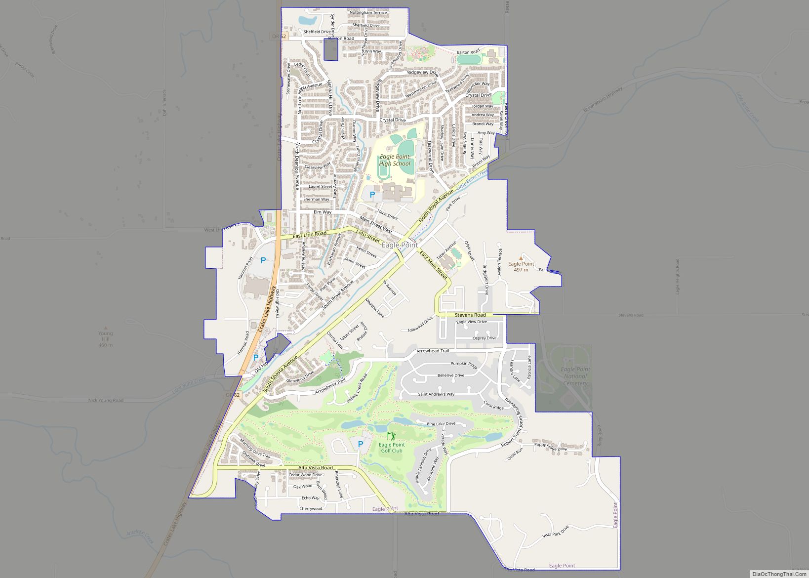
Online Interactive Map
Click on ![]() to view map in "full screen" mode.
to view map in "full screen" mode.
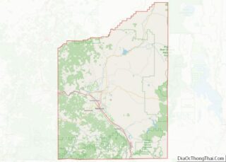
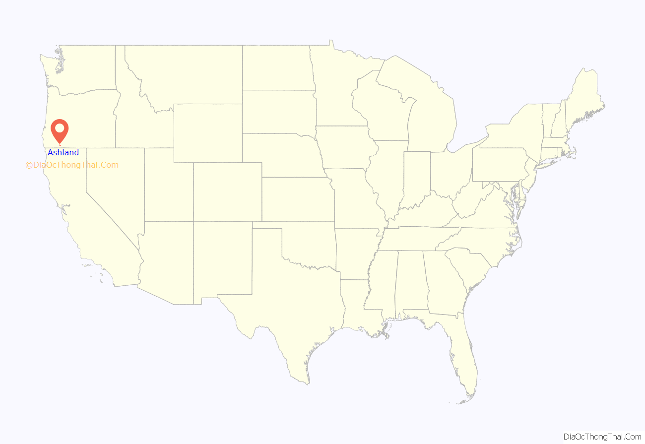
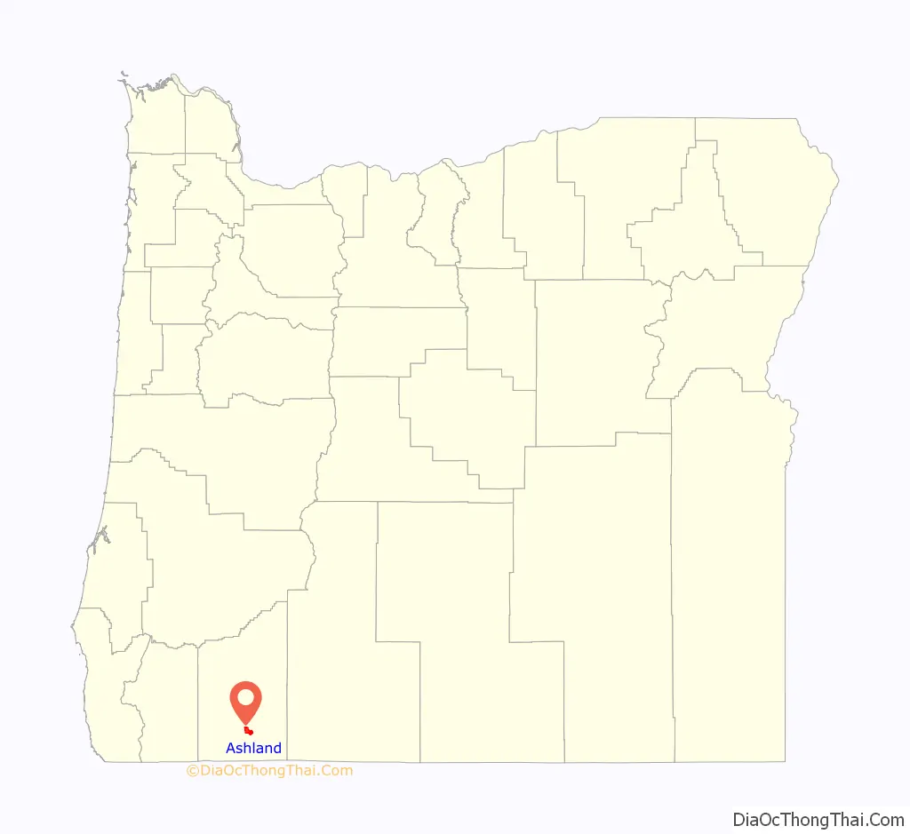
Ashland location map. Where is Ashland city?
History
Prior to the arrival of white settlers in mid-19th century, the Shasta people lived in the valley along Ashland Creek approximately where today’s city is located. Early Hudson’s Bay Company hunters and trappers following the Siskiyou Trail passed through the site in the 1820s. In the late 1840s, mainly American settlers following the Applegate Trail began passing through the area. By the early 1850s, the Donation Land Claim Act brought many to the Rogue Valley and into conflict with its native people. These often violent clashes, known ultimately as the Rogue River Wars, continued until 1856.
In 1851, gold was discovered at Rich Gulch, a tributary of Jackson Creek, and a tent city grew on its banks, today’s Jacksonville. Settlers arrived in the Ashland area in January 1852, including Robert B. Hargadine, Sylvester Pease, Abel D. Helman, Eber Emery, and others. Helman and Hargadine filed the first donation land claims in Ashland. Helman and Emery built a sawmill along what was then called Mill Creek to turn timber into lumber for settlers. In 1854, they and another settler, M. B. Morris, built a second mill, Ashland Flouring Mills, to grind local wheat into flour. The community around the mill became known as “Ashland Mills”. A post office was established in Ashland Mills in 1855 with Helman as postmaster.
During the 1860s and 1870s the community grew, establishing a school, churches, businesses and a large employer, Ashland Woolen Mills, which produced clothing and blankets from local wool. In 1871, the Post Office dropped “Mills” from Ashland’s name. In 1872 Reverend J. H. Skidmore opened a college, Ashland Academy, a predecessor of Southern Oregon University.
In 1887, Portland, Oregon and San Francisco, California were joined by rail at Ashland. Until 1926, when most rail service began taking a different route (east through Klamath Falls to avoid the steep grade through the Siskiyou Mountains), Ashland thrived on rail trade of local products, including pears, peaches, and apples.
In 1908, the Women’s Civic Improvement Club petitioned for the creation of community space along Ashland Creek, which became Ashland Canyon Park. The discovery of lithia water near Emigrant Lake around the same time led to a plan to establish a mineral spa at the park. Voters approved bonds to pay for the project, which included piping the mineral water from its source to Ashland. The town engaged John McLaren, landscape architect of San Francisco’s Golden Gate Park, to design the park, renamed Lithia Springs Park, later shortened to Lithia Park. Although the park was popular, the mineral spa plans proved too expensive for local taxpayers and were abandoned in 1916. Meanwhile, entrepreneurs took to bottling and selling mineral waters from the area’s springs.
During the Fourth of July celebration in 1935, Angus L. Bowmer arranged the first performances of what would become the Oregon Shakespeare Festival. The festival has grown since then, and has become an award-winning and internationally known regional theater company.
Many of Ashland’s historic buildings have been preserved and restored. The city has 59 individual structures and four historic districts (Downtown District, Siskiyou-Hargadine District, Railroad District, Skidmore Academy District) on the National Register of Historic Places. The structures include the Enders Building (home of the Columbia Hotel), which from 1910 to 1928 contained the largest mercantile establishment between Sacramento and Portland.
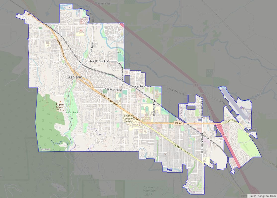
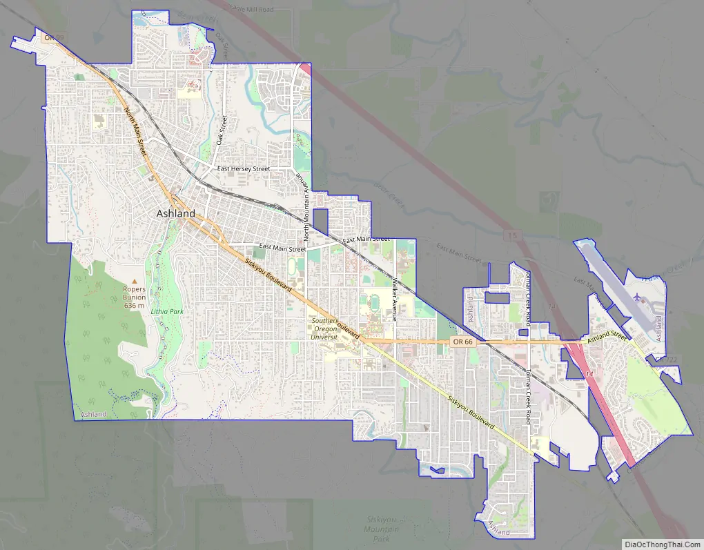
Ashland Road Map
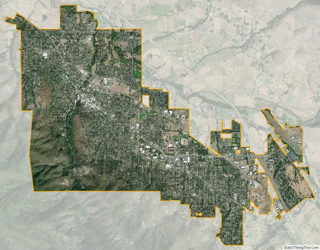
Ashland city Satellite Map
Geography
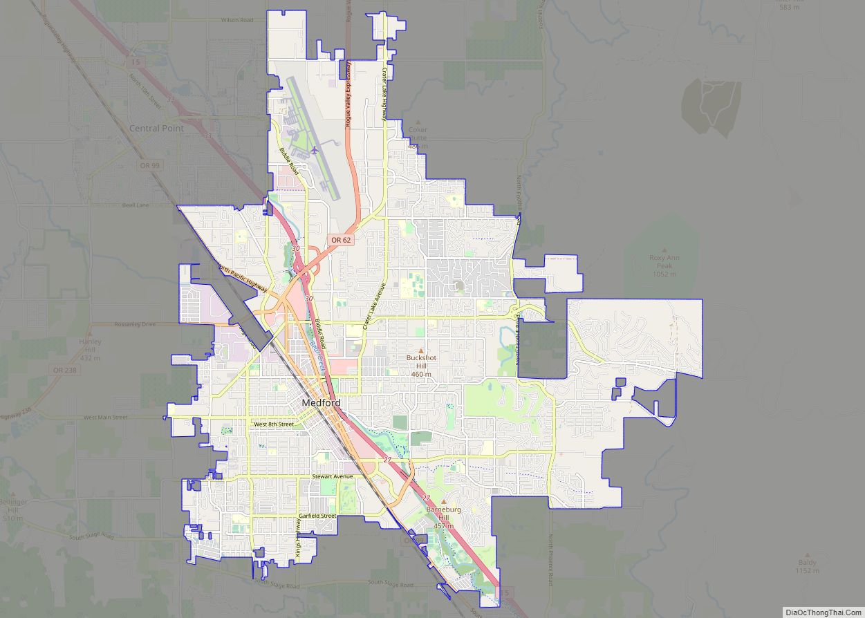
Ashland is at 1,949 feet (594 m) above sea level in the foothills of the Siskiyou and Cascade ranges, about 15 miles (24 km) north of the California border on Interstate 5 (I-5). About 10 miles (16 km) south of Ashland and 5 miles (8 km) north of the California border is Siskiyou Summit, which at 4,310 feet (1,310 m) is the highest point on I-5. Ashland is about 12 miles (19 km) southeast of Medford and 285 miles (459 km) south of Portland. According to the United States Census Bureau, the city has a total area of about 6.6 square miles (17.1 km), all land.
Ashland Creek and its tributaries begin on the flanks of Mount Ashland, at 7,533 feet (2,296 m) above sea level in the Siskiyou Mountains south of the city. Upstream (south) of the city boundary, these streams flow mainly through the Rogue River–Siskiyou National Forest. The creek flows through the city to meet Bear Creek, which roughly parallels I-5 along the east side of Ashland. Bear Creek, one of many streams in the Rogue Valley, flows generally northwest to join the Rogue River near Gold Hill, and from there the river flows generally west to its mouth on the Pacific Ocean.
Oregon Route 99, running roughly parallel to I-5, passes through downtown Ashland. Oregon Route 66 enters Ashland from the east and intersects Route 99 near the city center. Route 66 leads east 63 miles (101 km) to Klamath Falls.
Climate
Ashland lies within Oregon’s southwest interior climate zone, in which all but the higher-elevation sites are in the rain shadow of the Oregon Coast Range to the west. The largest urban areas in this zone in addition to Ashland are Medford and Grants Pass in the Rogue Valley, and Roseburg in the Umpqua River Valley further north. Although the mountain peaks in this zone receive up to 120 inches or 3,050 millimetres of precipitation a year, the urban areas and the valleys in which they lie generally get 20 inches (510 mm) or less. This valley climate is particularly good for growing fruit, especially pears, and for producing other crops and farm goods such as hay, grain, poultry, and beef.
Cloud cover in nearby Medford varies from an average of 21 percent in July to 86 percent in December. On average, precipitation falls in Ashland on 114 days each year and totals about 20 inches (510 mm). The average annual snowfall is only 1.4 inches or 0.04 metres. The average relative humidity, measured at 4 p.m. daily, is 47 percent in Medford, varying from 26 percent in July to 76 percent in December. According to the Köppen climate classification system, Ashland has a warm-summer Mediterranean climate (Csb).
The coolest month is December, with an average high temperature of 47 °F or 8.3 °C, and the warmest month is July, with an average high of about 88 °F or 31.1 °C. The highest temperature ever recorded in Ashland was 108 °F (42.2 °C), observed in August 1981, and the record low of −4 °F (−20 °C) occurred in December 1972. The wettest “rain year” has been from July 1926 to June 1927 with 29.77 inches (756.2 mm) and the driest from July 1954 to June 1955 with only 10.37 inches (263.4 mm). The wettest month on record has been December 1964 with 11.28 inches (286.5 mm), but the only other months with over 8 inches or 203.2 millimetres have been December 1996 with 10.89 inches (276.6 mm), November 1903 with 8.10 inches (205.7 mm) and November 1998 with 8.03 inches (204.0 mm).
Ashland’s coldest recorded daytime temperature was 15 °F (−9 °C) in December 1972. During the full year, the coldest day of the year averages around 34 °F (1 °C) or just above freezing. Warm summer nights are rare, with the record of 74 °F (23 °C) being set as far back as 1910. The mean for the warmest summer night between 1991 and 2020 was at a mild 62 °F (17 °C).
See also
Map of Oregon State and its subdivision: Map of other states:- Alabama
- Alaska
- Arizona
- Arkansas
- California
- Colorado
- Connecticut
- Delaware
- District of Columbia
- Florida
- Georgia
- Hawaii
- Idaho
- Illinois
- Indiana
- Iowa
- Kansas
- Kentucky
- Louisiana
- Maine
- Maryland
- Massachusetts
- Michigan
- Minnesota
- Mississippi
- Missouri
- Montana
- Nebraska
- Nevada
- New Hampshire
- New Jersey
- New Mexico
- New York
- North Carolina
- North Dakota
- Ohio
- Oklahoma
- Oregon
- Pennsylvania
- Rhode Island
- South Carolina
- South Dakota
- Tennessee
- Texas
- Utah
- Vermont
- Virginia
- Washington
- West Virginia
- Wisconsin
- Wyoming