Pilot Rock is a city in Umatilla County, Oregon, United States. The population was 1,502 at the 2010 census. It is part of the Pendleton–Hermiston Micropolitan Statistical Area. The main industries are timber and agriculture. Pilot Rock is home to the Boise Cascade /Kinzua Lumber lumber and pole mill as well as Pilot Rock High School. The name of Pilot Rock refers to a large basalt rock formation which is visible from the old Oregon Trail and was used in navigating wagon trains through the area.
| Name: | Pilot Rock city |
|---|---|
| LSAD Code: | 25 |
| LSAD Description: | city (suffix) |
| State: | Oregon |
| County: | Umatilla County |
| Incorporated: | 1911 |
| Elevation: | 1,637 ft (499 m) |
| Total Area: | 1.47 sq mi (3.81 km²) |
| Land Area: | 1.45 sq mi (3.76 km²) |
| Water Area: | 0.02 sq mi (0.05 km²) |
| Total Population: | 1,328 |
| Population Density: | 914.60/sq mi (353.18/km²) |
| ZIP code: | 97868 |
| Area code: | 541 |
| FIPS code: | 4157650 |
| GNISfeature ID: | 1125381 |
| Website: | www.cityofpilotrock.org |
Online Interactive Map
Click on ![]() to view map in "full screen" mode.
to view map in "full screen" mode.
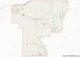
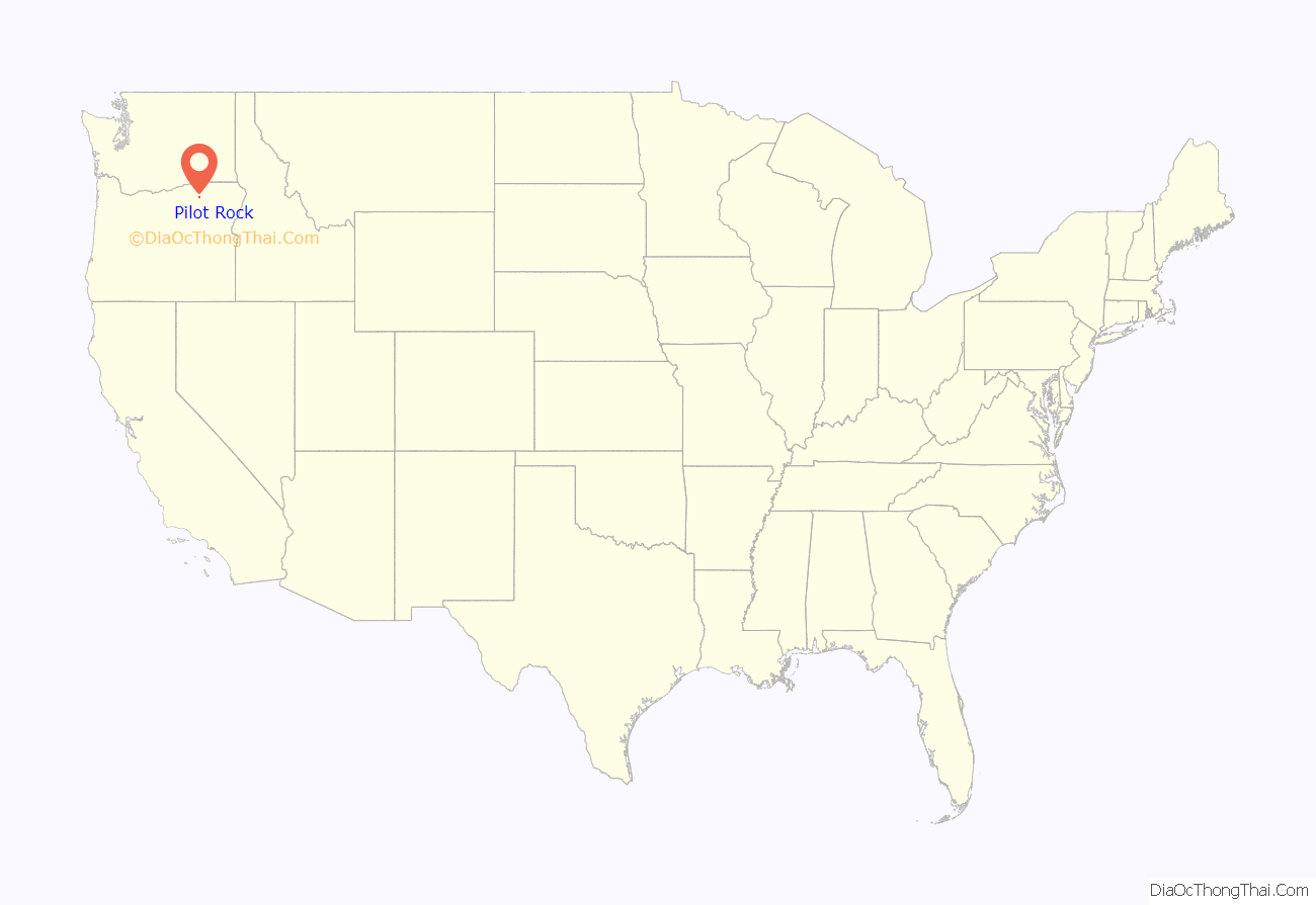
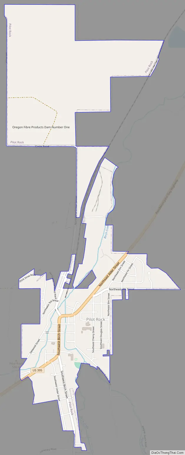
Pilot Rock location map. Where is Pilot Rock city?
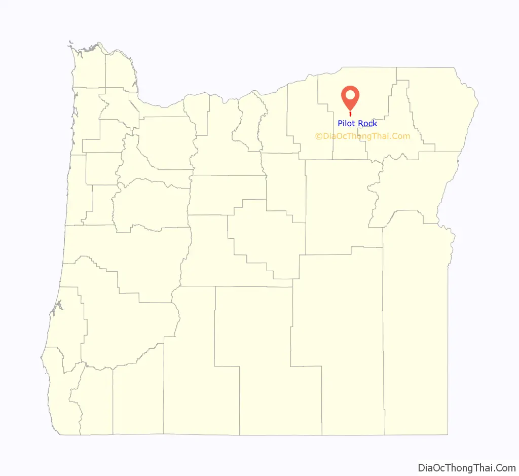
Pilot Rock Road Map
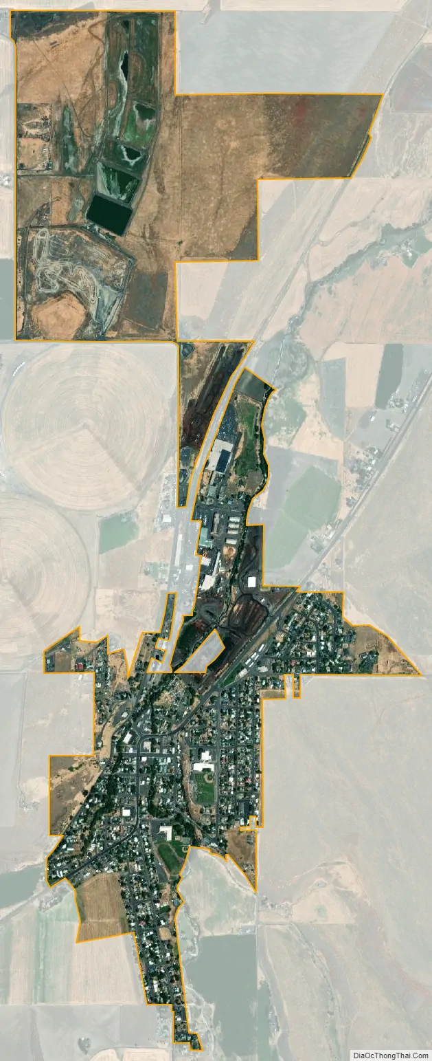
Pilot Rock city Satellite Map
Geography
According to the United States Census Bureau, the city has a total area of 1.47 square miles (3.81 km), of which 1.45 square miles (3.76 km) is land and 0.02 square miles (0.05 km) is water.
See also
Map of Oregon State and its subdivision: Map of other states:- Alabama
- Alaska
- Arizona
- Arkansas
- California
- Colorado
- Connecticut
- Delaware
- District of Columbia
- Florida
- Georgia
- Hawaii
- Idaho
- Illinois
- Indiana
- Iowa
- Kansas
- Kentucky
- Louisiana
- Maine
- Maryland
- Massachusetts
- Michigan
- Minnesota
- Mississippi
- Missouri
- Montana
- Nebraska
- Nevada
- New Hampshire
- New Jersey
- New Mexico
- New York
- North Carolina
- North Dakota
- Ohio
- Oklahoma
- Oregon
- Pennsylvania
- Rhode Island
- South Carolina
- South Dakota
- Tennessee
- Texas
- Utah
- Vermont
- Virginia
- Washington
- West Virginia
- Wisconsin
- Wyoming