Coldwater is a city in Branch County, Michigan, United States. As of the 2020 census, the city population was 13,822. It is the county seat of Branch County, located in the center of the southern border of Michigan. The city is surrounded by Coldwater Township, but is administratively autonomous.
| Name: | Coldwater city |
|---|---|
| LSAD Code: | 25 |
| LSAD Description: | city (suffix) |
| State: | Michigan |
| County: | Branch County |
| Founded: | 1861 |
| Elevation: | 965 ft (294 m) |
| Total Area: | 9.99 sq mi (25.87 km²) |
| Land Area: | 9.65 sq mi (25.00 km²) |
| Water Area: | 0.34 sq mi (0.88 km²) |
| Total Population: | 13,822 |
| Population Density: | 1,432.18/sq mi (552.99/km²) |
| ZIP code: | 49036 |
| Area code: | 517 |
| FIPS code: | 2617020 |
| GNISfeature ID: | 0623568 |
| Website: | www.coldwater.org |
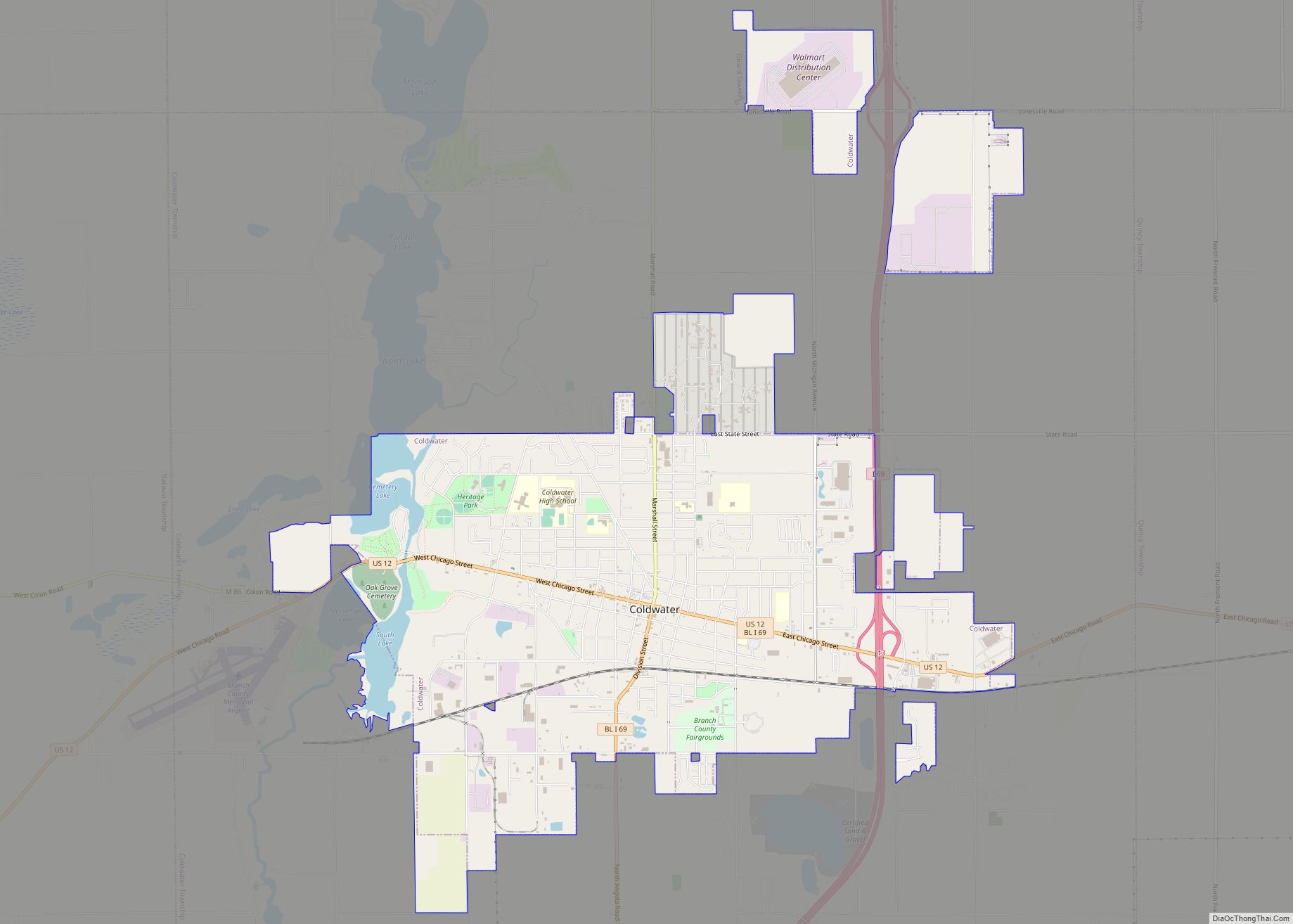
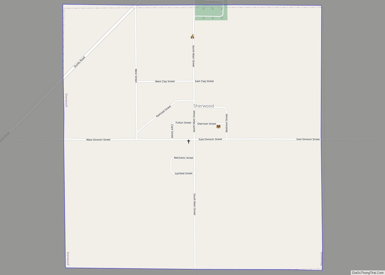
Online Interactive Map
Click on ![]() to view map in "full screen" mode.
to view map in "full screen" mode.
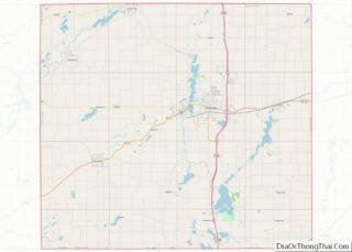
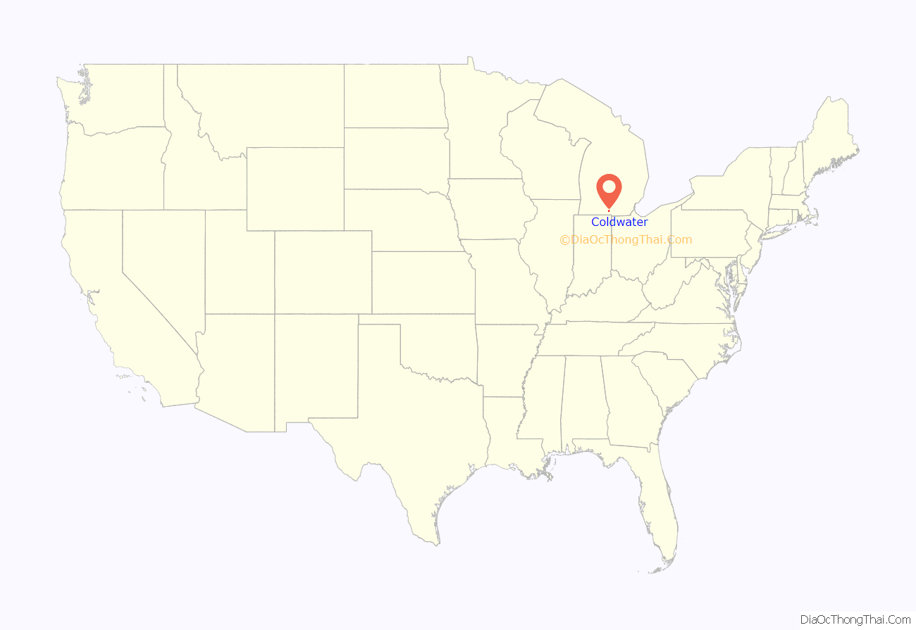
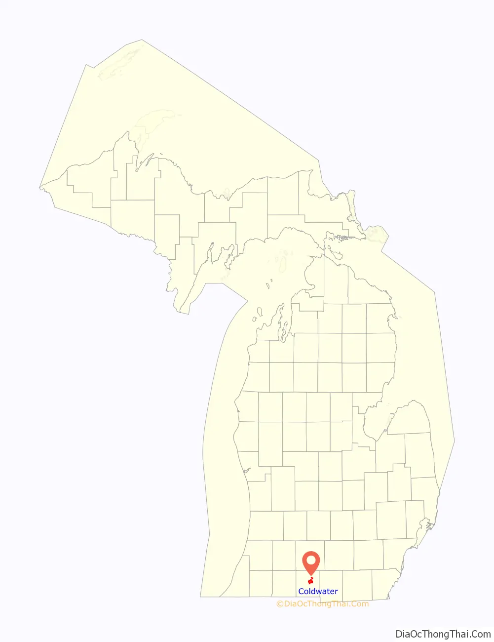
Coldwater location map. Where is Coldwater city?
History
American settlers did not move into the area until around 1830, with many arriving from New York and New England. Coldwater was incorporated as a village in 1837, and then incorporated by the legislature as a city in 1861. It was designated in 1842 as the county seat of Branch County.
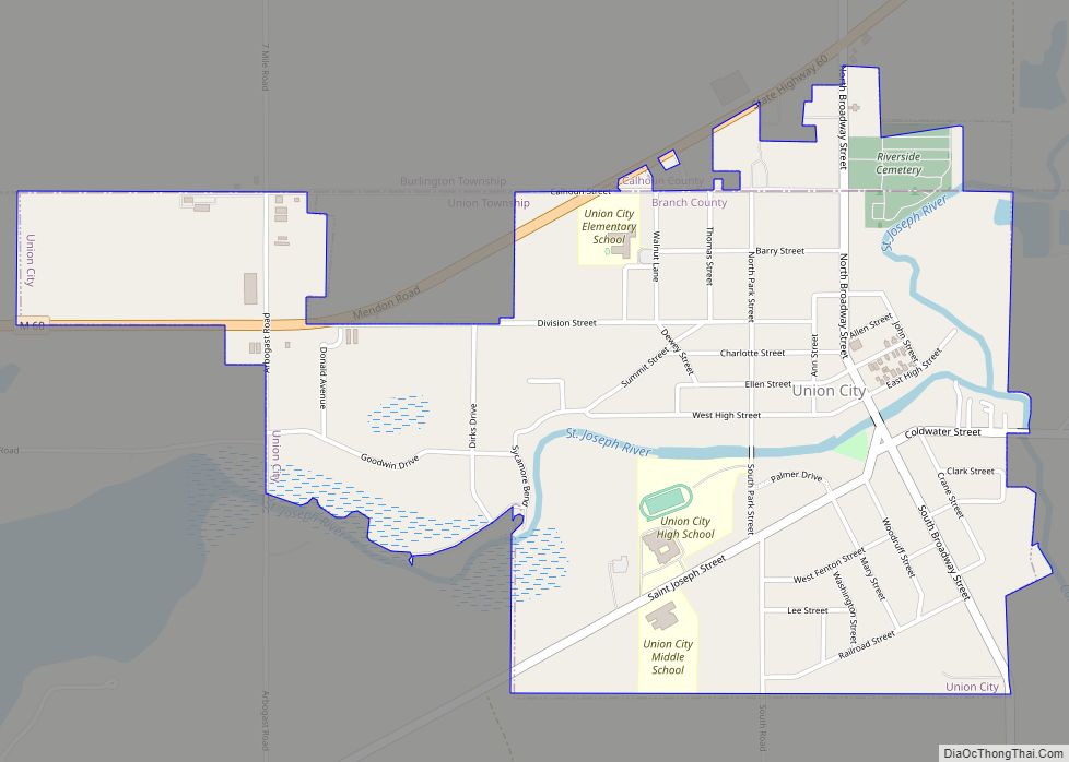
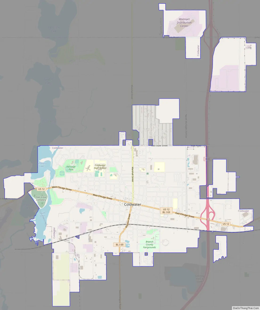
Coldwater Road Map
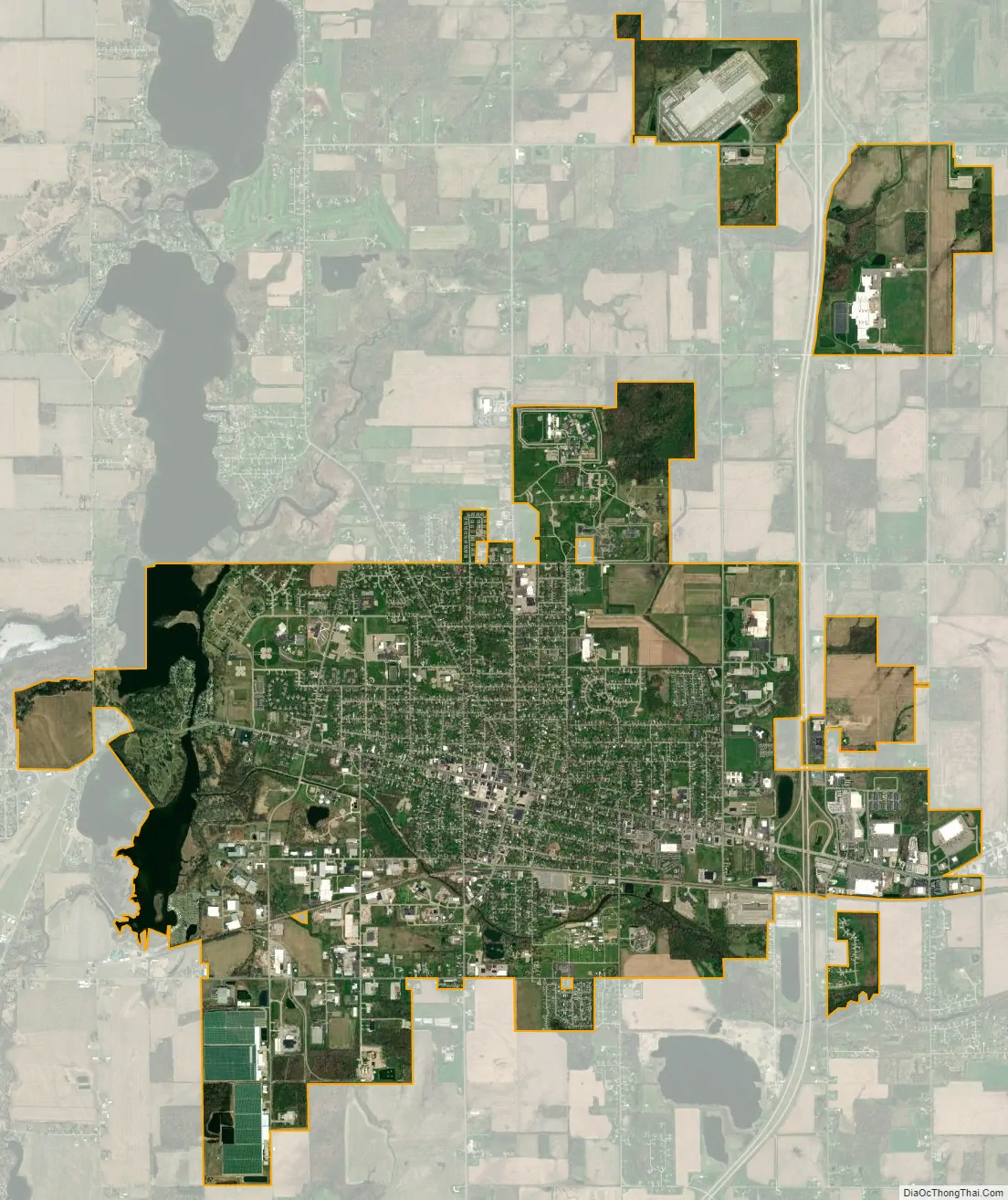
Coldwater city Satellite Map
Geography
The Coldwater River flows into the city from the south, originating from Coldwater Lake. The Coldwater chain of lakes also has an outlet called the Sauk River, which flows from its north end (near Quincy) and then through the south side of the city of Coldwater. Both combine to form a series of shallow, connected lakes on the city’s west side.
According to the United States Census Bureau, the city has a total area of 8.27 square miles (21.42 km), of which 8.03 square miles (20.80 km) is land and 0.24 square miles (0.62 km) is water.
Climate
Under the Köppen climate classification Coldwater has a humid continental climate that is borderline between categories Dfa (hot summer) and Dfb (long, warm summer).
National Weather Service records show that average January temperatures are a maximum of 28.9 °F or −1.7 °C and a minimum of 14.3 °F or −9.8 °C. Average July temperatures are a maximum of 81.4 °F or 27.4 °C and a minimum of 59.9 °F or 15.5 °C. There are an average of 8.5 afternoons with highs of 90 °F (32.2 °C) or higher and an average of 145.2 days with lows of 32 °F (0 °C) or lower. The record high temperature of 115 °F or 46.1 °C was on July 12, 2011, and the record low temperature was −23 °F or −30.6 °C on January 4, 1981.
Precipitation averages 35.66 inches or 905.8 millimetres annually. There is measurable precipitation on an average of 142.1 days. The wettest year was 1905 with 46.12 inches or 1,171.4 millimetres and the driest year was 1930 with 18.01 inches or 457.5 millimetres. The most precipitation in one month was 10.90 inches or 276.9 millimetres in May 1989. The most precipitation in 24 hours was 5.37 inches or 136.4 millimetres on June 26, 1978.
Snowfall averages 54.5 inches or 1.38 metres annually. There is measurable snowfall on an average of 34.6 days. The snowiest season was from July 1977 to June 1978 when 84.8 inches or 2.15 metres fell, including 50.7 inches or 1.29 metres in January 1978. A blizzard that month included 17.0 inches or 0.43 metres of snow on January 26, 1978.
See also
Map of Michigan State and its subdivision:- Alcona
- Alger
- Allegan
- Alpena
- Antrim
- Arenac
- Baraga
- Barry
- Bay
- Benzie
- Berrien
- Branch
- Calhoun
- Cass
- Charlevoix
- Cheboygan
- Chippewa
- Clare
- Clinton
- Crawford
- Delta
- Dickinson
- Eaton
- Emmet
- Genesee
- Gladwin
- Gogebic
- Grand Traverse
- Gratiot
- Hillsdale
- Houghton
- Huron
- Ingham
- Ionia
- Iosco
- Iron
- Isabella
- Jackson
- Kalamazoo
- Kalkaska
- Kent
- Keweenaw
- Lake
- Lake Hurron
- Lake Michigan
- Lake St. Clair
- Lake Superior
- Lapeer
- Leelanau
- Lenawee
- Livingston
- Luce
- Mackinac
- Macomb
- Manistee
- Marquette
- Mason
- Mecosta
- Menominee
- Midland
- Missaukee
- Monroe
- Montcalm
- Montmorency
- Muskegon
- Newaygo
- Oakland
- Oceana
- Ogemaw
- Ontonagon
- Osceola
- Oscoda
- Otsego
- Ottawa
- Presque Isle
- Roscommon
- Saginaw
- Saint Clair
- Saint Joseph
- Sanilac
- Schoolcraft
- Shiawassee
- Tuscola
- Van Buren
- Washtenaw
- Wayne
- Wexford
- Alabama
- Alaska
- Arizona
- Arkansas
- California
- Colorado
- Connecticut
- Delaware
- District of Columbia
- Florida
- Georgia
- Hawaii
- Idaho
- Illinois
- Indiana
- Iowa
- Kansas
- Kentucky
- Louisiana
- Maine
- Maryland
- Massachusetts
- Michigan
- Minnesota
- Mississippi
- Missouri
- Montana
- Nebraska
- Nevada
- New Hampshire
- New Jersey
- New Mexico
- New York
- North Carolina
- North Dakota
- Ohio
- Oklahoma
- Oregon
- Pennsylvania
- Rhode Island
- South Carolina
- South Dakota
- Tennessee
- Texas
- Utah
- Vermont
- Virginia
- Washington
- West Virginia
- Wisconsin
- Wyoming