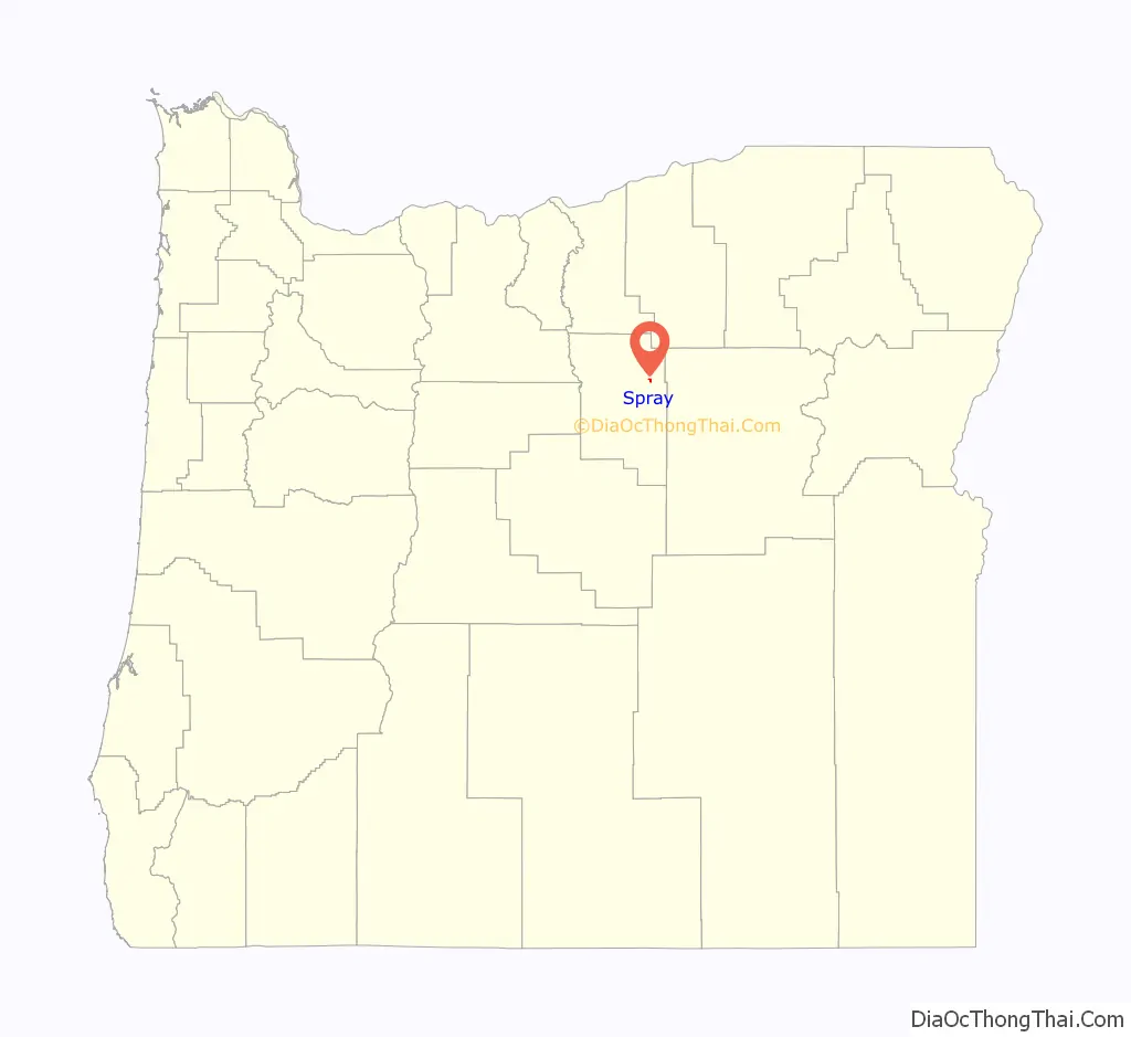
Spray is a city in Wheeler County, Oregon, United States. The population was 160 at the 2010 census.
| Name: | Spray town |
|---|---|
| LSAD Code: | 43 |
| LSAD Description: | town (suffix) |
| State: | Oregon |
| County: | Wheeler County |
| Incorporated: | 1958 |
| Elevation: | 1,772 ft (540.1 m) |
| Total Area: | 0.29 sq mi (0.75 km²) |
| Land Area: | 0.29 sq mi (0.75 km²) |
| Water Area: | 0.00 sq mi (0.00 km²) |
| Total Population: | 139 |
| Population Density: | 479.31/sq mi (185.28/km²) |
| ZIP code: | 97874 |
| Area code: | 541 |
| FIPS code: | 4169450 |
| GNISfeature ID: | 1127403 |
| Website: | www.sprayoregon.us |
Online Interactive Map
Click on ![]() to view map in "full screen" mode.
to view map in "full screen" mode.
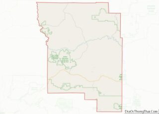
Spray location map. Where is Spray town?

History
Spray was named for John Fremont Spray, the community’s founder and first postmaster, and his wife, Mary E. Spray. The post office was established in 1900. In that same year, John Spray established a ferry to carry people across the John Day River, and he helped establish a school and a store in the community.
After formation of Wheeler County in 1899, Spray was suggested as a possible county seat. A county-wide election held in 1900 produced 436 votes for Fossil, 267 for Twickenham, and 82 for Spray. In 1958, Spray became the last Wheeler County community to incorporate as a city. John Butler was the first mayor.
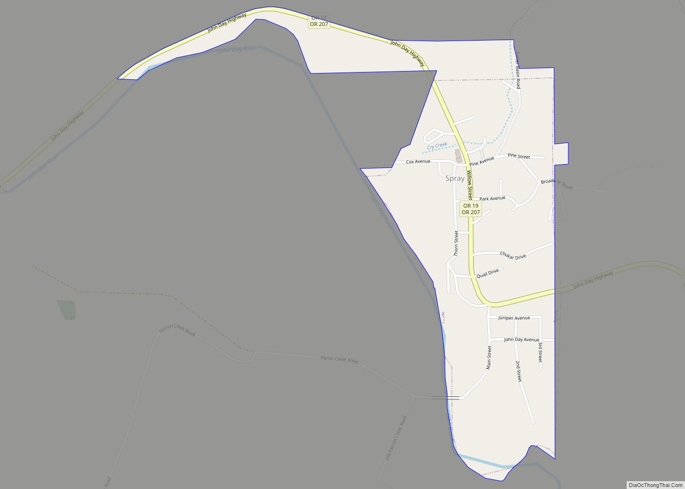
Spray Road Map

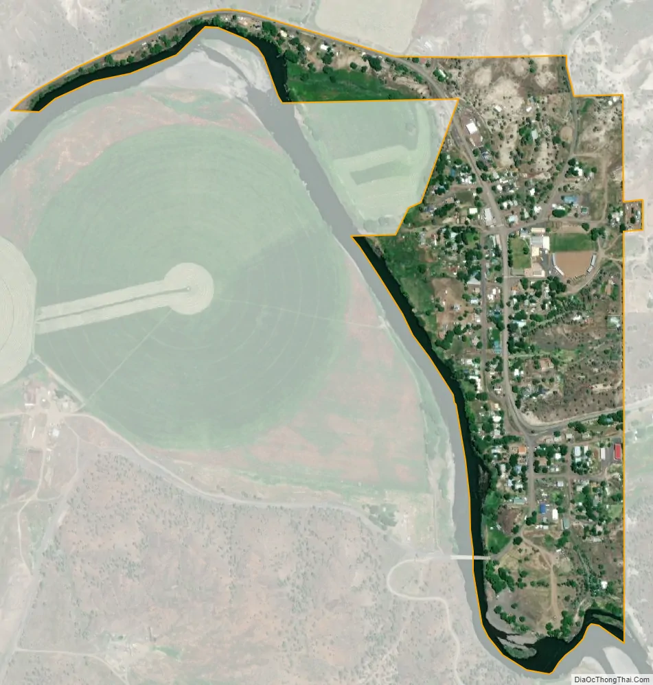
Spray city Satellite Map
Geography
Spray is located along the John Day River in north-central Oregon. According to the United States Census Bureau, the town has a total area of 0.29 square miles (0.75 km), all of it land.
Oregon Route 19 and Oregon Route 207, which meet 3 miles (4.8 km) east of Spray, overlap as they pass through the city. Spray is about 30 miles (48 km) southeast of Fossil along Route 19 and about 55 miles (89 km) south of Heppner along Route 207.
Climate
The average temperature in Spray in January is 33 °F (1 °C), and in July it is 72 °F (22 °C). The highest recorded temperature for Spray was 116 °F (47 °C) in 2007, and the lowest recorded temperature was −26 °F (−32 °C) in 1962. The average wettest month is May.
See also
Map of Oregon State and its subdivision: Map of other states:- Alabama
- Alaska
- Arizona
- Arkansas
- California
- Colorado
- Connecticut
- Delaware
- District of Columbia
- Florida
- Georgia
- Hawaii
- Idaho
- Illinois
- Indiana
- Iowa
- Kansas
- Kentucky
- Louisiana
- Maine
- Maryland
- Massachusetts
- Michigan
- Minnesota
- Mississippi
- Missouri
- Montana
- Nebraska
- Nevada
- New Hampshire
- New Jersey
- New Mexico
- New York
- North Carolina
- North Dakota
- Ohio
- Oklahoma
- Oregon
- Pennsylvania
- Rhode Island
- South Carolina
- South Dakota
- Tennessee
- Texas
- Utah
- Vermont
- Virginia
- Washington
- West Virginia
- Wisconsin
- Wyoming