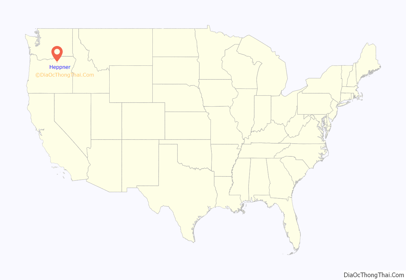
Heppner is a city in, and the county seat of, Morrow County, Oregon, United States. As of 2010, the population was 1,291. Heppner is part of the Pendleton-Hermiston Micropolitan Area. Heppner is named after Henry Heppner, a prominent Jewish-American businessman.
| Name: | Heppner city |
|---|---|
| LSAD Code: | 25 |
| LSAD Description: | city (suffix) |
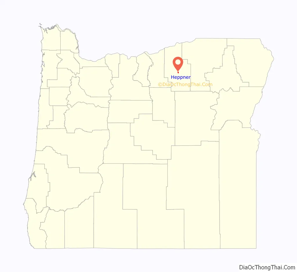
| State: | Oregon |
| County: | Morrow County |
| Incorporated: | 1887 |
| Elevation: | 2,192 ft (668 m) |
| Total Area: | 1.24 sq mi (3.20 km²) |
| Land Area: | 1.23 sq mi (3.19 km²) |
| Water Area: | 0.01 sq mi (0.02 km²) |
| Total Population: | 1,187 |
| Population Density: | 965.04/sq mi (372.65/km²) |
| ZIP code: | 97836 |
| Area code: | 458 and 541 |
| FIPS code: | 4133550 |
| GNISfeature ID: | 1121763 |
| Website: | www.cityofheppner.com |
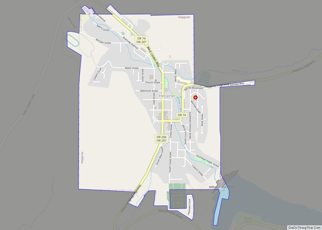
Online Interactive Map
Click on ![]() to view map in "full screen" mode.
to view map in "full screen" mode.
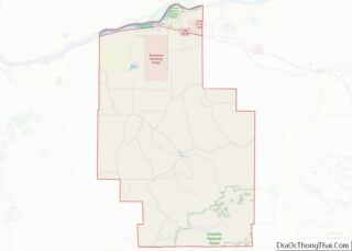
Heppner location map. Where is Heppner city?
History
Native American settlement
Native Americans lived and traveled along the land between the Columbia Gorge and the Blue Mountains for more than 10,000 years prior to European-American settlement. Ancient petroglyphs have been found approximately 45 miles (72 km.) north of Heppner in Irrigon and Boardman. In 1855, the U.S. Government and the predominant tribes in the region—the Cayuse, Umatilla, and Walla Walla—signed a treaty whereby the tribes gave up, or ceded, to the United States more than 6.4 million acres in what is now northeastern Oregon and southeastern Washington.
European-American settlement
Prior to Heppner’s founding in 1872, European-American ranchers used the area as sheep and cattle range as early as 1858. Records suggest these early cattlemen found abundant rye grass along creek bottoms.
Heppner was originally called Standsbury Flats for George W. Standsbury, one of the first European-American settlers in the area. In 1872, Colonel (Col.) Jackson Lee Morrow, a merchant, entered into a partnership with Henry Heppner, a prominent Jewish businessman, and they built a store on the crossing of the present May and Main streets. Soon thereafter, a mail and stagecoach line began operations between Pendleton and The Dalles and passed through Heppner.
Col. Jackson Lee Morrow was later elected to the Oregon legislative assembly and was instrumental in helping to carve out a new county for Heppner from neighboring Umatilla County and a portion of Wasco County. The assembly named the new county in Morrow’s honor.
Heppner was designated the temporary county seat at the time the county was created and narrowly defeated nearby Lexington in an election held in 1886 to determine the permanent county seat. Heppner was incorporated in the following year on February 9, 1887.
In 1888, the Oregon Railroad and Navigation Company completed a railroad spur from the Columbia River up the Willow Creek drainage to Heppner.
The Historic Morrow County Courthouse was built in 1902-03 and is one of the oldest continuously used courthouses in Oregon. In 1985, the courthouse was listed on the National Register of Historic Places.
Flood of June 1903
Heppner was almost destroyed by a flash flood on Sunday, June 14, 1903. The flood was precipitated by a sudden cloudburst and accompanying hail that caused a debris dam collapse and flash flooding, notably on Willow Creek. A wall of water and debris swept down the creeks and canyons and through the city. It has been estimated that 238 people (a quarter of the city’s population) drowned, making it the deadliest natural disaster in Oregon’s history. Property damage was reported at nearly $1 million. The nearby cities of Ione and Lexington also sustained significant damage. In 1983, the Willow Creek Dam at the outskirts of the city was finished.
Post-flood recovery
The railroad and a growing network of roads had by the early decades of the 20th century made Heppner a trade center and distribution point for regional farm products including wheat, alfalfa, sheep, cattle, horses, and hogs. Despite the flood and two fires in 1918 that destroyed City Hall, the Palace Hotel, the library, many businesses, and more than 30 homes, the community rebuilt. One of its creations, the Heppner Hotel, opened in 1920 and, housing a variety of businesses over the years, it served as a community gathering place through 1972, when its last restaurant closed.
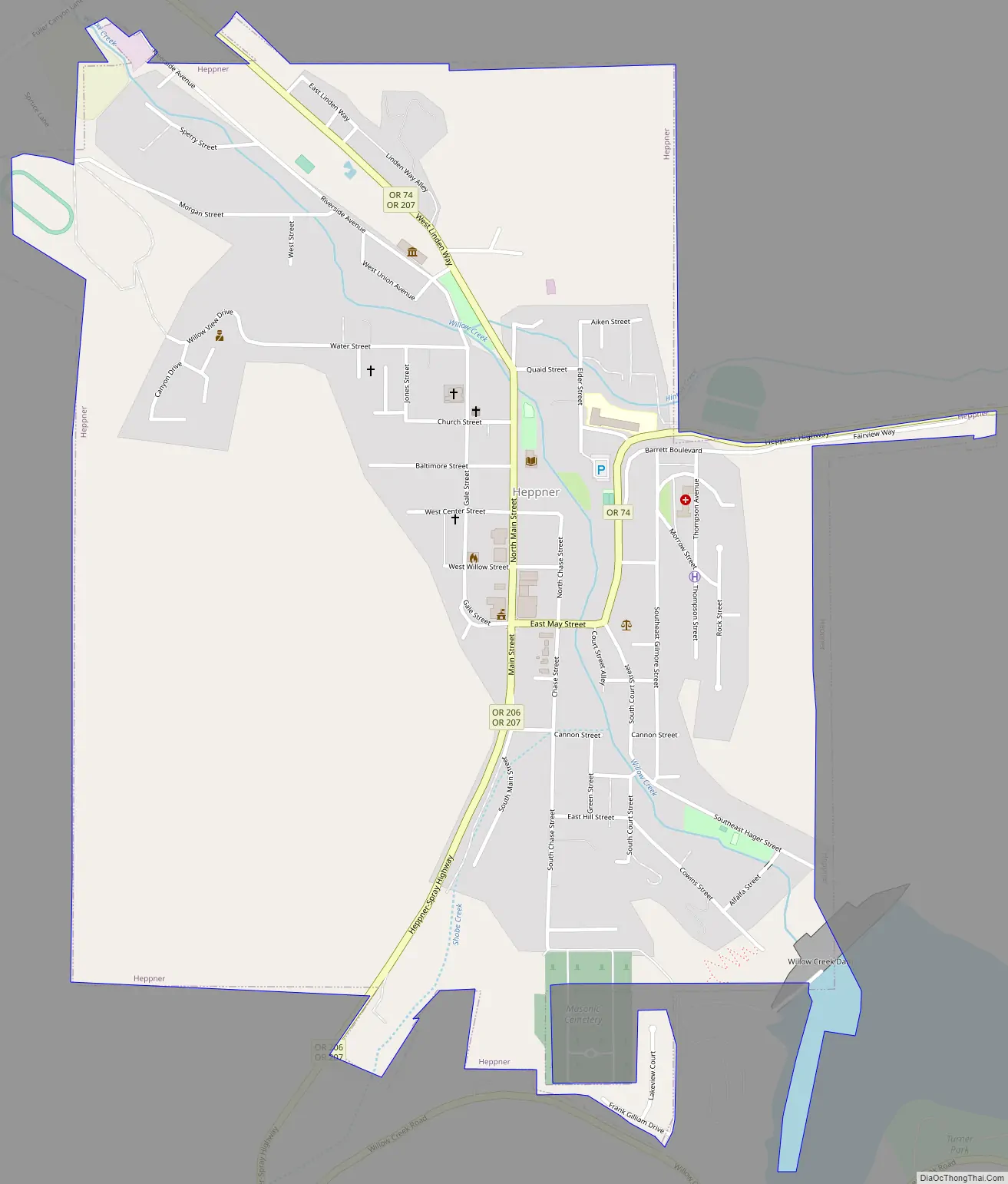
Heppner Road Map
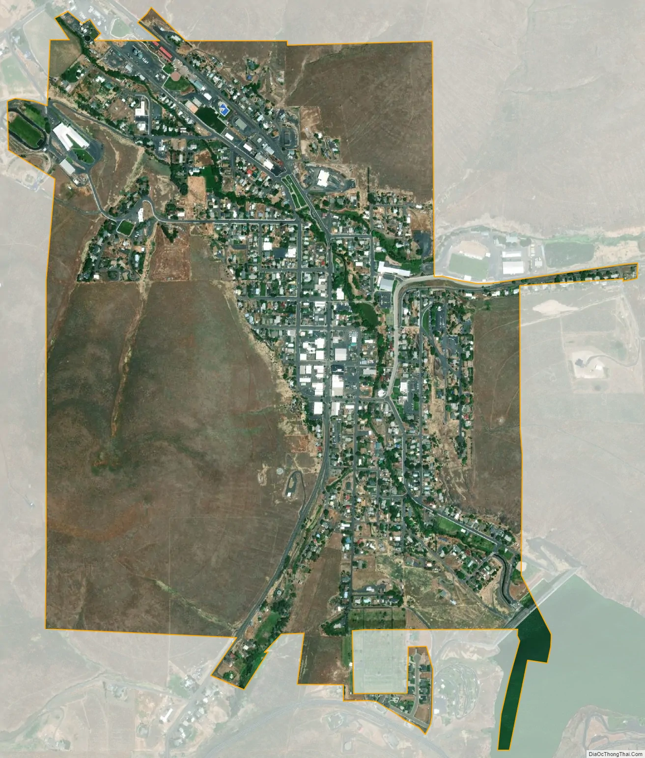
Heppner city Satellite Map
Geography
Heppner is at an elevation of 2,192 feet (668 m) between the Columbia River to the north and the Blue Mountains to the southeast. The city is along Oregon Route 74, about 60 miles (97 km) southwest of Pendleton and 185 miles (298 km) east of Portland.
Route 74 forms part of the Blue Mountain Scenic Byway, a 130-mile (210 km) set of roads connecting Interstate 84 (I-84) along the Columbia River with the North Fork John Day River in the Blue Mountains. Part of the route follows the Willow Creek drainage through Heppner.
Heppner is upstream of Lexington, Ione, and Arlington. According to the United States Census Bureau, the city has a total area of 1.24 square miles (3.21 km), of which, 1.23 square miles (3.19 km) is land and 0.01 square miles (0.03 km) is water.
Climate
According to the Köppen Climate Classification system, Heppner has a warm-summer mediterranean climate, abbreviated “Csb” on climate maps. The hottest temperature recorded in Heppner was 110 °F (43.3 °C) on August 10, 1898, while the coldest temperature recorded was −19 °F (−28.3 °C) on January 10, 1909 and January 12, 1909.
See also
Map of Oregon State and its subdivision: Map of other states:- Alabama
- Alaska
- Arizona
- Arkansas
- California
- Colorado
- Connecticut
- Delaware
- District of Columbia
- Florida
- Georgia
- Hawaii
- Idaho
- Illinois
- Indiana
- Iowa
- Kansas
- Kentucky
- Louisiana
- Maine
- Maryland
- Massachusetts
- Michigan
- Minnesota
- Mississippi
- Missouri
- Montana
- Nebraska
- Nevada
- New Hampshire
- New Jersey
- New Mexico
- New York
- North Carolina
- North Dakota
- Ohio
- Oklahoma
- Oregon
- Pennsylvania
- Rhode Island
- South Carolina
- South Dakota
- Tennessee
- Texas
- Utah
- Vermont
- Virginia
- Washington
- West Virginia
- Wisconsin
- Wyoming