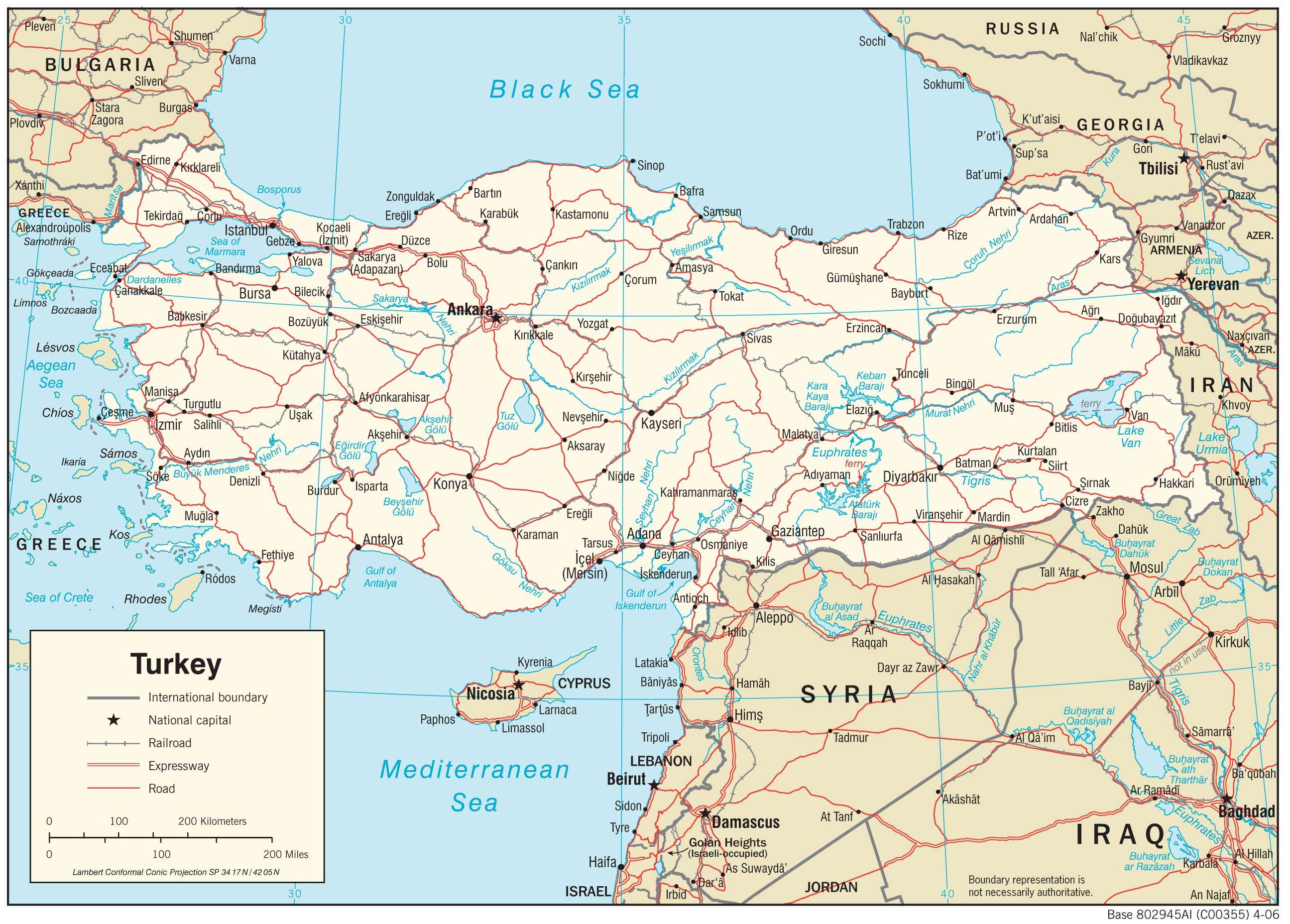
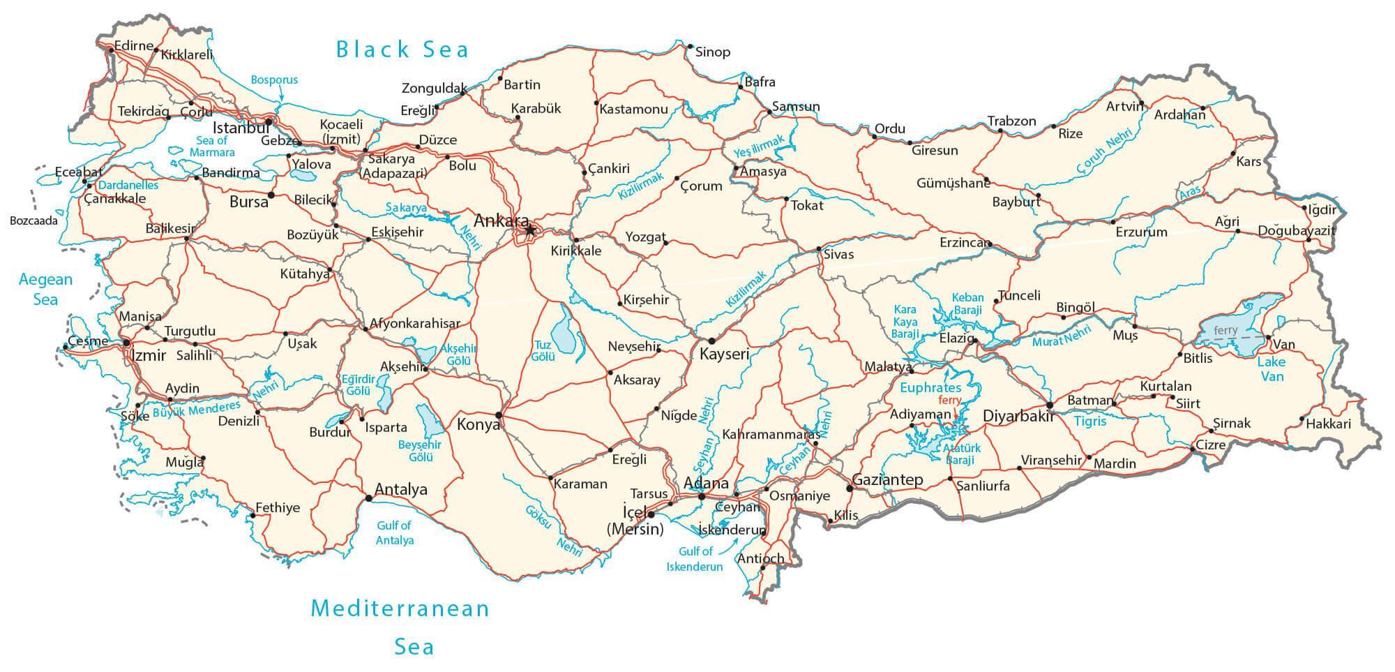
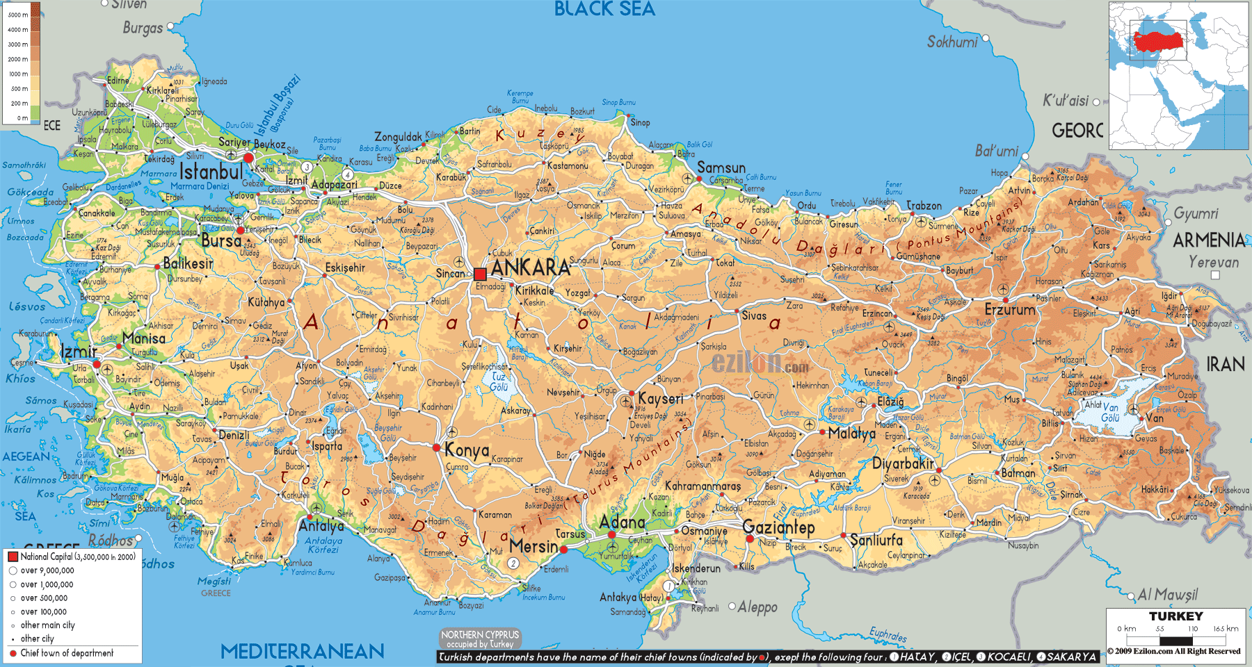
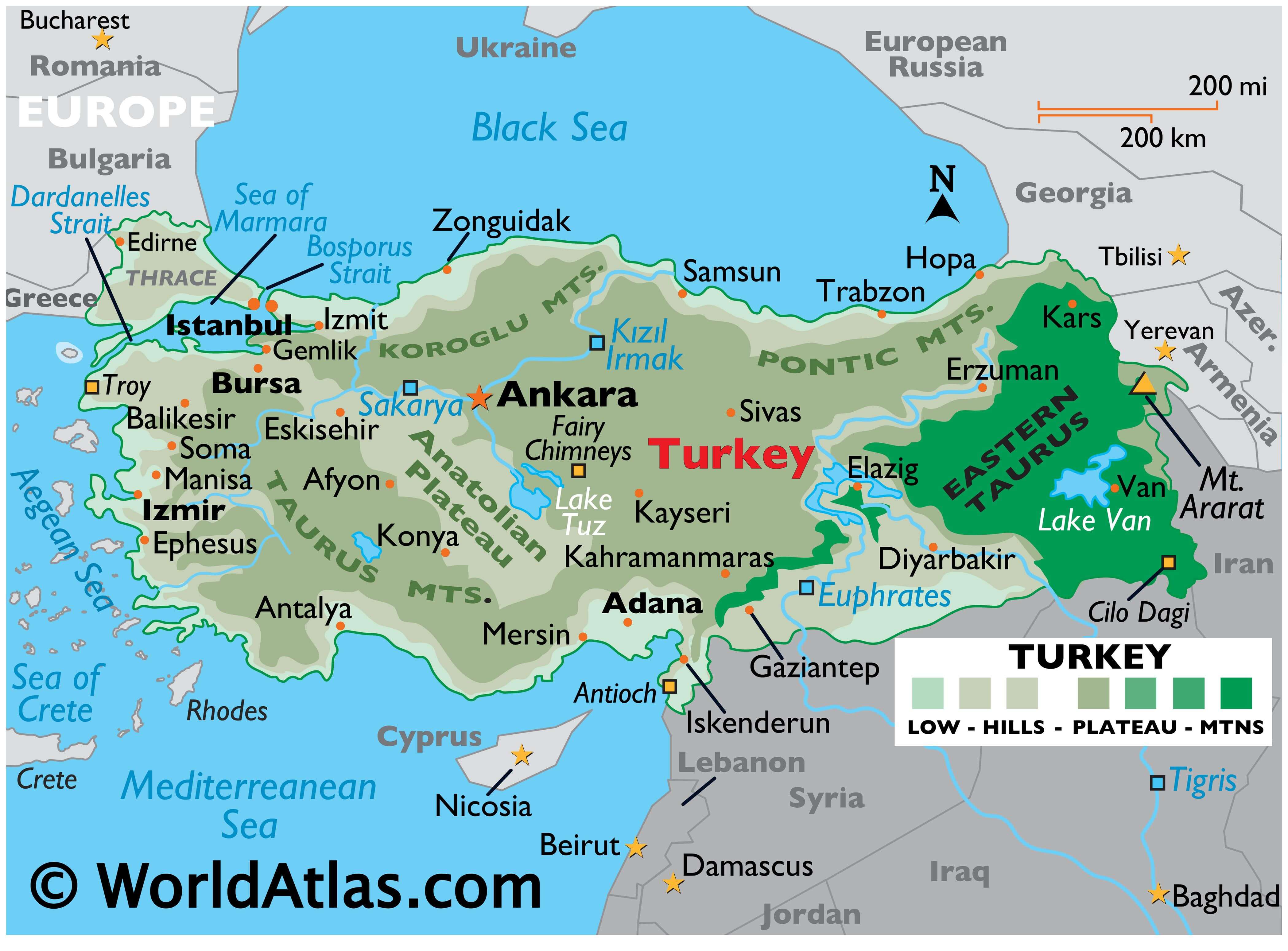
Turkey occupies an area of 783,356 sq. km with 97% of this area located in Asia and the rest in Europe. As observed on the physical map of the country above, the European part of Turkey called Eastern Thrace is located at the extreme eastern edge of the Balkan Peninsula. The Asian part that is separated from the former by the Turkish Straits, occupies most of the Anatolian Plateau region.
The European side of Turkey is mostly a series of rolling hills, while across the Bosporus Strait into central Turkey, the land rises into an elevated central plateau (Anatolian), surrounded by (and mixed with) high, rugged mountains, including the Taurus, Koroglu and Pontic ranges, all of which have been marked on the map above.
Many peaks in Turkey exceed 10,000 feet, and the tallest, most rugged ones, are found in the Eastern Taurus Mountains.
Turkey’s highest point is Mt. Ararat which peaks at 16,948 ft. (5,166m).
Along the Black Sea and Mediterranean coastlines, the land is lower and quite fertile.
The Tigras, Kizilirmak, Sakarya, and Euphrates are the most significant rivers, and Lake Van is the largest lake.
As a geological point-of-interest, the country is positioned on one of the planet’s major fault lines, and earthquakes are rather common.
| Flag: |  |
|---|---|
| Legal Name: | Republic of Turkey |
| Capital Value: | Ankara |
| Official languages: | Turkish |
| Demonym(s): | TurkishTurk |
| Government: | Unitary presidential constitutional republic |
| Legislature: | Grand National Assembly |
| Total Area: | 783,562 km² |
| Land Area: | 769,632 km² |
| Water Area: | 13,930 km² |
| Population: | 83,429,615 |
| Density: | 111/km (287.5/sq mi) (107th) |
| GDP: | $754.41 Billion |
| GDP Per Capita: | $9,042.49 |
| Currency Value: | Turkish liras (TRY) |
| Driving side: | right |
| Calling code: | +90 |
| Internet TLD: | .tr |
Discover the beauty of Turkey with this reference map! It showcases the country’s physical features, including mountains, rivers, and lakes, as well as its administrative divisions. The map also includes cities, towns, highways, and roads. Explore the stunning landscape of Turkey with this detailed map!
Online Interactive Political Map
Click on ![]() to view map in "full screen" mode.
to view map in "full screen" mode.
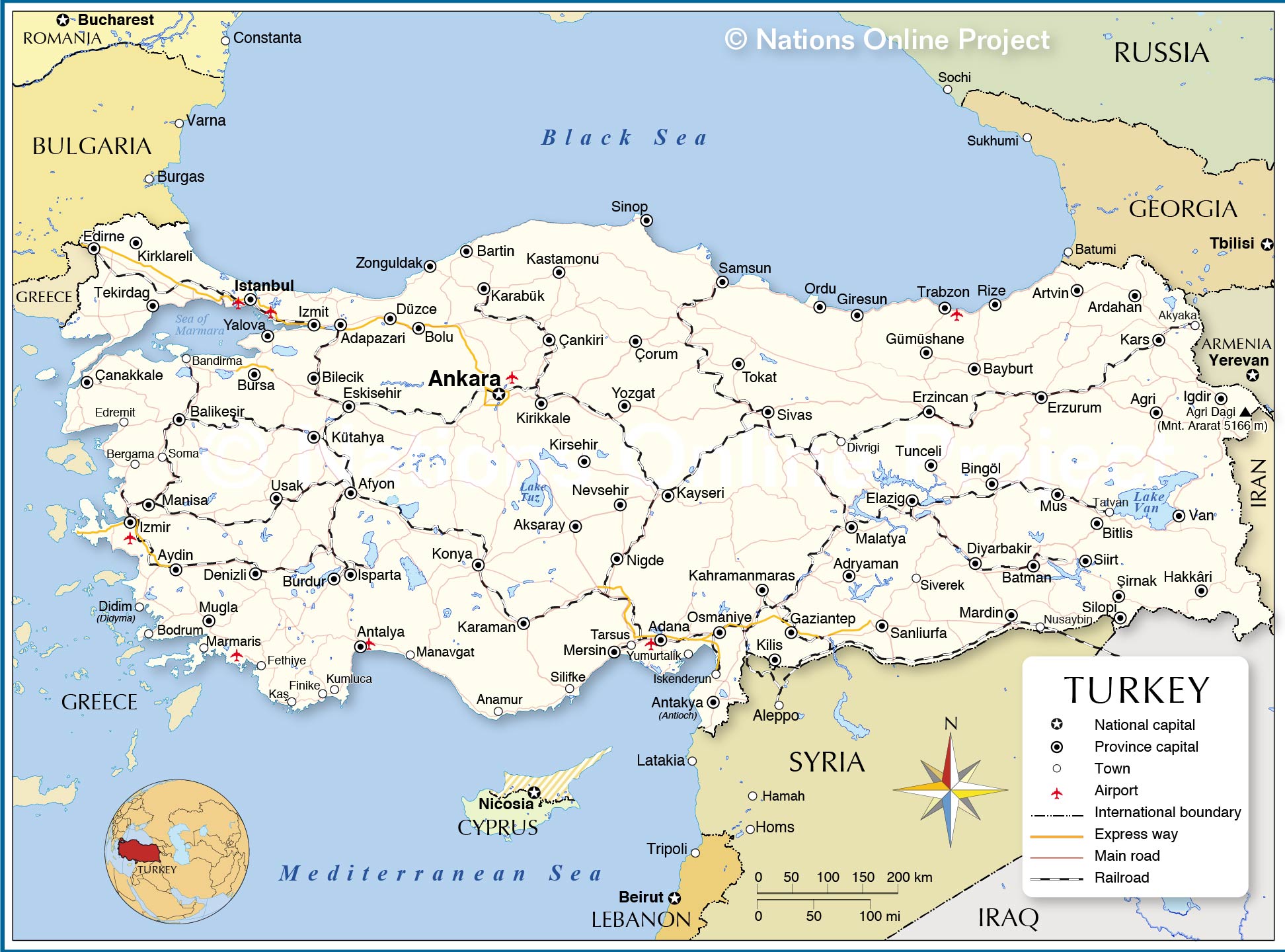
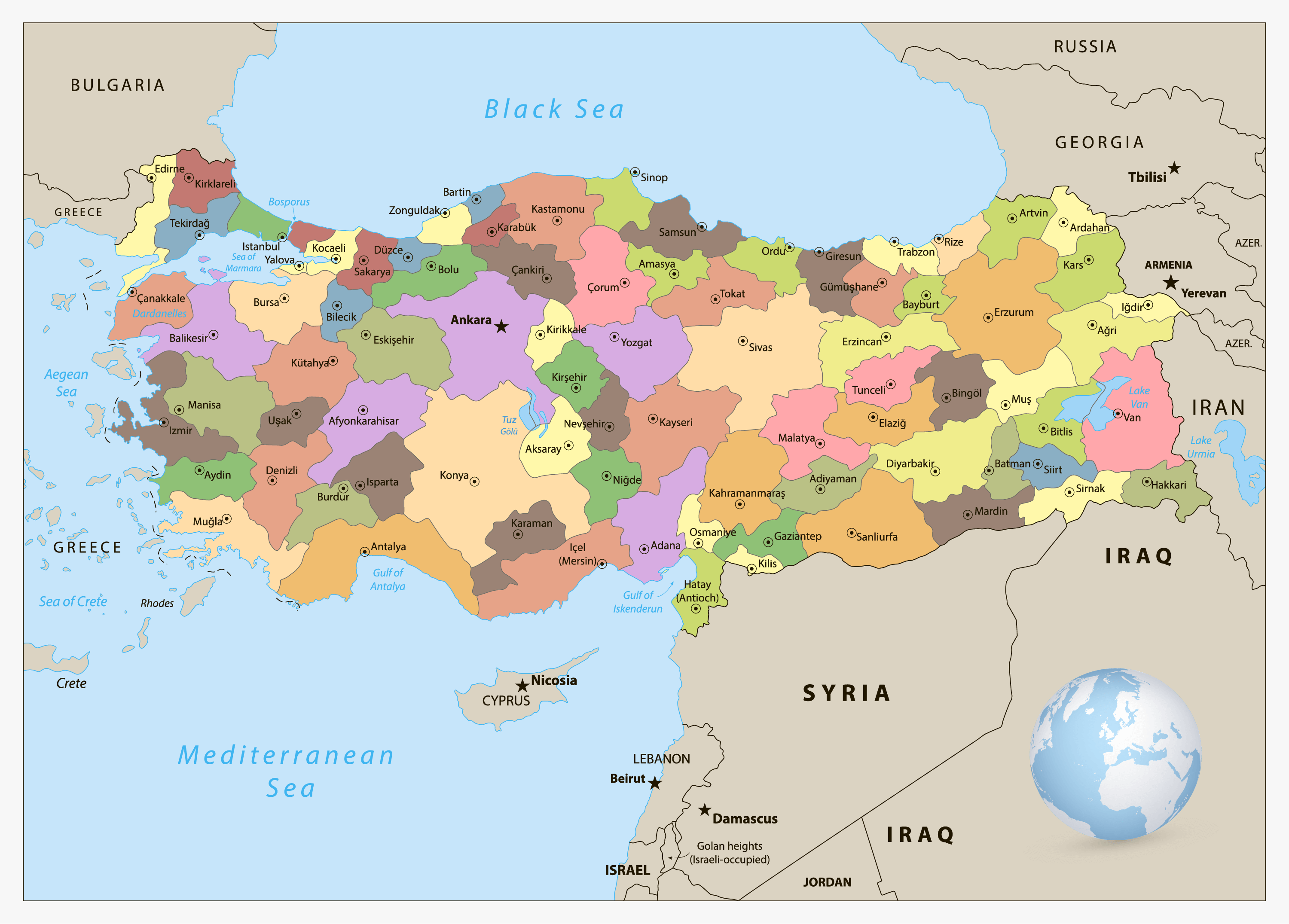
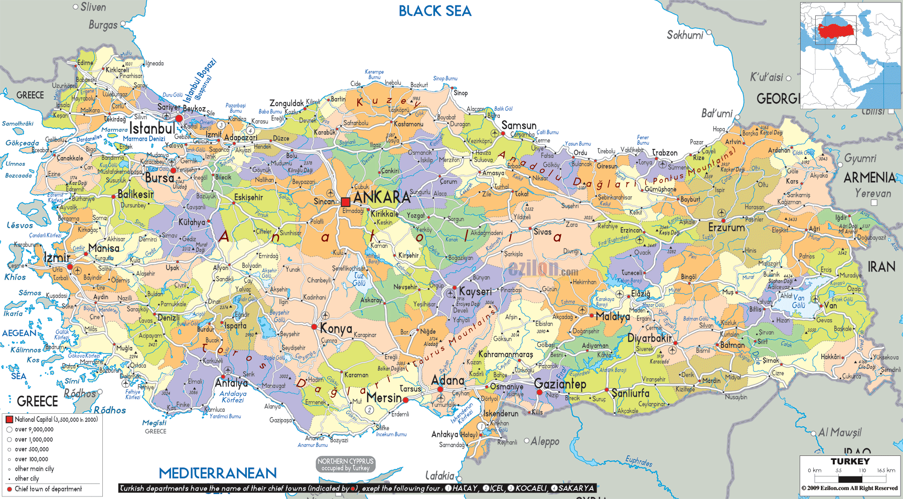
Turkey is divided into 81 provinces (iller, singular – ili) for the sake of proper administration. These provinces are further subdivided into 937 districts and smaller subdivisions. The 81 provinces in alphabetical order are as follows: Adana, Adiyaman, Afyonkarahisar, Agri, Aksaray, Amasya, Ankara, Antalya, Ardahan, Artvin, Aydin, Balikesir, Bartin, Batman, Bayburt, Bilecik, Bingol, Bitlis, Bolu, Burdur, Bursa, Canakkale, Cankiri, Corum, Denizli, Diyarbakir, Duzce, Edirne, Elazig, Erzincan, Erzurum, Eskisehir, Gaziantep, Giresun, Gumushane, Hakkari, Hatay, Igdir, Isparta, Istanbul, Izmir (Smyrna), Kahramanmaras, Karabuk, Karaman, Kars, Kastamonu, Kayseri, Kilis, Kirikkale, Kirklareli, Kirsehir, Kocaeli, Konya, Kutahya, Malatya, Manisa, Mardin, Mersin, Mugla, Mus, Nevsehir, Nigde, Ordu, Osmaniye, Rize, Sakarya, Samsun, Sanliurfa, Siirt, Sinop, Sirnak, Sivas, Tekirdag, Tokat, Trabzon (Trebizond), Tunceli, Usak, Van, Yalova, Yozgat, and Zonguldak.
With an area of 40,813.52 sq. km, Konya is the biggest province of Turkey by area and Istanbul is the most populous one.
Ankara, the capital city of Turkey and the country’s second-largest city is located in the central part of the Anatolian peninsula.
Location Maps
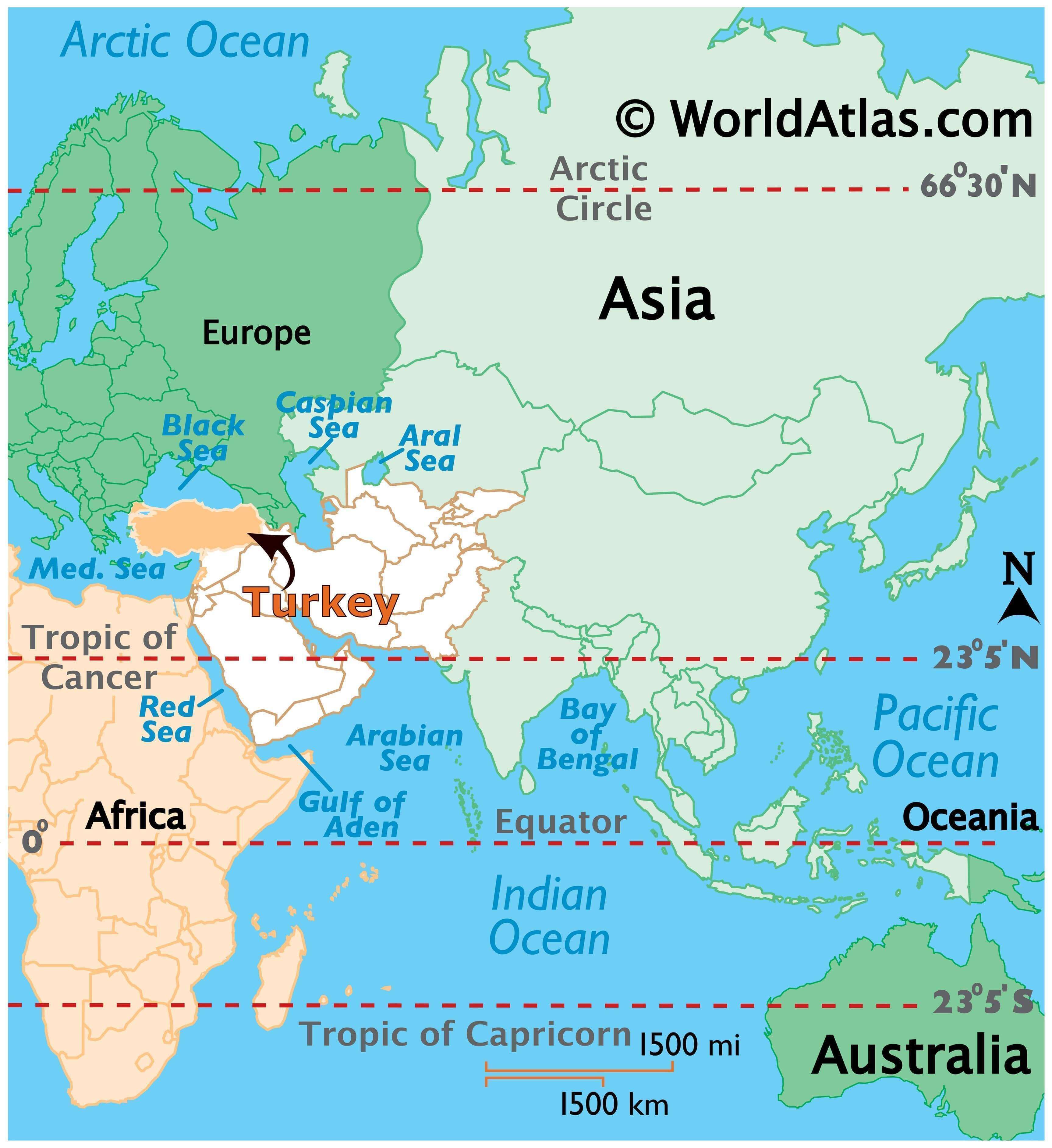
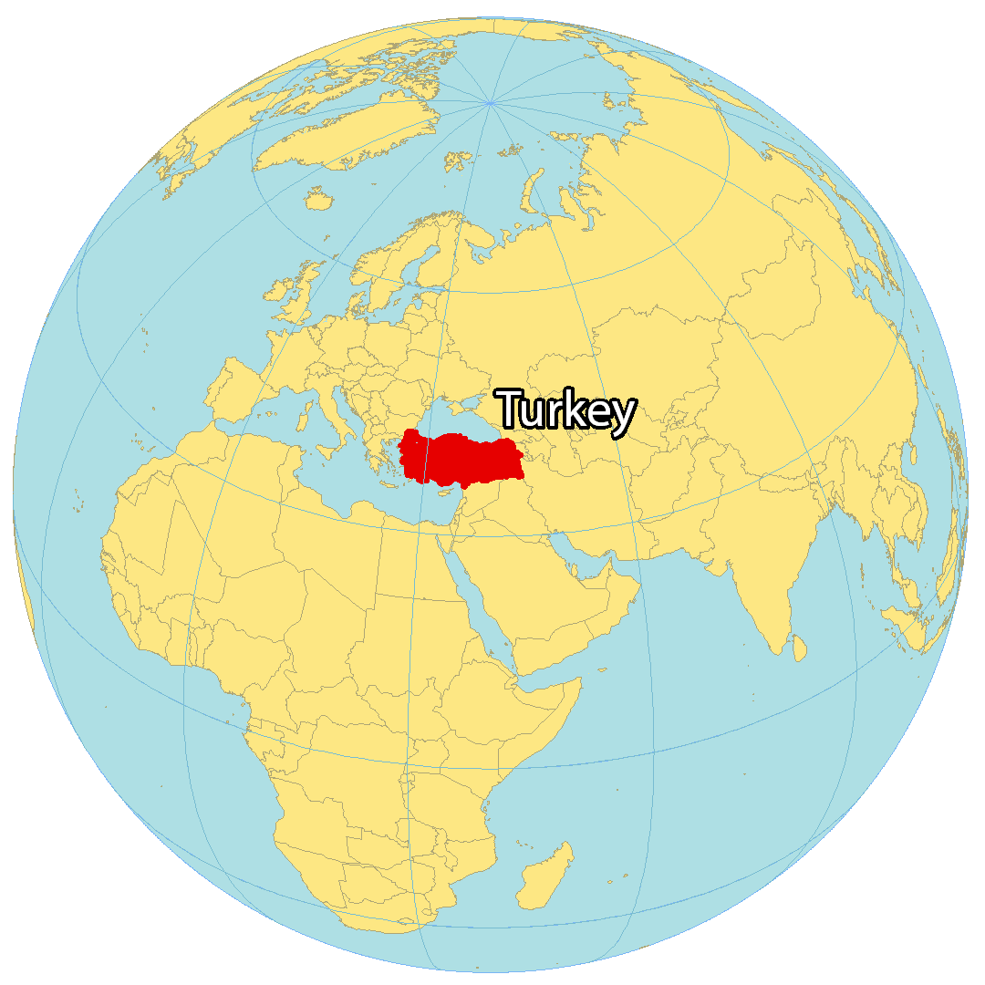
Where is Turkey?
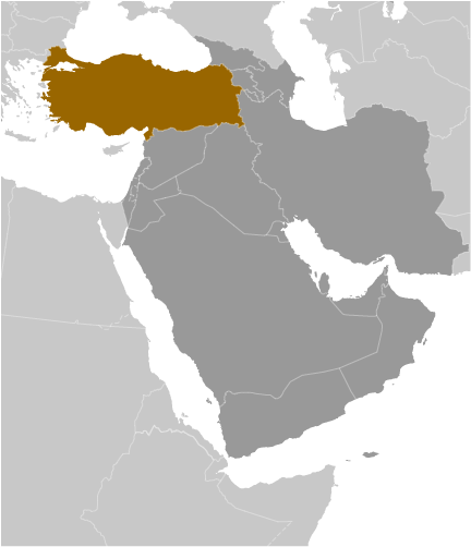
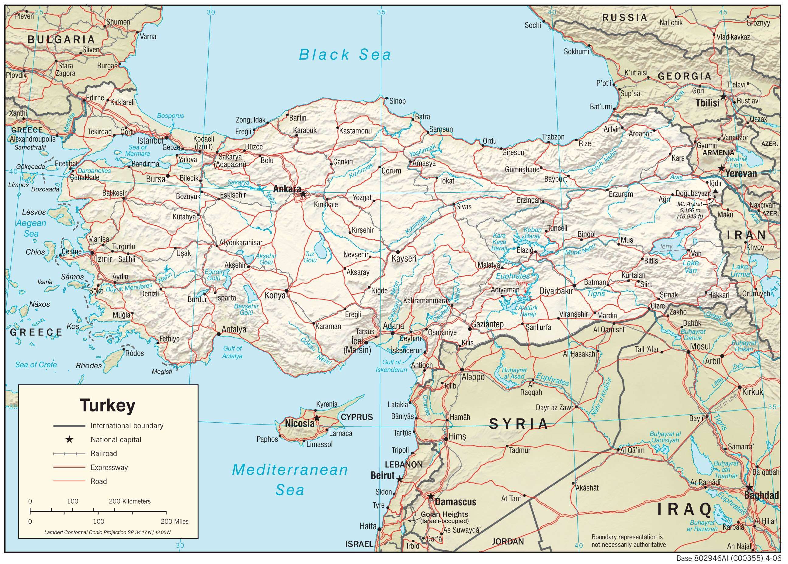
Turkey is located at the crossroads of two continents, Southeastern Europe and Western Asia. It has a total of 7,200 kilometers of coastline along the Mediterranean Sea in the south, the Aegean Sea in the west, and the Black Sea in the north. Turkey borders several countries including Georgia, Bulgaria, Syria, Iraq, and Iran.
Turkey is known for its world heritage sites, shipwrecks, the first-ever university, philosophers, and carpets. Its capital is Ankara but Istanbul is the largest city and financial center, which was formerly known as Constantinople. Its history extends thousands of years back, such as the story of the legendary Trojan War that took place in Troy, Turkey. Other major cities include Izmir, Bursa, and Adana.
High Definition Political Map of Turkey
Turkey Administrative Map

Physical Map of Turkey
Transportation Map of Turkey